- Conception Bay
-
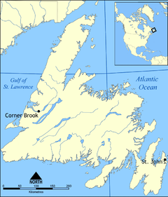
 Conception BayLocation of Conception Bay in Newfoundland
Conception Bay is a Canadian bay located on the northeast coast of the island of Newfoundland. The bay indents the Avalon Peninsula with the opening of the bay to the Atlantic Ocean at the northeast. It is bounded by Cape St. Francis 47°48.63′N 52°47.15′W / 47.8105°N 52.78583°W in the south and Split Point 48°05.99′N 52°50.94′W / 48.09983°N 52.849°W near Bay de Verde in the north. It has a maximum depth of 300 meters (980 ft).[1]
Conception Bay covers an area of 1295 square kilometers and contains several islands, the three major ones being Bell Island, Little Bell Island and Kelly's Island. The Bay is fed into by rivers from both the east and west side of the bay, which are then fed into the Atlantic Ocean.
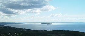 View of Conception Bay, looking southwest from Portugal Cove 47°36.50′N 52°51.34′W / 47.6083°N 52.85567°W towards Holyrood. The larger island is Kelly's Island and the smaller one is Little Bell Island.
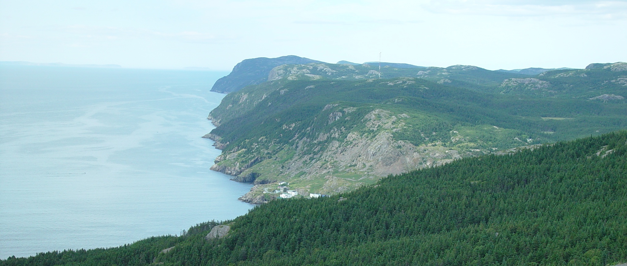
 View of Conception Bay, Newfoundland and Labrador, looking north from Portugal Cove 47°36.50′N 52°51.34′W / 47.6083°N 52.85567°W. Bay de Verde and Baccalieu Island can be seen in the distance.
History
The name Conception Bay comes from the Portuguese Baía da Conceição or Baia de Comceica and was presumably given in honour of the Feast of the Conception, December 8. The name first appears on the Oliveriana map of 1505 – 1508.
Conception bay was the site of Britaniola Colony, established in 1610. It was the site of Sea-Forest Plantation founded in 1610 and Bristol's Hope Plantation founded in 1619.
From the late 1890s to the 1960s, Bell Island was home to an iron ore mine in Wabana operated most recently by the Dominion Steel and Coal Corporation (DOSCO); the ore was shipped to DOSCO's steel mill in Sydney, Nova Scotia. During World War II, DOSCO cargo ships sitting at anchor, along with the loading pier at Wabana, were the target of German U-boats on at least two occasions. During one particular attack on ore carriers sitting at anchor, a torpedo missed its target and struck the pier, making Bell Island one of the few places in North America to suffer a direct enemy attack (see Attacks on North America during World War II). The wrecks of the 4 cargo ships sunk during these two attacks are visible at low tide; a memorial on shore is dedicated to the 69 merchant sailors who lost their lives.
Other information
The provincial government operates a passenger-vehicle ferry service from Bell Island to Portugal Cove (on the bay's southeastern shore),[2] operating through what locals know as the "Bell Island Tickle."
Humpback whales have been known to enter the bay while migrating. Private vessels and tourist charters frequent the bay's waters during the summer months.
Property development in the St. John's exurb of Conception Bay South in recent decades has led to increasing recreational use of the bay.
References
- ^ DeJong, Brad; Sanderson, Brian (1994-09-06]). "The Circulation and Hydrography of Conception Bay, Newfoundland". Department of Physics, Mmeorial University of Newfoundland. http://www.physics.mun.ca/~bdeyoung/deyoung_sanderson_AO_1995.pdf. Retrieved 2007-11-16.
- ^ "NL Government web site:Bell Island - Portugal Cove Ferry Service". Archived from the original on 2007-08-07. http://web.archive.org/web/20070807153229/http://www.tw.gov.nl.ca/FerryServices/maplayouts/MAP-A-Bell.stm. Retrieved 2007-11-16.
Categories:- Bays of Newfoundland and Labrador


Wikimedia Foundation. 2010.