Hartford Bridge, Cheshire
- Hartford Bridge, Cheshire
Infobox_Bridge
bridge_name=Hartford Bridge
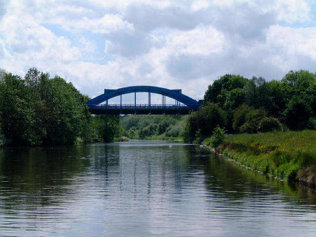
caption=Hartford Bridge
official_name=
carries=A556
crosses=River Weaver
locale=Hartford, Cheshire
maint=
id=
design=
mainspan=
length=
width=
height=
load=
clearance=
below=
traffic=
open=1938
closed=
toll=None
troll=
map_cue=
map_
map_text=
map_width=
coordinates= coord|53|14|15.8|N|2|31|48.2|W|type:landmark_scale:2000_region:GB
lat= 53.237722
long= -2.530056
The Hartford Bridge, or Blue Bridge, is a single-span road bridge crossing the River Weaver at Hartford, Cheshire in England. The bridge is located on the A556 as part of the Northwich bypass.
Wikimedia Foundation.
2010.
Look at other dictionaries:
Hartford Bridge — may refer to:*Hartford Bridge, Cheshire, a bridge in Cheshire, England *Hartford Bridge, Hampshire, a village in Hampshire, England *Hartford Bridge, Northumberland, a village in Northumberland, England … Wikipedia
Hartford (Cheshire) — Hartford Koordinaten 53° 15′ N, 2° 33′ W … Deutsch Wikipedia
Hartford, Cheshire — infobox UK place country = England official name= Hartford map type= Cheshire latitude= 53.2450 longitude= 2.5490 population = 5,515 (2001) country= England region= North West England shire county = Cheshire shire district= Vale Royal… … Wikipedia
Civil parishes in Cheshire — A map of Cheshire, showing the Boroughs : (1) Cheshire West and Chester; (2) Cheshire East; (3) Warrington; and (4) Halton. A civil parish is a subnational entity, forming the lowest unit of local government in England. There are 332 civil… … Wikipedia
Farndon, Cheshire — Coordinates: 53°05′07″N 2°52′41″W / 53.08519°N 2.8781°W / 53.08519; 2.8781 … Wikipedia
List of churches in Cheshire — This is a list of Christian churches in the ceremonial county of Cheshire, England. Church of England The Anglican churches in the county are either part of the diocese of Chester or the diocese of Liverpool. Chester diocese is divided into two… … Wikipedia
Malpas, Cheshire — Coordinates: 53°01′08″N 2°45′50″W / 53.019°N 2.764°W / 53.019; 2.764 … Wikipedia
Mollington, Cheshire — Coordinates: 53°13′34″N 2°57′32″W / 53.226°N 2.959°W / 53.226; 2.959 … Wikipedia
Moston, Cheshire West and Chester — Coordinates: 53°13′23″N 2°53′53″W / 53.223°N 2.898°W / 53.223; 2.898 … Wikipedia
Overton, Cheshire — Coordinates: 53°01′43″N 2°47′09″W / 53.02851°N 2.78572°W / 53.02851; 2.78572 … Wikipedia