Rosebank (Metrorail station)
- Rosebank (Metrorail station)
Infobox Station
name=Rosebank
type=Metrorail commuter rail station
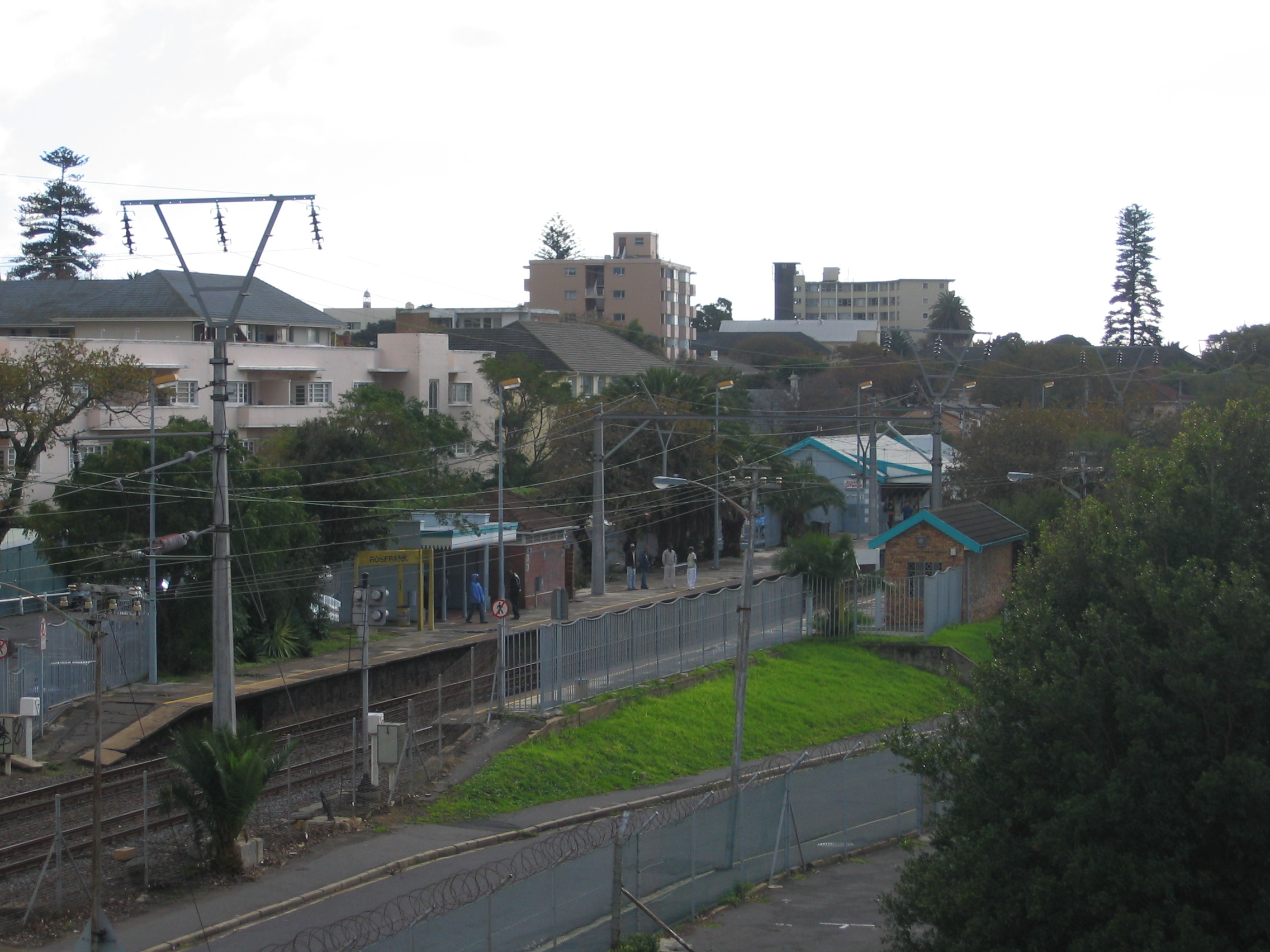
image_size=300px
image_caption=
address=Ryan Road, Rosebank, 7700
coordinates=coord|-33.9547|18.4731|type:railwaystation_region:ZA|display=inline,title
line=rail color box|system=MWC|line=Southern
other=UCT Jammie Shuttle (within walking distance)
structure=At-grade
platform=2 side platforms
tracks=2
parking=approx. 50 spaces
owned=SARCC
services=
map_locator=
Rosebank is a Metrorail station in Rosebank, Cape Town, on the Southern Line. It is located between Main Road and Liesbeek Parkway; on the west side it is accessible from Ryan Road and Hope Road, while on the east side it is accessible from Lower Nursery Road.
Rosebank is the closest railway station to the main campus of the University of Cape Town, being located only 300 metres from the university's Jammie Shuttle bus stop at Tugwell Hall residence.
The station has two high-level side platforms, connected by a pedestrian subway under the tracks. In normal operation, Platform 1 (the western platform) is used for trains travelling towards Cape Town, while Platform 2 (the eastern platform) is used for trains travelling towards Simon's Town.
Notable Places Nearby
* University of Cape Town main campus
* Baxter Theatre Centre
* Council for Scientific and Industrial Research Cape Town office
* South African Bureau of Standards Cape Town office
Wikimedia Foundation.
2010.
Look at other dictionaries:
Rosebank, Cape Town — Rosebank is one of the Southern Suburbs of Cape Town, South Africa, located between the suburbs of Mowbray and Rondebosch.GeographyRosebank is located on the lower eastern slope of Devil s Peak, stretching down to the Liesbeeck River, and on the… … Wikipedia
Southern Line (Metrorail) — Liniennetzplan Metrorail Kapstadt Innenansicht Kapstadt Hauptbahnhof Die Metrorail Kapstadt ist eine S Bahn artige Vorortbahn, die den Hauptbahnhof … Deutsch Wikipedia
Metrorail Kapstadt — Liniennetzplan Metrorail Kapstadt Innenansi … Deutsch Wikipedia
Metrorail (Western Cape) — Infobox Public transit name = Metrorail Western Cape Region locale = Cape Town, Western Cape transit type = Commuter rail system length = convert|423|km|abbr=on vehicles = 79 trainsets (868 coaches) stations = 109 (+ 5 halts) ridership = 621,000… … Wikipedia
Mowbray railway station — Mowbray Metrorail station Station statistics Address Station Road, Mowbray 7700 Coordinates … Wikipedia
Southern Line (Metrorail) — Infobox rail line name = Metrorail Southern Line color = ff0000 logo width = image width = caption = A Southern Line train pulls out of Kalk Bay station type = Commuter rail system = Cape Metrorail status = Operational locale = Cape Town, South… … Wikipedia
Southern Line — Liniennetzplan Metrorail Kapstadt Innenansicht Kapstadt Hauptbahnhof Die Metrorail Kapstadt ist eine S Bahn artige Vorortbahn, die den Hauptbahnhof … Deutsch Wikipedia
Gautrain — Infobox Rail companies logo filename =Gautrain Logo.jpg image filename = widthpx = franchise = Not subject to franchising nameforarea =stations regions =Johannesburg Park Station OR Tambo International Airport Pretoria secregions =Centurion,… … Wikipedia
Gautrain — Rame du Gautrain au dépôt. Réseau Train express régional Année d’ouverture 2010 (Sur la section ORT Sandton) Dernière extension 2011 … Wikipédia en Français
Cape Town — For other uses, see Cape Town (disambiguation). Cape Town Kaapstad iKapa City … Wikipedia