Wittmund (district)

Wittmund (district)

Infobox German district noregbez
name=Wittmund
state=Lower Saxony
capital=Wittmund
area=656.65
population=57,800
population_as_of=2004
density=88
carsign=WTM
url=http://www.landkreis.wittmund.de/

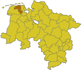
Wittmund is a "Landkreis" (district) in the northwestern part of Lower Saxony, Germany. It is situated in East Frisia, on the North Sea coast. Neighboring districts are (from the east clockwise) Friesland, Leer and Aurich.

Geography

The district contains part of the Wadden Sea and of the Lower Saxony Wadden Sea National Park. The coastal areas of the mainland are also known as Harlinger Land. The islands of Langeoog and Spiekeroog, both belonging to the East Frisian Islands, are part of this district.

History

The district was created by the Kingdom of Prussia in 1885 from the Amt Wittmund, the Amt Esens and the City of Esens. All were previously part of the District of Aurich. In 1977 the district was merged with the District of Friesland; however, the merger was not popular. The merger was declared unconstitutional in 1979 because it violated the rights of the former State of Oldenburg to which Friesland had belonged, and the two districts were re-established in their old boundaries.

Partnerships

The district has a partnership with the district of Schönebeck in Saxony-Anhalt. It was started with German reunification in 1990 to help to establish district administration in former East Germany.

Coat of arms

Towns and municipalities

External links

* [http://www.landkreis.wittmund.de/ Official homepage] de icon


Wikimedia Foundation. 2010.

Игры ⚽ Нужна курсовая?

Look at other dictionaries:

  • Wittmund (arrondissement) — Arrondissement de Wittmund Arrondissement de Wittmund Landkreis Wittmund Données génér …   Wikipédia en Français

  • Wittmund — Infobox German Location Art = Stadt Wappen = Wappen Wittmund.png Wappengröße = 81 lat deg = 53 | lat min = 34 | lat sec =29.49 lon deg = 7 | lon min = 46 | lon sec =51.34 Lageplan = Bundesland = Niedersachsen Landkreis = Wittmund Höhe = 4 Fläche …   Wikipedia

  • Arrondissement de Wittmund — 53° 35′ N 7° 45′ E / 53.58, 7.75 …   Wikipédia en Français

  • Friesland (district) — Infobox German district noregbez name=Friesland state=Lower Saxony capital=Jever area=608 population=99,900 population as of=1999 density=104 carsign=FRI url=http://www.friesland.de Friesland is a district ( Landkreis ) in Lower Saxony, Germany.… …   Wikipedia

  • Osnabrück (district) — Osnabrück   District   Country …   Wikipedia

  • Schönebeck (district) — Infobox German district noregbez name=Schönebeck state=Saxony Anhalt former regierungsbezirk=Magdeburg dissolved = 2007 07 01 capital=Schönebeck area=460.51 population=75,321 population as of=2002 density=164 carsign=SBK url=… …   Wikipedia

  • Diepholz (district) — Diepholz   District   Country …   Wikipedia

  • Northeim (district) — Northeim   District   Country …   Wikipedia

  • Aurich (district) — Infobox German district noregbez name=Aurich state=Lower Saxony capital=Aurich area=1287 population=187,700 population as of=2002 density=146 carsign=AUR url= [http://www.landkreis aurich.de/ landkreis aurich.de] Aurich is a district ( Landkreis… …   Wikipedia

  • Leer (district) — Infobox German district noregbez name=Leer state=Lower Saxony capital=Leer area=1086 population=163,800 population as of=2002 density=151 carsign=LER url=http://www.landkreis leer.de Leer is a district ( Landkreis ) in Lower Saxony, Germany. It… …   Wikipedia

Share the article and excerpts

Direct link
Do a right-click on the link above
and select “Copy Link”