- Charles River
-
This article is about the Massachusetts river. For other meanings, see Charles River (disambiguation).
Charles River  The Longfellow Bridge crossing over the Charles River, in the winter.
Country United States State Massachusetts Cities Hopkinton, Boston Source Echo Lake - location Hopkinton, Massachusetts, United States - elevation 350 ft (107 m) - coordinates 42°11′34″N 71°30′43″W / 42.19278°N 71.51194°W Mouth Boston Harbor - location Boston, Massachusetts, United States - elevation 0 ft (0 m) - coordinates 42°22′14″N 71°3′13″W / 42.37056°N 71.05361°W Length 80 mi (129 km) Basin 308 sq mi (798 km2) Discharge - average 302 cu ft/s (9 m3/s) - max 4,150 cu ft/s (118 m3/s) - min 0.1 cu ft/s (0 m3/s) 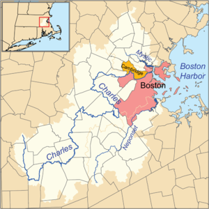 Charles, Mystic and Neponset river watersheds
The Charles River is an 80 mi (129 km) long river that flows in an overall northeasterly direction in eastern Massachusetts, USA. From its source in Hopkinton, the river travels through 22 cities and towns until reaching the Atlantic Ocean at Boston. It is also sometimes called the River Charles.
Contents
Route
The Charles River is fed by about 80 brooks and streams and several major aquifers as it flows snakelike for 80 miles (129 km),[1] starting at Echo Lake (42°11′35″N 71°30′43″W / 42.193012°N 71.5119°W) in Hopkinton, through 22 cities and towns in eastern Massachusetts before emptying into Boston Harbor. 33 lakes and ponds, and 35 communities are entirely or partially part of the Charles River watershed. Despite the river's length and relatively large drainage area (308 square miles; 798 km²), its source is only 26 miles (42 km) from its mouth, and the river drops only 350 feet (107 m) from source to sea. It is the most densely populated river basin in New England.[citation needed]
Brandeis University, Harvard University, Boston University, and the Massachusetts Institute of Technology are all located along the Charles River. Near its mouth, it forms the border between downtown Boston and Cambridge and Charlestown (a neighborhood of Boston). Here, the river opens out into a broad basin and is lined by the parks of the Charles River Reservation. On the Charles River Esplanade stands the Hatch Shell, where concerts are given in summer evenings. The basin is especially known for its Independence Day celebration. The middle section of the river, between the Watertown Dam and Wellesley is partially protected by the properties of the Upper Charles River Reservation and other state parks, including the Hemlock Gorge Reservation, Cutler Park, and the Elm Bank Reservation.
Recreation
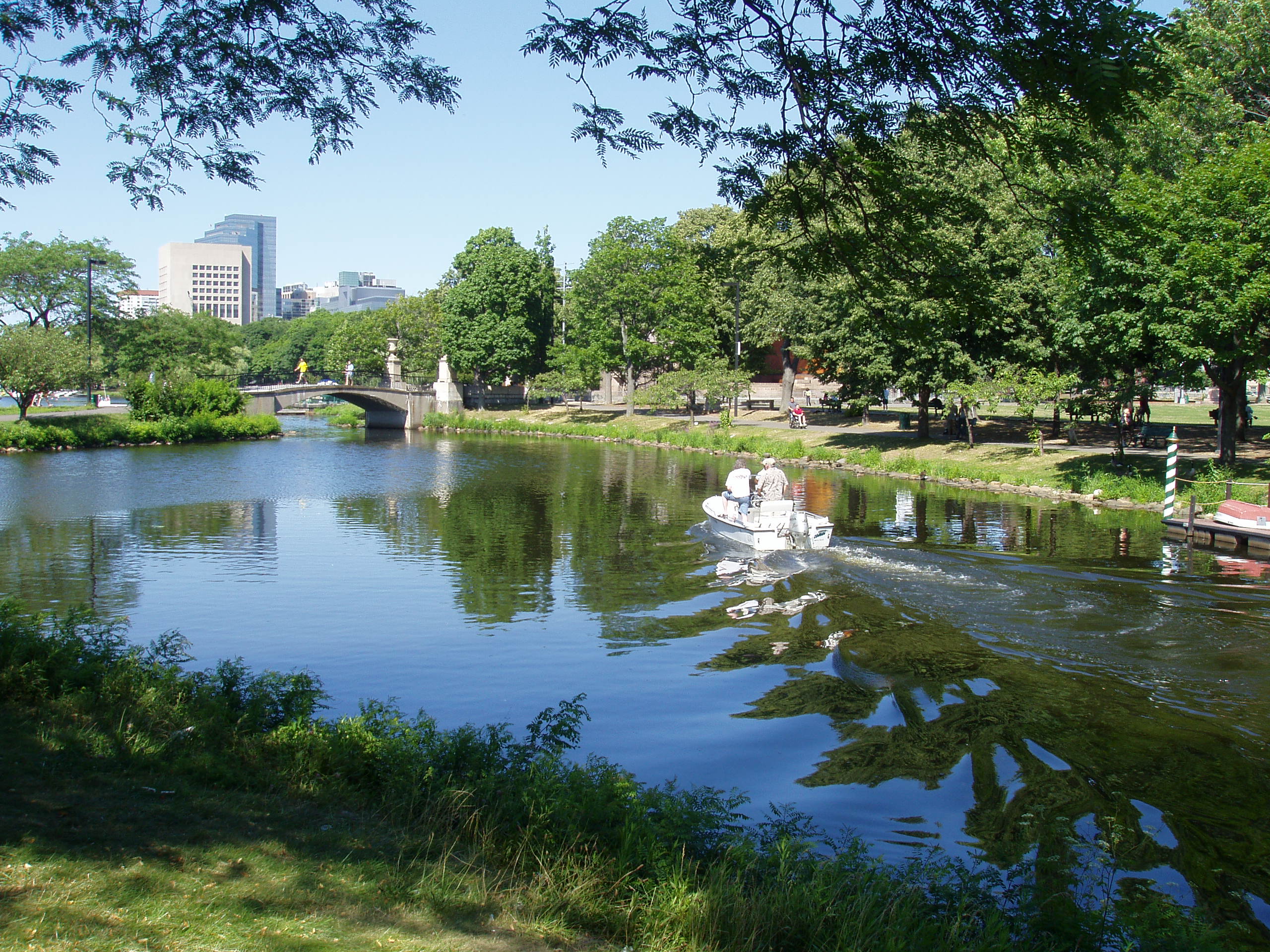
The river is well known for its rowing, sculling, dragonboating, and sailing, both recreational and competitive. The river may also be kayaked; depending on the season, however, kayakers can only navigate the Charles by getting out and dragging their kayaks for significant stretches. The "Lower Basin" between the Longfellow and Harvard bridges is home to Community Boating, the Harvard University Sailing Center, and the MIT Sailing Pavilion. The Head of the Charles Regatta is held here every October. In early June, the annual Hong Kong Boston Dragon boat Festival is held in Cambridge, near the Weeks Footbridge.
The Charles River Bike Path runs 23 miles (37 km) along the banks of the Charles, starting at the Museum of Science and passing the campuses of MIT, Harvard and Boston University. The path is popular with runners and bikers. Many runners gauge their distance and speed by keeping track of the mileage between the bridges along the route.[2]
History
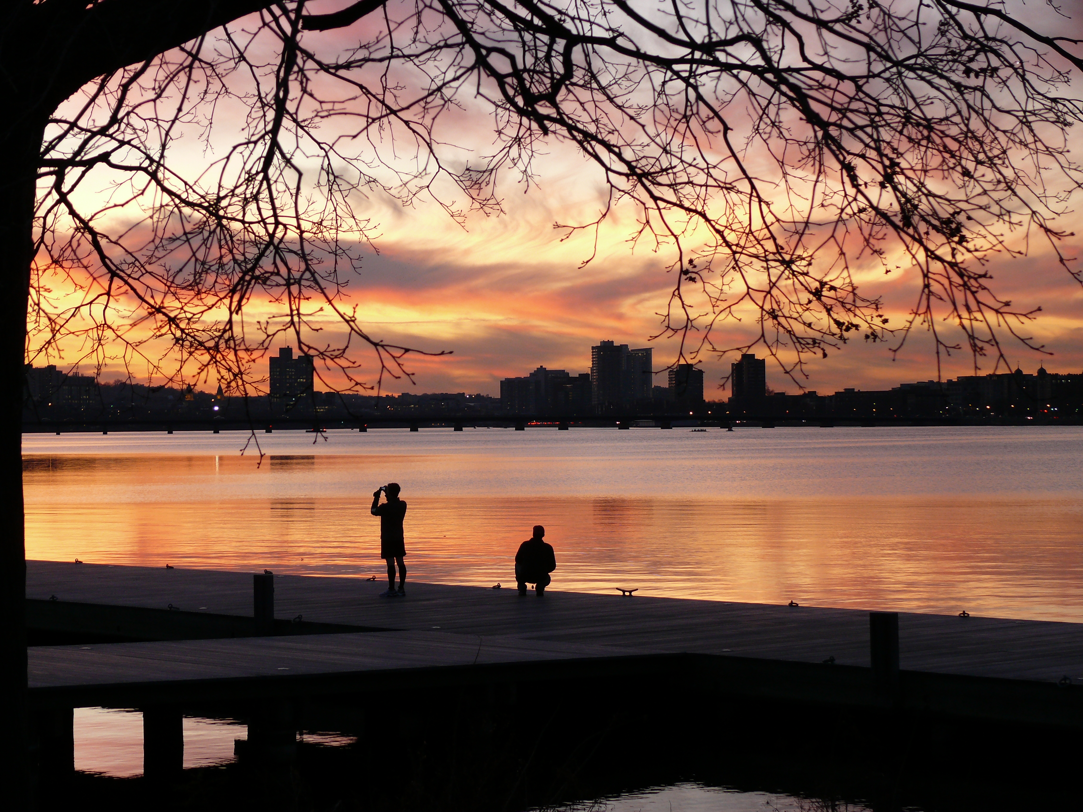
 View of the Charles River and Boston at night
The river's name, preceding the English version, was once thought to be Quinobequin (meandering), though that attribution has been discredited by, among others, the Harvard University Librarian in 1850.[citation needed] The river was used by Native Americans for local transportation and fishing, and as part of the passage from southeastern Massachusetts to northern New England.
Captain John Smith explored and mapped the coast of New England, naming many features including the Charles River, which he gave the Native American name, Massachusetts River. When Smith presented his map to Charles I he suggested that the king should feel free to change any of the "barbarous names" for "English" ones. The king made many such changes, but only four survive today, one of which is the Charles River, which Charles named for himself.[3]
In portions of its length, the Charles drops slowly in elevation and has relatively little current. Despite this, early settlers in Dedham, Massachusetts, found a way to use the Charles to power mills. In 1639, the town dug a canal from the Charles to a nearby brook that drained to the Neponset River. By this action, a portion of the Charles's flow was diverted, providing enough current for several mills. The new canal and the brook together are now called Mother Brook. The canal is regarded as the first industrial canal in North America. Today it remains in use for flood control.
Waltham was the site of the first fully integrated textile factory in America, built by Francis Cabot Lowell in 1814[citation needed], and by the 19th century, the Charles River was one of the most industrialized areas in the United States. Its hydropower soon fueled many mills and factories. By the century's end, 20 dams had been built across the river, mostly to generate power for industry. An 1875 government report listed 43 mills along the 9.5-mile (15 km) tidal estuary from Watertown Dam to Boston Harbor. From 1816 to 1968, the U.S. Army operated a gun and ammunition storage and later production facility known as the Watertown Arsenal. While it was key to many of the nation's war efforts over its several decades in operation, not the least of which being the American Civil War and World War I, its location in Watertown so near the Charles did great environmental harm. The old arsenal itself was declared a Super Fund site and, after its closure by the government, had to be cleaned at significant expense before it could be safely used again for other purposes. Likewise, the many factories and mills along the banks of the Charles supported a buoyant economy in their time but left a legacy of massive pollution.
Creation of modern Boston-Cambridge basin
 A sunny day on the Charles River Esplanade
Today's Charles River basin between Boston and Cambridge is almost entirely a work of human design. Owen A. Galvin was appointed head of the Charles River Improvement Commission by Governor William E. Russell in 1891. Their work led to the design initiatives of noted landscape architects Charles Eliot and Arthur Shurcliff, both of whom had apprenticed with Frederick Law Olmsted, and by the architect and landscape architect Guy Lowell. This designed landscape now includes over 20 parks and natural areas along 19 miles (31 km) of shoreline, from the New Dam at the Charlestown Bridge to the dam near Watertown Square.
Eliot first envisioned today's river design in the 1890s, an important model being the layout of the Alster basin in Hamburg,[4] but major construction began only after Eliot's death with the damming of the river's mouth at today's Museum of Science, an effort led in by James Jackson Storrow. The new dam, completed in 1910, stabilized the water level from Boston to Watertown, eliminating the existing mud flats, and a narrow embankment was built between Leverett Circle and Charlesgate. After Storrow's death, his widow Mrs. James Jackson Storrow donated $1 million toward the creation of a more generously landscaped park along the Esplanade; it was dedicated in 1936 as the Storrow Memorial Embankment. This also enabled the construction of many public docks in the Charles River Basin. In the 1950s a highway (Storrow Drive) was built along the edge of the Esplanade to connect Charles Circle with Soldiers Field Road, and the Esplanade was enlarged on the water side of the new highway.
The Inner Belt highway was proposed to cross the Charles River at the Boston University Bridge, but its construction was canceled in the 1970s.
Pollution and remediation efforts
As sewage, industrial wastewater and urban runoff flowed freely into the river from the surrounding city, the Charles River became well known for its high level of pollutants, gaining such notoriety that by 1955, Bernard DeVoto wrote in Harper's Magazine that the Charles was "foul and noisome, polluted by offal and industrious wastes, scummy with oil, unlikely to be mistaken for water." [5] It was not an uncommon sight to see toxins coloring the river pink and orange in spots, fish kills and submerged cars.[6]
Once popular with swimmers, awareness of the river's high pollution levels forced the state to shut down several popular swimming areas, including Cambridge's Magazine Beach and Gerry Landing public beaches. Until very recently, rowers and sailors who fell into the water were advised to go to the hospital for tetanus shots.[5]
 Sailboats moored on the Charlestown side of the Charles River with Bunker Hill Monument in the distance
Efforts to clean up the river and restore it to a state where swimming and fishing would be acceptable began as early as the 1960s and the program to clean up the Charles for good took shape in 1965 with the creation of the Charles River Watershed Association.[7] In 1995, the United States Environmental Protection Agency declared a goal of making the river swimmable by 2005.[5] In 1996, then governor William Weld plunged, fully clothed, into the river to prove his commitment to cleaning up the river.[8] In July 2007, the river hosted the Charles River Masters Swim Race, the first sanctioned race in the Charles in over five decades.[9]
A combination of public and private initiatives helped dramatically lower levels of pollutants by focusing on eliminating combined sewer overflows and storm water runoff. A new Charles River Dam was constructed downstream from the Science Museum site to keep salt water out of the basin. Since Weld's stunt, the river's condition has improved dramatically, although it was not deemed entirely swimmable by 2005. In 1995 the EPA rated the river's quality as a "D" compared to the most recent ranking of a "B+" and most days of the year, the river now meets swimming standards below the Harvard Bridge.[5] With the improved water quality, swimming and fishing are progressively re-emerging as about 90% of the length of the river is now considered safe for swimming.[7] Health risks remain, however, particularly after rainstorms and when walking in certain riverbeds stirs up toxic sediment.[citation needed]
During the period September 2004 to September 2006, the City of Cambridge and the state's Department of Conservation and Recreation introduced vegetation at Magazine Beach just west of the BU Bridge on the Cambridge side of the river. This introduced vegetation had significant problems surviving because it was not native to the Charles River.[citation needed] The vegetation installed created a wall preventing the reintroduction of swimming at Magazine Beach.[citation needed]
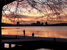 Sunset at Charles River in December 2010
The Conservation Law Foundation opposes the permit given to Mirant for the Mirant Kendall Generating Station, an electricity plant near Kendall Square, charging that the water it releases causes blooms of hazardous microorganisms, due to its warm temperature.[10]
It is a common belief that the water quality of the Charles River is at its worst after a large rainfall because of pollutants carried by runoff. However, a study, published in the Journal of the American Water Resources Association (April 2008), completed by researchers at Northeastern University, found high concentrations of E. coli bacteria in the Charles River after a long period of no rain. Using a mathematical model, the researchers then determined that two major tributaries, the Stony Brook and Muddy River, are the predominant sources of E. coli in the lower Charles River.[11]
Oysters have been used to filter and clean Charles River water.[12]
In popular culture
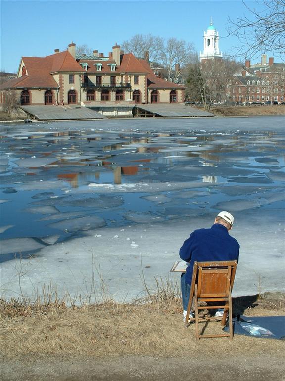
 Looking towards Boston across the Charles in winter
- The Charles River is an icon for Boston and is featured in the song "Dirty Water" by The Standells:
- Down by the River...
- Down by the banks of the River Charles
- (Oh, that's what's happenin' baby)
- That's where you'll find me
- Along with lovers, muggers, and thieves
- (Ahh, but they're cool people)
- But I love that dirty water
- Oh, Boston, you're my home
- Todd Rundgren's song "Boat on the Charles" from Runt: The Ballad of Todd Rundgren is written from the point of view of someone contemplating suicide in the Charles because of an unrequited love.
- In William Faulkner's The Sound and the Fury, the tormented character Quentin Compson commits suicide by jumping off the Anderson Bridge and drowning in the Charles.
- The 1994 film The River Wild opens with Meryl Streep rowing under the Watertown Bridge (Galen Street, Rt. 16) proceeding east past the Perkins School for the Blind Chapel tower and on to Boston.
- In the novel The Bell Jar by Sylvia Plath, the protagonist, Esther, briefly considers committing suicide by jumping into the Charles off of a bridge.
- In the short story "The Other" by Jorge Luis Borges a mature Borges sits on the bank of the river Charles and comes faces to face with a younger version of himself. He determines that in the past he must have had the encounter during a dream and dismissed it as fantasy, though later accepting it as real.
- In the Academy Award-winning film, Eternal Sunshine of the Spotless Mind, about one-fourth of the film takes place in the frozen river.
Gallery
-

The Charles River from the Boston side, facing Weld Boathouse and the main campus of Harvard University in Cambridge.
-

Panorama of the Charles River in May
-

View of Charles River at Newton Upper Falls
-

Charles River at Medfield-Millis town line
See also
 John W. Weeks Bridge
- List of crossings of the Charles River
- List of Charles River boathouses
- List of Massachusetts rivers
- Sudbury Aqueduct Linear District which crosses the river from Needham to Newton on the Echo Bridge
Notes
- ^ . http://architectureboston.com/2010/05/13/how-long-is-the-charles-river/.
- ^ http://web.mit.edu/track/indoor/bridges.html
- ^ Stewart, George R. (1967) [1945]. Names on the Land: A Historical Account of Place-Naming in the United States (Sentry edition (3rd) ed.). Houghton Mifflin. p. 38.
- ^ Karl Haglund (2003). Inventing the Charles River. Cambridge, Massachusetts: The MIT Press. ISBN 0262083078.
- ^ a b c d Swimming in the Charles River
- ^ Group Eyes Lawsuit Over Charles River Pollution
- ^ a b Charles River Watershed Association, includes swimmability maps
- ^ Online NewsHour: KERRY / WELD: DEAD HEAT
- ^ Malcom A. Glenn, Brown Charles Gets Green Light, Harvard Crimson, July 20, 2007
- ^ http://www.clf.org/programs/cases.asp?id=322
- ^ Researcher Develops Model to Track E. coli in Charles River Newswise, Retrieved on August 6, 2008.
- ^ Beard, David (October 26, 2008). "Oysters help clean the Charles River". The Boston Globe. http://www.boston.com/lifestyle/green/greenblog/2008/10/oysters_help_clean_the_charles.html.
References
- Inventing the Charles River, by Karl Haglund, MIT Press, 2003, in collaboration with the Charles River Conservancy.
- Gaining Ground: A History of Landmaking in Boston, by Nancy S. Seasholes, MIT Press, 2003.
- Omeros, by Derek Walcott, Faber and Faber (London), 1990. (Repeated references to the Charles river in descriptions of Boston life.)
- Benet, Steven Vincent & Carmer, Carly, The Charles, Rivers of America Series, New York: Farrar & Rinehart, 1941
External links
- The Esplanade Association
- Charles River Watershed Association
- Charles River Conservancy
- Department of Conservation and Recreation - Charles River
- "Swimmable by 2005" EPA Effort
- Charles River Swimming Club
- Charles River Museum of Industry
- US Geological Survey data on flow in Charles River at Waltham with links to data for other measurement sites
Categories:- Charles River
- Rivers of Suffolk County, Massachusetts
- Rivers of Middlesex County, Massachusetts
- Rivers of Norfolk County, Massachusetts
- Rivers of Worcester County, Massachusetts
- Rowing venues
- Landforms of Boston, Massachusetts
- Watersheds of Boston Harbor


Wikimedia Foundation. 2010.