- Cumbres and Toltec Scenic Railroad
-
Cumbres & Toltec Scenic Railroad 
Locale Conejos County and
Archuleta County
in Colorado and
Rio Arriba County
in New MexicoDates of operation 1970–present Track gauge 3 ft (914 mm) Headquarters Denver & Rio Grande Railroad
San Juan Extension
Nearest city: Antonito, Colorado and Chama, New Mexico Coordinates: 36°54′9″N 106°34′42″W / 36.9025°N 106.57833°WCoordinates: 36°54′9″N 106°34′42″W / 36.9025°N 106.57833°W Built: 1880 Architect: Denver & Rio Grande Railroad
Baldwin Locomotive WorksArchitectural style: Late 19th And Early 20th Century American Movements Governing body: State MPS: Railroads in Colorado, 1858-1948 MPS NRHP Reference#: 73000462[1] (original)
07000374[1] (increase)Significant dates Added to NRHP: February 16, 1973 Boundary increase: April 24, 2007 The Cumbres & Toltec Scenic Railroad (C&TS) is a narrow gauge heritage railroad running between Chama, New Mexico and Antonito, Colorado. It runs over the 10,015 ft (3,053 m) Cumbres Pass, the highest point on a US passenger railway.
The track was originally laid in 1880 by the Denver and Rio Grande Railroad. In 1970 the C&TS began to take tourists on six-hour trips between the two towns, using steam locomotives.
As Denver & Rio Grande Railroad San Juan Extension, the railway was listed on the National Register of Historic Places in 1973. The boundaries of the NRHP listed area were increased in 2007.[1]
Contents
Locations of Interest
- Chama, New Mexico 36°54′9″N 106°34′42″W / 36.9025°N 106.57833°W
- Cumbres Pass 37°01′10.4″N 106°26′53.4″W / 37.019556°N 106.448167°W
- Osier, Colorado 37°0′44″N 106°20′9″W / 37.01222°N 106.33583°W
- Toltec Gorge, New Mexico 36°59′3.9″N 106°18′22.2″W / 36.984417°N 106.306167°W
- Sublette Station 36°59′20″N 106°13′48″W / 36.98889°N 106.23°W
- Antonito, Colorado 37°4′11″N 106°0′42″W / 37.06972°N 106.01167°W
Historic and railfan interest
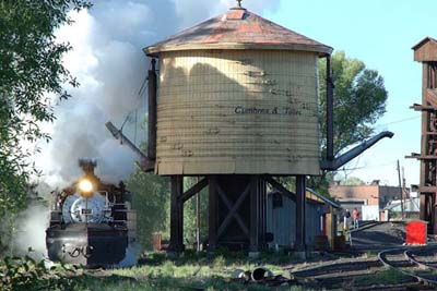
Chama today is a small village, but considered hallowed ground by many railfans. Chama houses one of the most physically complete railroad yards from the steam era in the United States. Although portions of the roundhouse, warehouses, and parking lots have been changed, the railroad yard still has the feel of 1960 and earlier. The yard tracks contain authentic rolling stock of the Denver and Rio Grande indigenous to the railroad line.
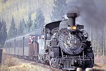
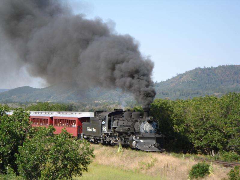
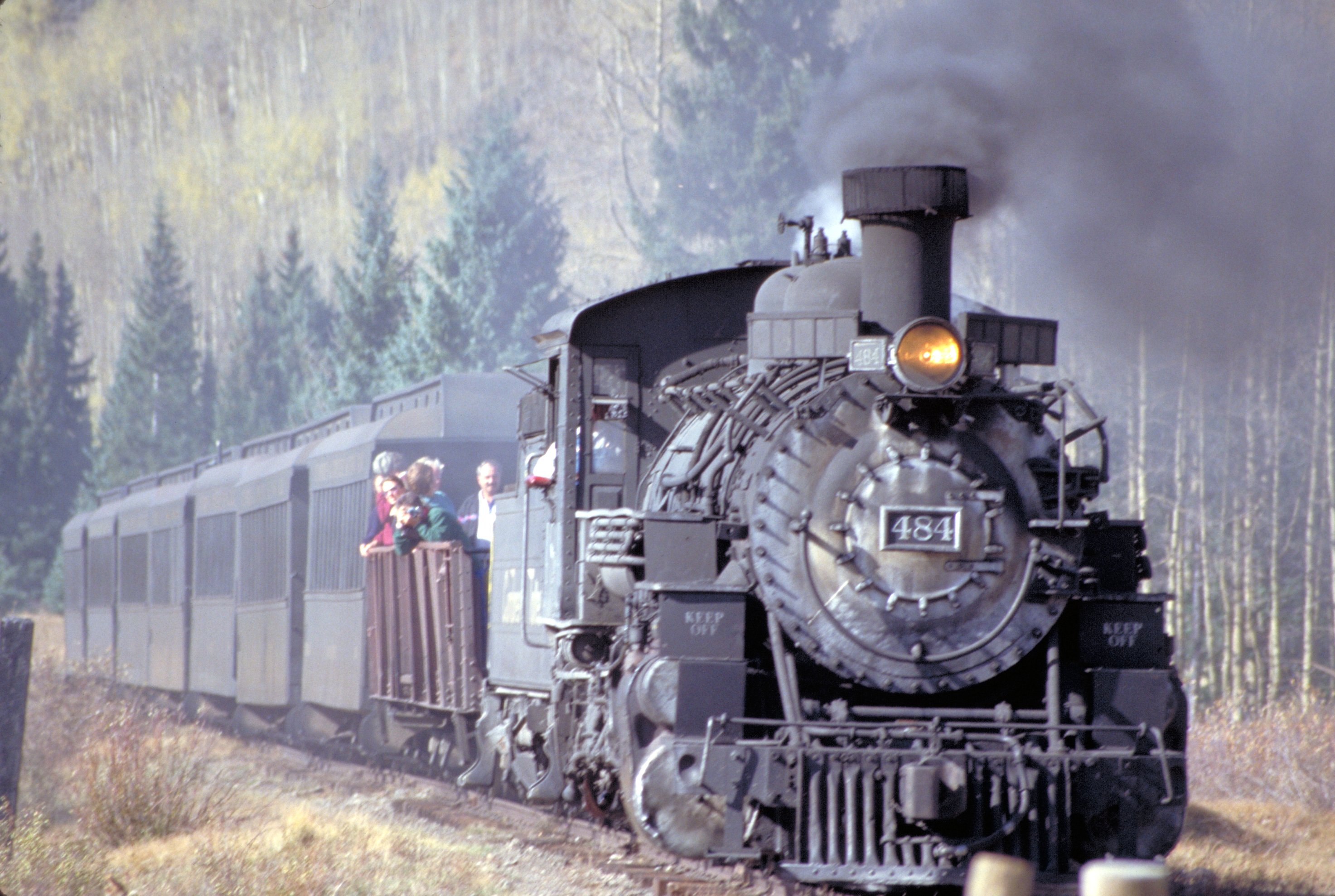
All the locomotives of the railroad were built for the C&TS's precursor, all 2-8-2 Mikados. These range from the K-27 "Mudhen", #463, once owned by Gene Autry, to the K-37s, originally built as standard gauge locomotives by Baldwin in 1903 and re-built as narrow gauge locomotives by the D&RGW in 1928-30 in the railroad's Burnham Shops in Denver. The mainstays are the venerable K-36 fleet, turned out by Baldwin Locomotive Works in 1925. The flagship of the line is K-36, #487, which has seen the most service.
Operational information
The C&TS is 64 miles (103 km) of former Denver and Rio Grande Western trackage. While officially headquartered in Chama, the railroad splits most of its functions between the terminuses of the railroad. The Cumbres and Toltec Commission offices are at Antonito, along with the railroad's main car shop, where repairs to rolling stock are performed. The main center of actual operation for the railroad is Chama, the site of the locomotive repair shop.
Schedule[dated info]
The 2010 schedule calls for trains operating 7 days a week, from Saturday, May 22 through Sunday, October 17. Each day trains will depart both Chama and Antonito, with trains meeting at Osier before returning to either Chama or Antonito. This will allow either a one-way trip across the entire line (with charter bus return) or a round trip to Osier and back to either end.
Fire damage
On June 23, 2010, a brush fire severely damaged the Lobato Trestle. The railway trucked locomotive 484 and some coaches from Chama to Cumbres so that operations could continue on both sides of the break. [2]
As of Monday, June 20, 2011, the Lobato Trestle is back in service, and trains are once more traveling the full length of the railroad, from Chama, New Mexico to the summit of Cumbres Pass and beyond, all the way to Antonito, Colorado. This includes the daily lunch stop at Osier.
Trip description
Chama to Osier
 C&TS #487 in the Chama Yard
Beginning in Chama (Milepost 344.12), the railroad makes a nearly straight shot northeast after leaving the yard and crossing the Rio Chama (Rio Grande). About a mile later begins a 4% grade which is nearly constant from there to Cumbres. with the exception of a stretch at Coxo. The first siding on the line is located at Lobato (MP: 339.99), located here are the remnants of a stock pen, and a water tank specifically made for a movie in the 1970s. The tank was used later in Indiana Jones and the Last Crusade. The water tank was knocked over in 2006, due to age and high winds. Just under a quarter of a mile away, is Lobato Trestle, the second highest trestle on the line, built in 1883. Due to weight restrictions, only one locomotive at a time is allowed to cross; therefore, all double-headers must separate, and rejoin on the other side. On June 23, 2010, a fire of unknown origin burned the deck of the bridge destroying the wooden deck and railroad crossties. This fire also caused unrepairable damage to the bridge's steel spans, requiring their replacement. Trains departed Cumbres instead of Chama for the rest of the 2010 season. Work to replace the bridge spans began in March 2011 and was finished in June 2011. The first passenger train over the bridge occurred on the morning on June 20, 2011.
From here to Cumbres, the railroad operates on the north side of Wolf Creek. On the journey to the top at Cumbres, the train passes Cresco Siding and water tank (MP 335.10) and navigates a small canyon past Hamilton's Point. Exiting the canyon, the track makes a turn to the northwest and up the Wolf Creek drainage through Coxo. At a narrow point of the valley, the track makes a horseshoe turn up to Windy Point, which the train rounds to enter Cumbres Pass.
At Cumbres (MP 330.48), elevation 10,015 ft (3,053 m), is the Car Inspector's House, Water Standpipe, remnants of the extensive snow shed, and the Section House, which replaced the original depot after it was demolished in the 1950s. Cumbres is the highest point on the railroad. From here east, the track heads down at 2.5%, and descends the Cumbres Loop, more commonly refer to as "Tanglefoot Curve". After exiting the loop, the track follows a general easterly direction until Milepost 327.6, where they turn north up the Los Pinos Valley.
Heading north, the track loses elevation, while the valley slopes up, with the track and valley floor finally meeting at Mile 325, where the track once again changes direction, heading south on the other side of the valley, following the Rio de Los Pinos toward Osier. After Mile 323, the track again leaves the valley, on a much steeper grade, while the track clings to the valley created by the river. Along the way, the track crosses Cascade Trestle (MP 319.95), taller than the Lobato Trestle, at 137 ft (42 m). Approximately a mile and a half later, the track enters Osier, Colorado, the mid-point of the railroad where the two trains meet for lunch. Here, riders may return to their point of origin, or switch trains and ride to the opposing terminus.
Antonito to Osier
 C&TS steam locomotive #489
This section covers the eastern portion of the line from the small cattle and junction town of Antonito to Osier, the midpoint of the line.
Antonito (MP 280.70) is a small company town of the former railroad main line. It is home to the C&TS car shop, a water tank, and other relics. Most of the facilities were built by the Cumbres & Toltec, as the original rail yard, wye, and station were not sold to the states of Colorado and New Mexico.
Shortly after leaving the station, the train heads straight for 3 miles (4.8 km), until coming into some hills. Shortly thereafter, the train crosses Ferguson's Trestle (MP 285.87), named for a man who was hung from a locomotive there. The original trestle was featured in the 1988 TV movie Where The Hell's That Gold? starring Willie Nelson and Delta Burke. In filming, a planned explosion ended up getting out of hand and the bridge was burned down. Traffic was halted for a week while the C&TS built a temporary bridge; the following winter it rebuilt the trestle to match the original. About three miles (5 km) later, the train makes the first of 11 crossings into New Mexico, and climbs a ledge up to a lava mesa. Lava (291.55) has the old water tank from Antonito which was moved here in 1971. The track goes around a horseshoe curve which is also used as a reversing loop to turn the rotary snow plow trains from Chama. The Cumbres and Toltec has two rotary snowplows, Rotary OM and Rotary OY.
Heading west, the track rounds Whiplash Curve, a double horseshoe curve. About a mile from Whiplash Curve lie the sidings and wye at Big Horn. Past Big Horn the train loops around the sides of mountains going through horseshoe curves before reaching the first water stop at Sublette.
Sublette is an abandoned railroad section camp, consisting of a log bunk house, a section house, a siding, and other buildings. There used to be a water tank at the western end of the siding, but today, in its place, is a standpipe. After filling the tender with water, the engine and the train slowly creep into lush aspen groves.
After departing Sublette comes Toltec Siding, which in the 50's was the meeting place of long oil well pipe trains moving between Chama and Farmington to Alamosa. Shortly afterwords, trains pass through Mud Tunnel, which is unique because it is lined with wooden pillars since it is made through soft volcanic ash. When the beams in the tunnel collapsed, the D&RGW made a "shoo fly" around the tunnel to allow passengers and small cars to be moved around the tunnel to an awaiting train. After passing through this, trains pass around Phantom Curve and through Calico Cut, and then the train slows as trains enter the longer Rock Tunnel. Trains exit the tunnel, entering the Toltec Gorge, where the track is 600 ft (180 m) above the river. The line follows the river the rest of the way to Osier.
See also
- Denver & Rio Grande Railroad
- List of Denver and Rio Grande Western Railroad lines
- San Juan Express
- Durango and Silverton Narrow Gauge Railroad
- D & RG Narrow Gauge Trestle
- Narrow gauge railroads in the United States
- List of Colorado historic railroads
- List of heritage railroads in the United States
- Heber Valley Historic Railroad
References
- ^ a b c "National Register Information System". National Register of Historic Places. National Park Service. 2008-04-15. http://nrhp.focus.nps.gov/natreg/docs/All_Data.html.
- ^ "Bridge Fire Severs Route". Railfan & Railroad. September 2010.
External links
- Official Cumbres & Toltec Scenic Railroad Web Site
- Friends of the Cumbres & Toltec Scenic Railroad
- Cumbres & Toltec Scenic Railroad Photos
- Official Cumbres History Page
 State of New Mexico
Topics Delegations · Geography · Government · History · Landmarks · Military · Natural history · New Mexicans · Settlements · Transportation · Tribes · Visitor attractions
Society Culture · Demographics · Economy · Education · Politics
Regions Cities Alamogordo · Albuquerque · Artesia · Carlsbad · Clovis · Corrales · Deming · Española · Farmington · Gallup · Grants · Hobbs · Las Cruces · Las Vegas · Los Alamos · Los Lunas · Lovington · Portales · Raton · Rio Rancho · Roswell · Ruidoso · Santa Fe · Silver City · Socorro · Sunland Park · Taos · Tucumcari
Counties Bernalillo · Catron · Chaves · Cibola · Colfax · Curry · De Baca · Doña Ana · Eddy · Grant · Guadalupe · Harding · Hidalgo · Lea · Lincoln · Los Alamos · Luna · McKinley · Mora · Otero · Quay · Rio Arriba · Roosevelt · Sandoval · San Juan · San Miguel · Santa Fe · Sierra · Socorro · Taos · Torrance · Union · Valencia
U.S. National Register of Historic Places Topics Lists by states Alabama • Alaska • Arizona • Arkansas • California • Colorado • Connecticut • Delaware • Florida • Georgia • Hawaii • Idaho • Illinois • Indiana • Iowa • Kansas • Kentucky • Louisiana • Maine • Maryland • Massachusetts • Michigan • Minnesota • Mississippi • Missouri • Montana • Nebraska • Nevada • New Hampshire • New Jersey • New Mexico • New York • North Carolina • North Dakota • Ohio • Oklahoma • Oregon • Pennsylvania • Rhode Island • South Carolina • South Dakota • Tennessee • Texas • Utah • Vermont • Virginia • Washington • West Virginia • Wisconsin • WyomingLists by territories Lists by associated states Other The main article for this category is Narrow gauge railways.Categories:- Visitor attractions in Archuleta County, Colorado
- Visitor attractions in Conejos County, Colorado
- 3ft gauge railways
- Narrow gauge railways by country
- Rail transportation in the United States
- Narrow gauge railways in North America
- Narrow gauge railroads in Colorado
- Heritage railroads in Colorado
- National Register of Historic Places in Colorado
- Historic districts in Colorado
- Heritage railroads in New Mexico
- Narrow gauge railroads in New Mexico
- National Register of Historic Places in New Mexico
- Historic districts in New Mexico
- Railway-related listings on the National Register of Historic Places
- Historic Civil Engineering Landmarks
- Companies operating former Denver and Rio Grande Western Railroad lines
- Transportation in Rio Arriba County, New Mexico
- Visitor attractions in Rio Arriba County, New Mexico
- Museums in Rio Arriba County, New Mexico
- Railroad museums in New Mexico
- Visitor attractions in Alamosa County, Colorado
- Transportation in Alamosa County, Colorado
- Transportation in Archuleta County, Colorado
- Transportation in Conejos County, Colorado
- Passenger rail transportation in Colorado
- Passenger rail transportation in New Mexico
Wikimedia Foundation. 2010.