- Transbaikal
-
"Dauria" redirects here. For other uses, see Dauria (disambiguation).
 Transbaikal view at Chita
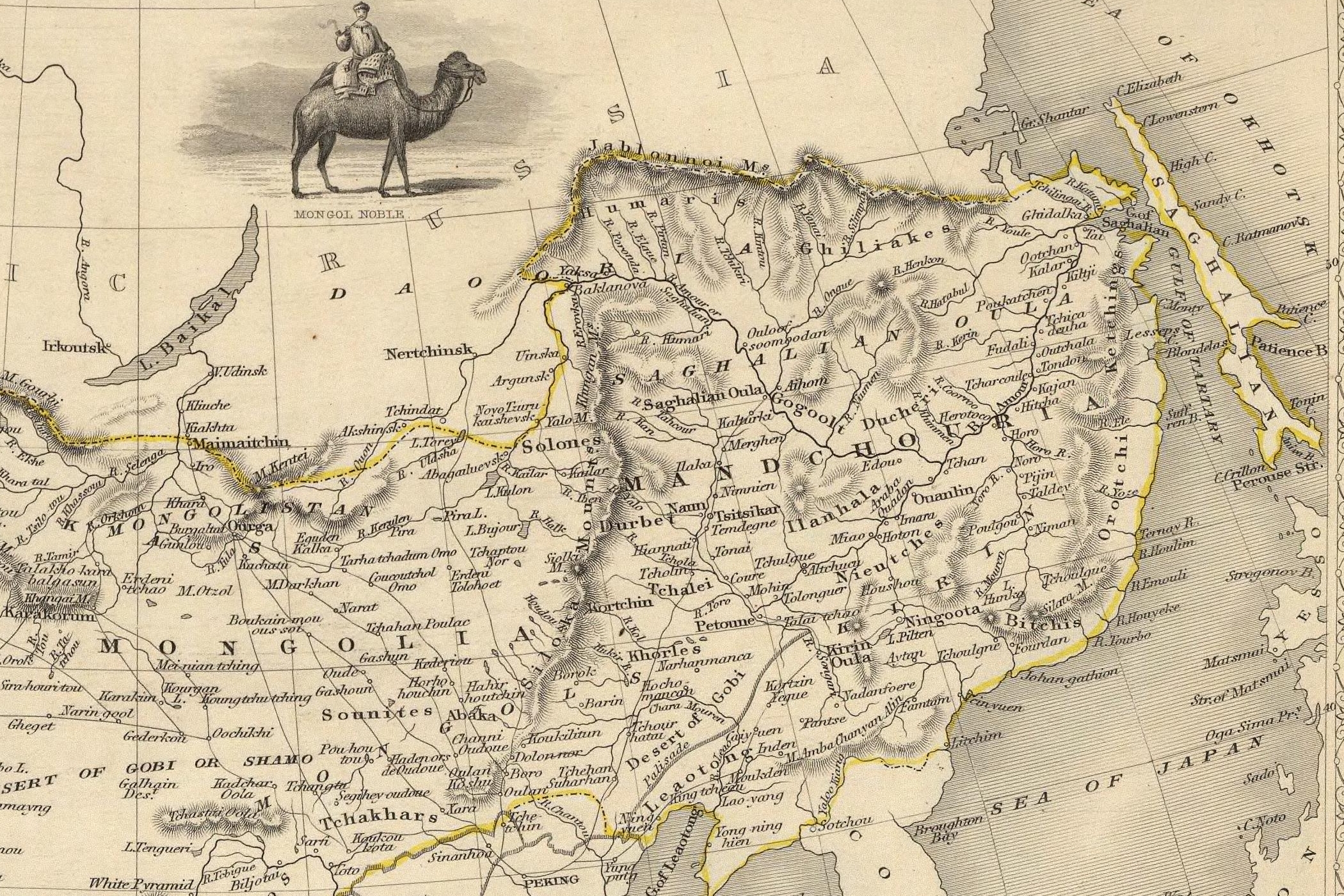
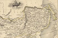 Dauria on a British 1851 map.
As the map was published 7 years before the Treaty of Aigun, eastern (Amur) Dauria is still shown as part of Chinese EmpireTransbaikal, Trans-Baikal, Transbaikalia (Russian: Забайкалье, Zabaykalye), or Dauria (Даурия, Dauriya) is a mountainous region to the east of or "beyond" (trans-) Lake Baikal in Russia. The alternative name, Dauria, is derived from the ethnonym of the Daur people. It stretches for almost 1000 km from north to south from the Patomskoye Plateau and North Baikal Plateau to the Russian state border. The Transbaikal region covers more than 1000 km from west to east from Baikal to the meridian of the confluence of the Shilka and Argun Rivers.
In Imperial Russia, Dauria was itself an oblast with its capital at Nerchinsk, then at Chita and became part of the Far Eastern Republic in 1920. It is currently divided into Buryatia and Zabaykalsky Krai and makes up nearly all of the territory of these two federal subjects.
The region has given its name to various animal species including Daurian Hedgehog, and the following birds: Asian Brown Flycatcher (Muscicapa dauurica), Daurian Jackdaw, Daurian Partridge, Daurian Redstart, Daurian Starling, Daurian Shrike and the Red-rumped Swallow (Hirundo daurica). The common name of the famous Dahurian Larch (Larix gmelinii) as well as that of the Dahurian Buckthorn (Rhamnus davurica) are also derived from the same source.
Oktyabrsky (Октябрьский) village, Amur Oblast, near the Russia-China border is a large site of uranium mining and processing facilities.[1]
See also
- Transbaikal (disambiguation)
- Amur Front
References
- ^ Shandala N, Filonova A, Titov A, Isaev D, Seregin V, Semenova V, and Metlyaev EG (2009), Radiation situation nearby the uranium mining facility, Environmental section poster P.9, 54th Annual Meeting of the Health Physics Society, 12-16 July 2009, Minneapolis, MN, USA.
 This article incorporates text from a publication now in the public domain: Chisholm, Hugh, ed (1911). Encyclopædia Britannica (11th ed.). Cambridge University Press.
External links
Categories:- Siberia
- Traditional subdivisions of Russia
- Geography of Northeast Asia
- History of Siberia

Wikimedia Foundation. 2010.