- Montclair, Oakland, California
-
For the city in San Bernardino County, California, see Montclair, California. For other uses, see Montclair.
Coordinates: 37°49′56″N 122°12′33″W / 37.83222°N 122.20917°W
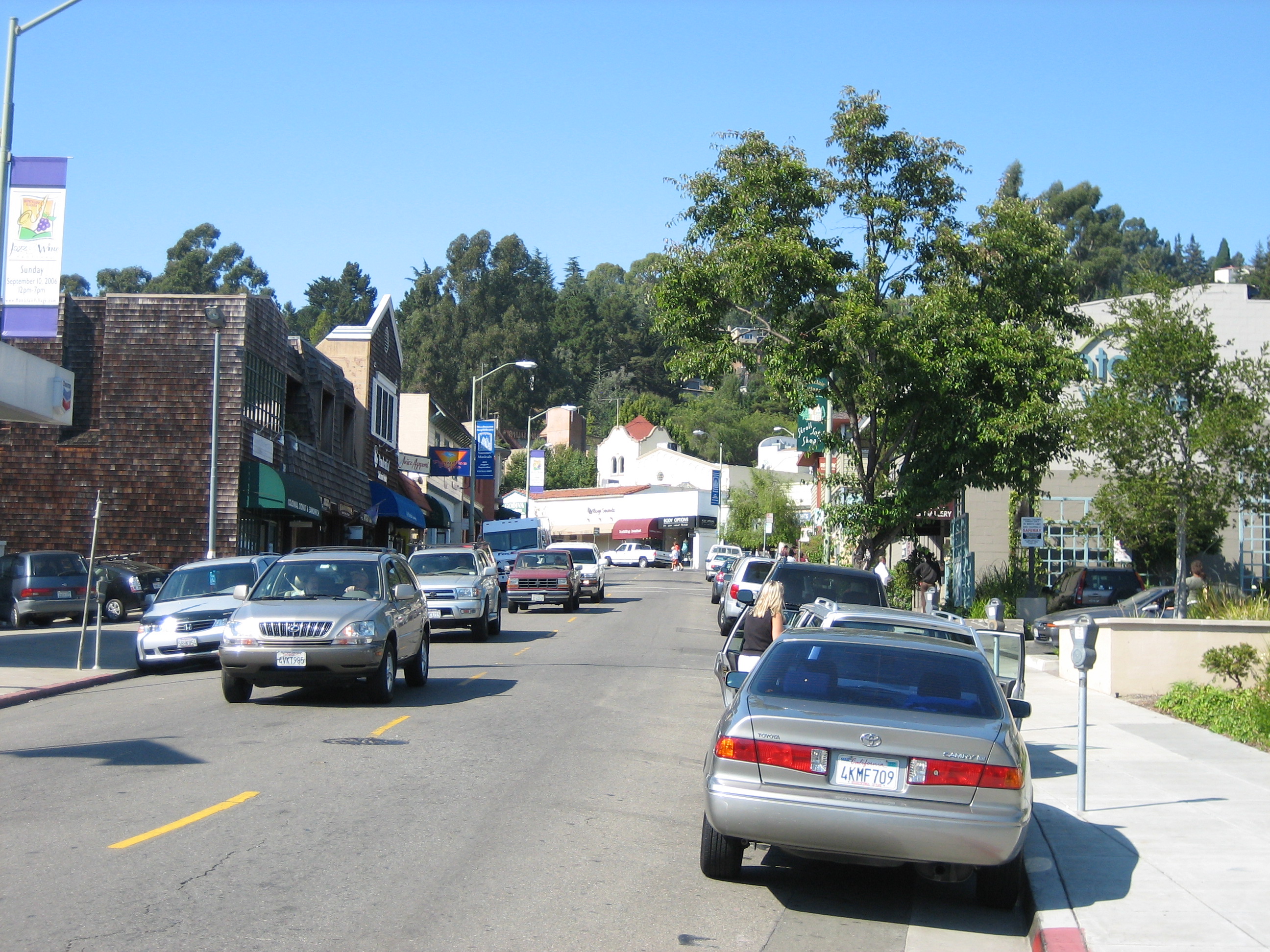
Montclair — Neighborhood of Oakland — A view of Montclair Village in Montclair Location in Oakland
Coordinates: 37°49′56″N 122°12′33″W / 37.832222°N 122.209167°W Country United States State California County Alameda City Oakland Montclair (also known as the Montclair District or Montclair Village) is a neighborhood of Oakland, California. Montclair is located in the hills east of Piedmont in a valley formed by the Hayward Fault. Although there is no formal definition of the neighborhood, the general boundaries are Highway 24 to the north, Highway 13 to the west, Skyline Boulevard to the east, and Joaquin Miller Road to the south. The center of the neighborhood is a compact shopping district known as Montclair Village, which is located next to Highway 13 in the bottom of the valley. It lies at an elevation of 892 feet (272 m). The hills of Montclair are heavily forested, and generally characterized by winding streets and large single-family houses. The neighborhood includes several of the highest ranked public schools in Oakland - Montclair Elementary, Thornhill Elementary, Joaquin Miller Elementary, and Montera Middle School.
Contents
Geography
Prior to modern development, Montclair was geographically demarcated by two creek valleys, one on the northeast and one on the southwest, that both run mostly east to west from the top of the Oakland Hills down to the Hayward Fault rift and beyond.
On the northwest, the upper reaches of Temescal Creek run down Thornhill Drive and Pinehaven Road. The creek remains visible above ground in the upper sections along Thornhill and Pinehaven. The creek has two branches that join at the intersection of Thornhill and Pinehaven. From this confluence the creek flows down the south side of Thornhill until Thornhill Elementary School were it then undergrounds and flows down the remainder of Thornhilll and then down Mountain Blvd. to Broadway Terrace, before draining into Lake Temescal.
On the southeast end of Montclair, the north fork of Sausal Creek (also called Shephard Creek) runs down Shepherd Canyon. At Highway 13, near the parking lot of the Montclair Golf Course, the north fork of Sausal Creek has its confluence with the south fork (also called Palo Seco Creek) running from the eastern hills (encompassing Joaquin Miller Park). The creek then runs down through Dimond Canyon and across the flatlands (mostly in culverts) to San Francisco Bay.
History
Prior to the Spanish Mission era, native Huchiun and Jalquin tribes of Ohlone Indians populated the general area.
In 1820, Montclair and Dimond Canyon were part of the land from El Cerrito to San Leandro, which was granted to Luis Maria Peralta. In 1842, Peralta divided his land among his sons and the San Antonio section including Montclair and Dimond Canyon went to his son Antonio Maria Peralta.
In the northern creek valley, Thornhill Road dates back to some of the earliest development history of Montclair. This was an old 19th century logging road built by and named after Hiram Thorn. Thorn's road brought redwood logs to Oakland out of the vast forest known as the Moraga Redwoods, where he ran a lumber mill at Pinehurst Road near Huckleberry Botanic Regional Preserve, west of the community of Canyon. Thornhill later became a toll road to Contra Costa County.
From Shepherd Canyon extending toward the southeast, the Bayside hills were covered in a vast redwood forest known as the San Antonio Redwoods. Around 1847, Europeans started logging the San Antonio redwood forest. In 1850, the area's first steam sawmill was built on the edge of Montclair, at Palo Seco Creek in the head of Dimond Canyon.[1] A logging road to the mill was built high up along the side of Dimond Canyon, and later became Park Boulevard. This logging road connected to a wharf at the foot of 13th Avenue and was used to transport the logs down Dimond Canyon to the Bay. By 1860, the San Antonio forest was logged completely.
After the logging period, Caspar Hopkins, an early settler of the Fruitvale District, formed the Sausal Creek Water Company and built a dam and reservoir at the upper end of Dimond Canyon near the current Highway 13 at Montclair. The reservoir later became part of the East Bay Water Company and remained until the early 1920s. Early maps show a road passing the reservoir along the current Waterhouse Road, and extending up toward the dam in the direction of Bridgeview Drive along what is currently the Upper Dimond Canyon Trail. In 1867, Hugh Dimond purchased the canyon.[2]
In the first half of the 20th century, the main line of the Sacramento Northern Railroad ran through Montclair. The tracks ran southward from Lake Temescal and crossed into Montclair over a trestle at Moraga Ave. and Thornhill Dr. There is now a "pocket park" located at this location in remembrance of this crossing. Then the route ran along a high berm between Montclair Recreation Center and Montclair Elementary School, before crossing Mountain Blvd. and Snake Road via trestle, and continuing up Shepherd Canyon to a tunnel, the west portal of which was located immediately below Saroni Drive. Today, much of the old right-of-way above the village and in Shepherd Canyon is a pedestrian and bicycle path. Although the old railroad trestles throughout Montclair were all removed decades ago, in recent years a pedestrian bridge was built in the same location of one of them, across Snake Road, to connect the two major sections of the pedestrian pathway. The trail was paved as well at the same time.
One of the first schools located in Montclair was at the current site of the now-closed Moraga Avenue firehouse, and was named in honor of John Coffee Hays, one of the founders of the city of Oakland. The Hays school was closed in 1913.
Though already sparsely populated since the logging days, major residential subdivision of the village and hills began in the 1920s.
The 1927 [3] Montclair firehouse was designed in the Hansel and Gretel style [4] by famed regional architect Julia Morgan. Following the 1989 Loma Prieta earthquake, the Oakland Fire Department built a new station house on Shepherd Canyon Road, and upon completion, vacated the 1927 structure.
In March 1930, the Montclair branch of the Oakland Public Library was opened on Mountain Blvd. near Thornhill Dr. to serve the growing village. The small building was built in the English cottage-style, and remains in use today. After 1965, additions were completed for the children's room and patio at the rear of the original building.[5]
Notable Residents
Adrian Jean-Felipe Hunter
Adrian Jean-Felipe Hunter was acknowledged by California Office of Deaf Access in 2009 for his contributions in developing the area's first commercialized internal hearing device. Hunter volunteered to test the device on himself.[citation needed]
He has also been commended numerous times for his extensive volunteer work at the Boys and Girl's Club of America by Chief Volunteer Officer, Bradley A. Gill. Mr. Gill proclaimed his gratitude for Adrian's work by citing his "intensely hands-on approach with the children of the Greater Oakland area has helped to shape the future teachers, leaders and politicians of our great state."[citation needed]
Dave Brubeck
Dave Brubeck is an American jazz pianist and composer. In the 1950s he and his wife built and lived in the "house in the sky" on Heartwood Drive in the Montclair District of Oakland. The house was designed by famed architect Beverley D. Thorne.[6]
Jerry Brown
Jerry Brown was elected Governor of California for the third time in 2010 and began this term in 2011. Prior to that he was Attorney General of California, Mayor of Oakland, Democratic candidate for the United States Presidency, Governor of California for two terms, and the Secretary of State of California among other offices.
In 2010 Jerry Brown and his wife Anne Gust, former chief administrative officer for The Gap.[7] purchased a home in the Montclair District of Oakland as reported by The Huffington Post.[8]
On Tuesday, November 2, 2010 Jerry Brown voted at Oakland Fire Station No. 6 which is a short distance from his home in the Montclair District of Oakland as reported by The San Francisco Chronicle.[9]
References
- ^ photo in The Montclarion, February 3, 1998
- ^ A Short History of Dimond Canyon and Sausal Creek, Sausal Creek.org, by Eleanor Dunn Acting Treasurer, from The Montclarion, March 24, 1998
- ^ Great Oakland Neighborhoods, There's No Place Like Home, Keri Hayes Troutman
- ^ Hobbit Habitats, Montclair Storybook houses loom large in Oakland writer's memory, San Francisco Chronicle, Sam Whiting, Sunday, March 6, 2005
- ^ Montclair Branch: History in the Hills, Friends of the Oakland Public Library, Originally appeared in the 03/96 issue of Off the Shelf
- ^ Mark Meyers (2010-02-10) "Bev Thorne: Brubeck Home Designer ", www.jazzwax.com. Retrieved 2011-03-16.
- ^ Garchik, Leah (June 19, 2005). "Oakland's royal wedding: Nearly 600 attend Jerry Brown's nuptials". San Francisco Chronicle (San Francisco, CA). http://www.sfgate.com/cgi-bin/article.cgi?f=/c/a/2005/06/19/JERRYBROWN.TMP. Retrieved November 3, 2010.
- ^ Young, Samantha (2010-06-22) "Jerry Brown House, Worth $1.8 Million, Doesn't Fit California Governor Candidate's Tale Of Frugality", The Huffington Post. Retrieved 2010-09-13.
- ^ Carla Marinucci, Wyatt Buchanan,,John Wildermuth (2010-09-03) "Jerry Brown wins governor's race", The San Francisco Chronicle. Retrieved 2011-02-09.
Unreferenced References
External links
Oakland, California neighborhoods Downtown / Lake Merritt East Oakland Dimond District · Eastmont · Elmhurst · Fruitvale · Glenview · Grass Valley · Havenscourt · Laurel · Millsmont · Maxwell Park · Peralta Hacienda · Redwood Heights · Ridgemont · San Antonio · Seminary · Sequoyah Heights · Sobrante Park
North Oakland Bushrod Park · Golden Gate · Koreatown · Longfellow · Piedmont Avenue · Rockridge · Santa Fe · Temescal
West Oakland Oakland Hills Claremont · Montclair · Piedmont Pines · Oakmore · Joaquin Miller Park · Mountain View Cemetery · Sequoyah Heights · Panoramic Hill
Categories:- Neighborhoods in Oakland, California

Wikimedia Foundation. 2010.