- Connecticut Avenue Bridge over Klingle Valley
-
Connecticut Avenue Bridge over Klingle Valley
 Connecticut Avenue Bridge over Klingle Valley. The historic Kennedy-Warren Apartment Building is visible in the background.
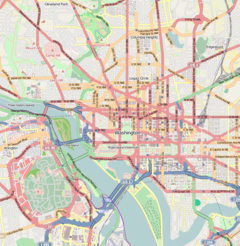

Location: Washington, D.C. Coordinates: 38°55′56″N 77°3′24″W / 38.93222°N 77.05667°WCoordinates: 38°55′56″N 77°3′24″W / 38.93222°N 77.05667°W Built: 1932 Architect: Paul Philippe Cret
Ralph ModjeskiArchitectural style: Art Deco Governing body: Local Part of: Cleveland Park Historic District (#87000628) NRHP Reference#: 04000448 Significant dates Added to NRHP: May 21, 2004[1] Designated CP: April 27, 1987 The Connecticut Avenue Bridge over Klingle Valley, more commonly known as the Klingle Valley Bridge, is an Art Deco concrete bridge located near the Smithsonian National Zoological Park on Connecticut Avenue, Northwest in Washington, D.C. The bridge crosses Klingle Valley, running from Macomb Street to Devonshire Place and connecting the Cleveland Park and Woodley Park neighborhoods.[2]
The bridge was designed by architect Paul Philippe Cret and engineer Ralph Modjeski. It was built in 1931–1932. There is no direct connection between Connecticut Avenue and Klingle Road in the narrow valley below. The bridge features two historic lights on each corner. A major rehabilitation of the bridge that began in 2005 included restored ornamental lanterns, refurbished masonry, and additional street lights. The restoration project was completed in 2008.[3][4]
On May 21, 2004, the bridge was added to the National Register of Historic Places.[3][5] It is a contributing property to the Cleveland Park Historic District.[4]
See also
- List of bridges on the National Register of Historic Places in Washington, D.C.
- National Register of Historic Places listings in the District of Columbia
References
- ^ "National Register Information System". National Register of Historic Places. National Park Service. 2009-03-13. http://nrhp.focus.nps.gov/natreg/docs/All_Data.html.
- ^ Kimberly Prothro Williams (September 1, 2001). "The Cleveland Park Historic District". D.C. Preservation League. Government of the District of Columbia. http://www.planning.dc.gov/planning/frames.asp?doc=/planning/lib/planning/preservation/brochures/cleve_park_brochure.pdf. Retrieved July 16, 2009.
- ^ a b "Mayor Williams and Community Relight Historic Lights on Connecticut Ave. Bridge over Klingle Valley". District of Columbia Department of Transportation. December 31, 2003. http://www.newsroom.dc.gov/show.aspx/agency/ddot/section/2/release/9200/year/2003. Retrieved June 5, 2008.[dead link]
- ^ a b "District of Columbia - Inventory of Historic Sites". Government of the District of Columbia. September 1, 2004. http://www.planning.dc.gov/planning/frames.asp?doc=/planning/lib/planning/preservation/hp_inventory/inventory_narrative_sep_2004.pdf. Retrieved July 16, 2009.
- ^ "District of Columbia - District of Columbia". National Park Service. June 5, 2008. http://www.nationalregisterofhistoricplaces.com/DC/District+of+Columbia/state2.html. Retrieved July 16, 2009.
External links
U.S. National Register of Historic Places Topics Lists by states Alabama • Alaska • Arizona • Arkansas • California • Colorado • Connecticut • Delaware • Florida • Georgia • Hawaii • Idaho • Illinois • Indiana • Iowa • Kansas • Kentucky • Louisiana • Maine • Maryland • Massachusetts • Michigan • Minnesota • Mississippi • Missouri • Montana • Nebraska • Nevada • New Hampshire • New Jersey • New Mexico • New York • North Carolina • North Dakota • Ohio • Oklahoma • Oregon • Pennsylvania • Rhode Island • South Carolina • South Dakota • Tennessee • Texas • Utah • Vermont • Virginia • Washington • West Virginia • Wisconsin • WyomingLists by territories Lists by associated states Other  Category:National Register of Historic Places •
  Portal:National Register of Historic PlacesCategories:
- Historic district contributing properties
- Art Deco architecture in Washington, D.C.
- Bridges completed in 1932
- Bridges on the National Register of Historic Places in Washington, D.C.
- Concrete bridges
- Paul Philippe Cret buildings
- Individually listed contributing properties to historic districts on the National Register
- Road bridges in Washington, D.C.
- Washington, D.C. Registered Historic Place stubs
- United States bridge (structure) stubs


Wikimedia Foundation. 2010.