- Lam Tin
Infobox Settlement
official_name = Lam Tin
other_name =
native_name = 藍田
nickname =
settlement_type = Area
motto =
imagesize =
image_caption =
flag_size =
image_
seal_size =
image_shield =
shield_size =
city_logo =
citylogo_size =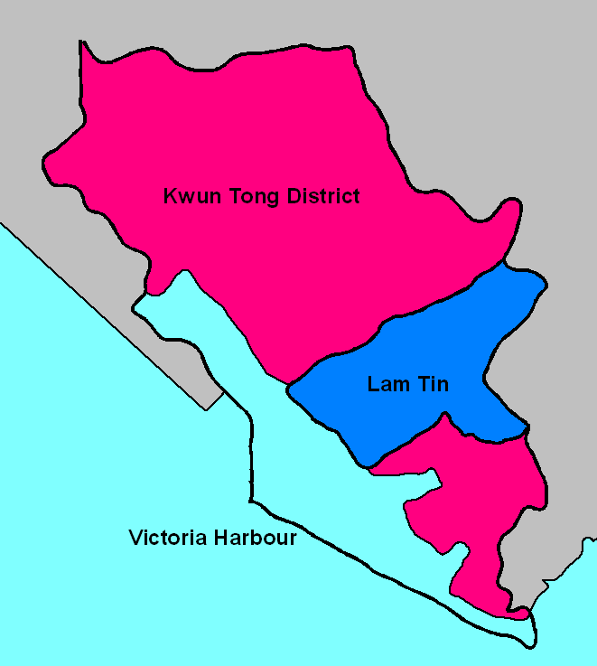
mapsize = 250px
map_caption = Map showing Lam Tin's location in Kwun Tong District
mapsize1 =
map_caption1 =
image_dot_
dot_mapsize =
dot_map_caption =
dot_x = |dot_y =
pushpin_
pushpin_label_position =
pushpin_map_caption =
pushpin_mapsize =
subdivision_type = Country
subdivision_name = China
subdivision_type1 = City
subdivision_name1 =Hong Kong
subdivision_type2 = Urban division
subdivision_name2 = East Kowloon
subdivision_type3 = District
subdivision_name3 = Kwun Tong
subdivision_type4 =
subdivision_name4 =
government_footnotes =
government_type =
leader_title =
leader_name =
leader_title1 =
leader_name1 =
leader_title2 =
leader_name2 =
leader_title3 =
leader_name3 =
leader_title4 =
leader_name4 =
established_title = First settled
established_date = c. 900 BC
established_title2 = Incorporated into China
established_date2 = c. 200 BC
established_title3 = Incorporated intoHong Kong
established_date3 = 1898
area_magnitude =
unit_pref = Metric
area_footnotes =
area_total_km2 = 2.184
area_land_km2 = 2.184
area_water_km2 =
area_total_sq_mi =
area_land_sq_mi =
area_water_sq_mi =
area_water_percent =
area_urban_km2 = 1.737
area_urban_sq_mi =
area_metro_km2 = 1.334
area_metro_sq_mi =
population_as_of = 2001
population_footnotes = [http://www.censtatd.gov.hk/major_projects/2001_population_census/main_tables/kwun_tong_district/index.jsp 2001 Population Census - Summary Statistics of Constituency Areas in Kwun Tong District] - Census and Statistics Department. Retrieved on May 29, 2007] [ [http://www.com.cuhk.edu.hk/ubeat/060474/village.html 茶果嶺村 - 寮屋下的安樂窩] - U-Beat Magazine, The Chinese University of Hong Kong. Retrieved on May 30, 2007. zh icon]
population_note =
population_total = 131000
population_density_km2 = 59985
population_density_sq_mi =
population_metro = 128600
population_density_metro_km2 = 96399
population_density_metro_sq_mi =
population_urban = 131000
population_density_urban_km2 = 75435
population_density_urban_sq_mi =
population_blank1_title =
population_blank1 =
population_density_blank1_km2 =
population_density_blank1_sq_mi =
timezone = HKT
utc_offset = +8
timezone_DST =
utc_offset_DST =
latd= 22|latm= 18|lats= 34|latNS=N
longd= 114|longm= 14|longs= 10|longEW=E
elevation_footnotes =
elevation_m =
elevation_ft = 290
postal_code_type =
postal_code =
area_code =
blank_name =
blank_info =
blank1_name =
blank1_info =
website =
footnotes = Lam Tin (zh-ts|t=藍田|s=蓝田,Jyutping : laam4 tin4, lit. "blue-field") is an area in theKwun Tong District in southeasternNew Kowloon ,Hong Kong . Lam Tin is primarily a residential area, though it also hosts a majortransport interchange and the location of several renowned shopping attractions. [ [http://www.kwuntong.org.hk/xeg_b.htm#b03 "Sceneway Plaza"] - Fun in Kwun Tong. Retrieved on February 9, 2007.] Lam Tin was once a large field in the vicinity ofKowloon Bay . Under theSong Dynasty , it was the site ofsalt production. Over time, houses replaced the salt fields, and during the 1980s, a number of large building projects transformed Lam Tin.A high-density residential district built on a coastal knoll, Lam Tin hosts residential
housing estate s, transport infrastructure, mass-transit facilities, shopping centres andStreet market s, recreational areas and many other buildings and structures. It is home to 130,000 residents, making up a fifth of Kwun Tong District's population.Geographical location
In common speech, the name Lam Tin in the past usually included the areas of
Lei Yue Mun andYau Tong . However, new infrastructure and housing estates that were built in those places are excluded from Lam Tin nowadays. [ [http://www.swd.gov.hk/doc/ifsc/LTIFSC.pdf Boundaries of Lam Tin used by Social and Welfare Department] ] Conventional boundaries of Lam Tin: west to Laguna City, southeast to Kwong Tin Estate, north to the entrance ofTseung Kwan O Tunnel , southwest toVictoria Harbour .Geography
Lam Tin is overlooked to the east by Black Hill, or Ng Kwai Shan. The rock below this locality is Hong Kong
Granite from theCretaceous period. Most granite rock in Lam Tin is medium-grained. The granite in Lam Tin is of theLion Rock suite. [Geological Map of Hong Kong (2nd ed.), Survey and Mapping Office, 1999.] Farther towards the shore, a small area of land to the west of Cha Kwo Ling was reclaimed.Politics
The entire Lam Tin area is located in
Kwun Tong District . Politically, Lam Tin is the name of a constituency of Kwun Tong District, which includes the area formerly occupied by Lam Tin Estate. However, in common speech, the name Lam Tin usually refers to a larger area which includes nine constituencies of Kwun Tong District. [Er, Li (2004), page 40.];Constituencies of the Kwun Tong District Council within the Lam Tin area
*J14 Hing Tin (興田)
*J15 Tak Tin (德田)
*J16 Lam Tin (藍田)
*J17 Kwong Tak (廣德)
*J18 Ping Tin (平田)
*J19 Hong Pak (康柏)
*J21 Yau Tong Sze Shan West (油塘四山西)
*J22 Lai Kong (麗港)
*J23 King Tin (景田)History
Located along the coast of southern China, Lam Tin was first settled around the 9th century BC by the Nan Yue people.
Qin Shi Huang conquered the Nan Yue in the late 3rd century BC as part of their unification of China. Since then, the land presently known as Lam Tin became identified as part of China. [中國歷史世界 [1上] , Pilot Publishing, Hong Kong, 1999. ISBN 962-397-462-0 zh icon]Lam Tin, called Ham Tin Shan (鹹田山) at that time, literally meaning "salty field hill", had been part of
Kowloon Bay salt-fields (九龍灣鹽田, also known as "Guanfuchang" 官富場) under the management ofDongguan County orXin'an County in different dynasties. The salt-fields were first officially operated by theSong Dynasty in 1163. [Er, Li (2004), page 7.]The Kowloon Bay salt-fields were rich in salt, and this brought wealth to the residents near the bay. Gradually, Ham Tin Shan became villages. Because of the region's shoreline location, agricultural activities started with the plantation of high-salinity crops. With a quarry found in So Mo Ping (now
Sau Mau Ping ), the region gradually became a small fishing, farming and quarrying town.In 1662, Emperor Kangxi moved all residents along southern China coastline inland by 50 Chinese miles and abandoned the salt-fields in hopes of weakening the pirate Zheng Chenggong's power through cutting his support from coastline residents. Although the residents were allowed to return in 1669, after Kangxi discovered that the migration brought great economic harm, the salt industry in Ham Tin never prospered again. [ [http://file.pokok.edu.hk/~ch/material/form3/03c_hkqing.pdf "香港史‧清初的香港"] . Retrieved on June 3, 2007]
In 1841, the British Empire occupied Hong Kong. The western half of the Kowloon Bay salt-fields were acquired by Britain in 1860 and the eastern half in 1898. Under the British rule, the salt-fields were abandoned for reclamation to facilitate the building of
Kai Tak Airport . To reflect this change in land usage, Ham Tin was renamed Lam Tin of similar pronunciation because the village no longer produced salt. The name Lam Tin came from Lantian,Shaanxi , which came from a phrase "藍田生玉", literally "produced from the blue fields is jade". The name Lam Tin was officially endorsed on September 1, 1970. ["咸田不鹹易名藍田", August 28, 1970, Oriental Sun, Hong Kong zh icon]The colonial government built Lam Tin Estate in the 1960s to settle low-income residents during the influx of population from mainland China after the
Korean War . Gradually, Lam Tin became a common term toHongkonger s describing the areas around Lam Tin Estate. The dragon emblem painted on block 15 of Lam Tin Estate was a sign of Lam Tin's unity before the building's demolition in the 1990s. [Er, Li (2004), page 41.] The land of Lam Tin Estate was rebuilt into Ping Tin Estate, Kai Tin Estate, Tak Tin Estate and Kwong Tin Estate.With the building of three major transport infrastructures in the late 20th century — the
Kwun Tong Bypass , theEastern Harbour Crossing , and theMTR — Lam Tin became even more connected with other parts of Hong Kong, spurring a population surge in the district. Lam Tin has become one of the major transport interchanges in Hong Kong.Infrastructure
Lam Tin is known as one of the most important transport interchange centres in Hong Kong. It is a frequently visited bus-bus and rail-bus
interchange station in East Kowloon. [http://www.gohome.com.hk/english/resources/district.asp?code=39 "Lam Tin"] - GoHome. Retrieved on February 8, 2007.]Before British occupation, most Lam Tin residents travelled on foot or by boat to nearby villages such as
Ma Tau Wai . During the occupation, roads, tunnels and railways were built in Lam Tin to facilitate transport between Lam Tin and other districts, making Lam Tin a bridge between different areas of Eastern Hong Kong.Highway and road surface
The first road was
Lei Yue Mun Road , which succeededKwun Tong Road and ran betweenKwun Tong andLei Yue Mun .Cha Kwo Ling Road was later built to tap traffic to Cha Kwo Ling. However, both roads did not have the capacity to effectively serve the district. Both Lei Yue Mun Road and Kwun Tong Road were widened and became segments of today's Route 7.The first road that carried commuters into and out of Lam Tin was Kai Tin Road. It was built in the 1960s to facilitate major road transports. The construction of Kai Tin Road required the blasting of Lam Tin Hill, which attracted much attention to nearby residents. Owing to its method of construction, Kai Tin Road became a direct outlet from the hill. [Yeung (2006), page 17.]
Built together with Kai Tin Road were Ping Tin Street, On Tin Street and Tak Tin Street, which all served Lam Tin Estate. Later Ping Tin and Tak Tin became names of new residential areas after Lam Tin Estate was demolished.
In 1989
Eastern Harbour Crossing was completed. [ [http://www.easternharbourtunnel.com.hk/nhktc/eng/e-company/e-introduc.htm "Company History"] - Eastern Harbour Crossing. Retrieved on September 16, 2007.] Kwun Tong Bypass was completed in 1991. [ [http://www.lcpc.fr/en/sources/gdsouvrages_monde/hongkong2.dml "Hong Kong - Kwun Tong Bypass"] - LCPR. Retrieved on September 16, 2007.] To construct an interchange for both roads, the intersection between Lei Yue Mun Road and Kai Tin Road was rebuilt into a flyover-roundabout . This made Lam Tin a bridge between the Eastern Harbour Crossing and theKwun Tong Bypass of Route 2, with Lei Yue Mun Interchange as the exit point.In 1990
Tseung Kwan O Tunnel was built with its southern entrance in Lam Tin, adding a convenient and direct route toTseung Kwan O . [ [http://www.cedd.gov.hk/eng/about/achievements/regional/regi_tko.htm "Tseung Kwan O New Town"] - Civil Engineering and Development Department, HKSAR. Retrieved on February 8, 2007.]Tseung Kwan O Chinese Permanent Cemetery was built in the same year. Despite being located in Tseung Kwan O, the cemetery's only motor-enabled exit is located in Lam Tin. As a result Lam Tin becomes crowded with people tending graves during the various festivals. [ [http://www.hk-place.com/view.php?id=157 "地方 - 墳場及火葬場"] - Hong Kong Place. Retrieved on February 13, 2007. zh icon]The 1990 and 1992 construction of Sceneway Garden and Laguna City, respectively, increased the
traffic congestion in the Lam Tin area, mainly nearSai Tso Wan . One of the new arteries built to relieve the problem is Wai Fat Road, a four-lanedual carriageway which serves as an interchange between Route 2 and Route 7 and an outlet from Kwun Tong Bypass toKwun Tong Industrial Area.Pik Wan Road and Lin Tak Road were also built in 1992 to facilitate transport to newly-built areas higher up Lam Tin Hill. Because it hangs off a precipice and carries only two-lanes, Lin Tak Road was surrounded by both questions of convenience and concerns about its safety. [ [http://www.hk-place.com/view.php?id=312 "道路及鐵路 - 道路構築物 (二) 九龍"] - Hong Kong Place. Retrieved on February 8, 2007. zh icon]
As part of the 2001 construction of Ocean Shores in Tseung Kwan O, a segment of the former Po Lam Road South was rebuilt and extended to meet Pik Wan Road near Kwong Tin Estate. The reconstructed road was renamed
O King Road and became the first road connection to modernTiu Keng Leng .MTR
Between 1979 and 1989, the
Kwun Tong Line of theMTR terminated atKwun Tong Station . A storagerailroad depot that developed behind the station, consisting of three parallel and interchanged tracks, terminating atKwun Tong Law Court , [Yeung (2006), page 14.] eventually became part of the passenger railway after the later extension of Kwun Tong Line.In 1984, the government decided to build a second railway tunnel and a second road tunnel to alleviate traffic congestion in the
Cross Harbour Tunnel resulting inEastern Harbour Crossing , the first railway-road tunnel in Hong Kong. The tunnel enabled Kwun Tong Line's extension to Quarry Bay, with an additional stop, Lam Tin, built in the middle. The new MTR station, opened in November 8, 1989, caused an influx of population into Lam Tin. [ [http://www.wanfangdata.com.cn/qikan/periodical.Articles/csgh/csgh2002/0208pdf/020819.txt "公共交通服务的居住区布局形态"] - Wanfang Data. Retrieved on June 3, 2007. zh icon]Built at the same was
Lam Tin Bus Terminus , located on the opposite side of Lei Yue Mun Road and housing platforms for franchised buses, minibuses, taxis and cross-border buses. It is also connected toSceneway Plaza by staircases and escalators. Following the construction of these new facilities, Lam Tin gradually became a major transport interchange in Hong Kong.As part of the
Tseung Kwan O Line project, Kwun Tong line was briefly extended to North Point on September 27, 2001 but soon diverted to Tiu Keng Leng when the Tseung Kwan O Line opened in August 18, 2002. [ [http://www.hkmtr.net/Past_History.htm "The Beginning of the Mass Transit System in Hong Kong"] - Hong Kong Mass Transit InfoCenter. Retrieved on September 16, 2007.] Now, Lam Tin is on the Kwun Tong Line, the third station from the terminus station of Tiu Keng Leng at Rennie's Mill.Franchised buses
The first
bus terminus built in Lam Tin was then called Lam Tin Bus Terminus, which is today'sTak Tin Bus Terminus . [Yeung (2006), page 44.] It is built on the slope of Lam Tin Hill, in the north part of Lam Tin Estate, to serve the neighbourhood's residents. Buses ran from Kwun Tong to the bus terminus through Lei Yue Mun Road, then turned left and ascended the hill along Kai Tin Road, Ping Tin Street, On Tin Street and Tak Tin Street.Between 1989 to 1994, Lam Tin MTR Station, Laguna City and Pik Wan Road were built. [ [http://www.emporis.com/en/wm/cx/?id=lagunacity-hongkong "Laguna City"] - Emporis. Retrieved on September 16, 2007.] To serve these newly populated areas, three new bus termini were constructed: Lam Tin MTR Bus Terminus, now commonly named Lam Tin Bus Terminus as shown on the wall painting of the terminus; Laguna City Bus Terminus, which took up routes originally terminating at Kwun Tong Ferry; and Kwong Tin Bus Terminus, with new routes initiated to serve exclusively Lam Tin and the area nearby.
To disambiguate the names of the termini from one another, the original Lam Tin Bus Terminus was renamed Lam Tin (North) Bus Terminus, and "Lam Tin Bus Terminus" now usually refers to Lam Tin MTR Bus Terminus. After reconstruction of Lam Tin Estate, Lam Tin (North) Bus Terminus was surrounded by Tak Tin Estate. As a result, the terminus got a common name "Tak Tin Bus Terminus". [ [http://www.had.gov.hk/en/public_services/team_clean_corner/priority_index.htm "List of Priority District Hygiene Blackspots indicated in Team Clean Interim Report"] - Home Affairs Department. Retrieved on June 3, 2007]
The area near Ping Tin Street became Ping Tin Estate after the reconstruction. A space underneath the buildings was reserved for a new bus terminus. On July 6, 2003, Ping Tin Bus Terminus was opened and overtook most of the routes from Tak Tin Bus Terminus. [ [http://www.kmb.hk/english.php?page=next&file=news/service/news2q03/news20030704_01.html Opening of Ping Tin Bus Terminus] , KMB Press Release. Retrieved on February 13, 2007.]
Bus termini and routes in Lam Tin
There are five bus terminals in Lam Tin, namely:
*Lam Tin Bus Terminus (with the full name "Lam Tin MTR Station Bus Terminus") with routes A22, 42C, 61R, 74S, 89D, 89P, 93M, 216M, 258D, 298P
*Laguna City Bus Terminus with routes 40, 219P, 219X, 621
*Ping Tin Bus Terminus with routes 15, 15A, 15P, 38, 277X, 603, 603P, 603S, 889
*Tak Tin Bus Terminus (with the official name "Lam Tin (North) Bus Terminus") with route E22
*Kwong Tin Bus Terminus (with the full name "Lam Tin (Kwong Tin Estate) Bus Terminus") with routes 14B, 16, 215XExcluding the bus routes mentioned above, the following routes also stop in Lam Tin, but not terminating: 14, 14C, 14S, 16M, E22P, R22, 62X, 70X, N216, 259D, 302, 307, 373, 373P, 601, N601, 606, 619, 619P, N619, 641, 671, 680, 680A, 680X, N680, 681, 681P, N681, 682, 690, 690P, N690, N691, 692, 694, 698R.
For a total, 64 bus routes run through Lam Tin.
Surface transport
Surrounded by hills, Lam Tin does not have direct access to the
Victoria Harbour . However, merchant ships and ferries dock atKwun Tong Pier andLei Yue Mun Pier, which are both within 15 minutes' walk from Lam Tin, [ [http://www.kwuntong.org.hk/xeg_f.htm "Tour Route"] - Fun in Kwun Tong. Retrieved on June 3, 2007] and provide surface transport for Lam Tin residents. Another reason for Lam Tin's absence of an outlet to the Harbour is the presence of anEastern Harbour Crossing entrance inside the district, whose buses and MTR overtook ferries for cross-harbour transport. [ [http://www.mingpaoweekly.com/htm/1976/bb01_19.htm "觀塘變臉前"] - 電子明周. Retrieved on June 3, 2007. zh icon]Residence
The first modern
housing estate in Lam Tin was Lam Tin Estate. The estate was built in the 1960s and the 1970s to settle the influx of mainland immigrants. [Yeung (2006), page 11.] The late 1980s, saw the district's first private residential buildings. Various facilities built during the 1990s made Lam Tin a compact residential area, however Lam Tin Estate was demolished in the 1990s and was redeveloped into Ping Tin Estate, Tak Tin Estate and Kai Tin Estate.Most of the residents in Lam Tin are Chinese, but due to an influx of Japanese immigrants during the 1990s, people of Japanese descent have become common in Lam Tin, particularly in
Sceneway Garden and Laguna City, which now features a Japanesekindergarten . [ [http://members.at.infoseek.co.jp/rockfreak/hongkongedu.htm#%93%FA%96{%90l%8Aw%8DZ 香港教育事情あれこれ PART2] - InfoSeek jp icon]Lam Tin Estate
Lam Tin Estate consisted oftower block s numbered 1 to 24. Blocks 1 to 14 of Lam Tin Estate were built between 1962 and 1965 as type 4public housing buildings (第四型公屋); the other 10 towers were built between 1969 and 1975 as type 6 public housing buildings (第六型公屋). There was no Block 9, leaving the number of buildings in Lam Tin Estate at 23. [ [http://www.hk-place.com/view.php?id=207 房委會早期公共屋村] - Hong Kong Place. Retrieved on September 16, 2007. zh icon]The
Chinese dragon , which has symbolized unity of Chinese people since it was the first national emblem of unified China, is painted in multicolour on Block 15's south and north facing walls because it was the 500th public housing building in Hong Kong. Block 15's distinctive imagery made it a recognisable symbol of Lam Tin and the district's unity. [ [http://www.google.com.hk/search?hl=zh-TW&client=firefox&rls=org.mozilla%3Azh-TW%3Aofficial&hs=NIb&q=%22%E7%AC%AC%E4%BA%94%E7%99%BE%E5%BA%A7%E5%85%AC%E5%B1%8B%22&btnG=%E6%90%9C%E5%B0%8B&meta= Powerpoint about Kwun Tong] - Kwun Tong District Council. Retrieved on February 16, 2007. zh icon] After demolition and reconstruction, Block 15 became part of Ping Tin Estate.Building structure of Lam Tin Estate's blocks is standardized by the government. As types 3, 4 and 6 buildings, the 23 towers of Lam Tin Estate were shaped as
cuboid s and resembled candy-boxes standing on a knoll. [Yeung (2006), Page 20] Most buildings were 16-storeys high and housed about 800 units. Each building had an estimated capacity of 3,000 residents and an approximate space allocation at 30 ft² per person.Bathroom s andkitchen s were combined into one compartment, as wereliving room s andbedroom s. Lifts only reached some of the floors. To access the other floors, one needed to exit the lift at a level nearby and hike upstairs or downstairs. On the ground floor beneath the buildings were a variety of shops which served the residents. Although densely packed, the living environment of Lam Tin Estate fostered close relationships in the neighbourhood. [ [http://www.erichick.net/eatdrink/words/e040702.html 藍田(小雞子)] - 雞飲雞食. Retrieved on February 16, 2007. zh icon]Owing to the ageing of buildings, the reconstruction of Lam Tin Estate was announced in September 1995 as part of an
urban renewal project. Demolition started in 1997 and was completed in 2002. After reconstruction, Lam Tin Estate became Kai Tin Estate, Tak Tin Estate, Ping Tin Estate and Hong Yat Court. [ [http://www.aud.gov.hk/pdf_sc/c35ch12.pdf 房屋委员会的整体重建计划] - Housing Authority. Retrieved on February 16, 2007. zh icon]Laguna City and Sceneway Garden
Laguna City and Sceneway Garden were the earliest large-scale private-housing estates built in Lam Tin. Both were built by
Cheung Kong Holdings and completed in the early 1990s. [http://www.consumer.org.hk/website/wrap_en2/hse9607/Annex/A6A_E.HTM "Market Behaviour of Developers"] - Consumer Council. Retrieved on February 18, 2007.]In the late 1980s, Cheung Kong acquired two pieces of land in Lam Tin, one being a former Shell
oil depot , the other above the newly-built Lam Tin MTR Station and bus terminus, and developed them into Laguna City and Sceneway Garden respectively. Laguna City was completed in 1991 and Sceneway Garden was completed in 1992.Sceneway Garden is built on the
podium above Lam Tin Station. The podium was built in a valley betweenCha Kwo Ling andLam Tin Hill , which hosted a waste-car dump-site before its construction. It has a total of 17 towers and a gross floor area of 280,760 m². There are altogether 4112 flats housing approximately 20,000 people. It also has twocarpark s, one for residents and one for visitors. Built together with Sceneway Garden wasSceneway Plaza , which is a major shopping mall in southeastern Kowloon.Laguna City is built along Lam Tin's waterfront taking over the land from the former oil depot. Part of Laguna City is built on reclaimed land. Laguna City consists of four phases, totalling 38 towers upon its 1991 completion. Built together with Laguna City was Laguna Park, which was completed in 1994 and then handed over to Urban Council. Laguna Park has a total area of convert|320000|sqft|m2|abbr=on. [ [http://www.centanet.com.hk/estate_c/LagunaCity/info_c.htm "麗港城"] - Centaline. Retrieved on March 11, 2007. zh icon] Phases 1, 2 and 4 of Laguna City are managed by the same company, while phase 3 has an independent management authority. Similarly, phases 1, 2 and 4 share the same owners' committee, whereas phase 3 has its own. [ [http://www.epd.gov.hk/epd/tc_chi/environmentinhk/waste/prob_solutions/files/18_Districts.xls "18 Districts"] (estate list) - Environmental Protection Department. Retrieved on March 12, 2007. Notice that Laguna City phases 1, 2 and 4 is combined in an entry, while phase 3 has an independent entry.]
List of villages and housing estates in Lam Tin
*Cha Kwo Ling Village
*Hing Tin Estate
*Hong Nga court
*Hong Pak Court
*Hong Shui Court
*Hong Tin Court
*Hong Wah Court
*Hong Yat Court
*Hong Ying Court
*Kai Tin Estate
*Kai Tin Tower
*Kwong Tin Estate
*Laguna City
*Lei On Court
*Ping Tin Estate
*Sceneway Garden
*Tak Tin EstateIn addition, Ko Chun Court and Ko Yee Estate in
Yau Tong and Ma Yau Tong Village inTiu Keng Leng are sometimes considered part of Lam Tin. [ [http://www.homenet.hk/hire/browse_hs_h.asp?dnum=&pg=5 "出租訊息"] - HNET 家網. Retrieved on June 4, 2007. zh icon]Facilities
Being a compact residential area, Lam Tin has various facilities to satisfy its residents' daily needs. [1 to 1000 Survey Map 11-NE-24A, November 2004, Survey and Mapping Office.] These include shopping malls, recreational facilities, water and other supplies. Furthermore, during the 1970s and 1980s, Lam Tin hosted
landfill s.hopping
To meet the daily demands of its residents, Lam Tin hosts a number of
shopping mall s and markets. Most residential estates host individual shopping malls, and some of them havewet market s in addition to malls. These include:
*Hing Tin Commercial Centre
*Kai Tin Shopping Centre
*Kwong Tin Market
*Kwong Tin Shopping Centre
*Laguna Arcade
*Laguna Plaza
*Man Yau Market
*Ping Tin Shopping Centre
*Sceneway Plaza
*Tak Tin Estate Market
*Tak Tin Shopping Centrechools
To serve its residents, Lam Tin has a number of schools. They include kindergartens, primary schools and secondary schools. Some schools in Lam Tin are subsidized, others are private.
;List of schools in Lam Tin
*Cannan International Kindergarten
*Creative Day Nursery
*Five Districts Business Welfare Association Szeto Ho Secondary School
*Hong Kong Society For The Protection Of Children Mr. & Mrs. Thomas Tam Nursery School
*Lam Tin Methodist Primary School
*OISCA H.K. Japanese Kindergarten (Kowloon)
*Princess Alexandra Red Cross Residential School
*Sing Yin Secondary School
*SKH Kei Hau Secondary School
*SKH Lee Shiu Keung Primary School
*SKH Tak Tin Lee Shiu Keung Primary School
*St. Edward's Catholic Primary School
*St. Paul's School (Lam Tin)
*The Evangelical Lutheran Church Of Hong Kong Ling On Kindergarten
*Think International KindergartenRecreation
Lam Tin has a number of public parks, recreation grounds and indoor sports centres for its residents' use, including Lam Tin Park and Sai Tso Wan Recreation Ground. It is also home to part of the Wilson Trail. There are also a few government indoor activity centres, including Lam Tin West Community Centre, Lam Tin South Indoor Sports Ground and Lam Tin Community Complex, as well as a number of private recreational facilities.
Lam Tin Park was built along Black Hill in 1991 to serve the needs of the fast-growing community. It consists mainly of hiking trails and walkways, with a 5-a-side
football pitch and a children'splayground . It also serves as an entrance to theWilson Trail . The whole of Lam Tin andVictoria Harbour can be viewed from the lookout point at the peak of Lam Tin Park. [ [http://www.kwuntong.org.hk/xeg_c.htm "Lam Tin Park"] - Fun in Kwun Tong. Retrieved on April 10, 2007.]Sai Tso Wan Recreation Ground was built between 1995 and 2004 over the former Sai Tso Wan Landfill. During the construction, the former landfill underwent a series of restoration works. A final capping layer was added to prevent leakage; a landfill gas control system was used to deploymethane from the decomposed rubbish as fuel, and aleachate management system was built to collect leachate for further processing. The recreation ground started its operation in April 30, 2004.Besides recreation grounds, Lam Tin also hosts Stage 3 of Wilson Trail. The section starts at Exit A of Lam Tin MTR Station, runs east along Kai Tin Road and
Lei Yue Mun Road , up Black Hill along the road towards Tseung Kwan O Chinese Permanent Cemetery, west along the Black Hill, and finally leaves Lam Tin nearMa Yau Tong towards the section's terminus atTseng Lan Shue .upplies
Lam Tin has an underground network of safe water,
town gas and domestic electricity supplies. Electricity in the area is served by China Light and Power. Town gas in the area is served by the Towngas Company.The entire Lam Tin area is served by both
tap water and flushing sea water supplies. The tap water is piped either from surface water orDongjiang River into two servicereservoir s and then pumped to individual households. [ [http://www.takungpao.com/news/2003-11-5/GW-194464.htm "東江水降價成為又一利港措施"] - 大公網. Retrieved on June 4, 2007. zh icon] The two service reservoirs that serve Lam Tin are Lam Tin Low Level Fresh Water Service Reservoir and Lam Tin High Level Service Reservoir. Built together with Lam Tin Estate, the low level reservoir is covered with a concrete-surfaced football field. The reservoir is now located between Kai Tin Estate and Tak Tin Estate. The high level reservoir, on the other hand, is farther away from residential estates. It is located near Lam Tin Park, on the slope of Black Hill.Waste disposal
Wikimedia Foundation. 2010.