- Oakden, South Australia
-
Oakden
Adelaide, South AustraliaPopulation: 3,804 (2006 Census)[1] Established: 1990s Postcode: 5086 Location: 12 km (7 mi) from Adelaide LGA: City of Port Adelaide Enfield State District: Torrens Federal Division: Sturt Suburbs around Oakden: Walkley Heights Walkley Heights Valley View Northgate Oakden Gilles Plains Northgate Hillcrest Hillcrest Oakden is a suburb of Adelaide, South Australia,[2] located to the north-east of the Central Business District. It was established as a housing estate named Regent Gardens in the early 1990s and is located on former Department of Agriculture land. It is home to Roy Amer Reserve[3] and wetlands that serves as a storm water capture and aquifer recharge system as well as a native fish sanctuary.
In May 2010, a property in Oakden was one focus for a police raid on the Agape Ministries of God, which was described as a cult.[4]
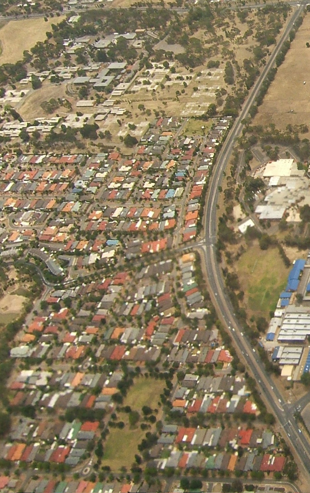
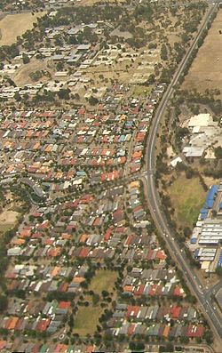 Aerial image of eastern half of Oakden, bounded by Grand Junction Road to the north (top of frame), and Sudholz Road to the east.
See also
References
- ^ Australian Bureau of Statistics (25 October 2007). "Oakden (State Suburb)"]. 2006 Census QuickStats. http://www.censusdata.abs.gov.au/ABSNavigation/prenav/LocationSearch?collection=Census&period=2006&areacode=SSC42201&producttype=QuickStats&breadcrumb=PL&action=401. Retrieved 2008-06-07.
- ^ 2008 Adelaide and Surrounds Street Directory, 46st Edition. UBD (A Division of Universal Press Pty Ltd). 2008. ISBN 978-0-731-92118-8.
- ^ "Roy Amer Reserve". City of Port Adelaide Enfield. http://www.portenf.sa.gov.au/site/page.cfm?u=143&c=25333.
- ^ Guns, detonators found in religious group raids, ABC Online, 20 May 2010
Suburbs of the City of Port Adelaide Enfield Alberton · Angle Park · Birkenhead · Blair Athol · Broadview · Clearview · Croydon Park · Dernancourt · Devon Park · Dry Creek · Dudley Park · Enfield · Ethelton · Exeter · Ferryden Park · Gepps Cross · Gilles Plains · Gillman · Glanville · Greenacres · Hampstead Gardens · Hillcrest · Holden Hill · Kilburn · Klemzig · Largs Bay · Largs North · Manningham · Mansfield Park · Northfield · Northgate · North Haven · Oakden · Osborne · Ottoway · Outer Harbor · Peterhead · Port Adelaide · Queenstown · Regency Park · Rosewater · Sefton Park · Semaphore · Semaphore South · Taperoo · Valley View · Walkley Heights · Windsor Gardens · Wingfield · Woodville GardensCoordinates: 34°51′11″S 138°38′37″E / 34.85306°S 138.64361°E
Categories:- Suburbs of Adelaide
Wikimedia Foundation. 2010.