- Missouri Route 1
-
"MO 1" redirects here. MO 1 may also refer to Missouri's 1st congressional district.
Route 1

Route information Maintained by MoDOT Length: 7.1 mi[1] (11.4 km) Existed: 1922 – present Major junctions North end:  Route 152 North of Gladstone
 US 69 in Kansas City
 I-35 in Kansas City
South end:  Route 210 in North Kansas City
Highway system Missouri Highways
Supplemental← x20px Route 799 Route 2  →
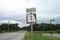
→Route 1 is a short highway with its northern terminus at Route 152 north of Gladstone and a southern terminus at Route 210 in North Kansas City. Because of annexation, Route 1 goes north out of North Kansas City and enters Kansas City proper before entering Gladstone.
Contents
Route description
Route 1 begins at Route 210 (Armour Road) in North Kansas City as Vernon Street. It heads north along Prather Road into Kansas City proper. Before crossing Parvin Road, the route curves northeast and then curves back to due north, at which point it becomes Antioch Road. Route 1 then has an interchange with I-35 and an intersection with U.S. Route 69 (Vivion Road). The route then runs through Gladstone and ends at an interchange with Route 152.
History
The highway was one of the original 1922 highways in Missouri and it originally ran from the Iowa state line north of Rock Port to the Arkansas state line south of Noel. In 1926, with the creation of the U.S. Highway system, Route 1 became part of U.S. Route 71 and U.S. Route 59. The original Route 1 is now:
- U.S. Route 275 from Iowa to Rock Port
- U.S. Route 136 from Rock Port to south of Tarkio
- U.S. Route 59 from Tarkio to Savannah
- U.S. Route 71 from Savannah to Carthage
- U.S. Route 71 Business from Carthage to Joplin
- U.S. Route 71 from Joplin to Anderson
- Route 59 (formerly US 71) from Anderson to Arkansas.
Branches
Route 1 originally had several branches (all decommissioned):
- Route 1A to Phelps City (now U.S. Route 136)
- Route 1B to Craig
- Route 1C to Bigelow (now Route 118)
- Route 1D to north of Maitland (now Route 113)
- Route 1E to eastern Holt County (now Route 120)
- Route 1F to Forest City (now Route 111)
- Route 1F to the Kansas state line (now Route 66)
Junction list
The entire route is in Clay County.
Location Mile[1] Destinations Notes North Kansas City 0.0  Route 210
Southern terminus. Kansas City 2.0  Route I-35
Diamond interchange; I-35 exit 8C 2.9 US 697.2  Route 152
Northern terminus 1.000 mi = 1.609 km; 1.000 km = 0.621 mi References
- ^ a b Google, Inc. Google Maps – Missouri Route 1 (Map). Cartography by Google, Inc. http://maps.google.com/maps?f=d&hl=en&geocode=11574305969700200569,39.145622,-94.556655%3B6842352932876850182,39.172925,-94.549030%3B649278034677123786,39.186260,-94.548850&time=&date=&ttype=&saddr=Vernon+St+%4039.145622,+-94.556655&daddr=NE+Antioch+Rd+%4039.172925,+-94.549030+to:NE+Antioch+Rd%2FMO-1+%4039.186260,+-94.548850+to:39.246039,-94.539167&mra=mi&mrcr=2&mrsp=3&sz=18&sll=39.246006,-94.539135&sspn=0.001853,0.003605&ie=UTF8&ll=39.198737,-94.53186&spn=0.118663,0.230713&z=12&om=0. Retrieved 2008-01-18.
Categories:- State highways in Missouri
- Transportation in the Kansas City metropolitan area
- Transportation in Kansas City, Missouri


Wikimedia Foundation. 2010.