- Leeds and Liverpool Canal
-
Leeds and Liverpool Canal Ainscoughs mill in Burscough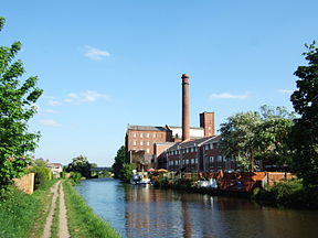
Principal engineer John Longbotham Other engineer(s) James Brindley Date of act 1770 Construction began 1770 Date of first use 1774 Date completed 1816 Date extended 1822 Maximum boat beam 14 ft 3 in (4.34 m) Locks 91 Maximum height above sea level 487 ft (148 m) Status Open Navigation authority British Waterways Leeds and Liverpool Canal Legend

Aire and Calder Navigation 


Start of Leeds & L'pool 


1 River lock, Leeds 2 Office lock 

225H Railway bridge 


to Shipley 3 St Ann's Ing lock 

225D A58 Wellington Road 
4 Oddy Locks (2) 6 Spring Garden lock 7 Kirkstall lock 8 Forge Locks (3) 11 Newlay Locks (3) 214A A658 Harrogate Road 14 Dobson Locks (2) 16 Field Locks (3) 
Bradford Wharfs 
Locks (10) 

Bradford Canal 
Shipley 19 Hirst lock 


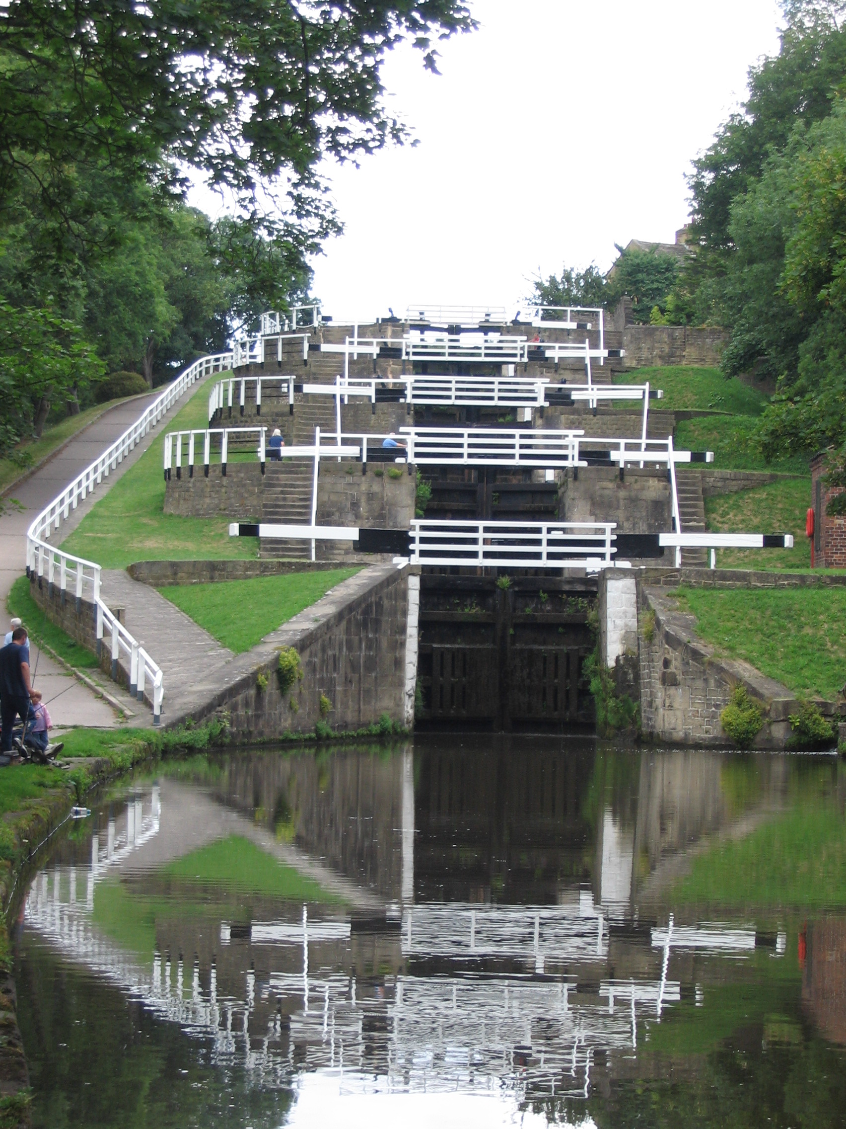
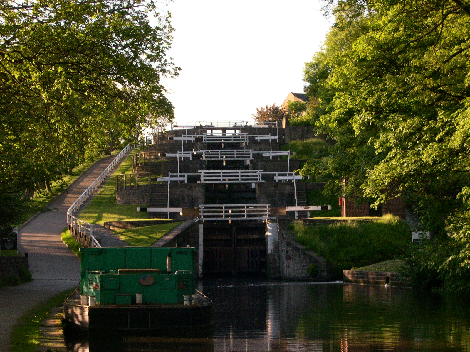
19 Aqueduct 20 Dowley Gap locks (2) 22 Bingley Three Rise Locks (3) 25 Bingley Five Rise Locks (5) 
Silsden 
Skipton 

Thanet Canal (or Springs Branch) 30 Holme Bridge lock 

Eshton Beck 31 various locks in Gargrave (5) 
Priest Holme Rly bridge 
Priest Holme aqueduct (River Aire) 36 Bank Newton locks (6) to Bootle 42 Greenberfield locks (3) 
Foulridge Tunnel (1640 yd) 

Feeders 
45 Barrowford locks (7) 
M65 motorway aqueduct Gannow Tunnel (559 yd) 
M65 bridges (4) M65 motorway aqueduct 52 Blackburn locks (6) M65 motorway 58 Johnson's Hill locks (7) M61 motorway 65 Wigan locks (23) 
Wigan Junction Poolstock locks (2) 
Leigh Branch 
Jn with Bridgewater Canal 86 various locks in Wigan (4) 90 Dean Locks + Appley Locks (4) 
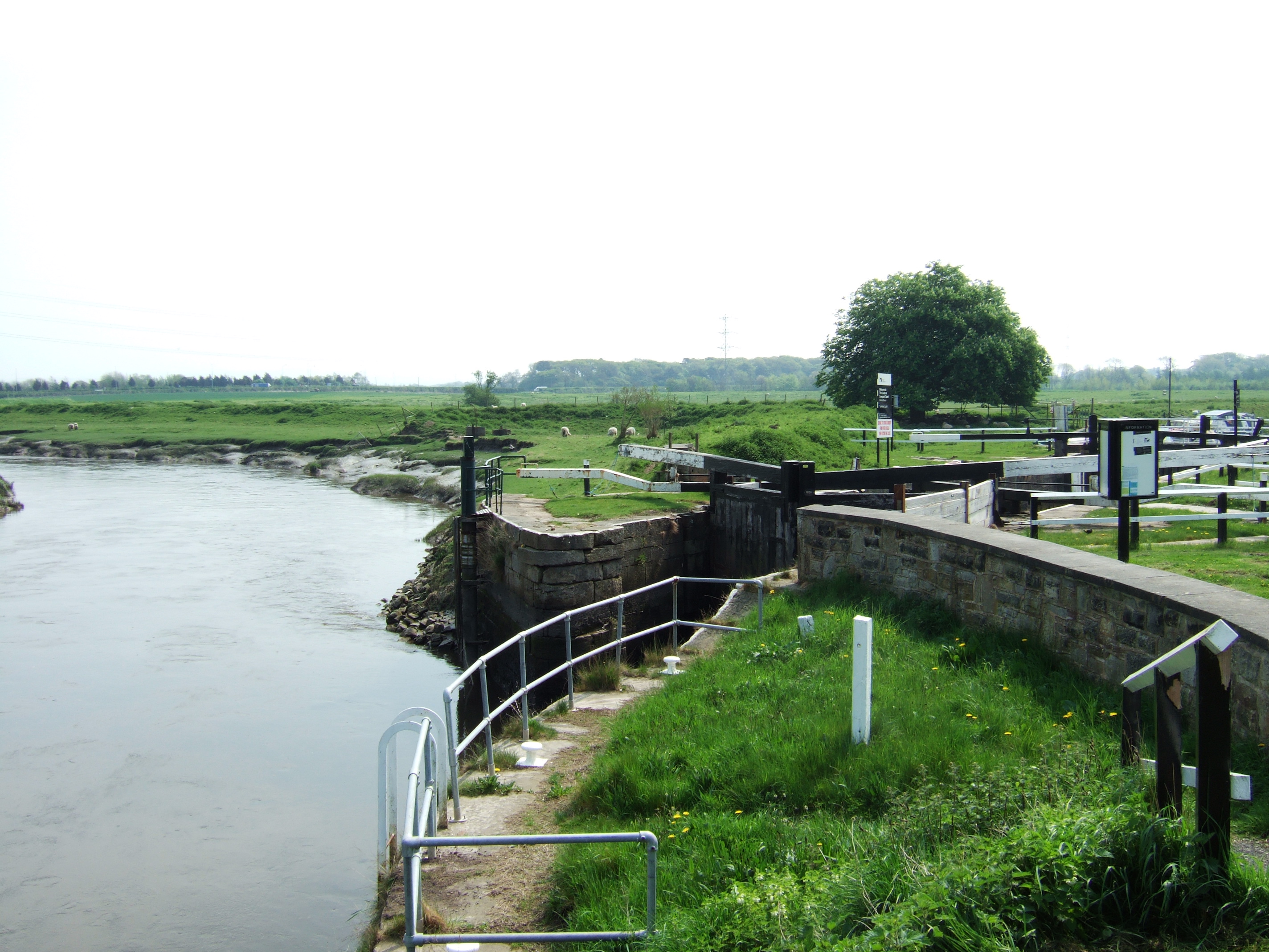
River Ribble 
River Douglas 8 locks on branch Rufford Branch M58 motorway M57 motorway Aintree Bootle Liverpool Canal Link Stanley Dock locks (4) 
Eldonian Basin, Liverpool 
Stanley Dock 
Lock Tunnels (3) Pier Head Mann Island Lock Canning Dock The Leeds and Liverpool Canal is a canal in Northern England, linking the cities of Leeds and Liverpool. Over a distance of 127 miles (204 km), it crosses the Pennines, and includes 91 locks on the main line. It has several small branches, and in the early 21st century a new link was constructed into the Liverpool docks system.
Contents
History
Background
In the mid-18th century the growing towns of Yorkshire including Leeds, Wakefield and Bradford, were trading increasingly. While the Aire and Calder Navigation improved links to the east for Leeds, links to the west were limited. Bradford merchants wanted to increase the supply of limestone to make lime for mortar and agriculture using coal from Bradford's collieries and to transport textiles to the Port of Liverpool.[1] On the west coast, traders in the busy port of Liverpool wanted a cheap supply of coal for their shipping and manufacturing businesses and to tap the output from the industrial regions of Lancashire. Inspired by the effectiveness of the wholly artificial navigation, the Bridgewater Canal opened in 1759–60. A canal across the Pennines linking Liverpool and Hull (by means of the Aire and Calder Navigation) would have obvious trade benefits.
A public meeting took place at the Sun Inn in Bradford on 2 July 1766 to promote the building of such a canal.[2] John Longbotham was engaged to survey a route. Two groups were set up to promote the scheme, one in Liverpool and one in Bradford. The Liverpool committee was unhappy with the route originally proposed, following the Ribble valley through Preston, considering that it ran too far to the north, missing key towns and the Wigan coalfield. A counter-proposal was produced by John Eyes and Richard Melling, improved by P.P. Burdett, which was rejected by the Bradford committee as too expensive, mainly because of the valley crossing at Burnley. James Brindley was called in to arbitrate, and ruled in favour of Longbotham's more northerly route, though with a branch towards Wigan, a decision which caused some of the Lancashire backers to withdraw their support, and which was subsequently amended over the course of development.
An Act was passed in May 1770 authorising construction, and Brindley was appointed chief engineer and John Longbotham clerk of works; following Brindley's death in 1772, Longbotham carried out both roles.
Construction
A commencement ceremony was held at Halsall, north of Liverpool on 5 November 1770, with the first sod being dug by the Hon. Charles Mordaunt of Halsall Hall. The first section of the canal opened from Bingley to Skipton in 1773.[3] By 1774 the canal had been completed from Skipton to Shipley, including significant engineering features such as the Bingley Five Rise Locks, Bingley Three Rise Locks and the seven-arch aqueduct over the River Aire. Also completed was the branch to Bradford. On the western side, the section from Liverpool to Newburgh was dug. By the following year the Yorkshire end had been extended to Gargrave, and by 1777 the canal had joined the Aire and Calder Navigation in Leeds.[3] On the western side it reached Wigan by 1781, replacing the earlier and unsatisfactory Douglas Navigation. By now, the subscribed funds and further borrowing had all been spent, and work stopped in 1781 with the completion of the Rufford Branch from Burscough to the River Douglas at Tarleton. The war in the American colonies and its aftermath made it impossible to continue for more than a decade.[4]
In 1789 Robert Whitworth developed fresh proposals to vary the line of the remaining part of the canal, including a tunnel at Foulridge, lowering the proposed summit level by 40 feet, and a more southerly route in Lancashire. These proposals were authorised by a fresh Act in 1790, together with further fund-raising, and in 1791, construction of the canal finally recommenced south-westward from Gargrave,[3] heading toward Barrowford in Lancashire.
In 1794 an agreement was reached with the Manchester, Bolton and Bury Canal company to create a link near Red Moss near Horwich.[5] However by this time the competing Rochdale Canal had begun construction and was likely to offer a more direct journey to Liverpool via Manchester and the Bridgewater Canal. The company's experiences running the two sections of the canal had also shown that coal[1] not limestone would be its main cargo, and that there was plenty of income available from local trade between the settlements along the route. With this in mind in the same year, the route was changed again with a further Act,[3] moving closer to that proposed by Burdett and the planned canal link did not materialize. Yet more fund-raising took place, as the Foulridge Tunnel was proving difficult and expensive to dig. The new route took the canal south via the expanding coal mines at Burnley,[6] Accrington and Blackburn, but would require some sizable earthworks to pass the former. The completion in 1796 of the 1,640 yards (1,500 m) long Foulridge Tunnel and the seven rise locks at Barrowford enabled the canal to open to eastern Burnley.[3] At Burnley, rather than using two sets of locks to cross the shallow Calder valley, Whitworth designed a 1,350 yards (1,234 m) long and up to 60 feet (18 m) high, embankment. It would also require a 559 yards (511 m) tunnel nearby at Gannow and a sizeable cutting to allow the canal to traverse the hillside between the two. It took 5 years to complete this work, with the embankment alone costing £22,000.[7] Once completed, the canal opened to Enfield near Accrington in 1801.[3] It would be another 9 years until it reached Blackburn only 4 miles away. Following the French Revolution, Britain had been at war with France from 1793 to 1802. The peace proved temporary, with the Napoleonic Wars beginning the following year. High taxes and interest rates during this period made it difficult for the company to borrow money, and the pace of construction inevitably slowed.
The Manchester, Bolton and Bury Canal company proposed another link from Bury to Accrington. This new link would have been known as the Haslingden Canal. The Peel family asked the canal company not to construct the crossing over the River Hyndburn above their textile printworks; such a crossing would have required the construction of embankments, and reduced the water supply to their factories.[4] Consequently Accrington was bypassed and the Haslingden Canal was never built.
The latest plan for the route had it running parallel to, and then crossing the isolated southern end of the Lancaster Canal, but common sense prevailed and the Leeds and Liverpool connected with the Lancaster Canal between Wigan and Johnson's Hillock. The main line of the canal was thus completed in 1816.
There had been various unsuccessful negotiations to connect the canal to the Bridgewater Canal at Leigh but agreement was finally reached in 1818 and the connection was opened in 1820, thus giving access to Manchester and the rest of the canal network. The Bridgewater Canal, like most of Brindley's designs was for narrow boats of 72 feet (22 m) length, whereas the Leeds and Liverpool had been designed for broad boats of 62 feet (19 m) length. There was naturally a desire by the narrow boats to reach Liverpool and the locks of the westerly end of the canal were extended to 72 feet (22 m) in 1822.
Operation
The canal took almost 40 years to complete, in crossing the Pennines the Leeds and Liverpool had been beaten by the Huddersfield Narrow Canal and the Rochdale Canal. The most important cargo was always coal, with over a million tons per year being delivered to Liverpool in the 1860s, with smaller amounts exported via the old Douglas Navigation. Even in Yorkshire, more coal was carried than limestone. Once the canal was fully open, receipts for carrying merchandise matched those of coal. The heavy industry along its route, together with the decision to build the canal with broad locks, ensured that (unlike the other two trans-Pennine canals) the Leeds and Liverpool competed successfully with the railways throughout the 19th century and remained open through the 20th century.
20th century
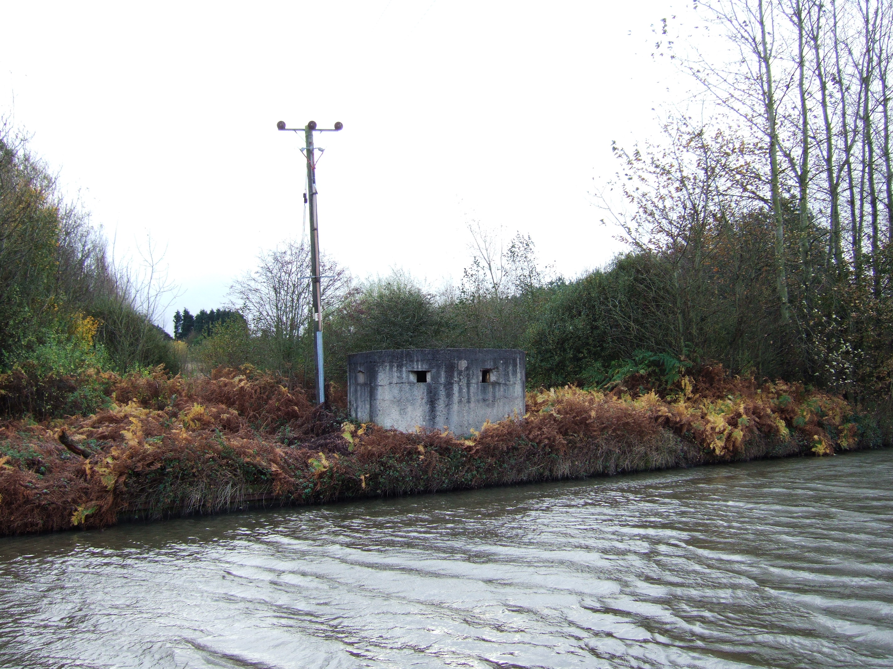
 A concrete pillbox by the canal
 1890s warehouse - Weavers' Triangle - Leeds and Liverpool Canal
The canal suffered some damage during World War II. It was breached by a German mine in Bootle and the headquarters at Pall Mall were damaged. The canal in West Lancashire was part of Britain's defensive plans against invasion. Along the canal there were tank traps, bunkers and blockhouses. Some buildings such as barns and pubs along the canal were fortified. There are still some remaining concrete pillboxes and brick built blockhouses.
Trade continued on the canal until as late as the 1980s. Coal was shipped to the power station in Wigan until 1972 and corn to Ainscough's Mill in Burscough until 1960. The last horse drawn barge was 'Parbold' (1960). The especially cold winters in the early 1960s was thought to have finished off commercial use of the main line of the canal, however a load of timber passed over the full length in 1965, from Liverpool to Leeds. Freight returned in 1973 (coal from Castleford to Skipton), plus various other odd cargoes, then grain was carried between Liverpool and Manchester from 1974 for some years, plus a few loads across the summit - the last being 30 tonnes of herring meal on short boat 'Weaver', from Selby to Manchester (September 1978). The last intensive use of the canal for freight was carriage of effluent from Esholt to Leeds (Knostrop) between May 1978 and December 1979, and aggregate from Trent wharves to Shipley - this ceased in 1982. The section of canal between Aintree and the Liverpool terminus was classed as Remainder in the review of the waterways and therefore only receives enough maintenance to keep it structurally sound.
In the 1950s and 1960s the Mersey Motor Boat Club (MMBC) did a lot of work to keep the canal open and in use. With a variety of boats, converted lifeboats and wooden boats from the Lakes, they kept boats moving on the canal after commercial use stopped. The Leeds and Liverpool Canal is one of the quietest canals for leisure boating on the network.
In the 1960s, the Pall Mall terminus basin was filled in up to Chisenhale Street Bridge (Bridge A). In the 1980s the Eldonian Village housing estate was built for the community which was disrupted by the building of the Mersey Tunnel and the demolition of the Tate and Lyle sugar refinery. This meant the canal was filled in between Chisenhale Street Bridge (Bridge A) and just north of Burlington Street Bridge (Bridge B). As part of the development a new bridge was built, Vauxhall Bridge (un-numbered) which was opened in 1994 by Cilla Black.
In August 2010, a 60-mile stretch of the canal was closed due to the low reservoirs, following the driest start to the year since records began. It was reopened the following month, although some restrictions remained.[8] Some canal boat operators temporarily relocated to other parts of the canal. As of 11 August 2010, as many as 200,000 fish were moved to different areas in the canal to prevent their death in the low-level waters.[citation needed]
Route

The Leeds and Liverpool Canal main line is 127 miles (204 km) long and crosses the country from Liverpool, Merseyside to Leeds, West Yorkshire. It has two main side-branches, the Leigh Branch and the Rufford Branch. The summit level is at 487 feet (148 m). The canal was built with locks 60 ft (18 m) long and 14 ft 3 in (4.34 m) wide to accommodate the Yorkshire Keel barges already in use on the Rivers Aire and Humber. However, the locks on the Leigh Branch and the mainline between Wigan and Liverpool (and Rufford Branch), were extended to a length of 72 feet (22 m) to accommodate the longer boats trading on the rest of the canal network following the building of the Leigh Branch.
 The Leeds and Liverpool Canal at Wigan Pier
The original Liverpool terminus was at Clarke's Basin in present-day Old Hall Street.[9] This later moved to Pall Mall when land was sold to a railway company. A direct connection to the docks via Stanley Dock was built in 1846.
From Liverpool to Appley Locks, the canal runs for 27 miles (43 km) without locks, across the West Lancashire Coastal Plain.
The two main side-branches both connect to other waterways. The Rufford Branch links into the River Douglas and, via the Ribble Link and the River Ribble to the previously isolated Lancaster Canal. The Leigh Branch from Wigan leads to the Bridgewater Canal and thus to Manchester and the Midlands.
The Leeds and Liverpool Canal is said to be the longest single canal in England constructed by one company, but it is shorter than the Grand Union Canal which was made up of many smaller canals merged together. The Leeds Liverpool Canal includes the southern part of the Lancaster Canal between Johnsons Hillock and Wigan Top Lock.
The canal at Aintree passes close to the racecourse and gives the name to the course's Canal Turn. The canal has one of the country's most photographed canal features - the Bingley Five Rise Locks at Bingley. Bingley Five Rise and the Burnley Embankment are two of the original Seven Wonders of the canal world chosen by Robert Aickman.
Liverpool link
The new £20 million Liverpool Canal Link was completed in 2009,[10] and opened on 25 March 2009.[11] It re-connects the Leeds and Liverpool Canal to Liverpool's South Docks via Stanley Dock,[12] allowing boats to travel past the world-famous Three Graces and into the Albert Dock.
Places on route
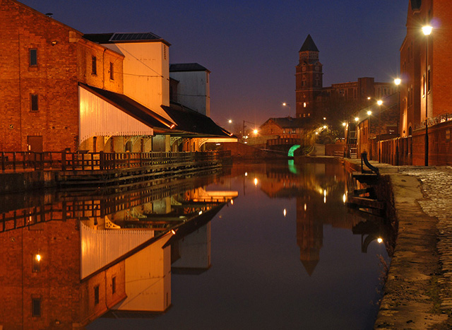
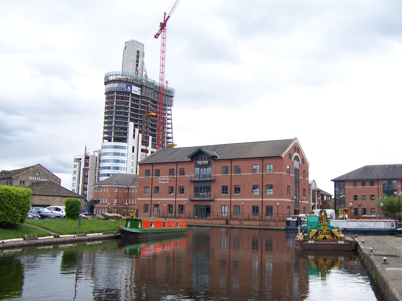
 Leeds and Liverpool Canal near Granary Wharf in Leeds
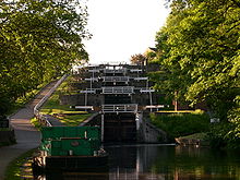 Bingley Five Rise Locks
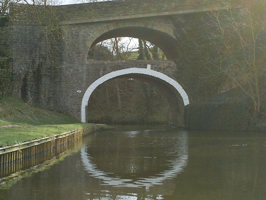
 The Double Arched bridge (number 161) at East Marton
 Canal boats at Appley Bridge
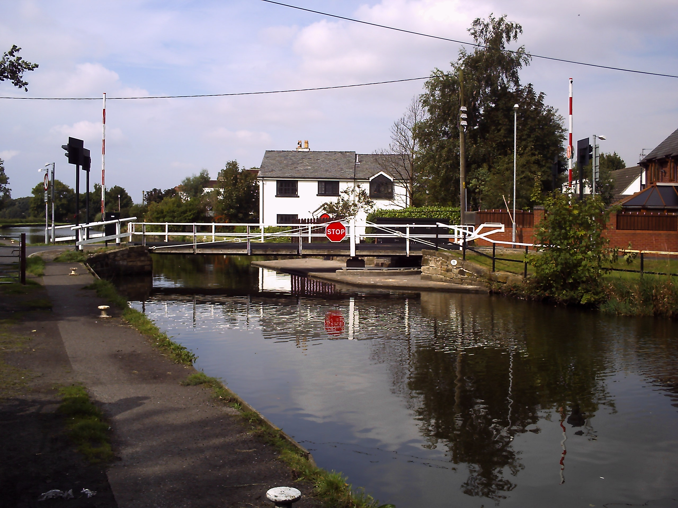
 Bell's Swing Bridge #16 in Lydiate
 Original buildings from Clarkes Basin Liverpool
Direction: East (top) to West (bottom)
- Leeds
- Granary Wharf
- Armley Pool
- Kirkstall
- Rodley
- Apperley Bridge
- Shipley
- Saltaire
- Bingley
- Keighley
- Silsden
- Kildwick
- Skipton
- Gargrave
- East Marton
- Barnoldswick
- Foulridge Tunnel
- Barrowford
- Nelson
- Burnley
- Ightenhill
- Gannow Tunnel
- Hapton
- Clayton-le-Moors - the halfway point
- Church
- Rishton
- Blackburn
- Riley Green
- Wheelton
- Johnson's Hillock
- Chorley
- Wigan - Wigan Pier
- Appley Bridge
- Parbold
- Lathom
- Burscough
- Scarisbrick
- Halsall
- Haskayne
- Downholland Cross
- Lydiate
- Maghull
- Melling
- Aintree
- Litherland
- Bootle
- Vauxhall
- Stanley Dock Branch:
See also
- Leeds and Liverpool Canal Society
- Liverpool Canal Link
- Weavers' Triangle
References
- ^ a b (pdf) Origin & Historic Development. Bradford Council. http://www.bradford.gov.uk/NR/rdonlyres/1F7D2D6B-8298-4893-AA99-2CE7C2EA2D00/0/Leeds_Liverpool_2_Historic_Development.pdf. Retrieved 2011-02-27
- ^ Clarke, Mike (1994). The Leeds & Liverpool Canal. Carnegie Publishing. ISBN 1-85936-013-0.
- ^ a b c d e f "The Leeds & Liverpool Canal Society Chronology". Northern Heritage. 2006. http://www.llcs.org.uk//whitep2.htm. Retrieved 2008-06-14.
- ^ a b Clarke, Mike. "The Leeds-Liverpool Canal". cottontown.org. http://www.cottontown.org/page.cfm?pageid=2594&language=eng. Retrieved 2008-08-18
- ^ Priestley, Joseph (1831). Historical Account of the Navigable Rivers, Canals and Railways of Great Britain. Longman, Green. http://books.google.com/?id=eUqIucVmZjwC&pg=PA435&lpg=PA435&dq=1791+bury+canal. Retrieved 2008-06-27.
- ^ (pdf) Lancashire Hidtoric Town Survey Programme Burnley. Lancashire County Council. http://www.lancashire.gov.uk/environment/documents/historictowns/BurnleyComplete_LowRes.pdf. Retrieved 2011-03-03
- ^ Brian Hall (1977). Burnley: A Short History. Burnley: Burnley Historical Society. pp. 40. ISBN 0-9500695-3-1.
- ^ British Waterways announces phased reopening of Leeds & Liverpool Canal British Waterways 15 September 2010.
- ^ "Walking and Cycling guide to the Canal". Towpath Treks. 2006. http://www.towpathtreks.co.uk/LLC/liverpool_canal.html. Retrieved 2008-06-14.
- ^ "Photographs of current work". Pennine Waterways. http://www.penninewaterways.co.uk/ll/liverpool-link15.htm. Retrieved 2008-06-14.
- ^ "New canal link to boost tourism". BBC News. 25 March 2009. http://news.bbc.co.uk/1/hi/england/merseyside/7962742.stm. Retrieved 2009-03-26.
- ^ Liverpool Link
Further reading
- Clarke, Mike (1990). The Leeds and Liverpool Canal. Preston: Carnegie Press. ISBN 0-948789-40-9
External links
- Google Map of Leeds Liverpool Canal and Branches
- "200-year-old 'canal cottages' at risk in Liverpool city centre: Must we lose this historic link with Liverpool's commercial past?". The fight to save 91-93 Old Hall Street. 10 September 2001. http://www.liverpool.ndo.co.uk/oldhall. Retrieved 2006-05-03.
- Leeds & Liverpool Canal, waterscape.com - Walks, cycle routes, attractions and visits.
- Leeds & Liverpool Canal - history, virtual tour
- Photographs and History of the Leeds & Liverpool Canal
- Towpath Treks Blog
- Map of canal route
Coordinates: 53°47′N 1°31′W / 53.783°N 1.517°W
Categories:- Transport in Liverpool
- Sites of Special Scientific Interest in West Yorkshire
- Canals in Blackburn
- Canals in Bradford
- Canals in Burnley
- Canals in Leeds
- Canals in Wigan
- Canals in Liverpool
- Canals in England
- Canals in West Yorkshire
- Canals in Lancashire
- Canals in Merseyside


Wikimedia Foundation. 2010.