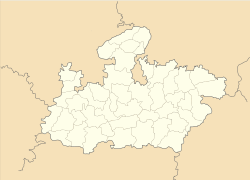
- Nagda
-
Nagda — city — Coordinates 22°47′N 75°16′E / 22.78°N 75.27°ECoordinates: 22°47′N 75°16′E / 22.78°N 75.27°E Country India State Madhya Pradesh District(s) Ujjain Population
• Density
116,525 (2001[update])
• 80 /km2 (207 /sq mi)
Time zone IST (UTC+05:30) Area
1,200 square kilometres (460 sq mi)
• 529 metres (1,736 ft)
Codes-
• Pincode • 456331-5
Website www.nagdacity.com JANMAI JAI NAGARI i.e.Nagda (Hindi: नागदा) is a city in Ujjain district in the Indian state of Madhya Pradesh. It is an industrial town in the Malwa region of western Madhya Pradesh and is situated on the bank of Chambal River.
The name of the town was actually nag-dah which means cremation/burning (dah) of snakes (nag). The ancient city was developed by king Janmejay. Janmejay was a Hindu King of Pandava Dynasty. Nagda was mentioned in the literature of Kalidasa. Presently, Nagda is a major industrial town having manufacturing unit of Viscose fibre, thermal power plant and a chemical plant, It is a major ISO granted railway junction on the Delhi-Mumbai railway line.It is exactly 694km from both delhi as well as mumbai.
Prior to being an industrial town, Nagda was a small village. The location near river Chambal and availability of acres of land attracted Ghanshyam Das Birla to set up a major facility. Today Nagda is one of the largest viscose staple fiber manufacturers in Asia.
Contents
Geography
(1735 ft) above sea level. Name of Famous Colonies: 1.Prakash Nagar Colony 2.Indu Colony 3.Jiwaji Nagar 4.Vidhya Nagar 5.Indrapuri 6.Birlagram Labour Colony Naming as A,B,C,D,E,F,G,H, Blocks 7.Police line 8.Durga Vihar Colony 9.Durgapura 10.Durgapura Labour Chemical Colony 11.Chemical Colony, Durgapura rd 12.Mehatwas 13.Peer Nagar, Durgapura 14.Ram Nagar, Durgapura 15.Grasim Staff Colony 16.Grasim Chemical Staff Colony 17.Honey Moon Blocks, Durgapura 18.Managers Block, Janseva Rd 19.Grasim ABC Line 20.Grasim XYZ Colony 21.56-Block 22.Beema Colony,Petrol Pump Birlagram 23.Baadi Pura 24.Government Colony 25.Jabaran Colony 26.Khachrod Naka 27.Tower Square 28.ID-Gah 29.Mirchi Bazar 30.Station Choraha 31.Badri Vishal Mandir Square 32.Oza Colony 33.Mony Jeen 34.Gujjar Mohalla 35.Nai Delhi 36.Paaliya Road 37.Tanki Square 38.Housin board 39.Shri Ram Colony 40.Sindi Colony 41.Patel Gali 42.Aadhi nath nagar 43.Kasai Mohalla 44.Anjani Nagar 45.Mehidpur Road. 46.Jawahar Marg 47.MG Road 48.Kirt Nagar 49.AMLAVDIYA ROAD 50.BCI STAFF COLONY 51.chambal marg 52.juna nagda 53.chetan pura 54.kota fatak 55.Shivpura colony 56.gandhi gram colony
Demographics
As of 2001 India census,[1] Nagda had a population of 96,525. Males constitute 52% of the population and females 48%. Nagda has an average literacy rate of 69%, higher than the national average of 59.5%: male literacy is 77%, and female literacy is 60%. In Nagda, 14% of the population is under 6 years of age.
Educational institutions
- Agoshdeep International Public School
- Aditya Birla Public School
- Aditya Birla Higher Secondary School
- Aditya Birla Senior Secondary School
- Fatima Convent School(ICSE AFFILIATED)
- Mother Mary English School
- Vardhmaan Convent H.S. School
- Bharat Commerce H.S. School
- Grasim Vidyalaya
- AISECT-IGNOU LEARNING CENTER, NAGDA.
- shree sheshshyai college of prof. studies
Industries
- Grasim Industries Limited
- Lanxess Industries
- Grasim Chemical Division
- Autofina Industries
- pooja industries,guradiya road
- Chawla mobile centre
Nagda is headquarter of world's largest producer of rayon, GRASIM Industries Ltd. Grasim Industries Limited was incorporated in 1948; Grasim is the largest exporter of Viscose Rayon Fiber in the country, with exports to over 50 countries. This, along with Aditya Birla Nuvo can be considered as companies of the AV Birla Group. Grasim is headquartered in Nagda kharach (kosamba). Nagda is the highest tax paying town of Ujjain division. Nagda is fastest developing town of Malwa region and also having its geopolitical importance in the map of world. The railway and police stations are ISO granted. There is a big Taalaab in the North end of the city. The near by famous cities are Ujjain,Ratlam,Unhel,Mehidpur city, Khachrod, Hotels;- celebrity hotel
- sun shine,hospital square
- shivmayam
Religious places
- shitla mata mandir jawahar marg
- Madina Masjid Jawahar marg
- Shri Sheshshai Birla Temple
- Khade Hanuman Mandir
- Delanpur
- Mukteshwar Mahadev Mandir
- Badrivishal Mandir [Mandi]
- Jain Mandir in Mandi Area
- Jain Dadawadi Methwas Birlagram
- Nakoda Jain Mandir,(live Mandir)
- Chamunda Mata Mandir chambal
- Ganesh Temple(birlagram)
- Badi Masjid (mirchi bazar)
- Holy Church near Nagar Palika
- Shrinath ji temple
- Kalka Mata mandir mehatwas
- Shri Sidh Hanuman Mandir MPEB road Mehatwas Nagda
- Gayatri Mandir(mandi)
- Sai mandir ( Mandi
- Ram Nagar(On Ajimabad Pardi Road)
- Shri Sai Mandir (Shri Ram Colony)
- shri gurudwara gurusingh sabha
- saranam ayyappa temple birlagram
- Peer Baba Dargah Durgapura road
- Catholic church,kota phatak
- hanuman mandir (nayan gaon)
- hanuman mandir (birlagram)
- hanuman mandir juna nagda
- hanuman mandir m.g.road
Transportation
Nagda is situated on the basin of river Chambal.It is an important junction between Delhi,Mumbai and Bhopal.Road and rail connections are good and also having Birla aerodrome for personal use.Ujjain Udaipur highway byepass is passing via nagda. ==PRESIDENT===Shrimati Shobha ji Yadav
References
- ^ "Census of India 2001: Data from the 2001 Census, including cities, villages and towns (Provisional)". Census Commission of India. Archived from the original on 2004-06-16. http://web.archive.org/web/20040616075334/http://www.censusindia.net/results/town.php?stad=A&state5=999. Retrieved 2008-11-01.
Cities and towns in Ujjain Division Dewas district Mandsaur district Neemuch district Ratlam district Shajapur district Agar · Akodia · Badagoan · Badod · Kanad · Maksi · Polay Kalan · Shajapur · Shujalpur · Soyatkalan · SusnerUjjain district Related topics Cities and towns
in other DivisionsCOLLECTED BY PRAMOD R NAIR
Categories:- Railway stations in Madhya Pradesh
- Cities and towns in Ujjain district
-
Wikimedia Foundation. 2010.


