- Dembidolo
-
Dembidolo
SayoLocation within Ethiopia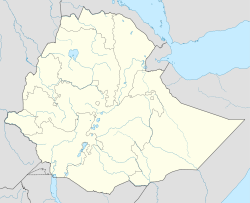
 Dembidolo
Coordinates: 8°32′N 34°48′E / 8.533°N 34.8°ECoordinates: 8°32′N 34°48′E / 8.533°N 34.8°E Country Ethiopia Region Oromia Zone Mirab (West) Welega Elevation 1,701 m (5,581 ft) Population (2005) – Total 35,065 Time zone EAT (UTC+3) Dembidolo (or Dembi Dolo; formerly Sayo) is a market town in southwestern Ethiopia. Located in the Mirab Welega Zone of the Oromia Region, this town has a latitude and longitude of 8°32′N 34°48′E / 8.533°N 34.8°E with an elevation between 1701 and 1827 meters above sea level.
Dembidolo is known for goldsmith work and for tej production.[1] The town also possesses an airport (ICAO code HADD, IATA DEM).
History
Originally known as Sayo, after the semi-autonomous kingdom that had ruled in this area in the years after 1900, by 1920 this town served as the seat of the governors of this part of southwestern Ethiopia until the Italian conquest.[2] Richard Pankhurst notes that during this period Dembidolo was "a great commercial centre for coffee, where by the 1930's perhaps 500,000 kilos of beans, besides large quantities of wax and skins, were exported every year to the Sudan."[3] Emperor Iyasu V visited Dembidolo around 1912, and was welcomed by Dejazmach Jote.[4]
By 1958 Dembidolo became one of 27 places in Ethiopia ranked as First Class Township. That same year, the Commercial Bank of Ethiopia opened a branch in the town.[4]
The last military action of the Oromo Liberation Front (OLF) before the demise of the Derg 1991 occurred at Dembidolo, when some of its units reportedly killed more than 700 government soldiers.[4] Afterwards, the OLF assumed civilian control of Dembidolo and its surrounding territory. However, when the OLF found that their efforts to field candidates in the rest of the Oromia region were frustrated by the Oromo Peoples' Democratic Organization, which also had the support of the ruling Tigrayan People's Liberation Front, the OLF withdrew from the government in 1992. This proved to be a disaster for the OLF, as EPRDF forces captured Dembidolo and forcibly drove the OLF membership into exile.[5]
In February 2008, police in Dembidolo arrested 16 people belonging to the opposition Oromo Federalist Democratic Movement, accusing them of being members of the banned OLF. Although two weeks later a court ordered them all released when police failed to provide evidence to support their accusations, they were subsequently threatened with physical harm by local officials.[6]
Demographics
Based on figures from the Central Statistical Agency in 2005, this town has an estimated total population of 35,065 of whom 18,129 are men and 16,936 are women.[7] The 1994 census reported this town had a total population of 19,587 of whom 9,832 were males and 9,755 were females. It is the largest settlement in Sayo woreda.
Notes
- ^ As attested, for example, by Matt Philips and Jean-Bernard Carillet, Ethiopia and Eritrea, third edition (n.p.: Lonely Planet, 2006), p.251
- ^ Donald Donham includes Sayo as one of the "strictly limited" number of local domains that were permitted a degree of independence in return for accepting the rule of Emperor Menelik II. Donham, "The making of an imperial state" in The Southern Marches of Imperial Ethiopia, Donald Donham and Wendy James, editors (Oxford: James Currey, 2002) p. 37
- ^ Richard Pankhurst, Economic History of Ethiopia (Addis Ababa: Haile Selassie I University, 1968), p. 450
- ^ a b c "Local History in Ethiopia" (pdf) The Nordic Africa Institute website (accessed 28 November 2007)
- ^ Political Competition in Oromia, Human Rights Watch website (accessed 17 March 2009)
- ^ "Ethiopia: Repression Sets Stage for Non-Competitive Elections", HRW website (accessed 17 March 2009)
- ^ CSA 2005 National Statistics, Table B.4
Cities of Ethiopia Adama (Nazret) · Addis Ababa · Adigrat · Adwa · Ambo · Arba Minch · Asella · Awasa · Axum · Bahir Dar · Debre Berhan · Debre Marqos · Debre Tabor · Debre Zeyit · Degehabur · Dembidolo · Dessie · Dila · Dire Dawa · Gambela · Goba · Gode · Gondar · Harar · Irgalem · Jijiga · Jimma · Kebri Dahar · Kombolcha · Mek'ele · Negele Arsi · Negele Boran · Nekemte · Shashamane · Sodo · Weldiya · Wukro · Ziway
Categories:- Populated places in the Oromia Region

Wikimedia Foundation. 2010.