- Niles, Michigan
-
Niles, Michigan — City — Main Street of Niles, looking up hill from the river.
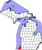
Nickname(s): The City of Four Flags Location of Niles, Michigan
Coordinates: 41°49′49″N 86°15′3″W / 41.83028°N 86.25083°W State Michigan Counties Berrien, Cass Area - Total 5.9 sq mi (15.3 km2) - Land 5.8 sq mi (15.0 km2) - Water 0.1 sq mi (0.4 km2) Elevation 686 ft (209 m) Population (2010) - Total 11,600 - Density 2,000.0/sq mi (773.3/km2) Time zone Eastern (EST) (UTC-5) - Summer (DST) EDT (UTC-4) ZIP codes 49120-49121 Area code(s) 269 FIPS code 26-57760[1] GNIS feature ID 0633412[2] Website http://www.ci.niles.mi.us/Default.htm Niles is a city in Berrien and Cass counties in the U.S. state of Michigan, near South Bend, Indiana. The population was 11,600 at the 2010 census. It is the greater populated of two principal cities of and included in the Niles-Benton Harbor, Michigan Metropolitan Statistical Area, which has a population of 156,813.[3]
Located in Berrien County, Niles lies on the banks of the St. Joseph River, at the site of the French Fort St. Joseph, first built in 1697 to protect the Jesuit Mission established in 1691. After 1761, it was held by the British and was captured on May 25, 1763, by Native Americans during Pontiac's Rebellion. The British retook the fort but it was not regarrisoned and served as a trading post. During the American Revolutionary War, the fort was held for a short time by a Spanish force. The occupation of the fort by the four nations of France, Britain, Spain, and the United States has earned Niles the nickname City of Four Flags.[4]
The town was named after Hezekiah Niles (editor of the Niles Register, a Baltimore newspaper.) The town of Niles as it exists today was settled in 1827. Between 1820 and 1865, Niles was an integral part of the Underground Railroad, helping slaves escape from as far south as New Orleans through the Heartland, and eventually into Canada.[5][6][7]
Contents
Geography
The city is situated on the St. Joseph River and is mostly surrounded by Niles Township. Glacial deposits of large boulders and smooth stones mingle with heavy sedimentary deposits, producing rolling hills and steep river banks. The soil is rich and fertile. Crinoida and related fossils are easily found south of the city.
According to the United States Census Bureau, the city has a total area of 5.9 square miles (15.3 km²), of which, 5.8 square miles (15.0 km²) of it is land and 0.1 square miles (0.4 km²) of it (2.36%) is water.
Demographics
As of the census[1] of 2000, there were 12,204 people, 5,096 households, and 3,052 families residing in the city. The population density was 2,109.5 per square mile (813.8/km²). There were 5,531 housing units at an average density of 956.0 per square mile (368.8/km²). The racial makeup of the city was 82.19% White, 12.36% African American, 0.66% Native American, 0.52% Asian, 0.08% Pacific Islander, 1.26% from other races, and 2.93% from two or more races. Hispanic or Latino of any race were 3.97% of the population.
There were 5,096 households out of which 30.8% had children under the age of 18 living with them, 39.2% were married couples living together, 16.3% had a female householder with no husband present, and 40.1% were non-families. 34.3% of all households were made up of individuals and 13.8% had someone living alone who was 65 years of age or older. The average household size was 2.35 and the average family size was 3.02.
In the city the population was spread out with 26.9% under the age of 18, 8.8% from 18 to 24, 28.1% from 25 to 44, 20.8% from 45 to 64, and 15.4% who were 65 years of age or older. The median age was 35 years. For every 100 females there were 87.9 males. For every 100 females age 18 and over, there were 80.9 males.
The median income for a household in the city was $31,208, and the median income for a family was $38,870. Males had a median income of $31,395 versus $22,991 for females. The per capita income for the city was $16,584. About 9.9% of families and 13.6% of the population were below the poverty line, including 17.8% of those under age 18 and 7.2% of those age 65 or over.
Points of interest
 The Fort St. Joseph Museum, the former carriage house of the Victorian Chapin Mansion.
Chapin Mansion, a very fine example of Victorian Queen Anne Architecture<http://www.ci.niles.mi.us/Community/MuseumsHistoricSites.htm>, was built by Henry A. Chapin from 1882-1884<http://www.michigan.org/Property/Detail.aspx?p=B10714>. In 1932, the family sold the mansion to the City of Niles with the assurance that the mansion would always be open to visitors. The mansion is now the current Niles City Hall and may be visited during normal business hours, and tours can be arranged in advanced<http://www.ci.niles.mi.us/Community/MuseumsHistoricSites.htm>. The Chapin Mansion carriage house is now the city's museum. This local museum houses artifacts culled from indigenous Native American cultures. The museum also includes various European artifacts from early colonial time periods into the mid 20th century. Finally, the museum has a small collection of "oddities" such as a two headed lamb.
The Riverfront Park in Niles stretches about a mile and a half of the St. Joseph River. The park and the immediate surrounding down town area is the main stage for many of the cities seasonal cultural events, including the Niles Riverfest, the Bluegrass Festival, the Hunter Ice Festival, and the Apple Festival Parade. The park also includes the Armed Forces Memorial, public stage, City's free skateboard park, playground, and sand volleyball courts. Niles includes two other smaller but still notable parks. The Saint Joseph River Park, parts of which are now being excavated, is south of the French Paper Mill Factory Dam and is believed to possibly to include part of the original forgot St. Joseph's Fort. Archaeologists have uncovered numerous artifacts at this location. However, do to the fact this is undeveloped public land, the likely size of the fort, and possible out lying settlers homes it is also possible this is not the true site of Fort St. Joseph. Niles also has a small park, Island Park, that is on an Island in the middle of St. Joseph's River. Because of its location the park has been completely submerged underwater. The river's natural flood is in part why Downtown Niles is built on a hill.
Niles has two fine restaurants, the Riverfront Cafe and the Millennium Steak House,both have good service and cultural environments. In 2003, the City of Niles was awarded a MEDC Community Development Block Grant which, together with private and city funds, allowed for the removal of aluminum fronts from two blocks on Main St. Basic facade restoration along with streetscape improvements were also made, including brick sidewalks and numerous brick flower beds. The still fully functioning Jerry Taylor Airport also the location of the City's annual Fourth of July celebration lies at the Eastern edge of the City.
Near Niles City includes The Fernwood Botanical Garden and Nature Preserve just outside the city limit headed towards Buchanan, Michigan. Barren Lake and her small community is just two miles beyond the city limit to East. The University of Notre Dame is six miles across the state line in South Bend, Indiana.
Notable Dates in Recent Niles History
2003 March Niles receives designation as 30th National LISC Neighborhood Main Street Initiative community.
2004 June Niles is chosen as one of 7 MEDC (MSHDA) Michigan Main Street Communities.
2005 June Niles receives the Governors Award for Historic Preservation for the work done restoring the building facades on Main Street.
2006 May Niles Michigan ranks 159th on Forbes list of Best Small Places for Business.
2006 November Niles becomes the first MSHDA Michigan Main Street program to receive accreditation through the National Trust for Historic Preservations National Main Street Center. There are currently 28 Main Street programs in the State of Michigan 8 of which are nationally accredited programs. All of the accredited Main Street programs in Michigan except Niles are in Oakland County.
2007 April Niles Michigan ranks 140th on Forbes list of Best Small Places for Business (the highest ranking Michigan city on the list).
2007 June The Downtown Niles Historic District was listed on the National Register of Historic Places.
2007 September Niles DDA Main Street was chosen the Michigan Main Street Community of the Year.
2007 December The Niles DDA Main Street program receives accreditation through the National Trust for Historic Preservations National Main Street Center for the second consecutive year.
2008 March Niles Michigan ranks 110th on Forbes list of Best Small Places for Business (the highest ranking Michigan city on the list).
Transportation
See also: Niles (Amtrak station)Rail
The two rail lines currently serving Niles are Amtrak's Blue Water and Wolverine Services. The Blue Water line serves the Port Huron-Chicago route. The Wolverine line serves the Pontiac-Chicago route. Freight service provided by the Norfolk Southern Railway. However, it was once served by several other lines. The Amtrak line was the Michigan Central Railroad's main line, opened through Niles in 1848 and 1849. The St. Joseph Valley Railroad opened in 1870 as the Michigan Central's South Bend Branch, and the Michigan Air-Line Railroad, leased to the Michigan Central, opened a line heading east from Niles in 1871, known as the Air Line Branch. The final line through Niles was the southeast-northwest Benton Harbor Branch of the Cleveland, Cincinnati, Chicago and St. Louis Railway (also known as the Big Four), originally opened by the Elkhart, Niles and Lake Michigan Railroad in 1881. All of these lines were part of the New York Central Railroad system. The Air Line Branch was abandoned at Niles in 1937, and the Benton Harbor Branch (Big Four) was removed north of Niles in 1980. The South Bend Branch was removed later that decade.[8]
Cincinnati Wabash and Michigan Railway Company
This company was incorporated by the purchasers of the Cincinnati Wabash and Michigan Railroad Company, certificate of incorporation being filed with the Secretary of the State of Indiana under date of April 16, 1880. The original Cincinnati Wabash and Michigan Railroad Company was incorporated June 30, 1871, and the line opened from Goshen, Indiana, to Anderson, Indiana, May 21, 1876. The reorganized Cincinnati Wabash and Michigan Railway Company consolidated August 11, 1882, with the Elkhart Niles and Lake Michigan Railroad Company, chartered as a revival of the Elkhart and Lake Michigan Railroad Company in Michigan June 19, 1880; this latter consolidation making a complete line from Benton Harbor, Michigan, to Anderson, Indiana. The entire stock of the Cincinnati Wabash and Michigan Railway Company is owned by The Cleveland Cincinnati Chicago and St Louis Railway Company, which has operated the line as a part of its road since November 1, 1890; formal lease to the latter having been executed April 1, 1891, lease effective July 1, 1891, running one hundred years.
The Amtrak station is located along the main line east of the former Benton Harbor Branch crossing and west of the former junctions with the South Bend and Air Line Branches. Amtrak uses the old Michigan Central station; the current structure was built in 1892 and is listed on the National Register of Historic Places.[9] Scenes in films such as Continental Divide, Midnight Run and Only the Lonely were shot here. Baggage cannot be checked at this location; however, up to two suitcases in addition to any "personal items" such as briefcases, purses, laptop bags, and infant equipment are allowed on board as carry-ons.
Major Highways
Interstates


 I-80/I-90 is routed along the Indiana Toll Road, just across the Indiana state line.
US highways
Michigan State Trunklines
Indiana Highways
 SR 933 (continuation of M-51)
Transit
Niles is served by Niles Dial-A-Ride Transportation System (DART).[10] The service has been running since 1974. It is run by Niles City Council and operated under contract by McDonald Transit. The agency is based in the same building as the city's Amtrak station. In addition to Dial-a-Ride service, it offers fixed route service via Route 2. The route runs through Niles throughout the weekdays. As of January 1, 2011, it also stops at South Bend, Indiana once every two hours. The route connects to South Bend TRANSPO Route 5 at Auten Road/Route 933 intersection.[11]
Media
The newspaper for the town is the Niles Daily Star.[12] Niles is served by South Bend, Indiana, television and radio (see Template:South Bend TV and Template:South Bend Radio).
Notable people
- Thomas Fitzgerald (1796–1855), U.S. Senator and probate judge
- Aaron Montgomery Ward (1844–1913), founder, Montgomery Ward
- John Francis Dodge (1864–1920), automobile industry pioneer
- Horace Elgin Dodge (1868–1920), automobile industry pioneer
- Ring Lardner (1885–1933), Sr., satirist, short story writer and sports columnist
- Tommy James (1947-), musician, Tommy James and the Shondells
- Tommy Shaw (1953-), musician, Styx (former resident here, not a native)
- Dave Schmidt (1957-), Major League Baseball pitcher
- Jason Newsted (1963-), musician, Metallica
- Jake Cinninger (1975-), musician, Umphrey's McGee
- Mark Anderson (1960-), Editor American Free Press
- Guy Murray, college runner at Detroit, Detroit head cross country/track coach
- Acklee King (1953-), musician, Junior Walker & the All Stars
- Diane Seuss (1956-), poet, winner of 2009 Juniper Prize for Poetry
- Michael Tanke (1989-), professional soccer player, Rochester Rhinos
Schools
The Niles Community Schools[13] consist of five elementary buildings: Northside (grades pre-K and K), Ellis (grades K & 1), Howard (grades 2-5), Ballard (grades K-5), and Eastside (grades K-5). The Niles District also has two junior highs: Oak Manor (grade 6) and Ring Lardner (grades 7-8). Niles High School contains grades 9-12. In addition, the Niles Schools also have Cedar Lane (alternative education), Southside (special education), and Westside (adult education and administration). The Niles Vikings compete in the West Division of the Southwestern Michigan Athletic Conference for sports. The 2000 Mens Basketball Team went to the MHSAA Class B Final Four in the Mens State Basketball Tournament. The 2000 and 2001 Niles Powerlifting Teams finished Runners Up in the USAPL Michigan State High School Powerlifting Championships. The 2001 through 2003 Mens Football Teams went to the Division III MHSAA State Football Playoffs. The 2009 Ladies Softball Team won the MHSAA Division II State Softball Championship.
References
- ^ a b "American FactFinder". United States Census Bureau. http://factfinder.census.gov. Retrieved 2008-01-31.
- ^ "US Board on Geographic Names". United States Geological Survey. 2007-10-25. http://geonames.usgs.gov. Retrieved 2008-01-31.
- ^ Population of Michigan Regions and Statistical Areas, 2000 and 2010, at www.michigan.gov
- ^ "Getting to Know the Four Flags Area: The Story of Fort St. Joseph". Four Flags Area Council on Tourism website.
- ^ http://www.ci.niles.mi.us/community/fortstjosephmuseum/overviewfortstjosephmuseum.htm
- ^ http://www.motopera.org/mg_ed/educational/UndergroundRR.html
- ^ http://driscoll-class.wikispaces.com/file/view/underground_railroad.jpg/86344275/underground_railroad.jpg
- ^ Michigan's Internet Railroad History Museum: Niles, Michigan
- ^ Michigan Historical Marker: Michigan Central Railroad Niles Depot
- ^ Dial A Ride Transportation SystemCity of Niles website.
- ^ http://www.ci.niles.mi.us/DeptsAndServices/NilesDialARide/RouteServiceToSouthBend1210.pdf
- ^ Niles Daily Star website
- ^ Niles Community Schools website
External links
Municipalities and communities of Berrien County, Michigan County seat: St. Joseph Cities Benton Harbor | Bridgman | Buchanan | Coloma | New Buffalo | Niles‡ | St. Joseph | Watervliet
Villages Baroda | Berrien Springs | Eau Claire | Galien | Grand Beach | Michiana | Shoreham | Stevensville | Three Oaks
Charter
townshipsBenton | Coloma | Lake | Lincoln | Niles | Oronoko | St. Joseph | Watervliet
General law
townshipsBainbridge | Baroda | Berrien | Bertrand | Buchanan | Chikaming | Galien | Hagar | New Buffalo | Pipestone | Royalton | Sodus | Three Oaks | Weesaw
Unincorporated
communitiesBenton Heights | Berrien Center | Dayton | Fair Plain | Glendora | Harbert | Lake Michigan Beach | Lakeside | Millburg | New Troy | Paw Paw Lake | Riverside | Sawyer | Scottdale | Shorewood Hills | Union Pier
Footnotes ‡This populated place also has portions in an adjacent county or counties
Municipalities and communities of Cass County, Michigan County seat: Cassopolis Cities Dowagiac | Niles‡
Villages Townships Unincorporated
communitiesCorey | Jones
Footnotes ‡This populated place also has portions in an adjacent county or counties
Coordinates: 41°49′47″N 86°15′15″W / 41.82972°N 86.25417°W
Categories:- Populated places in Berrien County, Michigan
- Populated places in Cass County, Michigan
- Populated places established in 1827
- Cities in Michigan
- Niles, Michigan


Wikimedia Foundation. 2010.