- Ortonville, Minnesota
-
Ortonville, Minnesota — City — Location of Ortonville, Minnesota
Coordinates: 45°18′21″N 96°26′38″W / 45.30583°N 96.44389°W Country United States State Minnesota Counties Big Stone, Lac qui Parle Area – Total 3.4 sq mi (8.9 km2) – Land 3.4 sq mi (8.8 km2) – Water 0.1 sq mi (0.1 km2) Elevation 1,017 ft (310 m) Population (2010)[1] – Total 1,916 – Density 635.8/sq mi (245.5/km2) Time zone Central (CST) (UTC-6) – Summer (DST) CDT (UTC-5) ZIP code 56278 Area code(s) 320 FIPS code 27-48706[2] GNIS feature ID 0649005[3] Ortonville is a city in Big Stone and Lac qui Parle counties in the U.S. state of Minnesota at the southern tip of Big Stone Lake, along the border with South Dakota. The population was 1,916 at the 2010 census.[1] It is the county seat of Big Stone County.[4] Big Stone Lake State Park is nearby.
Contents
Geography
According to the United States Census Bureau, the city has a total area of 3.5 square miles (8.9 km²), of which 3.4 square miles (8.8 km²) is land and 0.1 square miles (0.1 km²) (1.45%) is water.
U.S. Routes 12 and 75 and Minnesota State Highway 7 are three of the main routes in the city.
Demographics
Historical populations Census Pop. %± 1890 768 — 1900 1,247 62.4% 1910 1,774 42.3% 1920 1,758 −0.9% 1930 2,017 14.7% 1940 2,469 22.4% 1950 2,577 4.4% 1960 2,674 3.8% 1970 2,665 −0.3% 1980 2,550 −4.3% 1990 2,205 −13.5% 2000 2,158 −2.1% 2010 1,916 −11.2% U.S. Decennial Census As of the census[2] of 2000, there were 2,158 people, 923 households, and 594 families residing in the city. The population density was 635.8 people per square mile (245.8/km²). There were 1,125 housing units at an average density of 331.4 per square mile (128.1/km²). The racial makeup of the city was 97.68% White, 0.42% African American, 0.88% Native American, 0.09% Asian, 0.28% from other races, and 0.65% from two or more races. Hispanic or Latino of any race were 0.56% of the population.
There were 923 households out of which 28.1% had children under the age of 18 living with them, 54.0% were married couples living together, 8.0% had a female householder with no husband present, and 35.6% were non-families. 33.6% of all households were made up of individuals and 20.4% had someone living alone who was 65 years of age or older. The average household size was 2.25 and the average family size was 2.88.
In the city the population was spread out with 23.9% under the age of 18, 5.1% from 18 to 24, 20.2% from 25 to 44, 24.6% from 45 to 64, and 26.1% who were 65 years of age or older. The median age was 45 years. For every 100 females there were 84.6 males. For every 100 females age 18 and over, there were 79.8 males.
The median income for a household in the city was $30,614, and the median income for a family was $39,375. Males had a median income of $30,590 versus $20,179 for females. The per capita income for the city was $17,132. About 7.2% of families and 9.2% of the population were below the poverty line, including 9.5% of those under age 18 and 10.1% of those age 65 or over.
Media
AM Radio
AM radio stations Frequency Call sign Name Format Owner City 1350 AM KDIO Real Country Country Armada Media Ortonville FM Radio
FM radio stations Frequency Call sign Name Format Owner Target city/market City of license 101.5 FM KCGN Praise FM Contemporary Christian Christian Heritage Broadcasting Ortonville Ortonville 106.3 FM KPHR Power 106.3 Classic Rock Armada Media Watertown Ortonville References
- ^ a b "2010 Census Redistricting Data (Public Law 94-171) Summary File". American FactFinder. U.S. Census Bureau, 2010 Census. http://factfinder2.census.gov/faces/tableservices/jsf/pages/productview.xhtml?pid=DEC_10_PL_GCTPL2.ST13&prodType=table. Retrieved 23 April 2011.
- ^ a b "American FactFinder". United States Census Bureau. http://factfinder.census.gov. Retrieved 2008-01-31.
- ^ "US Board on Geographic Names". United States Geological Survey. 2007-10-25. http://geonames.usgs.gov. Retrieved 2008-01-31.
- ^ "Find a County". National Association of Counties. http://www.naco.org/Counties/Pages/FindACounty.aspx. Retrieved 2011-06-07.
Municipalities and communities of Big Stone County, Minnesota County seat: OrtonvilleCities 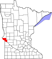
Townships Akron | Almond | Artichoke | Big Stone | Browns Valley | Foster | Graceville | Malta | Moonshine | Odessa | Ortonville | Otrey | Prior | Toqua
Footnotes ‡This populated place also has portions in an adjacent county or counties
Municipalities and communities of Lac qui Parle County, Minnesota Cities 
Townships Agassiz | Arena | Augusta | Baxter | Camp Release | Cerro Gordo | Freeland | Garfield | Hamlin | Hantho | Lac qui Parle | Lake Shore | Madison | Manfred | Maxwell | Mehurin | Perry | Providence | Riverside | Ten Mile Lake | Walter | Yellow Bank
Footnotes ‡This populated place also has portions in an adjacent county or counties
Coordinates: 45°18′17″N 96°26′41″W / 45.30472°N 96.44472°W
Categories:- Populated places in Big Stone County, Minnesota
- Populated places in Lac qui Parle County, Minnesota
- Cities in Minnesota
- County seats in Minnesota


Wikimedia Foundation. 2010.