- Joplin, Missouri
-
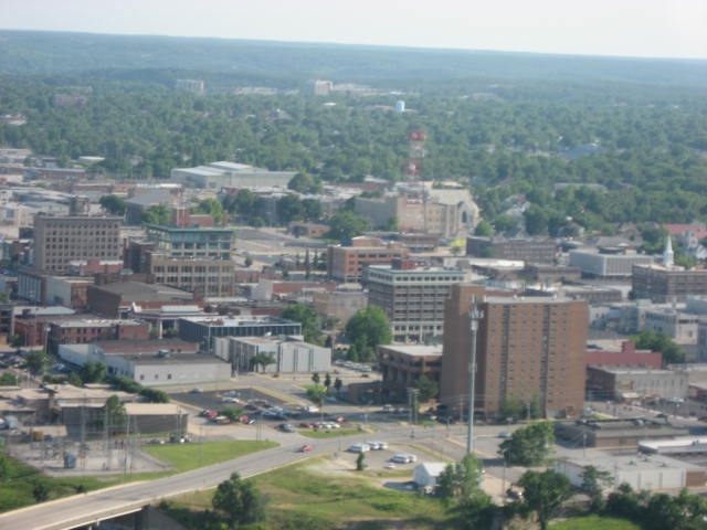
Joplin, Missouri — City — Aerial view of downtown Joplin, 2009
Motto: "Proud of Our Past...Shaping Our Future'" Location in the state of Missouri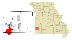
Coordinates: 37°5′3″N 94°30′47″W / 37.08417°N 94.51306°WCoordinates: 37°5′3″N 94°30′47″W / 37.08417°N 94.51306°W Country United States State Missouri Counties Jasper, Newton Platted Incorporated 1873 Government – Mayor Mike Woolston Area – Total 31.5 sq mi (81.7 km2) – Land 31.4 sq mi (81.4 km2) – Water 0.1 sq mi (0.2 km2) Elevation 1,004 ft (306 m) Population (2010)[1] – Total 50,150 – Density 1,592.1/sq mi (614.7/km2) Time zone CST (UTC-6) – Summer (DST) CDT (UTC-5) ZIP codes 64801-64804 Area code(s) 417 FIPS code 29-37592[2] GNIS feature ID 0729911[3] Website JoplinMO.org Joplin is a city in southern Jasper County and northern Newton County in the southwestern corner of the US state of Missouri. Joplin is the largest city in Jasper County, though it is not the county seat. As of the 2010 census, the city population was 50,150.[1] In 2010, the surrounding Metropolitan Statistical Area had an estimated population of 175,518.[4]
Although often believed to have been named for the ragtime composer Scott Joplin, who lived in Sedalia, Missouri, Joplin is named for Reverend Harris Joplin, an early settler and the founder of the area's first Methodist congregation. Joplin was established in 1873 and expanded significantly from the wealth created by the mining of zinc; its growth faltered after World War II when the price of the mineral collapsed. The city gained travelers as Route 66 passed through it; "Joplin, Missouri" is among the lyrics to Bobby Troup's legendary song, immortalizing the city among others on the famous highway.
On May 22, 2011, Joplin was struck by an extremely powerful EF-5 tornado, resulting in at least 160 deaths and more than 900 injuries, along with total destruction of thousands of houses, and severe damage to numerous apartments and businesses, St. John's Medical Center, and multiple school buildings.[5]
Contents
History
19th century
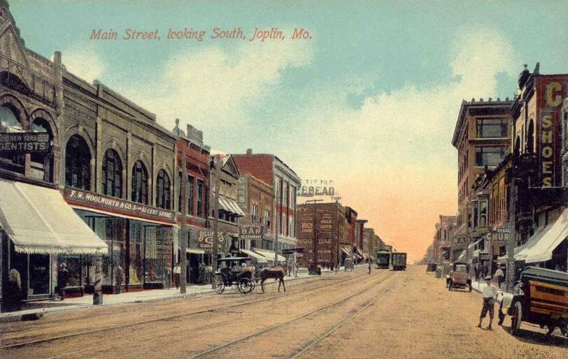
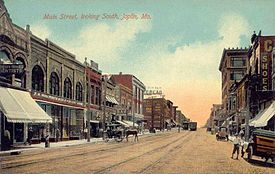 Main Street c. 1910
Lead was discovered in the Joplin Creek Valley before the Civil War, but it was only after the war that significant development took place. By 1871, numerous mining camps had sprung up in the valley and resident John C. Cox filed a plan for a city on the east side of the valley.[6] Cox named his village Joplin City after the spring and creek nearby, which had been named for the Reverend Harris G. Joplin, an early settler who founded the first Methodist congregation in the area in mid-century.
The Carthage resident Patrick Murphy filed a plan for a city on the opposite side of the valley and named it Murphysburg.[7] While the nearest sheriff was in Carthage, frontier lawlessness abounded in Joplin and the historic period was referred to as the "Reign of Terror". The cities eventually merged into Union City, but when the merger was found illegal, the two cities split. Murphy suggested that a combined city be named Joplin. The cities merged again on March 23, 1873, this time permanently, as the City of Joplin.[8]
While Joplin was first settled for lead mining, zinc, often referred to as "jack", was the mineral resource on which the town built its economy. As railroads connected Joplin to major markets in other cities, it was on the verge of dramatic growth. By the turn of the century, the city was becoming a regional metropolis. Construction centered around Main Street, with many bars, hotels, and fine homes nearby. Joplin's three-story "House of Lords" was its most famous saloon, with a bar and restaurant on the first floor, gambling on the second, and a brothel on the third. Trolley and rail lines made Joplin the hub of southwest Missouri and, as the center of the "Tri-state district", it soon became the lead and zinc mining capital of the world.
As a result of extensive surface and deep mining, Joplin is dotted with open pit mines and mine shafts. Mining left many tailings piles (small hills of ground rock), which are considered unsightly locally. The open pit mines pose both hazards, but some find them to have a kind of beauty as well. The main part of Joplin is nearly 75% undermined, with some mine shafts well over 100 ft (30m) deep. These mine shafts have occasionally caved in, creating sink holes. The mining history and geology are well documented in the mineral museum in town.
20th century
 Panorama of Joplin, circa 1910
Joplin began to add cultural amenities; in 1902 residents passed a tax to create a public library, and gained matching funds that enabled them to build the Carnegie Library. It was seen as the symbol of a thriving city. In 1930 the grand commercial Electric Theater was built, one of the many movie palaces of the time. It was later bought and renamed the Fox by Fox Theatres corporation. With the Depression and post-World War II suburban development, moviegoing declined at such large venues.
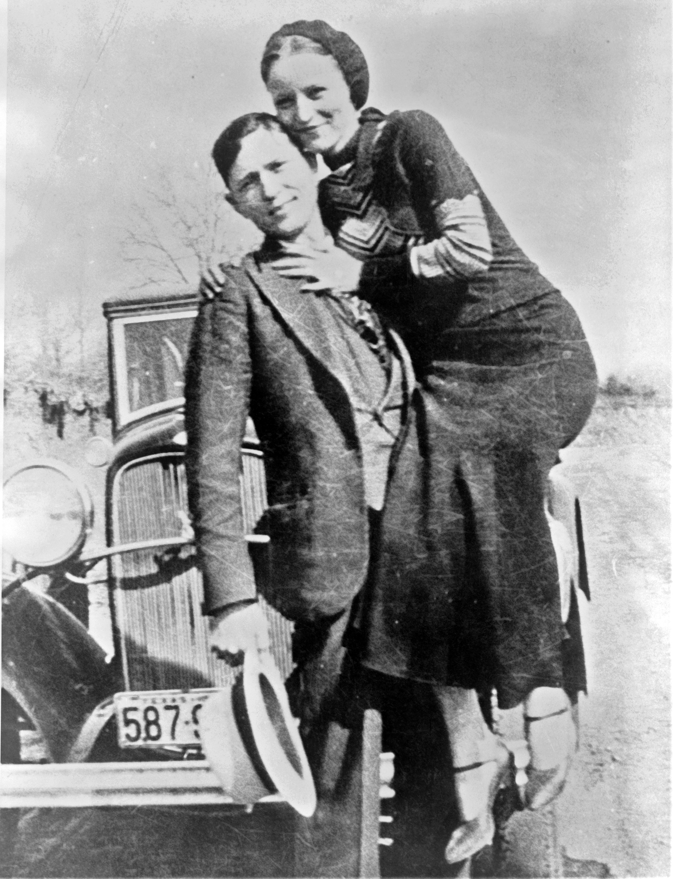
 Bonnie & Clyde, photo developed by the Joplin Globe after the shoot out.
In 1933 during the Great Depression, the notorious criminals Bonnie and Clyde spent some weeks in Joplin, where they robbed several area businesses. Tipped off by a neighbor, the Joplin Police Department attempted to apprehend the pair. Bonnie and Clyde escaped after killing Newton County Constable John Wesley Harryman and Joplin Police Detective Harry McGinnis; however, they were forced to leave most of their possessions behind, including a camera.[9] The Joplin Globe developed and printed the film, which showed now-legendary photos of Bonnie's holding Clyde at mock gunpoint, and of Bonnie with her foot on a car fender, posed with a pistol in her hand and cigar in her mouth. The Missouri Advisory Council on Historic Preservation nominated the house where the couple stayed, at 34th Street and Oak Ridge Drive, for inclusion on the National Register of Historic Places on February 13, 2009.
After World War II, most of the mines were closed, and population growth leveled off. The main road through Joplin running east and west was designated as part of US Route 66, which became famous as more Americans took to newly constructed highways. The roads provided improved access between cities but also drew off population to newer housing and eventually retail centers.
In the 1960s and 1970s, nearly 40 acres (16 hectares) of the city's downtown were razed in an attempt at urban renewal, as population and businesses had moved to a suburban fringe along newly constructed highways. The Keystone hotel and Worth Block (former home of the House of Lords) were notable historic structures that were demolished. The Connor Hotel was partially demolished and then collapsed, killing three, before it was totally demolished. Christman's Department Store stands (converted into loft apartments), as does the Joplin Union Depot, since railroad restructuring and the decline in passenger traffic led to its closure. Other notable historic structures in Joplin include the Carnegie Library, Fred and Red's Diner, the Frisco Depot, the Scottish Rite Cathedral, and the Crystal Cave (filled in and used for a parking lot). The Newman Mercantile Store has been adapted for use as City Hall. The Fox Theatre has been adapted for use as the Central Christian Center.[citation needed]
On May 6, 1971, Joplin was struck by a severe tornado, resulting in one death and 50 injuries, along with major damage to many houses and businesses.[10]
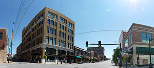
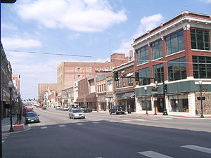 Historic district at 6th and Main, looking North, 2010.
21st century
The city has two major hospitals, St. John's Regional Medical Center and Freeman Health System, which serve the region. The city has a park system including a golf course, three swimming pools, walking trails, the world's largest remaining globally unique Chert Glades and Missouri's first Audubon Nature Center located in Wildcat Park. A waterfall, Grand Falls, is on Shoal Creek just south of town. Included in Schifferdecker Park is the Everett J. Ritchie Tri-State Mineral Museum and Dorothea B. Hoover Historical Museum.
Numerous buildings in Joplin have been listed on the National Register of Historic Places for their historic and architectural significance.[11] Recently[when?], the city has undertaken a project to revitalize its Main Street downtown district. It has refurbished sidewalks and added new lamp posts to highlight the historic center of the city.
Numerous trucking lines such as CFI (now Con-Way Truckload) are headquartered in town, as the city is situated near the geographic and population centers of the nation. Eagle-Picher Industries, TAMKO Building Products, AT&T Communications and FAG Bearings are noted employers in Joplin, and Leggett & Platt (Fortune 500) is located in nearby Carthage. The city is served by the Joplin Regional Airport located in the north of town near Webb City.
In the 1990s, the city continued to expand eastward toward U.S. 71 (future I-49). Large-scale development occurred along Range Line Road, particularly around Northpark Mall. Numerous suburbs adjacent to the city include Carl Junction, Duquesne, Airport Drive, Oronogo, Carterville, Redings Mill, Shoal Creek Drive, Leawood, and Saginaw.
Due to its location near two major highways and its many event and sports facilities, Joplin attracts travelers and is a destination for conferences and group events. Joplin offers nearly 2,500 hotel rooms, the majority located within a 1/4 mile area of Range Line and I-44. It has the 30,000-square-foot (2,800 m2) John Q. Hammons Convention and Trade Center, which serves as the primary event facility for conventions, associations, and large events.
Each June, Joplin hosts the Boomtown Run, a half marathon, 5k. and kids run. The event attracts runners from across the country, and features USTA certified courses which start and end in the historic downtown area. Celebrity runners featured at the pre-race banquet have included Bart Yasso, Sarah Reinerston, Suzy Favor-Hamilton, and Jeff Galloway. In 2011, due to the devastating EF-5 tornado that struck Joplin on May 22, just three weeks before the run, the event was transformed in the Boomtown Run Day of Service. More than 270 individuals registered for the race after the tornado struck, knowing their proceeds would benefit tornado recovery. On June 11, approximately 320 registered runners and volunteers turned out to help clean debris and sort donations, contributing more than 1,200 hours of service.
May 2011 tornado
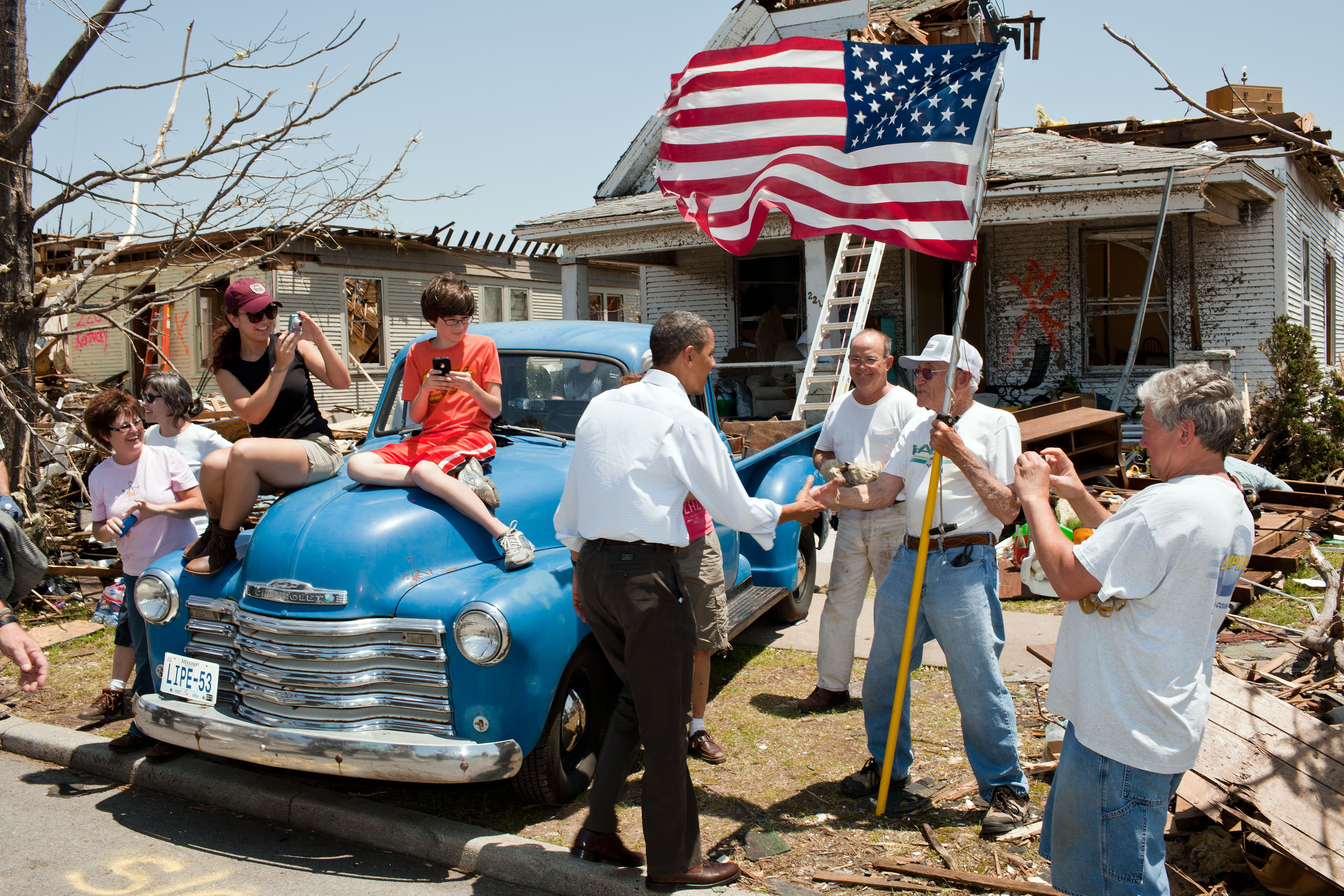
 President Obama greets Hugh Hills, 85, in front of his home on May 29, 2011. Hills hid in a closet during the tornado, which destroyed the second floor and half the first floor of his house.See also: 2011 Joplin tornado
On May 22, 2011, an EF-5 tornado first touched down near the western edge of the city among large, newer homes, at about 5:41 pm CDT (2241 UTC) and tracked eastward across the city and across Interstate 44 into rural portions of Newton and Lawrence counties. It was reported to have been about 0.75 miles (1.21 km) in width and 22.1 miles (35.6 km) long. About 8,000 houses, 18,000 cars, and 450 businesses were flattened or blown away in Joplin, particularly in the section between 13th and 32nd Streets across the southern part of the city. The tornado narrowly missed the downtown area. St. John's Regional Medical Center was significantly damaged, with many windows and the exterior walls damaged, and the upper floors destroyed. The local high school, Joplin High School was destroyed as well. A total of 160 people died from tornado-related injuries as of the end of July 2011. The Weather Channel video showed entire neighborhoods flattened. Communications were lost and power was knocked out to many areas.[12] An official statement from the National Weather Service has categorized the Joplin tornado as an EF5.[13][14][15][16] On Sunday, May 29, 2011, President Barack Obama, Missouri Governor Jay Nixon, and FEMA Director Craig Fugate visited and toured Joplin to see what the damage looked like and attended a memorial service for the deceased. Later that day, the city held a moment of silence at 5:41 pm, to mark the time the tornado struck. The area was declared a federal disaster area.
Government
Local government for the City of Joplin is provided through an elected nine member City Council, which includes the city's Mayor who is responsible for serving as meeting chair and official spokesman for the City Council, and the Mayor Pro Tem who is responsible for performing the Mayor's duties in the latter's absence, both of whom are elected every two years by their fellow council members.[17] Law enforcement services are provided by the Joplin Police Department.[18] On the state-level, the city is represented in the Missouri House of Representatives by Republican Bill White of the 129th District,[19] although a small portion of the city lies within the 128th District represented by Republican Charlie Davis,[20] and in the Missouri Senate by Republican Ron Richard.[21] The city also lies within Missouri's 7th congressional district.
Geography
Joplin is located at 37°4′40″N 94°30′40″W / 37.07778°N 94.51111°W (37.077760, −94.511024).[22] According to the United States Census Bureau, the city has a total area of 31.5 square miles (81.6 km²), of which, 31.4 square miles (81.4 km²) of it is land and 0.1 square miles (0.2 km²) of it (0.25%) is water. The city is drained by Joplin Creek, Turkey Creek, Silver Creek and Shoal Creek. Joplin is the center of what is regionally known as the Four State Area: Oklahoma, Arkansas, Missouri, and Kansas.
Joplin is located north of Highway I-44, its passage to the west into Oklahoma. In recent years, the residential development of Joplin have spread north to about Webb City. US Route 66 passes through Joplin. Joplin is mentioned in the song "Route 66".
Climate
Joplin has a humid subtropical climate, with mild to cold winters and hot, humid summers. Joplin is situated in "Tornado Alley", a broad region where cold air from Canada collides with warm, moist air from the Gulf of Mexico and dry air from the lee of the Rocky Mountains, leading to the formation of powerful supercell thunderstorms from which the tornadoes spawn.
Climate data for Joplin, Missouri Month Jan Feb Mar Apr May Jun Jul Aug Sep Oct Nov Dec Year Average high °F (°C) 42
(6)49
(9)59
(15)69
(21)77
(25)85
(29)90
(32)89
(32)81
(27)71
(22)57
(14)46
(8)67.9 Average low °F (°C) 24
(−4)29
(−2)38
(3)46
(8)55
(13)65
(18)69
(21)68
(20)59
(15)48
(9)37
(3)27
(−3)47.1 Precipitation inches (mm) 1.84
(46.7)2.25
(57.2)3.62
(91.9)4.32
(109.7)5.07
(128.8)5.42
(137.7)3.55
(90.2)3.82
(97)5.22
(132.6)3.94
(100.1)4.06
(103.1)2.96
(75.2)46.07
(1,170.2)Source: weather.com[23] Demographics
Historical populations Census Pop. %± 1880 7,038 — 1890 9,943 41.3% 1900 26,023 161.7% 1910 32,073 23.2% 1920 29,902 −6.8% 1930 33,454 11.9% 1940 37,144 11.0% 1950 38,711 4.2% 1960 38,958 0.6% 1970 39,256 0.8% 1980 39,126 −0.3% 1990 40,961 4.7% 2000 45,504 11.1% 2010 50,150 10.2% U.S. Decennial Census As of the census[2] of 2010, there were 50,150 people, 20,860 households, and 12,212 families residing in the city. The population density was 1,448.4 people per square mile (559.2/km²). There were 23,322 housing units at an average density of 678.9 per square mile (262.1/km²). The racial makeup of the city was 87.6% White, 3.3% African American, 1.8% Native American, 1.6% Asian, 0.3% Pacific Islander, 1.7% from other races, and 3.6% from two or more races. Hispanic or Latino of any race were 4.5% of the population.
There were 20,860 households out of which 26.2% had children under the age of 18 living with them, 40.1% were married couples living together, 13.5% had a female householder with no husband present, and 41.5% were non-families. 29.4% of all households were made up of individuals and 25.3% had someone living alone who was 65 years of age or older. The average household size was 2.28 and the average family size was 2.89.
In the city the population was spread out with 24.21% under the age of 19, 9.4% from 20 to 24, 25.12% from 25 to 44, 22.16% from 45 to 64, and 13.18% who were 65 years of age or older. The median age was 35 years. For every 100 females there were 90.4 males.
The median income for a household in the city was $30,555, and the median income for a family was $38,888. Males had a median income of $28,569 versus $20,665 for females. The per capita income for the city was $17,738. About 10.5% of families and 14.8% of the population were below the poverty line, including 18.8% of those under age 18 and 9.4% of those age 65 or over.
Education
Primary and secondary education
Joplin is home to thirteen public elementary schools in the Joplin R-VIII School District: Cecil Floyd, Columbia, Duenweg, Duqeusne, Eastmorland, Emerson, Irving, Jefferson, Kelsey Norman, McKinley, Royal Heights, Stapleton, and West Central. It has three public middle schools, East, North, and South and one high school, Joplin High School. The first high school was founded in 1885 and was located where the current Memorial Hall now stands on 8th and Joplin Ave. The JHS student population was nearly 2200 kids in the 2008–2009 school year.[24] A school bond issue for $57.3 million was passed in April 2007, allowing the district to build two new middle schools (East and South Middle Schools) to replace the old Memorial and South Middle Schools, and to give a major renovation and double the size of North Middle School.[25] Joplin also has many private schools, such as College Heights Christian School, Martin Luther School, and more. St. Mary's Catholic Elementary School, St. Peter's Middle School, McAuley Regional High School are private Catholic schools established in 1885. There is also one Independent School, Thomas Jefferson Independent Day School, which has been running since 1993.[26]
 Carnegie Library in Joplin, 2009
College
The Joplin College of Physicians and Surgeons operated from 1880 to 1884. Today Joplin is home to Missouri Southern State University, founded in 1937 as a junior college and expanded in the following decades. There are two Bible colleges, Ozark Christian College and Messenger College.
Library
Joplin is served by the Joplin Public Library, which is situated on Main Street between the intersections of 3rd and 4th Streets.
Transportation
Joplin is served by the mainline of the Kansas City Southern (KCS) railroad, as well as by branchlines of the BNSF Railway and Missouri and Northern Arkansas Railroad (MNA). The city was once a beehive of railroad activity; however, many of the original railroad lines serving Joplin were abandoned after the demise of the mining and industrial enterprises. Passenger trains have not served the city since the 1960s. The city's Union Depot is still intact along the KCS mainline and efforts are underway to restore it.
Interstate 44 connects Joplin with Springfield and St. Louis to the east and Tulsa and Oklahoma City to the west. U.S. Route 71 runs east of the city, connecting Joplin to Kansas City to the north and Ft. Smith, AR to the south. Highway 71 is currently being converted to Interstate 49 and is expected to be completed by 2012.[27][28] The highway is already built to four-lane freeway and expressway standards from Kansas City but has a few at grade intersections that need to be upgraded to interstate standards.
Joplin once boasted an extensive trolley and inter-urban rail system. Today, part of the city is served by the Sunshine Lamp Trolley, which commenced service in July 2007, and expanded to 3 routes in 2009.
In addition, the Joplin Regional Airport provides multiple daily roundtrip flights to Dallas/Fort Worth operated by American Eagle Airlines.
People
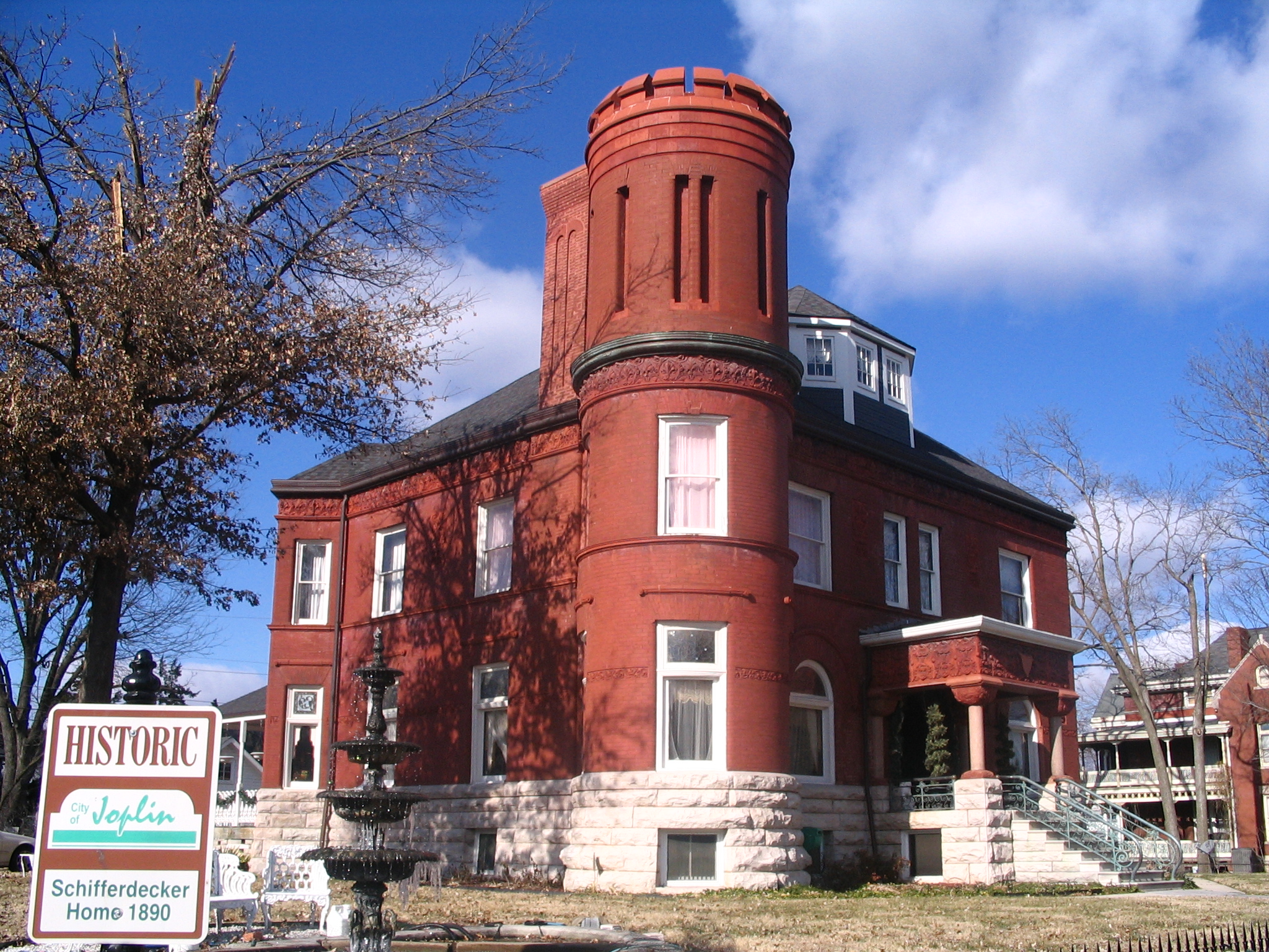
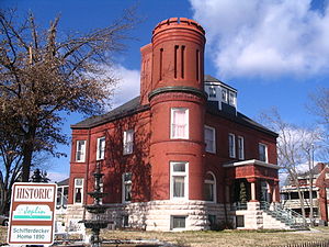 1890 Schifferdecker Home in Joplin, 2010.
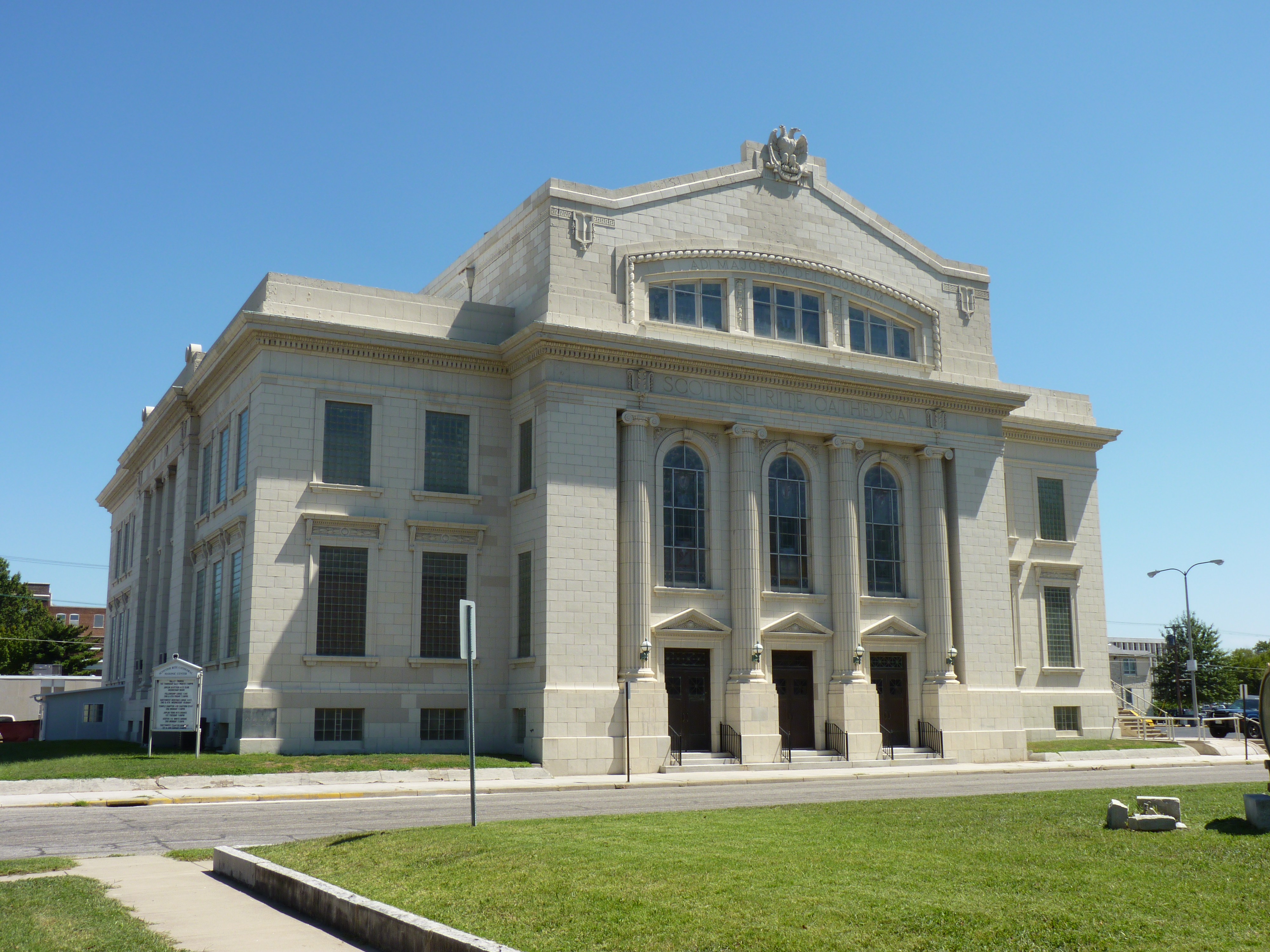
 Scottish Rite Cathedral in Joplin, 2010.
- Ferrell Anderson, baseball player; died in Joplin
- Harvey Bailey, Depression-era criminal, the "Dean of American Bank Robbers"; spent his last years in Joplin, and died there in 1979. He is buried in Joplin
- Thomas Hart Benton, painter and muralist; as a teenager made cartoons for the Joplin American
- Lonny Chapman, actor; graduated from Joplin High School and Joplin Junior College (now Missouri Southern State University)
- Alan Cockrell, coach for the Seattle Mariners; attended Parkwood High School
- Bill Grigsby, sportscaster; began career broadcasting Joplin Miners baseball games
- T.J. Holmes, journalist; began reporting career at KSNF
- Christofer Drew Ingle, musician, under the alias Never Shout Never; attended Joplin Senior High
- H. Dale Jackson, Baptist minister and ethicist; lived in Joplin with his wife when they were newly married in 1949
- Oliver Winfield Killam, Texas oil industrialist, former Oklahoma state legislator; lived in Joplin
- Mickey Mantle, New York Yankees outfielder and first baseman; played with the Class C "Joplin Miners" minor league baseball team in 1950
- J. Eddie Peck, actor; was raised in Joplin, graduated from Parkwood High School
- Rod Smith, wide receiver for the NFL's Denver Broncos; graduated from Missouri Southern State University
- Jeff Speakman, actor; graduated from Missouri Southern State University
- Gabby Street, manager of the St. Louis Cardinals; adopted Joplin as his hometown
- Alvin Clarence Thomas, better known as Titanic Thompson American Road Gambler, Golfer and Hustler. Married first wife Nora Trushel in Joplin.
- James Thrash, wide receiver for the NFL's Washington Redskins; graduated from Missouri Southern State University
- Brian Williams, broadcaster; lived in Joplin for his first TV job at KOAM-TV
People born in Joplin, Missouri
- Tony Alamo, religious evangelist, convicted child sexual abuser and polygamist
- John Whitby Allen, photographer and model railroading pioneer
- Emily Newell Blair, was an American writer, suffragist, national Democratic Party political leader, a founder of the League of Women Voters and feminist.
- Billy Cook, a serial killer
- Robert Cummings, actor
- Scott Elbert, Major League Baseball pitcher
- Langston Hughes, poet and writer
- Christofer Drew Ingle, singer (raised in Joplin, Missouri; born in San Diego, California[29])
- Hale Irwin, golfer
- Jack Jewsbury, captain of the Portland Timbers of Major League Soccer
- Tito Landrum, baseball player
- Jamie McMurray NASCAR driver
- Charles McPherson, jazz musician
- Darryl R. Matthews, Sr., Past General President, Alpha Phi Alpha Fraternity, Inc.[30]
- Elva Miller, singer
- Lisa Myers, broadcast journalist
- Charles Plumb, cartoonist of the syndicated Ella Cinders comic strip
- Carl Pomerance, mathematician
- Darrell Porter, baseball player
- Mel Purcell, tennis player
- Pattiann Rogers, poet
- Pauline Starke, silent film actress
- William Tobin, journalist[31]
- Dennis Weaver, actor
- Percy Wenrich, composer
- Grant Wistrom, former NFL defensive end
References
 Historic district at 5th and Main in Joplin, 2010.
- ^ a b "2010 City Population and Housing Occupancy Status". U.S. Census Bureau. http://factfinder2.census.gov/faces/tableservices/jsf/pages/productview.xhtml?pid=DEC_10_PL_GCTPL2.ST13&prodType=table. Retrieved May 23, 2011.
- ^ a b "American FactFinder". United States Census Bureau. http://factfinder.census.gov. Retrieved 2008-01-31.
- ^ "US Board on Geographic Names". United States Geological Survey. 2007-10-25. http://geonames.usgs.gov. Retrieved 2008-01-31.
- ^ "Joplin, MO MSA Population and Components of Change". Recenter.tamu.edu. http://recenter.tamu.edu/data/popm/pm3710.htm. Retrieved May 24, 2011.
- ^ "City official: Joplin tornado death toll at 153". Kansas City Star. June 13, 2011. http://www.kansascity.com/2011/06/13/2947417/city-official-joplin-tornado-death.html.
- ^ Dolph Shaner, The Story of Joplin (New York, New York: Stratford House, 1948), 20.
- ^ Shaner, Joplin, 21.
- ^ Shaner, Joplin, 31 – 33.
- ^ "Court TV, CrimeLab website, page on Bonnie and Clyde". Crimelibrary.com. http://www.crimelibrary.com/gangsters_outlaws/outlaws/bonnie/8.html. Retrieved May 24, 2011.
- ^ "Joplin Tornado", Joplin Public Library
- ^ "Historic Preservation Commission is revitalized". Joplin Independent. January 5, 2006. http://www.joplinindependent.com/display_article.php/mariwinn1136493341. Retrieved May 24, 2011.
- ^ "Powerful tornadoes kill at least 31 in U.S. Midwest". Reuters. May 22, 2011. http://www.reuters.com/article/2011/05/23/usa-weather-tornadoes-idUSN2213101220110523. Retrieved May 22, 2011.
- ^ Unattributed (May 23, 2011). "Five families rescued, 158 dead in Joplin". United Press International. http://www.upi.com/Top_News/US/2011/05/23/Tornado-death-toll-at-24-in-Joplin/UPI-69631306125745/. Retrieved May 23, 2011.
- ^ "Tornado Strikes Joplin; major damage reported". Ky3.com. May 23, 2011. http://www.ky3.com/news/kspr-tornado-strikes-joplin-major-damage-reported-20110522,0,7268775.story. Retrieved May 24, 2011.
- ^ "Joplin tornado death toll jumps to 89; The Wichita Eagle; May 22, 2011". Kansas.com. May 23, 2011. http://www.kansas.com/2011/05/22/1859953/tornado-strikes-joplin-mo.html. Retrieved May 24, 2011.
- ^ By the CNN Wire Staff (May 23, 2011). "116 dead in from tornado in Joplin, Missouri; number expected to rise". CNN. http://www.cnn.com/2011/US/05/23/missouri.tornado/index.html?hpt=P1&iref=NS1. Retrieved May 24, 2011.
- ^ http://joplinmo.org/council.cfm City of Joplin-City Council
- ^ http://www.joplinpolice.org/ City of Joplin, Missouri-Joplin Police Department
- ^ http://www.house.mo.gov/member.aspx?district=129 Representative Bill White-Missouri House of Representatives
- ^ http://www.house.mo.gov/member.aspx?year=2011&district=128 Representative Charlie Davis-Missouri House of Representatives
- ^ http://www.senate.mo.gov/11info/members/mem32.htm Missouri State Senator Ron Richard
- ^ "US Gazetteer files: 2010, 2000, and 1990". United States Census Bureau. 2011-02-12. http://www.census.gov/geo/www/gazetteer/gazette.html. Retrieved 2011-04-23.
- ^ "Monthly Averages for Joplin, MO". May 2011. http://www.weather.com/weather/wxclimatology/monthly/graph/64801. Retrieved February 22, 2010.
- ^ Joplin Schools Website, School Information[dead link]
- ^ Joplin Schools Website, New Middle School Plan Approved by Voters[dead link]
- ^ "Thomas Jefferson school website". Tjeffschool.org. http://tjeffschool.org. Retrieved May 24, 2011.
- ^ "I-49 Maps and Information". Modot.org. February 23, 2011. http://www.modot.org/southwest/I-49MapsandInformation.htm. Retrieved May 24, 2011.
- ^ "I-49 Coming to Missouri". Modot.mo.gov. August 4, 2010. http://www.modot.mo.gov/southwest/I49Update.htm. Retrieved May 24, 2011.
- ^ "The 5: NeverShoutNever!". MTV. June 12, 2009. http://www.mtv.com/videos/misc/400640/the-5-nevershoutnever.jhtml.
- ^ "Darryl R. Matthews, Sr. Elected General President of Alpha Phi Alpha Fraternity, Inc.". Jet Magazine. February 7, 2005. http://books.google.com/books?id=JbYDAAAAMBAJ&pg=PA30&dq=darryl+matthews+sr&hl=en&ei=cXzeTdrxC8yftgfH5fzlCQ&sa=X&oi=book_result&ct=result&resnum=1&ved=0CDkQ6AEwAA#v=onepage&q=darryl%20matthews%20sr&f=false.
- ^ Pemberton, Mary (April 9, 2009). "Journalist William J. Tobin dies at age 81". Seattle Times. Associated Press. http://seattletimes.nwsource.com/html/localnews/2009015931_apakobittobin.html. Retrieved May 23, 2011.
External links
- City of Joplin
- Chamber of Commerce
- Joplin Public Library
- Joplin Museum Complex
- The Joplin Globe, local newspaper
- Joplin School District
- Historic Joplin - website on Joplin history.
- Historic maps of Joplin in the Sanborn Maps of Missouri Collection at the University of Missouri
- May 2011 Tornado
- 29 photos of Joplin tornado damage, The Joplin Globe
- 34 photos of Joplin tornado damage, The Kansas City Star
- Numerous photos of Joplin tornado damage, Flickr
- Video of Joplin tornado, CNN
Municipalities and communities of Jasper County, Missouri Cities Alba | Asbury | Carl Junction | Carterville | Carthage | Duenweg | Jasper | Joplin‡ | La Russell | Neck City | Oronogo | Purcell | Reeds | Sarcoxie | Waco | Webb City

Villages Airport Drive | Avilla | Brooklyn Heights | Carytown | Duquesne | Fidelity
Unincorporated
communitiesDudenville‡ | Kendricktown | Maxville | Scotland
Footnotes ‡This populated place also has portions in an adjacent county or counties
Municipalities and communities of Newton County, Missouri Cities 
Villages Cliff Village | Dennis Acres | Grand Falls Plaza | Leawood | Loma Linda | Newtonia | Redings Mill | Ritchey | Shoal Creek Drive | Shoal Creek Estates | Silver Creek | Saginaw | Stark City | Stella | Wentworth
Unincorporated
communitiesHornet | Monark Springs | Racine | Spring City | Tipton Ford | Wanda
Footnotes ‡This populated place also has portions in an adjacent county or counties
Categories:- Cities in Jasper County, Missouri
- Communities on U.S. Route 66
- Cities in Newton County, Missouri
- Joplin, Missouri
- Joplin metropolitan area


Wikimedia Foundation. 2010.