- Canning, Nova Scotia
Infobox Settlement
official_name = Pagename
other_name =
native_name =
nickname =
settlement_type = Village
motto =
imagesize =
image_caption =
flag_size =
image_
seal_size =
image_shield =
shield_size =
city_logo =
citylogo_size =
mapsize =
map_caption =
mapsize1 =
map_caption1 =
image_dot_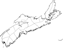
dot_mapsize =250px
dot_map_caption =Location of Pagename
dot_x = 70 |dot_y = 90
pushpin_
pushpin_label_position =
pushpin_map_caption =
pushpin_mapsize =
subdivision_type = Country
subdivision_name = CAN
subdivision_type1 = Province
subdivision_name1 = NS
subdivision_type2 = County
subdivision_name2 = Kings
subdivision_type3 =
subdivision_name3 =
subdivision_type4 =
subdivision_name4 =
government_footnotes =
government_type =
leader_title =
leader_name =
leader_title1 = Village Committee
leader_name1 = Village of Canning Commission
leader_title2 =
leader_name2 =
leader_title3 =
leader_name3 =
leader_title4 =
leader_name4 =
established_title =
established_date =
established_title2 =
established_date2 =
established_title3 =
established_date3 =
area_magnitude =
unit_pref =
area_footnotes =
area_total_km2 =
area_land_km2 =
area_water_km2 =
area_total_sq_mi =
area_land_sq_mi =
area_water_sq_mi =
area_water_percent =
area_urban_km2 =
area_urban_sq_mi =
area_metro_km2 =
area_metro_sq_mi =
population_as_of = 2006
population_footnotes =
population_note =
population_total = 859
population_density_km2 =
population_density_sq_mi =
population_metro =
population_density_metro_km2 =
population_density_metro_sq_mi =
population_urban =
population_density_urban_km2 =
population_density_urban_sq_mi =
population_blank1_title =
population_blank1 =
population_density_blank1_km2 =
population_density_blank1_sq_mi =
timezone = AST
utc_offset = -4
timezone_DST = ADT
utc_offset_DST = -3
latd=45|latm=11 |lats= 16|latNS=N
longd= 64|longm=25 |longs=15 |longEW=W
elevation_footnotes =
elevation_m =
elevation_ft =
postal_code_type = Postal code
postal_code =B0P 1H0
area_code = 902
blank_name =Telephone Exchange
blank_info =582
blank1_name = NTS Map
blank1_info = 021H01
blank2_name = GNBC Code
blank2_info = CAGBD
website = [http://canningnovascotia.ca http://canningnovascotia.ca]
footnotes =
Canning,Part of a series about Places in Nova Scotia Nova Scotia (2006 pop. 859) is a village in northeastern Kings County located at the crossroads of Route 221 and Route 358.The area was originally settled by
Acadian s who were expelled in1755 during the Acadian Expulsion. After the Acadians, Canning - first called Apple Tree Landing and then "'Habitant Corner" - was settled in 1760 byNew England Planters and by the Dutch followingWorld War II . The present name was adopted in honour of British prime ministerGeorge Canning . [ [http://www.gov.ns.ca/nsarm/cap/places/page.asp?ID=101 Place Names of Nova Scotia] ]Though much diminished in importance in recent years, Canning was once a major
shipbuilding centre andshipping and rail hub for farmers in Kings County. Canning merchants and farmers founded theCornwallis Valley Railway which ran from 1889 to 1961, connecting the village to theDominion Atlantic Railway mainline inKentville, Nova Scotia . The village suffered three major fires in its history.The Canadian parliamentarian
Frederick William Borden had a home in Canning. Canning has a prominent statue of Harold Lothrop Borden, a relative, who was killed in theBoer War and is buried inSouth Africa .A lighthouse that once served the port fell into disuse and abandonment but was restored in the 1990s. [ [http://fieldwoodhs.ednet.ns.ca/cfhslighthouse.html Lighthouse story] ]
References
External links
* [http://ns1763.ca/kingsco/borden_h.html Harold Borden monument]
* [http://fieldwoodhs.ednet.ns.ca/index.html Fieldwood Heritage Society, Canning]
* [http://ourvalley.ca/Communities/Canning-Nova-Scotia.asp Canning Nova Scotia]Subdivisions of Nova Scotia
References
Wikimedia Foundation. 2010.