- Chimayo, New Mexico
-
The Village of Chimayo — CDP — El Santuario
Nickname(s): El Potrero Santificado Location of Chimayó, New Mexico
Coordinates: 36°0′12″N 105°56′25″W / 36.00333°N 105.94028°WCoordinates: 36°0′12″N 105°56′25″W / 36.00333°N 105.94028°W Country United States State New Mexico Counties Rio Arriba, Santa Fe Government - Commissioner Barney Trujillo (D) Area - Total 5.5 sq mi (14.1 km2) - Land 5.5 sq mi (14.1 km2) - Water 0.0 sq mi (0.0 km2) Elevation 6,073 ft (1,851 m) Population (2010) - Total 3,177 - Density 535.9/sq mi (208/km2) - Demonym Chimayoan Time zone Mountain (MST) (UTC-7) - Summer (DST) MDT (UTC-6) ZIP code 87522 Area code(s) 505 FIPS code 35-14950 GNIS feature ID 0928711 Chimayo is a census-designated place (CDP)[1] in Rio Arriba and Santa Fe Counties in the U.S. state of New Mexico; the community's name is more correctly pronounced and spelled Chimayó, a name that derives from a Tewa name for a local landmark, the hill of Tsi Mayoh.[2][3] The town is unincorporated and includes many neighborhoods, called plazas or placitas, each with its own name, including El Potrero de Chimayó (the plaza near Chimayó's communal pasture) and the Plaza del Cerro (plaza by the hill).[2][4][5] The cluster of plazas called Chimayó lies near Santa Cruz about 25 miles north of Santa Fe. The population was 3,177 at the 2010 census.
Contents
Features
The Potrero plaza of Chimayó is known internationally for a Catholic chapel, the Santuario de Nuestro Señor de Esquipulas, commonly known as El Santuario de Chimayó. A private individual built it by 1816 so that local people could worship Jesus as depicted as Esquipulas; preservationists bought it and handed it over to the Archdiocese of Santa Fe in 1929. The chapel is now managed by the Archdiocese as a Catholic church. For its reputation as a healing site (believers claim that dirt from a back room of the church can heal physical and spiritual ills), it has become known as the "Lourdes of America," and attracts close to 300,000 visitors a year, including up to 30,000 during Holy Week (the week prior to Easter). It has been called "no doubt the most important Catholic pilgrimage center in the United States."[6] The sanctuary was designated a National Historic Landmark in 1970.
Chimayó is also known for the weaving traditions of the Ortega and Trujillo families, who have been weaving in the Spanish Colonial tradition for many generations and now operate weaving businesses near the Plaza del Cerro and in the placita of Centinela.[7] Their traditional craft is but one of several still practiced in the region, including tin smithing, wood carving, and making religious paintings. These activities, along with the local architecture and the landscape of irrigated fields, create a historic ambiance that attracts much tourism.
Chimayo chile
The town is also famous for its heirloom chile (Capsicum annuum "Chimayo").[8][9] In 2003 the Native Hispanic Institute's founder Marie Pilar Campos authored the Chimayo Chile Project[10] to replenish the 300-year-old native seed stock and revive the industry. The Chimayo Chile Project began planting in the spring of 2005, which is the foundation of its ongoing seed-distribution services to local farmers. The project's job development operations were funded by the United States, Office of Community Services[11] from 2005 through 2008. As part of the project's work with the state to revive the industry, two joint memorials have passed the New Mexico State Legislature.[8][9] The Chimayo Chile Project incorporated the local farmers, Chimayo Chile Farmers, Inc. Chimayo Chile Farmers, Inc. applied for the certification mark "Chimayo" with the USPTO in 2006 and was granted registration in 2009.[12] The 2008 New Mexico State Legislature, via New Mexico Department of Cultural Affairs, appropriated preservation support that resulted in the June 2009 publication, "Chimayo Chile, A Living History of Faith, Culture, and Art," written by Marie Pilar Campos of the Native Hispanic Institute.[13]
Pop culture
Chimayó figures prominently in Now Eleanor's Idea, an opera by Robert Ashley.[14] Ashley describes Chimayó in his foreword to the libretto as "the spiritual center of the lowrider world... Now Eleanor conceives of a television documentary program to study the exotic lowrider community... in the car shops" of Chimayo. Act II, Scene 2 is a recorded interview with Chimayó residents LowLow and Joan.
Geography
 Oblique air photo of Chimayo and vicinity, including lake Santa Cruz in lower right. Facing north in August 2011.
Chimayo is located at 36°0′12″N 105°56′25″W / 36.00333°N 105.94028°W (36.003247, -105.940244).[15]
Chimayó is sited in a valley within the Sangre de Cristo Mountains 24 miles (38.4 km) north of Santa Fe. Chimayó is approximately 6075 ft above sea level.
According to the United States Census Bureau, the CDP has a total area of 5.5 square miles (14.1 km²), all land.
Demographics
As of the census[16] of 2000, there were 2,924 people, 1,150 households, and 808 families residing in the CDP. The population density was 535.9 people per square mile (206.8/km²). There were 1,323 housing units at an average density of 242.5 per square mile (93.6/km²). The racial makeup of the CDP was 48.60% White, 0.14% African American, 0.68% Native American, 0.07% Asian, 44.84% from other races, and 5.68% from two or more races. Hispanic or Latino of any race were 90.83% of the population.
There were 1,150 households out of which 34.6% had children under the age of 18 living with them, 48.3% were married couples living together, 15.7% had a female householder with no husband present, and 29.7% were non-families. 26.2% of all households were made up of individuals and 8.1% had someone living alone who was 65 years of age or older. The average household size was 2.54 and the average family size was 3.05.
In the CDP the population was spread out with 25.3% under the age of 18, 9.1% from 18 to 24, 29.5% from 25 to 44, 23.9% from 45 to 64, and 12.2% who were 65 years of age or older. The median age was 36 years. For every 100 females there were 100.4 males. For every 100 females age 18 and over, there were 98.9 males.
The median income for a household in the CDP was $31,474, and the median income for a family was $35,938. Males had a median income of $28,009 versus $24,357 for females. The per capita income for the CDP was $17,023. About 14.1% of families and 19.0% of the population were below the poverty line, including 27.4% of those under age 18 and 28.6% of those age 65 or over.
Drug problems
Chimayó and surrounding areas of Rio Arriba County are known for a half century of drug problems, including heroin distribution and usage, property crimes, record rates of deaths due to overdose, and multiple large-scale federal drug raids.[17]
References
- ^ http://censtats.census.gov/data/NM/1603514950.pdf
- ^ a b Usner, Donald J. (1996). Sabino's Map: Life in Chimayó's Old Plaza. Museum of New Mexico Press.
- ^ Brad Olsen (2003). Sacred Places North America: 108 Destinations. CCC Publishing. ISBN 1888729090. http://books.google.com/books?id=3Dz8zuK2E5EC&pg=PA52&dq=chimay%C3%B3.
- ^ The Historic Preservation Program for New Mexico. New Mexico State Planning Office. 1973. http://books.google.com/books?id=BLkLAAAAYAAJ&q=%22Potrero+de+Chimay%C3%B3%22&dq=%22Potrero+de+Chimay%C3%B3%22&pgis=1.
- ^ Jamison, Cheryl Alters; Jamison, Bill (1991). The Rancho de Chimayo Cookbook: The Traditional Cooking of New Mexico. Harvard Common Press. ISBN 1558320350. http://books.google.com/books?id=Xyh9oPNPRlEC&pg=PA23&dq=potrero+pasture+commons+chimay%C3%B3.
- ^ Wroth, William H. "New Mexico Office of the State Historian: Santuario de Chimayó". http://www.newmexicohistory.org/filedetails.php?fileID=505. Retrieved 2008-03-23.
- ^ Robbins, Catherine C. (1982-07-18). "Shopper's World; Weavers of the Rio Grande". New York Times. http://query.nytimes.com/gst/fullpage.html?res=9B07E4D91739F93BA25754C0A964948260&sec=travel&spon=&pagewanted=all. Retrieved 2008-03-23.
- ^ a b "Study Chimayo chile and history" (pdf). 2005. http://legis.state.nm.us/Sessions/05Regular/Final/SJM031.pdf. Retrieved 2008-03-23.
- ^ a b "Chimayo chile farmers, in recognition" (pdf). http://legis.state.nm.us/Sessions/07Regular/Final/SJM035.pdf. Retrieved 2008-03-23.
- ^ "Native Hispanic Institute". http://www.nativehispanic.com.
- ^ http://www.acf.hhs.gov/programs/ocs/
- ^ "Chimayo Chile Farmers, Inc., USPTO Certification Application". http://tarr.uspto.gov/servlet/tarr?regser=serial&entry=78920649.
- ^ Campos, Marie Pilar, Chimayo Chile, A Living History of Faith, Culture, and Art, Native Hispanic Institute, June 2009, Library of Congress Control Number: 2009929762, ISBN 978-0-9840684-0-1
- ^ Ashley, Robert (2007). Now Eleanor's Idea. New York: Lovely Music. pp. 5. ISBN 978-0-9679974-4-5.
- ^ "US Gazetteer files: 2010, 2000, and 1990". United States Census Bureau. 2011-02-12. http://www.census.gov/geo/www/gazetteer/gazette.html. Retrieved 2011-04-23.
- ^ "American FactFinder". United States Census Bureau. http://factfinder.census.gov. Retrieved 2008-01-31.
- ^ John Burnett. "Lessons from New Mexico's War on Heroin". NPR. http://www.npr.org/templates/story/story.php?storyId=4804031.
Further reading
- Usner, Don J. Sabino's Map: Life in Chimayo's Old Plaza. Santa Fe: Museum of New Mexico P, 1995.
External links
- Chimayó Tourist Information, Chimayó Association of Businesses
- El Santuario de Chimayó
- More info on El Santuario de Chimayó and Nuestro Señor de Esquipulas
- Article on Chimayo's mission church
- Brief history of Chimayo
- Plaza del Cerro historic site
Municipalities and communities of Rio Arriba County, New Mexico City 
Village CDPs Alcalde | Chimayo‡ | Dulce | San Juan | Santa Clara Pueblo
Unincorporated
communitiesAbiquiú | Dixon | El Rito | Embudo | Hernandez | Navajo City | Ohkay Owingeh | Ojo Sarco | San Lorenzo | Tierra Amarilla | Truchas
Ghost towns Hopewell | Sublette
Indian reservation Footnotes ‡This populated place also has portions in an adjacent county or counties
Municipalities and communities of Santa Fe County, New Mexico Cities 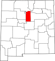
Town CDPs Agua Fria | Canada de los Alamos | Cedar Grove | Chimayo‡ | Chupadero | Cuartelez | Cundiyo | Cuyamungue | El Rancho | El Valle de Arroyo Seco | Eldorado at Santa Fe | Galisteo | Glorieta | Jaconita | La Cienega | La Puebla | Lamy | Los Cerrillos | Madrid | Pojoaque | Rio Chiquito | Rio en Medio | San Ildefonso Pueblo | Santa Cruz | Sombrillo | Tesuque
Unincorporated
communitiesNambé Pueblo | Seton Village | Stanley | Waldo
Indian reservation Footnotes ‡This populated place also has portions in an adjacent county or counties
Categories:- Populated places in Rio Arriba County, New Mexico
- Populated places in Santa Fe County, New Mexico
- Census-designated places in New Mexico
- Populated places in New Mexico with Hispanic majority populations


Wikimedia Foundation. 2010.