- Chisworth
-
Coordinates: 53°25′34″N 2°00′54″W / 53.426°N 2.015°W
Chisworth 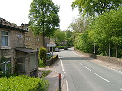
 Chisworth
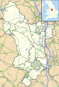
Chisworth shown within DerbyshireOS grid reference SK995920 District High Peak Shire county Derbyshire Region East Midlands Country England Sovereign state United Kingdom Post town GLOSSOP Postcode district SK13 Police Derbyshire Fire Derbyshire Ambulance North West EU Parliament East Midlands UK Parliament High Peak List of places: UK • England • Derbyshire Chisworth is a hamlet near Glossop, Derbyshire, England. It is located 3 miles south-west of Glossop's town centre, on the south side of the Etherow valley. The parish of Chisworth was formed in 1896, out of the parish of Chisworth and Ludworth. In 1901, it had a population of 409. From 1896 until 1934 it was in the Glossop Rural District, when it was placed with Ludworth into the Chapel en le Frith Rural District.[1] The village possesses a Methodist chapel. The A626 road passed through the hamlet. In June 1930, a local cloud burst caused flooding which killed one man and destroyed equipment at the mills, one of which never reopened.
 Panorama from the A626, over Kinderlee Mill and the Etherow valley
Contents
Kinderlee Mill
Kinderlee Mill made yarn thread and baut (string). It was owned by the J.R.Radcliffe who sold it to the Rowbottoms.[2] In 1930 it was damaged by the flood. The mill went bankrupt during the slump and was sold to Jacksons of Bradford; it was used to weave belting. In 2008, the mill was converted to residential use and in 2009 the new town houses were marketed.
 Kinderlee Mill and new town houses 2009
Holehouse Mill
Holehouse Mill made rope and twine. It was owned by the Rowbottoms. In 1929 it suffered two fires wiuthin six months.[2]
Chew Wood Mill
Chew Wood Mill was built in 1795, it was powered by water taken from the overflow from the Alma Coal Pit. It was managed by the Rowbotham family for 99 years. It was originally a carding and scrubbing mill for wool employing 14 children and women. It was used in the Boer War (1899–1902) to dye Khaki cloth for uniforms. It was flooded in June 1930 and subsequently closed and was demolished.[3]
Lee Valley Bleach Works
Known as the Bone Mill it burnt down in 1917, it was rebuilt but never worked.[2]
Coal
The Alma Coal Pit was at the junction of Sandy & Sanders Lane, the loading bay was at the wide paved part of the road and a small brick building opposite was the weighing machine box. This pit closed towards the end of the last century when they struck an underground stream & was flooded. I was a deep pit employing a lot of miners, the winding shaft was 120 yds deep and is now capped. The stream runs down a tunnel opposite Sandy Lane Farm. During the coal strike of 1921, the local men and those from Glossop had some success in digging for coal in Chew Woods.
There is some open cast workings at Mount View. This is documented in a book "Ludworth Moor Colliery" by Geoffrey du Feu & Roderick Thackray.[2]
References
- ^ Vision of Britain Accessed 22/6/2008.
- ^ a b c d Bocking
- ^ Quayle 2006, p. 128
Bibliography
- Bocking, Hannah. Reminiscences of Hannah Bocking of Intake Farm, Chisworth. Display board on site. http://freepages.genealogy.rootsweb.ancestry.com/~dusk/hannah_bocking.html. Retrieved 2009-05-31.
- Quayle, Tom (2006). The Cotton Industry in Longdendale and Glossopdale. Stroud,Gloucestershire: Tempus. pp. 159. ISBN 0752438832.
Categories:- Hamlets in Derbyshire
- Towns and villages of the Peak District
- Civil parishes in Derbyshire


Wikimedia Foundation. 2010.