- Oaks, Oklahoma
-
Oaks, Oklahoma — Town — Location of Oaks, Oklahoma
Coordinates: 36°9′56″N 94°51′13″W / 36.16556°N 94.85361°WCoordinates: 36°9′56″N 94°51′13″W / 36.16556°N 94.85361°W Country United States State Oklahoma Counties Delaware, Cherokee Area – Total 1.6 sq mi (4.2 km2) – Land 1.6 sq mi (4.2 km2) – Water 0.0 sq mi (0.0 km2) Elevation 1,030 ft (314 m) Population (2000) – Total 412 – Density 256.2/sq mi (98.9/km2) Time zone Central (CST) (UTC-6) – Summer (DST) CDT (UTC-5) ZIP code 74359 Area code(s) 539/918 FIPS code 40-53550[1] GNIS feature ID 1096160[2] Oaks is a town in Cherokee and Delaware counties in the U.S. state of Oklahoma. The population was 412 at the 2000 census.
Contents
Geography
Oaks is located at 36°9′56″N 94°51′13″W / 36.16556°N 94.85361°W (36.165583, -94.853475)[3].
According to the United States Census Bureau, the town has a total area of 1.6 square miles (4.2 km²), all land.
Demographics
As of the census[1] of 2000, there were 412 people, 125 households, and 86 families residing in the town. The population density was 256.2 people per square mile (98.8/km²). There were 137 housing units at an average density of 85.2 per square mile (32.9/km²). The racial makeup of the town was 13.59% White, 72.57% Native American, 0.24% Asian, 0.49% from other races, and 13.11% from two or more races. Hispanic or Latino of any race were 2.43% of the population.
There were 125 households out of which 36.0% had children under the age of 18 living with them, 44.8% were married couples living together, 16.8% had a female householder with no husband present, and 30.4% were non-families. 28.0% of all households were made up of individuals and 14.4% had someone living alone who was 65 years of age or older. The average household size was 2.97 and the average family size was 3.64.
In the town the population was spread out with 38.3% under the age of 18, 11.7% from 18 to 24, 21.6% from 25 to 44, 19.4% from 45 to 64, and 9.0% who were 65 years of age or older. The median age was 25 years. For every 100 females there were 89.0 males. For every 100 females age 18 and over, there were 86.8 males.
The median income for a household in the town was $25,268, and the median income for a family was $27,396. Males had a median income of $19,375 versus $15,000 for females. The per capita income for the town was $8,031. About 18.7% of families and 29.9% of the population were below the poverty line, including 39.5% of those under age 18 and 36.8% of those age 65 or over.
New Springplace Indian Mission
In 1801, the members of the Moravian Church from Salem in North Carolina (now Winston-Salem) decided to begin a mission to the Cherokee Indians who were then living in Georgia and Tennessee. As a result, they set up Springplace Mission in Springplace, Georgia. They continued the mission to the Cherokees there until the Cherokees signed the Treaty of New Echota with the Federal Government. This forced the Cherokees and the other 4 Civilized Tribes (the Chickasaws, Choctaws, Creeks and Seminoles) to give up their homelands in the Southeastern United States and move to Indian Territory, now Oklahoma. Springplace Mission was forced to close its doors and move with the Cherokees to northeastern Indian Territory. Upon arrival to Indian Territory, the Moravians selected a spot north of Tahlequah, the new Cherokee Nation capital, to found New Springplace Indian Mission, near current-day Oaks.
The area selected was a beautiful one with plentiful oak trees (which is probably where Oaks got its name from) and a spring creek (today called Spring Creek), and the site was on the military road from Fort Gibson, Indian Territory, to St. Louis, Missouri. The Civil War temporarily closed the mission, but work resumed until 1902, when the Danish Lutherans took over. Also in 1902, Oaks-Mission School was formed to accommodate the education for the Indian children staying in what became the Oaks Indian Mission. Later, a nearby school consolidated with Oaks, and the school became Oaks-Mission Public School. In 1980, the name of the mission was changed to Oaks Indian Center, and "mission" was dropped from Oaks' school name until the 1990s, when "mission" was re-instated. And in 2004, the name of the Oaks Indian Center was restored to Oaks Indian Mission.
Currently, the Oaks Indian Mission continues to house and mission to Indian children, just like it did in the early days as Springplace and New Springplace.
References
- ^ a b "American FactFinder". United States Census Bureau. http://factfinder.census.gov. Retrieved 2008-01-31.
- ^ "US Board on Geographic Names". United States Geological Survey. 2007-10-25. http://geonames.usgs.gov. Retrieved 2008-01-31.
- ^ "US Gazetteer files: 2010, 2000, and 1990". United States Census Bureau. 2011-02-12. http://www.census.gov/geo/www/gazetteer/gazette.html. Retrieved 2011-04-23.
Municipalities and communities of Cherokee County, Oklahoma City 
Towns Fort Gibson‡ | Hulbert | Oaks‡
CDPs Unincorporated
communitiesBarber | Briggs | Caney Ridge | Carters Landing Cookson | Dry Creek | Eli | Ellerville | Etta | Gabriel | Gideon | Green County Estates | Indian Meadows | Liberty | Lowrey | Manard | Melvin | Metory | Moodys | Park Hill | Peggs | Pettit | Pettit Bay | Pumpkin Center | Qualls | Scraper | Tailholt | Teresita | Thompson Corner | Tsa La Gi Indian Village | Pike City | White Oak | Wildcat Point | Zeb
Ghost towns Cave Spring | Chronister | Eureka | Greenleaf | Luckey | New Spring Place | Ozark | Robbins
Footnotes ‡This populated place also has portions in an adjacent county or counties
Municipalities and communities of Delaware County, Oklahoma Cities 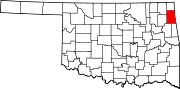
Towns Bernice | Colcord | Kansas | Oaks‡ | West Siloam Springs
CDPs Brush Creek | Bull Hollow | Cayuga | Cleora | Cloud Creek | Copeland | Dennis | Dodge | Dripping Springs | Flint Creek | Leach | New Eucha | Old Eucha | Rocky Ford | Sycamore | Tagg Flats | Twin Oaks | Zena
Unincorporated
communitiesFootnotes ‡This populated place also has portions in an adjacent county or counties
Categories:- Populated places in Cherokee County, Oklahoma
- Populated places in Delaware County, Oklahoma
- Towns in Oklahoma
- History of the America (North) Province of the Moravian Church
- Populated places in Oklahoma with Native American majority populations
- Cherokee towns


Wikimedia Foundation. 2010.