- Microsoft MapPoint
-
Microsoft MapPoint 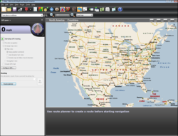
Microsoft MapPoint North America 2009Developer(s) Microsoft Stable release MapPoint 2011 / March 2011 Operating system Microsoft Windows Type GIS software License Proprietary EULA Website microsoft.com/mappoint Microsoft MapPoint is both a technology ("MapPoint Web Service," previously known as MapPoint .NET) and a specific software program created by Microsoft that allows users to view, edit and integrate maps. The software and technology are designed to facilitate the geographical visualization and analysis of either included data or custom data. Numerous acquisitions (Vexcel, Vicinity Corporation, GeoTango, etc.) have supplemented both data and feature integration.
MapPoint is intended for business users but competes in the low-end geographic information system ("GIS") market. It includes all of the functionality of the most recent version of Streets and Trips, the consumer mapping software, at the time of development, as well as integration with Microsoft Office, data mapping from various sources including Microsoft Excel, and a Visual Basic for Applications (VBA) interface allowing automation of the MapPoint environment.
The MapPoint technology is used in
- End-user desktop software:
- MapPoint (for North American and Western European business users)
- Microsoft Streets and Trips (for North American home users)
- Microsoft AutoRoute (for Western European home and small business users)
- Encarta encyclopedia (Atlas functionality)
- Web-based services:
- The Bing Maps website maps.bing.com
- The Microsoft Virtual Earth development platform
- The MapPoint Web Service using SOAP XML
- The Virtual Earth Map control, an ActiveX control, which lets users make requests via JavaScript to an AJAX map object
Contents
Versions
Microsoft MapPoint as the software is typically updated every two years and available in both upgrade and full packaged product form; the current version is 2011. Previous versions were released starting with 2000 (developing from Expedia Streets and Trips Planner 98, a consumer mapping application included with Office 97 Small Business Edition), which was slated to be included in the Office 2000 Premium Edition suite, but never was.[1][2]
- MapPoint 2000, initial release
- MapPoint 2001, very similar to 2000; more of a data update
- MapPoint 2002, updated interface to Office XP style
- MapPoint 2004, last version to run on Windows 9x
- MapPoint 2006, significantly updated GPS integration and features, last version supported on Windows 2000
- MapPoint 2009, updated interface with bigger icons, core engine remains the same
- MapPoint 2010, many user and API enhancements, including the ability to show/hide map symbols and labels by type[3]
- MapPoint 2011, significantly updated map data and points of interest
New versions have not always been at the same time as the equivalent Office releases despite being numbered similarly; notably the 2002 release was excluded from the Office XP suites due to a lack of equivalent programmability, and 2006 was released well before Office 2007. The program's icon and toolbars were not updated until the 2009 release to stay consistent with modern software applications.
Version 2009[4] sporting an overhauled interface and claimed better Office integration was released in late 2008.[5] The core map rendering engine remained the same and the GIS data was not updated as recently as one might expect of a product released in 2008, leaving out subdivisions, roads and other features that were completed in 2007 and which are shown on online mapping systems.[6] Further, the 2009 version replaced all built-in icons with icons that were mostly brown or darker colors. This made them difficult to see on the map and resulted in users trying to restore the icon sets from version 2006.[7]
Old versions 2004 and 2006 both included 336 pushpin symbols. The 2009 version replaced these symbols with a new set of 46 pushpins. A new template[8] can be used to add missing pushpin images to the program. The full range of pushpins were reintroduced in MapPoint 2010.
The software is available for Microsoft Windows, and includes a less-featured edition entitled Pocket Streets for the Windows CE family of products, such as Pocket PC, and Windows Mobile for Smartphone and Automotive.
Online
In 2002, Microsoft launched a free online MapPoint service.[9][10] This was superseded by MSN maps, Live search maps, and Bing Maps.
See also
References
- ^ http://www.microsoft.com/presspass/features/1999/07-12o2k.mspx
- ^ Paul Thurrott, Microsoft announces MapPoint 2000, Windows IT Pro, 3 November 1998
- ^ Mapping-Tools.com: How to use Microsoft MapPoint: New Features in MapPoint 2010
- ^ Review: MapPoint 2009
- ^ MapPoint 2009 arrives 9/1, Streets & Trips 2009 in October
- ^ Microsoft Streets and Trips 2009 will speak street names
- ^ Adding MapPoint 2006 Pushpins to MapPoint 2009, MapForums, a Community of VE/MapPoint Users and Developers.
- ^ Template adds old-style pushpins for Streets & Trips 2009 / MapPoint 2009
- ^ Robinson, Gail. "Microsoft launches UK mapping website". Webuser. http://www.webuser.co.uk/news/top-stories/378872/microsoft-launches-uk-mapping-website. Retrieved 26 July 2011.
- ^ "MSN MapPoint Offers a Better Alternative to MapQuest With a .NET Future; MapPoint .NET Platform Combined With Intuitive User Interface Brings Location Intelligence to Life on the Web With MSN MapPoint, Carpoint and HomeAdvisor.". Microsoft. Jan 24, 2002. http://goliath.ecnext.com/coms2/gi_0199-1319188/MSN-MapPoint-Offers-a-Better.html. Retrieved 26 July 2011.
External links
- Official website
- Review 1: Microsoft MapPoint
- Review 2: Mapping Software Solutions Under $500
- Review 3: MapPoint and Maptitude Destinations Known
- ninemsn Maps & Directions Microsoft MapPoint, more places, route multiple destinations, plan trips quickly and get real-time GPS functionality with this mapping ...
- MP2K Magazine, an independent magazine/community for MapPoint technologies
- Map Forums Forum for Microsoft MapPoint / Virtual Earth Discussion
- MapElves Wiki MapPoint and Virtual Earth Frequently Asked Questions (FAQ) List and Wiki
- New features of Mappoint 2006, A user review of new features of MapPoint 2006
- MapPoint discussion group - microsoft.public.mappoint
- MP2K Magazine Newsgroup
- MapPoint Web Service discussion group - mappoint.webservice
- Live Search Maps - Australia Mashup
- New USB GPS "Stick" receiver for MapPoint 2009 u-blox 5 technology used in GPS units bundled with MapPoint 2009 with GPS Locator
- Overview of the New Features in Microsoft MapPoint 2010 Richard Marsden highlights the new features in MapPoint 2010 including the "Map Settings" or cartographic layer pane, new programmatic capabilities for GPS control, GPS import/export and several other major enhancements including MapPoint 2009 "Fixes".
- Mapping-Tools.com specializes in a range of tools and add-ins for MapPoint. Some are freeware, some are commercial. Also includes a number of information articles about using MapPoint and programming MapPoint. Articles include how-tos, and reference material (e.g. pushpin listings).
Microsoft Office List of Microsoft Office programs · History of Microsoft Office Office suites Windows Mac OS Applications Desktop Access · Excel (Viewer) · InfoPath · Lync · OneNote · Outlook (Outlook Connector · Add-ins) · PowerPoint (Viewer) · Project · Publisher · SharePoint Designer · SharePoint Workspace · Visio · Word (Viewer)Server Forms Server · Groove Server · Lync Server · PerformancePoint Server · Project Server (Project Portfolio Server) · SharePoint Server (Excel Services · InfoPath Forms Services)Mobile Online Office tools Microsoft Office shared tools · Ribbon Hero 2Discontinued Related Technologies Office Online Categories:- Microsoft software
- GIS software
- End-user desktop software:

Wikimedia Foundation. 2010.