- Coleorton
-
Coordinates: 52°45′04″N 1°24′07″W / 52.751°N 1.402°W
Coleorton 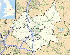
 Coleorton
Coleorton shown within LeicestershirePopulation 1,016 OS grid reference SK404172 Parish Coleorton District North West Leicestershire Shire county Leicestershire Region East Midlands Country England Sovereign state United Kingdom Post town COALVILLE Postcode district LE67 Dialling code 01530 Police Leicestershire Fire Leicestershire Ambulance East Midlands EU Parliament East Midlands UK Parliament North West Leicestershire List of places: UK • England • Leicestershire Coleorton (pronounced /kəˈlɔrtən/ kə-lor-tən) is a village and civil parish in North West Leicestershire, England. It is situated on the A512 road approximately 2 miles (3.2 km) east of Ashby de la Zouch. Nearby villages include Newbold, to the north, Thringstone to the east, and Swannington to the south-east.
In the 2001 census, the population of the parish was 1,016.[1]
Formerly an ancient parish in West Goscote hundred, Coleorton became part of Ashby de la Zouch Rural District which was created in 1894.[2]
Coal mining was an important industry in the area since the 15th century.[3] Coleorton Colliery, which was between Coleorton and Swannington, has now been closed, and a woodland Coleorton Wood was planted in 1991-2 on the colliery site as part of the National Forest.[4] Opencast mining was operated between 1985 and 1995.[3]
Coleorton was the birthplace of William Stenson (1771–1861), founder of Whitwick Colliery and 'Father of Coalville'
The Grade II* listed Coleorton Hall, in the west of the parish, was built in 1804-8 for the art patron Sir George Beaumont. William Wordsworth was a regular and frequent guest of Sir George Beaumont at the Hall. Between 1948 and 1997 the house was owned by the National Coal Board and used as offices, and it has now been converted into apartments.[5][6]
Coleorton has a post office and is served by three public bus services:
9 (Arriva) Leicester-Coalville-Ashby-Burton (Runs hourly from top of Lower Moor Road)[1]
155 (Arriva) Coalville-East Midlands Airport- Castle Donnington (runs hourly from anywhere on Lower Moor Road)[2]129 (Creswells) Loughborough-Ashby (Irregular journeys and runs from Zion Hill)[3]
References
- ^ "Census: Key Statistics: Parish Headcounts: Area: Coleorton CP (Parish)". Office for National Statistics. http://neighbourhood.statistics.gov.uk/dissemination/LeadTableView.do?a=3&b=796077&c=Coleorton&d=16&e=15&g=466770&i=1001x1003x1004&m=0&r=1&s=1214871447645&enc=1&dsFamilyId=779. Retrieved 2008-07-01.
- ^ "Coleorton AP/CP Leicestershire through time". A Vision of Britain Through Time. http://www.visionofbritain.org.uk/unit_page.jsp?u_id=10374352. Retrieved 2008-07-01.
- ^ a b Hartley, R. F. (January 2000). "An Archaeological Resource Assessment of Post-Medieval Leicestershire". East Midlands Archaeological Research Framework Project. University of Leicester. http://www.le.ac.uk/ar/research/projects/eastmidsfw/pdfs/37leicpmed.pdf. Retrieved 2008-07-01.
- ^ "The National Forest - Woodlands - Coleorton Wood". National Forest Company. 2005. http://www.nationalforest.org/visit/index.php?fuseaction=location.showlocation&loc_id=1633. Retrieved 2008-07-01.
- ^ Lennox, Marsya (2004-06-18). "Property: Apartments at Coleorton Hall". Birmingham Post. http://www.highbeam.com/doc/1P1-95624536.html. Retrieved 2008-07-01.
- ^ "Coleorton Hall Garden of Special Historic Interest". North West Leicestershire District Council. http://www.nwleics.gov.uk/development_control/documents/Coleorton_Hall_Garden_of_Special_Historic_Interest.pdf. Retrieved 2008-07-01.
External links
Categories:- Villages in Leicestershire
- Civil parishes in Leicestershire
- Leicestershire geography stubs

Wikimedia Foundation. 2010.