- Nitzanim
-
Nitzanim 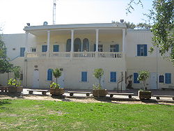
Hebrew נִצָּנִים, ניצנים Founded 1943 Founded by New immigrants Council Hof Ashkelon Region Southern coastal plain Affiliation HaOved HaTzioni Coordinates 31°42′59.75″N 34°38′1.68″E / 31.7165972°N 34.6338°ECoordinates: 31°42′59.75″N 34°38′1.68″E / 31.7165972°N 34.6338°E 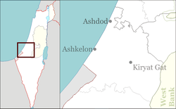
 Nitzanim
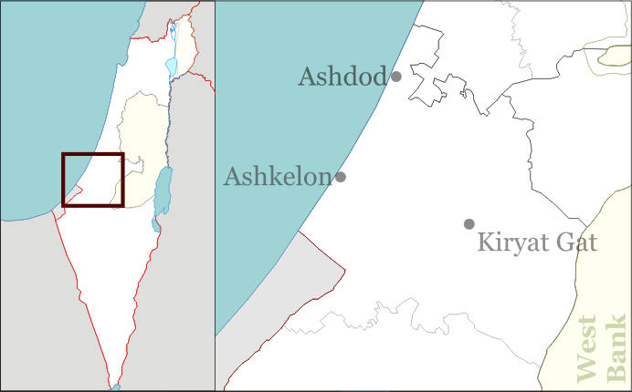
Nitzanim (Hebrew: נִצָּנִים, lit. Flower buds) is a kibbutz in southern Israel. Located between Ashkelon and Ashdod on the Nitzanim dunes, it falls under the jurisdiction of Hof Ashkelon Regional Council. In 2006 it had a population of 343.
The kibbutz was established after the Jewish National Fund purchased a 400-acre (1.6 km2) plot of land and a large house known as the "mansion" in 1942.[1] The first residents were immigrants, some of whom were Holocaust survivors. It later absorbed more immigrants from Poland and Romania.
The kibbutz was captured by the Egyptian army during the 1948 Arab-Israeli War in the Battle of Nitzanim, but was recaptured by Israeli forces at the end of the conflict, after which the settlement was re-established around four kilometres south of the original location. In 1949, Nitzanim Youth Village was established on the original site. The youth village closed in 1990, and during the 1990s the communal settlement of Nitzan was founded on the site.
References
- ^ Women of Valor Center - Nitzanim Society for the Preservation of Israel Heritage sites
Kibbutzim Moshavim Beit Shikma · Berekhya · Ge'a · Heletz · Hodia · Kokhav Michael · Mash'en · Mavki'im · Nir Yisrael · Netiv HaAsara · Talmei YafehCommunal settlements Youth villages Jewish villages depopulated during the 1948 Arab–Israeli War Behind the 1949 armistice lines: Beit Eshel · Beit Yosef · Masada · Mishmar HaYarden · Nitzanim · Sha'ar HaGolan · Yad Binyamin · Yad MordechaiGush Etzion: Other West Bank: Gaza Strip: Categories:- Hof Ashkelon Regional Council
- Kibbutzim
- Populated places established in 1943
- Jewish villages depopulated during the 1948 Arab–Israeli War

Wikimedia Foundation. 2010.