- Villa Guerrero, Jalisco
-
Villa Guerrero — Municipality and town — 

 Villa Guerrero
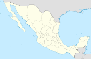
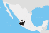
Coordinates: 21°52′52.8″N 103°35′45.75″W / 21.881333°N 103.5960417°WCoordinates: 21°52′52.8″N 103°35′45.75″W / 21.881333°N 103.5960417°W Country  Mexico
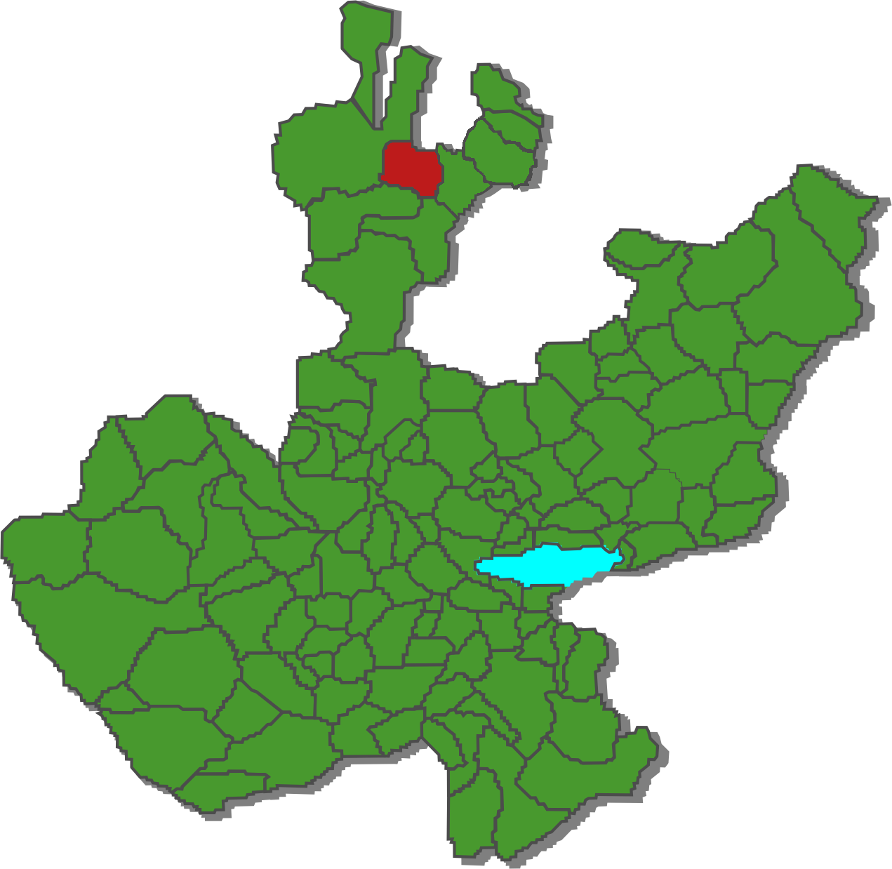
State Jalisco Government – Mayor Mario Gutiérrez Jara Elevation 1,767 m (5,797 ft) Population (2005) – Total 5,182 – Demonym Villa Guerrense Time zone CST (UTC-6) Postal code 46-100 Area code(s) (52) 437 Website www.villaguerrero.com The municipality of Villa Guerrero is located in the north of the state of Jalisco, México, between 103°22'30 and 103°50'00 longitude west and 21°54'00 and 22°10'00 latitude north, at an altitude of 1,767 metres (5,797 ft) above sea level.
The municipality shares its border on the north with the state of Zacatecas and the municipality of Mezquitic, to the south with the municipalities of Bolaños and Chimaltitán. To the east, it shares its border with the municipality of Totatiche and to the west with the municipality of Mezquitic. The municipality covers an area of 1,092 square kilometres (422 sq mi).
Contents
Population
The population of the municipality in 2005 was 5,182 inhabitants, of which 3,503 lived in the municipal seat of Villa Guerrero. The remaining population was spread throughout the rural areas within the municipality's borders. Some other notable localities within these borders include Ojo de Agua, Azqueltán, Santa Rita, Las Adjuntas, Izolta, La Cienega de Marquez,Uribes and Patagua.
The municipality has suffered decreasing population in recent decades, largely due to emigration. In 2000, 31% of the working population was employed in agriculture and husbandry, 14% in construction, 13% in commerce and 13% in manufacturing.
History
Prior to the Spanish conquest, the municipality of Villa Guerrero was inhabited by the indigenous Tepecan (Tepehuan). The area was conquered by the Spanish Captain Pedro Almíndez Chirino, sent by Nuño Beltrán de Guzmán in the year 1530. Shortly after the arrival of the Spanish into the area, the Huichol (Wixarika) migrated to the area's remote canyons and mountains. The Spanish settlement of the area at the end of the 16th century brought a number of Tlaxcaltec colonizers to the area.
The oldest Spanish land grant in the area was in 1579 to Luis de los Rios Proaño. The grant was for approximately 120 km² in the valley of Juanacatic (from the indigenous name for the valley: Xoncacatic, meaning place of the onions). Missions were founded by the Franciscans in the area in the latter years of the 16th century. In the early 17th century, the area was the scene of a number of indigenous uprisings, including one by the Wixarika and Tepecan in 1607, resulting in its abandonment by the few Spanish settlers. In 1622, the descendants of the original grantee took interest once again in the land, seeking out titles in Zacatecas. The land was eventually sold to Captain Juan de Escobedo and Captain Juan Diaz de Infante. Around 1673, European settlement in the region was still limited, with only one agricultural hacienda in the region known as Juanacatic.
In 1676, the Spanish military administrator for the region of Colotlán Toribio González de Escalante, began the extraction of saltpeter in the valley. From this activity, the place gained the name of El Salitre. Eventually the extraction of saltpeter ceased due to its cost inefficiency and the administrator's inability to retain sufficient labor.
In 1702, the Tepehuan and Wixarika from the nearby mountains and canyons joined forces in a rebellion. The result was an ajudication by the Spanish Crown that forced the major Spanish landowner, Ana de Santiago, widow of Juan Diaz de Infante, to trade some of her agricultural land in the plateau for land in the canyon. Thus the Tepehuan regained part of their historic lands in a location known as Patahua. The Tepehuan community received an official grant for the land in 1733.
In 1779, the Juanacatic hacienda was acquired by Pedro de Llanos y Valdés as the area began to experience large flows of European immigration. Agricultural activity and husbandry benefited from the mining activities in nearby Bolaños, which had begun large scale production in the 1730s. El Salitre became a regular stopover of the mule trains that transported the ore out of the canyon.
There were several battles in 1810 during the war for independence fought in the region. Many of the local indigenous groups, including the Wixarika fought on the side of the Spanish Crown.
Political reforms, such as the Iguala Plan undertaken in 1821 by the newly independent government extinguished separate treatment of indigenuos communities and communal lands of the Tepehuan were distributed to individuals. In 1838, the area was made part of the 8th Canton of the free and sovereign state of Jalisco, within the Mexican Republic and was assigned to the municipality of Totatiche within that canton.
Construction on a stone church to replace the adobe chapel of the town of El Salitre began in 1905. The work was completed nearly two decades later, following the Mexican Revolution. Soon thereafter, in 1921, the municipailty was separated from the municipality of Totatiche and declared an independent municipality by the state legislature and renamed Villa Guerrero in honor of Vicente Guerrero.
Geographical Description
Orography
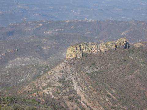
 Orography of Villa Guerrero: The Bolaños Canyon
The most common type of terrain in the municipality is mountainous (46%) followed by plains (34%) and rolling hills (20%). The altitudes in the municipality vary greatly, ranging from 900 to 2,100 meters (2,950–6,900) above sea level. Their highest elevations are: in the north, Mount of the Cross (Cerro de la Cruz), to the west, White Deer Mountain (Cerro del Venado Blanco), the Toril Mesa and the Chihuahua Mesa; to the south and southeast, Pine Mountain (Cerro del Pino) and Thistles Mountain (Cerro de los Cardos).
Hydrography
The municipality's hydrologic resources are provided mainly by the Bolaños River. Other larger streams with permantent flow include: Sataray River, Blue Puddle (Charco Azul) River and La Villa River. There are also streams with seasonal flow, including: Chihuahua Creek, Nogales Creek, Zacatequillas Creek, New Water (Agua Nueva) Creek, Rinconada Creek, La Labor Creek, Las Planillas Creek and Juanacatic Creek
Climate
The municipality's climate is semiarid, with dry winters and springs, and a temperate and dry winter without a well defined spring season. The annual average temperature is of 18.7 °C (66 °F), with a high of 27.6 °C (82 °F) and low of 9.8 °C (50 °F). Rainy season occurs in the months of June, July and August, and includes an average rainfall of 803.2 millimetres (31.62 in). There are an annual average of 11 days of frost. The dominant winds are in direction of the southeast.
Vegetation and Flora
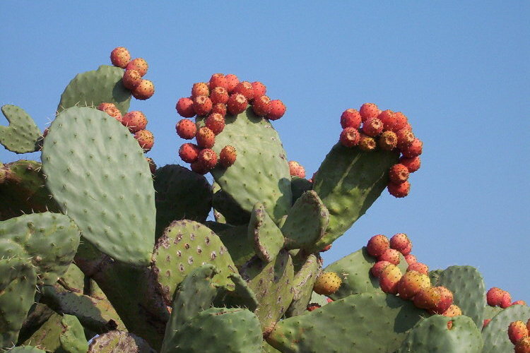
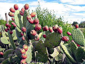 Villa Guerrero Vegetation: Prickly pear cactus
In the highest altitude zones there are natural forests composed of pine. In the lower altitudes, oak and live oak trees dominate. In the hills and lower altitudes there are cacti, acacia, Arizona kidneywood and other plant species. The foothills and the plains are covered by natural grasses.
Fauna
Rabbits, hares, deer, reptiles, mountain lions and other smaller species inhabit in this region.
Land Use
The composition of the municipality's soil includes Haplic Feozem, Regosol and Chromic Luvisol. The municipality has a territorial surface of 1,092.03 km² (269,846 acres), of which 282.98 km² (69,926 acres) are utilized for agriculture, 2,330.26 km² (575,820 acres) in livestock activities, 500 km² (123,553 acres) for forestry. Urban areas cover 0.3 km² (74 acres) and 75.73 km² have other uses. 1047.03 km² (258,727 acres) are owned by private parties and 45 km² (11,120 acres) are communal property.
External links
- Villa Guerrero Social Network website
- Tony Cordero Photography of Villa Guerrero
- History and Explanation of Villa Guerrero Coat of Arms
Sources
- Enciclopedia de los Municipios de México, State of Jalisco [1]
- Robert Dennis Shadow, Tierra Trabajo y Ganado en la Region Norte de Jalisco
- Nicolas Valdés Huerta, Historia de Villa Guerrero
- Insituto Nacional de Estadística, Geografía e Informática [2]
- Sistema de información del Estado de Jalisco [3]
Municipalities
and
(municipal seats)Acatic · Acatlán de Juárez · Ahualulco de Mercado · Amacueca · Amatitán · Ameca · Arandas · Atemajac de Brizuela · Atengo · Atenguillo · Atotonilco El Alto · Atoyac · Autlán de Navarro · Ayotlán · Ayutla · Bolaños · Cabo Corrientes (El Tuito) · Cañadas de Obregón · Casimiro Castillo · Chapala · Chimaltitán · Chiquilistlán · Cihuatlán · Cocula · Colotlán · Concepción de Buenos Aires · Cuautitlán de García Barragán · Cuautla · Cuquío · Degollado · Ejutla · El Arenal · El Grullo · El Limón · El Salto · Encarnación de Diaz · Etzatlán · Gómez Farías (San Sebastián del Sur) · Guachinango · Guadalajara · Hostotipaquillo · Huejúcar · Huejuquilla El Alto · Ixtlahuacán de los Membrillos · Ixtlahuacan del Río · Jalostotitlán · Jamay · Jesús María · Jilotlán de los Dolores · Jocotepec · Juanacatlán · Juchitlán · La Barca · La Huerta · La Manzanilla · La Manzanilla de La Paz · Lagos de Moreno · Magdalena · Mascota · Mazamitla · Mexticacan · Mezquitic · Mixtlán · Ocotlán · Ojuelos de Jalisco · Píhuamo · Poncitlán · Puerto Vallarta · Quitupan · San Cristobal de la Barranca · San Diego de Alejandría · San Gabriel · San Ignacio · San Juan de los Lagos · San Juanito de Escobedo (Antonio Escobedo) · San Julián, Jalisco · San Marcos · San Martín de Bolaños · San Martín de Hidalgo · San Miguel El Alto · San Sebastián del Oeste · Santa María del Oro · Santa María de los Angeles · Sayula · Tala · Talpa de Allende · Tamazula de Gordiano · Tapalpa · Tecalitlán · Techaluta de Montenegro · Tecolotlán · Tenamaxtlán · Teocaltiche · Teocuitatlán de Corona · Tepatitlán de Morelos · Tequila · Teuchitlán · Tizapan El Alto · Tlajomulco de Zuñiga · Tlaquepaque · Tolimán · Tomatlán · Tonalá · Tonaya · Tonila · Totatiche · Tototlán · Tuxcacuesco · Tuxcueca · Tuxpan · Unión de San Antonio · Unión de Tula · Valle de Guadalupe (Northern) · Valle de Guadalupe (Southern) · Valle de Juárez · Villa Corona · Villa Guerrero · Villa Hidalgo · Villa Purificación · Yahualica de González Gallo · Zacoalco de Torres · Zapopan · Zapotiltic · Zapotitlán de Vadillo · Zapotlán del Rey · Zapotlán el Grande · Zapotlanejo
 Categories:
- Populated places in Jalisco
- Municipalities of Jalisco


Wikimedia Foundation. 2010.