- Strait of Dover
-
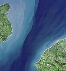
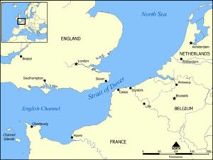 Map showing the location of the Strait of Dover.
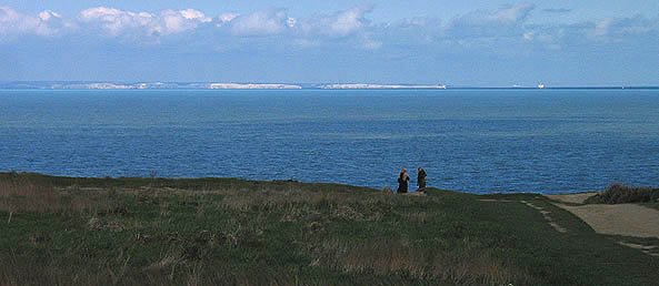
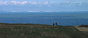 View of the English coast from France
The Strait of Dover or Dover Strait (French: Pas de Calais [pɑdə kalɛ], literally Strait of Calais, Dutch: Nauw van Calais) is the strait at the narrowest part of the English Channel. The shortest distance across the strait is from the South Foreland, 6 kilometres (some 4 miles) northeast of Dover in the county of Kent, England, to Cap Gris Nez, a cape near to Calais in the French département of Pas-de-Calais, France. Between these two points lies the most popular route for cross-channel swimmers as the distance is reduced to 34 km (21 mi).[1]
On a clear day, it is possible to see the opposite coastline and shoreline buildings with the naked eye, and the lights of land at night, as in Matthew Arnold's poem "Dover Beach".
Contents
Shipping traffic
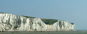 The white cliffs of Dover
Most maritime traffic between the Atlantic Ocean and the North and Baltic Seas passes through the Strait of Dover, rather than taking the longer and more dangerous route around the north of Scotland. The strait is the busiest international seaway in the world, used by over 400 commercial vessels daily. This has made safety a critical issue, with HM Coastguard maintaining a 24-hour watch over the strait and enforcing a strict regime of shipping lanes.[2]
In addition to the intensive east-west traffic, the strait is criss-crossed from north to south by ferries linking Dover to Calais and Boulogne. Until the 1990s these provided the only surface-based route across it. The Channel Tunnel now provides an alternative route, crossing underneath the strait at an average depth of 45 m (150 feet) underneath the seabed. The town of Dover gives its name to one of the sea areas of the British Shipping Forecast.
Geological formation
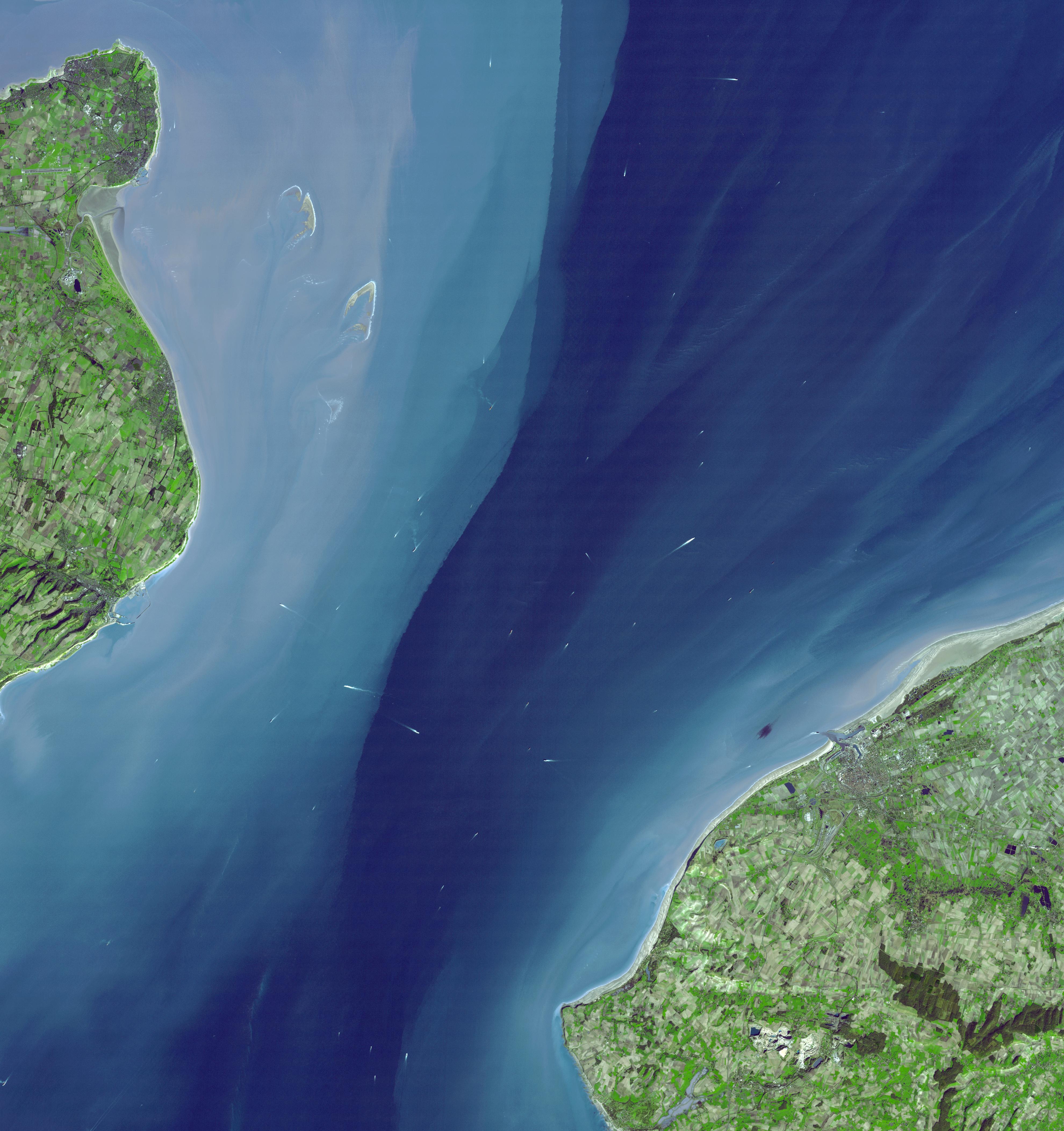
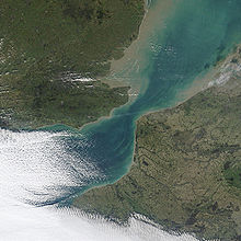 NASA Satellite image December, 2002
The strait is believed to have been created through erosion. At one time there was land where the strait is now, a south-east extension of the Weald joining what is now Great Britain to continental Europe. The eastern end of this old longer Weald is the Boulonnais chalk area in the Pas de Calais. The predominant geology on both the British and French sides and on the sea floor between is chalk. Although somewhat resistant to erosion, such erosion of the chalk can be seen on both coasts as impressive sea cliffs, the famous white cliffs of Dover, and Cap Blanc Nez on the French side of the strait. This same rock provided an excellent tunnelling medium for the Channel Tunnel.
 NASA Terra Satellite image March, 2001
The Rhine flowed northwards into the North Sea as the sea level fell during the start of the first of the Pleistocene Ice Ages. The ice created a dam from Scandinavia to Scotland, and the Rhine, combined with the Thames and drainage from much of north Europe, created a vast lake behind the dam, which eventually spilled over the Weald into the English Channel. This overflow channel was gradually widened and deepened into the Strait of Dover. A narrow deeper channel along the middle of the strait was the bed of the Rhine in the last Ice Age. In East Anglia there is a geological deposit that marks the old preglacial northward course of the Rhine.
However, a new study by Gupta et al. (2007)[3][4] suggests that the English Channel was formed by erosion caused by two major floods. The first was about 425 000 years ago, when an ice-dammed lake in the southern North Sea overflowed and broke the Weald-Artois chalk range in a catastrophic erosion and flood event. Afterwards, the Thames and Scheldt flowed through the gap into the English Channel, but the Meuse and Rhine still flowed northwards. In a second flood about 225 000 years ago the Meuse and Rhine were ice-dammed into a lake that broke catastrophically through a high weak barrier (perhaps chalk, or an end-moraine left by the ice sheet). Both floods cut massive flood channels in the dry bed of the English Channel, somewhat like the Channeled Scablands or the Wabash river in the USA.
Unusual crossings
For more details on this topic, see English channel#Notable channel crossings.Many crossings other than in conventional vessels have been attempted, including by pedalo, bathtub, amphibious vehicle and more commonly by swimming. French law bans many of these that British law does not, so most such crossings originate in England.
See also
Notes
- ^ "English Channel". The Cambridge Paperback Encyclopedia, 1999.
- ^ See The Channel Navigation Information Service (CNIS)
- ^ Gupta, Sanjeev; Collier, Jenny S.; Palmer-Felgate, Andy; Potter, Graeme (2007), "Catastrophic flooding origin of shelf valley systems in the English Channel", Nature 448 (7151): 342–346, Bibcode 2007Natur.448..342G, doi:10.1038/nature06018, PMID 17637667.
- ^ Europe cut adrift", by Philip Gibbard, pp 259-260, Nature, vol 448, 19 July 2007
External links
Categories:- Straits of the British Isles
- Kent
- Port of Dover, Kent
- English Channel
- France–United Kingdom border
- International straits


Wikimedia Foundation. 2010.