- Selenography
-
This article is about the study of selenography. For the Rachel's album, see Selenography (album).
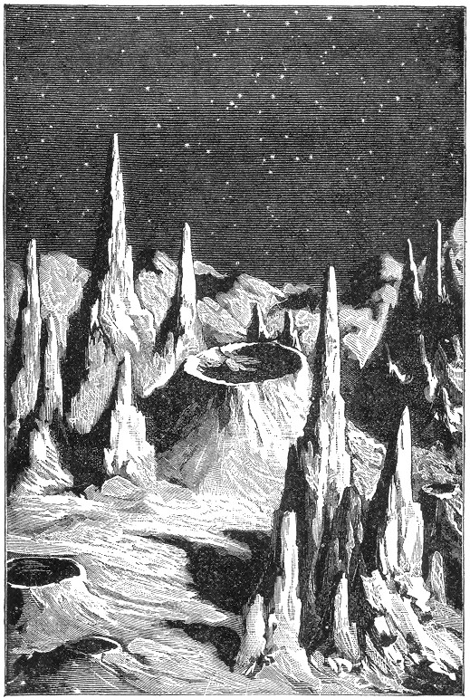
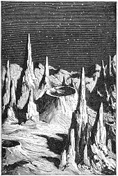 From the book Recreations in Astronomy by H. D. Warren D. D., published in 1879. The figure was named "Lunar Day", and it represents a historical concept of the lunar surface appearance. Robotic missions to the Moon later demonstrated that the surface features are much more rounded due to a long history of impacts.
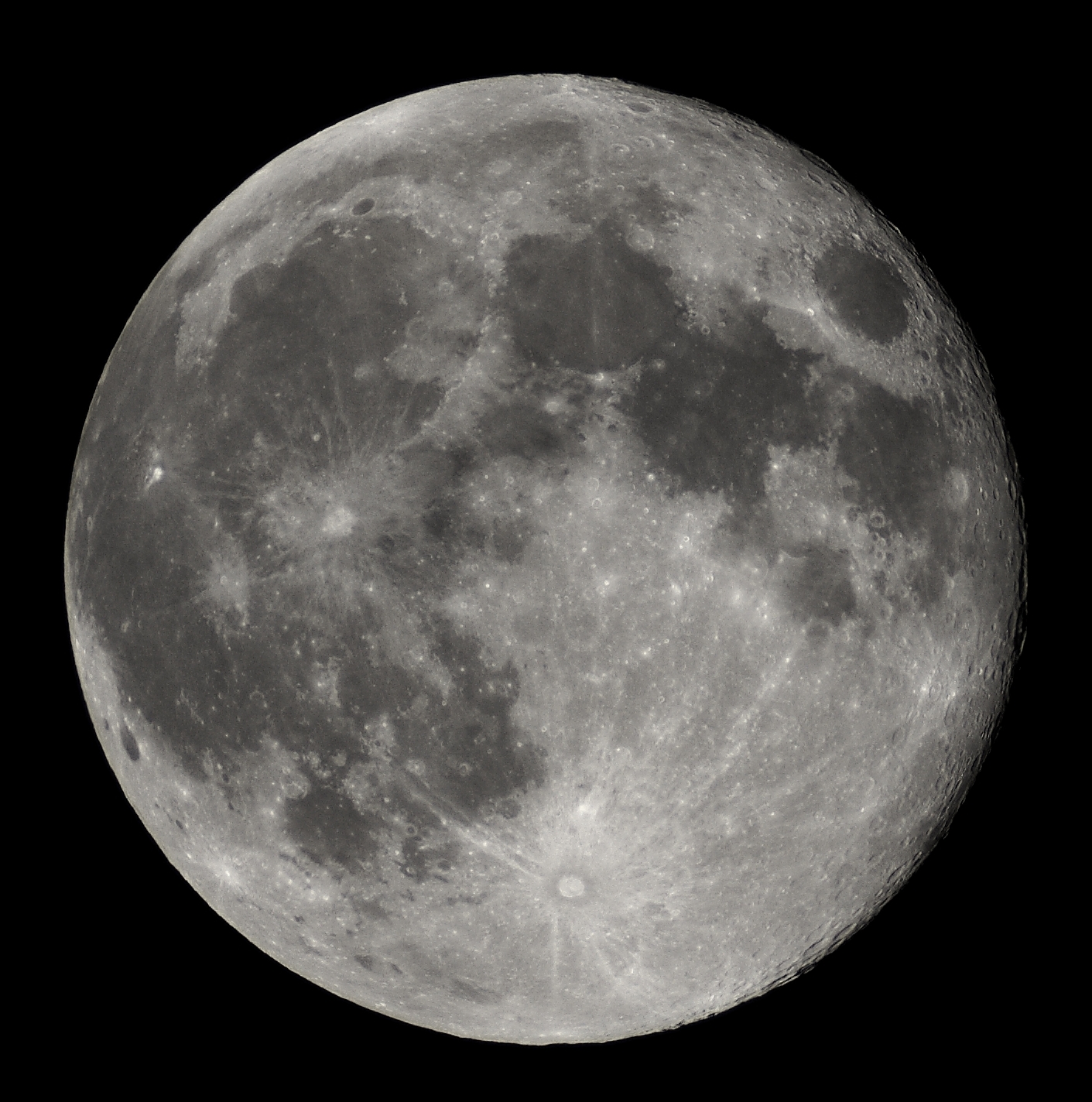
Selenography is the study of the surface and physical features of the Moon. Historically, the principal concern of selenographists was the mapping and naming of the lunar maria, craters, mountain ranges, and other various features. This task was largely finished when high resolution images of the near and far sides of the Moon were obtained by orbiting spacecraft during the early space era. Nevertheless, some regions of the Moon remain poorly imaged (especially near the poles) and the exact locations of many features are uncertain by several kilometers. Today, selenography is considered to be a subdiscipline of selenology, which itself is most often referred to as just "lunar science." The word selenography is derived from the Greek lunar deity Selene and γράφω (graphō, “I write”).
Contents
History
See also: Exploration of the MoonThe idea that the Moon was not perfectly smooth can be traced as far back as approximately 450 BC, when Democritus believed that there were "lofty mountains and hollow valleys" on the Moon. However, it was not until the end of the 15th century when serious study of selenography began. Around 1603, William Gilbert compiled the first lunar drawing based on naked-eye observations. Others soon followed, and when the telescope made its appearance, drawings were begun that at first were not very accurate, but soon became better as optics improved. In the early 18th century, the librations of the Moon were measured, showing that more than 50 percent of the lunar surface was visible to observers. In 1750, Johann Meyer produced the first reliable set of lunar coordinates that would enable astronomers to locate features on the Moon.
The systematic mapping of the Moon officially began in 1779 when Johann Schröter started making meticulous observations and measurements of the lunar features. The first published large map of the Moon, four sheets in size, was published in 1834 by Johann Heinrich von Mädler, who followed this up by publishing a book entitled, "The Universal Selenography.[1] All measurements were done by direct observation until March 1840, when J.W. Draper, using a five-inch reflector, produced a daguerreotype of the Moon, thus introducing photography to the astronomical world. At first, the images were of very poor quality, but like with the telescope two hundred years earlier, they very quickly became better. By 1890 lunar photography had become a recognized branch of astronomical research.
The 20th century brought more advances to study of the Moon. In 1959, Russia's Luna 3 sent back the first photographs of the far side of the Moon, giving the world the first glimpse of the until-then unseen side of our satellite. The United States launched the Ranger spacecraft between 1961 and 1965 to take photographs right down to the instant they impacted the surface, the Lunar Orbiters between 1966 and 1967 to photograph the Moon from orbit, and the Surveyors between 1966 and 1968 to take photos and soft land on the lunar surface. The Russian Lunokhods 1 (1970) and 2 (1973) traversed almost 50 km of the lunar surface, obtaining detailed images of the lunar surface. The Clementine spacecraft obtained the first near global map of the Moon's topography, as well as multispectral images. All of these missions sent back photographs that were of increasingly better resolution.
Mapping and naming the Moon
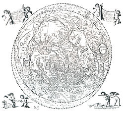 Map of the Moon by Johannes Hevelius (1647)
The oldest known illustration of the Moon was found in a passage tomb in Knowth, County Meath, Ireland. The tomb was carbon dated to 3330–2790 BCE.[2] However, this does not qualify as a map because no names were given to the features. Likewise, historical drawings of the Moon were made by Leonardo da Vinci, Thomas Harriot (1609), Galileo Galilei (1609) and Charles Scheiner (1614).[3]
The first serious attempts at naming the features of the Earth's moon as seen through a telescope were made by Michel Florent van Langren in 1645. His work is considered the first true map of the Moon, as it portrayed the various lunar maria, craters, and mountain peaks and ranges. Many of the features were given names that had a distinctly Catholic religious character, using the period names of Catholic royalty for craters and the names of Catholic saints for the capes and promontories. The maria were given Latin names of seas and oceans. Minor craters were given the names of astronomers, mathematicians, and other notable scholars of the past and present periods.
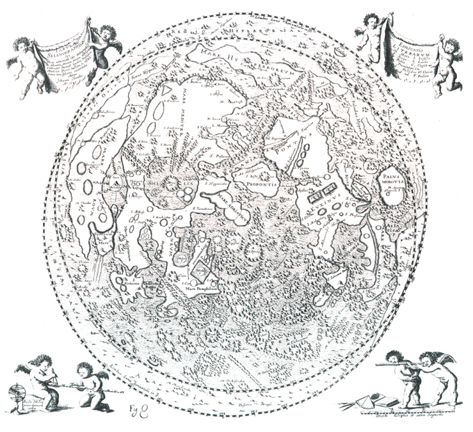
In 1647, Johannes Hevelius produced the rival work titled Selenographia, which formed the first lunar atlas. Hevelius ignored the nomenclature of Van Langren, and instead adopted the names of terrestrial features. These were mapped in a manner that corresponded to their place names on the Earth, particularly with respect to the ancient world as known to the Roman and Greek civilizations. This work of Hevelius proved influential among European astronomers of the period, and the Selenographia served as the standard reference work for over a century.
The modern scheme of lunar nomenclature was devised by Giambattista Riccioli, a Jesuit priest and scholar who lived in northern Italy. His Almagestum Novum was published in 1651 as a defense of the Catholic views during the Counter Reformation. In particular he argued against the views espoused by Galileo, Kepler, and Copernicus that favored a heliocentric model with elliptical planetary orbits. The work contained scientific reference material based on knowledge of the period, and was widely used by Jesuit teachers of the time. However the only significant aspect of the work to survive to the present period is Riccioli's system of lunar nomenclature.
The lunar illustrations in the Almagestum Novum were drawn by a fellow Jesuit teacher by the name of Francesco Grimaldi. The nomenclature was devised based on a subdivision of the visible lunar surface into octants, numbered in the Roman style from I through VIII. Octant I formed the northwest section, and subsequent octants proceeded in a clockwise direction aligned with the compass directions. Thus the octant VI lay to the south, and would include Clavius and Tycho craters.
The naming scheme had two components, the first used for the broad features of land and seas, and the second for the craters. Riccioli used the names of various historical effects and weather conditions attributed to the Moon throughout history. Thus there were the seas of crises (Mare Crisium), serenity (Mare Serenitatis), and fertility (Mare Fecunditatis). There were also the seas of rain (Mare Imbrium), clouds (Mare Nubium), and cold (Mare Frigoris). These were given their names in the Latin form.
The continental areas between the seas were given comparable names, but were opposite the names used for the seas. Thus there were the lands of sterility (Terra Sterilitatis), heat (Terra Caloris), and liveliness (Terra Vitae). However these names for the highland regions are no longer used on recent maps. See List of features on the Moon#Terra for a full list.
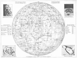
 Samples of lunar maps in the Selenetopographische Fragmente by Johann Hieronymus Schröter.
Many of the craters were named based on the octant in which they were found. Octants I, II, and III were use primarily for names from ancient Greece, such as Plato, Atlas, and Archimedes. Toward the middle in octants IV, V, and VI were names from the period of the ancient Roman empire, such as Julius Caesar, Tacitus, and Taruntius. Toward the bottom half of the map were placed scholars, writers, and philosophers from medieval Europe and Arabic regions.
The outer extremes of octants V, VI, VII, as well as all of octant VIII were devoted to contemporaries of Riccioli. The last also contained features named for Copernicus, Kepler, and Galileo. These were "banished" here far from the "ancients", as a political gesture to the Catholic Church.[citation needed] A number of craters around the Mare Nectaris were given the names of saints of the Catholic Church, following the tradition of Van Langren. These, however, were all connected in some aspect with astronomy. Later maps dropped the "St." from the names of these craters.
Riccioli's system of nomenclature was widely adopted after the publication of his Almagestum novum, and many of the names remain in common use today. The system was scientifically inclusive and was considered elegant and poetic in style, so it appealed widely to the thinkers of the period. It was also readily extensible with new names following the same scheme. Thus it came to replace the nomenclature of Van Langren and Hevelius.
Later astronomers and lunar mappers augmented the nomenclature with additional names of features. The most notable among these contributors was Johann Schröter who published a highly detailed map of the Moon in 1791: the Selenotopografisches Fragmenten. Schröter's adoption of Riccioli's often-used naming scheme effectively made it the standard system of lunar nomenclature. Riccioli's naming scheme was formally established as the doctrinal lunar nomenclature by a vote of the IAU in 1935, which gave standard names to 600 lunar features.
The system was later expanded and updated by the IAU during the 1960s, but the new designations were limited to the names of deceased scientists. After Soviet spacecraft photographed the far side of the Moon, many of the newly-discovered features were named after Soviet scientists and engineers. All subsequent names have been assigned by the IAU, although were assigned to still-living individuals, such as astronauts in Project Apollo.
Satellite craters
The nomenclature system for identifying satellite craters was originally devised by Johann Mädler. The craters that surrounded a major crater were identified by means of a letter. These subsidiary craters were usually smaller than the crater with which they were associated, but there are some exceptions. The craters could be assigned letters A through Z, with I omitted. (As the large majority of crater names were masculine, the main craters were termed "patronymic" craters.)
The assignment of the letters to satellite craters was originally a somewhat haphazard process, and they were typically assigned in order of significance rather than by their location. Precedence depended on the angle of illumination from the Sun at the time of the telescope observation, which could change over the course of the lunar day, so that in many cases the assignments could be made seemingly at random.
In a number of cases the satellite crater could lie closer to a main crater other than the one with which it is identified. To identify the patronymic crater, Mädler placed the identifying letter to the side of the feature mid-point closest to the main crater. This also had the advantage of allowing the names of the main craters to be omitted from the maps when identifying the subsidiary features.
Over the course of time, many of the satellite craters were assigned an eponym by lunar observers. The process of naming lunar features was formerly assumed by the International Astronomical Union (IAU) in 1919. The commission for naming these features formally adopted the convention of using capital Roman letters to identify craters and valleys.
When suitable maps of the far side became available by 1966, Ewen A. Whitaker assigned the names to satellite features based on the angle of the location relative to the main crater. A satellite crater located due north of the main crater was given the identifier 'Z'. The full 360° circle about the crater was then subdivided evenly into 24 parts, like a 24-hour clock. Each "hour" angle running clockwise was assigned a letter, beginning with 'A' at 1 o'clock. (The letters I and O were omitted, resulting in only 24 letters.) Thus a crater due south of the main crater was given the letter 'M'.
Historical lunar maps
 Map of the Moon by Andrees Allgemeiner Handatlas (1881)
The following is a list of historically-notable lunar maps and atlases, arranged in chronological order by publication date.
- Michel van Langren, engraved map, 1645.
- Johannes Hevelius, Selenographia, 1647.
- Giovanni Riccioli and Francesco Grimaldi, Almagestum novum, 1651.
- Giovanni Domenico Cassini, engraved map, 1679 (reprinted in 1787).
- Tobias Mayer, engraved map, 1749, published in 1775.
- Johann Hieronymus Schröter, Selenotopografisches Fragmenten, 1st volume 1791, 2nd volume 1802.
- John Russell, engraved images, 1805.
- Wilhelm Lohrmann, Topographie der sichtbaren Mondoberflaeche, Leipzig, 1824.
- Wilhelm Beer and Johann Heinrich Mädler, Mappa Selenographica totam Lunae hemisphaeram visibilem complectens, Berlin, 1834-36.
- Edmund Neison, The Moon, London, 1876.
- Julius Schmidt, Charte der Gebirge des Mondes, Berlin, 1878.
- Thomas Gwyn Elger, The Moon, London, 1895.
- Johann Krieger, Mond-Atlas, 1898. Two additional volumes were published posthumously in 1912 by the Vienna Academy of Sciences.
- Walter Goodacre, Map of the Moon, London, 1910.
- Mary A. Blagg and Karl Müller, Named Lunar Formations, 2 volumes, London, 1935.
- Philipp Fauth, Unser Mond, Bremen, 1936.
- Hugh P. Wilkins, 300-inch Moon map, 1951.
- Gerard Kuiper et al., Photographic Lunar Atlas, Chicago, 1960.
- Ewen A. Whitaker et al., Rectified Lunar Atlas, Tucson, 1963.
- Hermann Fauth and Philipp Fauth (posthumously), Mondatlas, 1964.
- Gerard Kuiper et al., System of Lunar Craters, 1966.
- Yu I. Efremov et al., Atlas Obratnoi Storony Luny, Moscow, 1967–1975.
- NASA, Lunar Topographic Orthophotomaps, 1978.
- Antonín Rükl, Atlas of the Moon, 2004.
See also
Notes
- ^ Wax and the Honey Moon, An account of Maedler's work and the creation of the first wax model of the Moon.
- ^ Stooke, Philip J. (February 1994). Neolithic Lunar Maps at Knowth and Baltinglass, Ireland. Bibcode 1994JHA....25...39S.
- ^ Taton, Reni (2003). Reni Taton, Curtis Wilson, Michael Hoskin. ed. Planetary Astronomy from the Renaissance to the Rise of Astrophysics, Part A, Tycho Brahe to Newton. General History of Astronomy. 2. pp. 119–126. ISBN 0521542057.
References
- Scott L. Montgomery (1999). The Moon and Western Imagination. University of Arizona Press. ISBN 0-8165-1711-8.
- Ewen A. Whitaker (1999). Mapping and Naming the Moon: A History of Lunar Cartography and Nomenclature. Cambridge University Press. ISBN 0-521-62248-4.
- William P. Sheehan and Thomas A. Dobbins (2001). Epic Moon: A history of lunar exploration in the age of the telescope. Willmann-Bell.
External links
- The Galileo Project: The Moon
- Observing the Moon: The Modern Astronomer's Guide
- Lunar control networks (USGS)
- The Rise And Fall of Lunar Observing, Kevin S. Jung
The Moon Physical features 
Orbit Lunar surface - Selenography
- Near side
- Far side
- Lunar mare
- (List)
- Craters
- (List)
- Mountains
- Valleys
- South Pole – Aitken basin
- Shackleton crater
- Water
- Soil
- Peak of eternal light
- Space weathering
- Transient lunar phenomenon
Lunar science Exploration Other topics - See also Solar System
- Natural satellite
Categories:- Lunar science
- Space science
- Planetary science
- Selenographers
- Cartography
Wikimedia Foundation. 2010.