- Ciuc County
-
Judeţul Ciuc — County (Judeţ) — 
Coat of arms
Country  Romania
Historic region Transylvania Capital city (Reşedinţă de judeţ) Miercurea Ciuc Established 1925 Ceased to exist Administrative and Constitutional Reform in 1938 Government - Prefect Area - Land 4,993 km2 (1,927.8 sq mi) Population (1930) - Total 146,584 Time zone EET (UTC+2) - Summer (DST) EEST (UTC+3) Ciuc County was a county (Romanian: judeţ) in the Kingdom of Romania. Its capital was Miercurea Ciuc. Its name was derived from the former county of the Kingdom of Hungary, Csík.
Contents
Geography
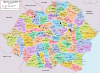
Ciuc County covered 4,993 km2 and was located in central part of Greater Romania, in Transylvania. Currently, the territory that comprised Ciuc County is now part of Harghita County. In the interwar period, the county neighbored Odorhei County to the west, Mureş County to the north, Neamţ County and Bacău County to the east, and Trei Scaune County to the south.
Administrative organization
Administratively, Ciuc County was divided into four districts (plăşi):
- Centrală
- Frumoasa
- Gheorgheni
- Sân-Mărtin
Later the Tulgheş district was created.
Population
According to the Romanian census of 1930 the population of Ciuc County was 145,806, of which 82.7% were ethnic Hungarians, 14.4% ethnic Romanians, and 1.6% Jews. Classified by religion: 81.3% were Roman Catholic, 13.8% Greek-Catholic, 1.7% Jewish, 1.9% Reformed (Calivinist), and 1.3% Orthodox Christian.
Urbanization
In 1930 the urban population of Ciuc County was 15,162, which included 83.8% Hungarians, 8.1% Romanians, and 5.6% Jews by ethnicity. The religious mix of the urban population was 78.9% Roman Catholic, 5.9% Jewish, 4.5% Greek-Catholic, 4.2% Reformed, 4.0% Eastern Orthodox, and 1.2% Armenian Catholic.
External links
- (Romanian) Ciuc County on memoria.ro
Alba · Arad · Argeş · Bacău · Baia · Bălţi · Bihor · Botoşani · Braşov · Brăila · Buzău · Cahul · Caliacra · Câmpulung · Caraş · Cernăuţi · Cetatea Albă · Ciuc · Cluj · Constanţa · Covurlui · Dâmboviţa · Dolj · Dorohoi · Durostor · Făgăraş · Fălciu · Gorj · Hotin · Hunedoara · Ialomiţa · Iaşi · Ilfov · Ismail · Lăpuşna · Maramureş · Mehedinţi · Mureş · Muscel · Năsăud · Neamţ · Odorhei · Olt · Orhei · Prahova · Putna · Rădăuţi · Râmnicu Sărat · Roman · Romanaţi · Satu Mare · Sălaj · Severin · Sibiu · Someş · Soroca · Storojineţ · Suceava · Târnava-Mare · Târnava-Mică · Tecuci · Teleorman · Tighina · Timiş-Torontal · Trei Scaune · Tulcea · Turda · Tutova · Vaslui · Vâlcea · Vlaşca
 Categories:
- Former counties of Romania
- Romania geography stubs


Wikimedia Foundation. 2010.