- Missouri Route 73
-
Route 73

Route information Maintained by MoDOT Length: 22.1 mi[1] (35.6 km) Existed: 1926 – present Major junctions South end: 
 US 65, Route 32, Buffalo
North end:  US 54 west of Camdenton
Highway system Missouri Highways
Supplemental←  Route 72
Route 74  →
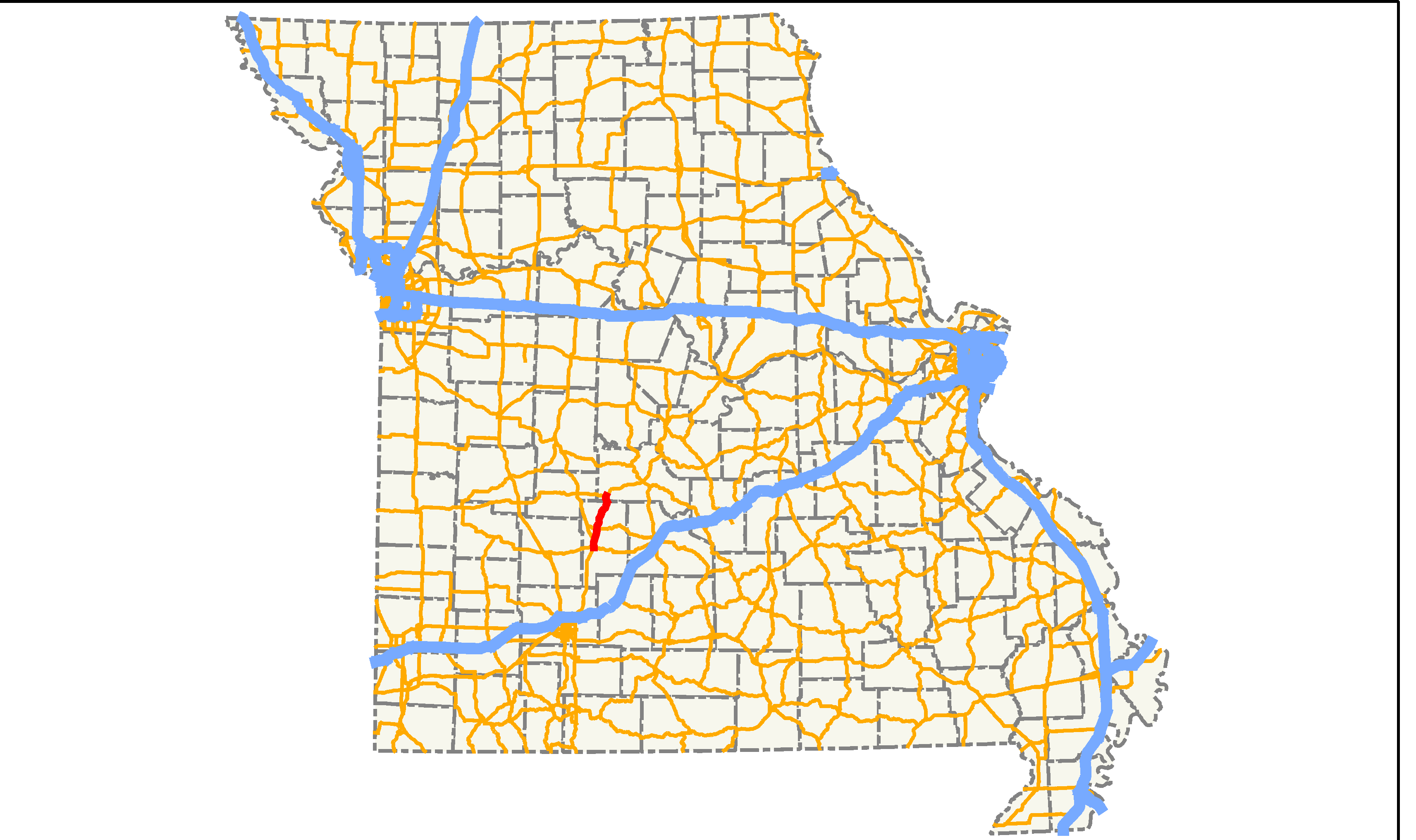
→Route 73 is a highway in southwest Missouri. It serves as a cut-off from Buffalo (its southern endpoint at U.S. Route 65) to the Lake of the Ozarks region. Its northern terminus is at U.S. Route 54 southwest of Camdenton. The highway is two lanes for its entire length.
Contents
Route description
Route 73 begins at US 65 in Buffalo, concurrent with Route 32. It runs east for one mile (1.6 km) before splitting off on its own alignment. The highway heads north and has an intersection with Route 64 at Pumpkin Center. North of Route 64, it runs through Tunas and Branch. It then ends at US 54 west of Macks Creek.
Southbound Route 73's control city is listed as Springfield, as the road serves as a cut-off for traffic heading from Lake of the Ozarks without having to travel further west to US 65.
History
Before the U.S. Highway system was established, Route 73 was part of Route 15.[2] In 1926, a significant part of Route 15 became U.S. Route 54, including the section that is today Route 73.[3] Sometime between 1932 and 1935, US 54 was realigned to the north (switching places with Route 64), rejoining its old alignment west of Macks Creek. The diagonal section cut off between Buffalo and Macks Creek became Route 73.[4]
Junction list
County Location Mile[1] Destinations Notes Dallas Buffalo 0.0 US 65, Route 32Southern terminus at US 65, begins concurrent with Route 32 0.6 Route 32Eastern end of Route 32 concurrency 5.6  Route DD
Pumpkin Center 8.2  Route 64
Tunas 15.9 
 Route D/E
17.8  Route PP
Camden 22.1 US 54Northern terminus 1.000 mi = 1.609 km; 1.000 km = 0.621 mi
Concurrency terminus • Closed/Former • Incomplete access • UnopenedReferences
- ^ a b Google, Inc. Google Maps – Missouri Route 73 (Map). Cartography by Google, Inc. http://maps.google.com/maps?f=d&hl=en&geocode=6470728820294966312,37.640510,-93.103890%3B12090140643049135228,37.640240,-93.092780%3B12966560634065646792,37.746760,-93.070830%3B1992374229690674521,37.849650,-93.027120%3B13800897363409416893,37.870720,-93.007560%3B14619556557236716817,37.930280,-93.004580&time=&date=&ttype=&saddr=W+Dallas+St%2FMO-32+%4037.640510,+-93.103890&daddr=W+Dallas+St%2FMO-32+%4037.640240,+-93.092780+to:37.676416,-93.09087+to:MO-73+%4037.746760,+-93.070830+to:MO-73+%4037.849650,+-93.027120+to:MO-73+%4037.870720,+-93.007560+to:MO-73+%4037.930280,+-93.004580&mrcr=1,2&mrsp=2&sz=16&mra=mi&sll=37.676399,-93.088896&sspn=0.007405,0.013604&ie=UTF8&ll=37.797848,-93.023987&spn=0.473122,0.870667&z=10&om=1. Retrieved 2007-10-13.
- ^ Missouri State Highway Commission (1923). Map Showing State Roads and Route Numbers (Map). http://www.cosmos-monitor.com/road/mo/hist/maps/etc/map1923.html. Retrieved 2007-10-13.
- ^ Missouri State Highway Commission (1927). Map Showing State Roads and Route Numbers (Map). http://www.cosmos-monitor.com/road/mo/hist/maps/1927/sw-central.html. Retrieved 2007-10-13.
- ^ Missouri State Highway Commission (1935). Weekly Detour Map (Map). http://www.cosmos-monitor.com/road/mo/hist/maps/1935-detour/sw-central.html. Retrieved 2007-10-13.
Categories:- State highways in Missouri

Wikimedia Foundation. 2010.