- Districts of Redditch
-
Coordinates: 52°17′N 1°56′W / 52.28°N 1.93°W
Redditch 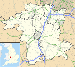
 Redditch
Redditch shown within WorcestershirePopulation 79,000 District Redditch Shire county Worcestershire Region West Midlands Country England Sovereign state United Kingdom Dialling code 01527 Police West Mercia Fire Hereford and Worcester Ambulance West Midlands EU Parliament West Midlands UK Parliament Redditch List of places: UK • England • Worcestershire Redditch is a town and local government district in north-east Worcestershire, England. The town is divided into separate districts. All street-name signs in Redditch have the street name in white lettering on a blue background and the district name in black lettering on a white background at the bottom of the sign. In the New Town areas the roads are usually named in alphabetical order and house numbering in the cul-de-sac closes is consecutive, starting with number 1 as the first house on the left as you enter, and the highest house number will be on the opposite side of the road as you leave.
Abbeydale
Politically, Abbeydale is represented by two Councillors from the Redditch Borough Council. They are;
- Cllr Diane Thomas (Lib Dems)
- Cllr Colin MacMillan (Con)
Astwood Bank
Main article: Astwood BankBatchley
Redditch United F.C. has its ground (The Valley Stadium) in Batchley.
On 17 July 2008 a Batchley (Council) by-election was held. Here were there results;
Brenda Quinney (CON) 630 votes
Greg Chance (LAB) 539 votes
Maurice Field (BNP) 299 votes
Russel Taylor (LD) 121 votes
Orion Moon (IND) 25 votes
Brockhill
Situated in the north west of the town. Almost entirely a residential area and home to many housing estates constructed in the last few years. The district lends its name to Brockhill (HM Prison), a Young Offenders Institution at the Hewell Grange complex.
Callow Hill
Main article: Callow Hill, WorcestershireChurch Green
 Church Green and St. Stephen's Church in central Redditch
A commercial district and public space in the centre of Redditch, Church Green forms part of the town centre, however it is treated as a district and typically appears in addresses for buildings located there. Church Green forms a traditional centre for the town, like a village green or town square, and features a bandstand and fountain (see picture, right). Dominated by St Stephen's church, it is home to several banks, estate agents, charity shops, a Chinese restaurant and other businesses.
Church Hill
The largest estate in Redditch,[1] occupying the north-east corner of the town, Church Hill Ward has yearly elections of Councillors due to its size and the number of councillors. The estate comprises Moons Moat, Marlfield Barn and Bomford Hill which boasts a Roman amphitheatre. Church Hill is divided into
- Church Hill North - primarily private residential
- Church Hill Centre - a small commercial centre with a community centre and flats run by the YMCA, a medical centre, dentist, shops and a take-away, and first and middle schools.
- Church Hill South - primarily social housing
with North and South parts separated by Church Hill Way (a buses only road), with Church Hill Centre in the middle. Church Hill's geometric layout, a characteristic of planned new town developments, largely separates private (North) residents from social (South) residents in their day-to-day lives, whilst bringing together the children of both sides of the community at common schools (in particular, at Church Hill Middle School). Church Hill North previously had its own first school, known as Marfield Farm First School, however this has since been closed and demolished. It has been characterised by some as something of a social planning experiment.[citation needed].
The estate is named after St Leonards church and the hill it stands on slightly north of Church Hill at Beoley.
Crabbs Cross
Main article: Crabbs CrossEnfield
Feckenham
Main article: FeckenhamFeckenham is technically a separate village, but is still governed by Redditch Borough Council and counts as a district.
Feckenham village arose because it straddled the ancient saltway track between Alcester and Droitwich (later a Roman road, now the modern B4090 road), and the early stretches of the Bow Brook.
Feckenham Forest once covered a substantial area of Worcestershire. It was used as a Norman royal hunting forest, and there was a royal hunting lodge near the village.
Greenlands
Headless Cross
 Birchfield Road, Headless Cross
 Water Tower, Headless Cross
Like Crabbs Cross, Headless Cross was once a village in its own right, it is thought to be named after Headless Cross farm, which was situated roughly where Vaynor Drive is today. Headless Cross may be derived from Smeethehedley, itself an indication of a role in Feckenham Forest.[2]
It still maintains the old village green, although it is now mostly a car park.
Keeping with the Redditch tradition of needle manufacture, Headless Cross once accommodated 3 needle works: the Needle Factory, located where Stonehouse Close is today; Phoenix Works on Birchfield Road and Mount Pleasant Mill on Evesham Road. A large brickworks was situated on Marlpit Lane, as well as a smaller one along Birchfield Road.
There are 2 schools in Headless Cross: The Vaynor First School and Walkwood CE Middle School, both located on Feckenham Road.
Due to its slight altitude advantage, both of Redditch's water towers were built in Headless Cross. The old one still stands and has since been converted to a residential abode. The distinctive shape of the current water tower has become something of a local icon and can be seen dominating the skyline as far away as the Hollybush Inn.
Black Sabbath's 1989 album Headless Cross is named after this district.
Hunt End
Main article: Hunt EndIpsley
Ipsley is home to the corporate headquarters of engineering firm GKN. Ipsley is one of the few estates in the town to not have any Council owned housing. In common with Winyates Green, all homes in the Ipsley estate are privately owned.
Lakeside
Lakeside is a largely industrial area of the town. Its location is within close proximity to the Arrow Valley Park. There is also a small housing estate.
Lodge Park
Lodge Park is where St. Bede's Catholic Middle School is. Politically, Lodge Park is represented by two Redditch Councillors, they are;
Cllr Andrew Fry (Labour)
Cllr Mark Shurmer (Labour)
Matchborough
Matchborough is a large district of Redditch. Its location lies between Winyates, Ipsley and Washford. Matchborough is the location of Arrow Vale High School and Matchborough First School. Matchborough consists of 2 areas, Matchborough East and Matchborough West, it also has a small shopping centre called Matchborugh Centre, similar to Church Hill and Winyates centres. Matchborough contains the areas most iconic feature, Matchborough Pond located near Arrow Vale High School.
Moons Moat
The district of Moon's Moat is an industrial and business estate in the north east of Redditch between Church Hill and Winyates. Moon's Moat itself is located in Church Hill.
The district takes its name from an ancient moated homestead which was founded by Monks and dates back to the 12th century. It is now a listed heritage site. The medieval homestead was inhabited by the Mohun family which is where the name "Moon's" Moat comes from (Mohun being an early name for Moon). The homestead was last in use in the 18th century, but by the end that century the Mohun's had died out. The homestead fell into disuse and became a ruin. What was left of the homestead was removed so that nothing visible now remains on the site.
The Moon's Moat site is believed to be haunted by the ghost of Lady Mohun who is said to appear on or near to the site on the eve of St Agnes (21 January). There is some folklore and history associated with the site concerning a suicide and a murder which may explain the ghost story.
Oakenshaw
Where McDonalds and Tesco are.
Oakenshaw South
Was built in the 1980s and consists of ten small, quiet closes.
Only a fifty minute walk from the town centre.
Park Farm
There is an Industrial Park in Park Farm. Park Farm is in the "Central Redditch" area.
Politically, Park Farm comes under the Lodge Park ward represented by two Councillors from the Labour Party.
Riverside
Smallwood
Southcrest
A mosque is being built near B&Q.
Town Centre
 Worcester Square layout
The primary commercial core of Redditch is the indoor shopping centre, the Kingfisher Centre. Designed like an out of town mall facility, with fully covered walkways and integrated multi-storey car parks, the Kingfisher Centre was built in place of several established Redditch town centre streets. The walkways are named after these streets. The centre, along with Church Green and municipal buildings such as the Borough Council, Redditch central library and FE College are enclosed on three sides by the raised one-way, three-lane Redditch Ringway. Designed for access to the car parks, it illustrates the early roads for prosperity approach in new town design philosophy applied in the UK in the 1960s and 1980s.
Walkwood
Home to the Bramley Cottage and Walkwood Coppice, a Local Nature Reserve.
Washford
Washford is primarily a modern industrial estate in south-east Redditch. It is home to the corporate headquarters of automotive and bicycle accessories retailer Halfords, along with many smaller businesses. It is named after the Washford Mill, which is now a popular public house and restaurant. Though a Mill has stood on this shet since 1066 and it is mentioned in the Domesday Book. A lot of the areas of Redditch been so.... Ipsley, Batchley, Feckenham and neighbouring Bordesley and beoley all been Saxon settlements.
Webheath
Webheath is a district of Redditch, in Worcestershire, England. The district neighbours Batchley and the village of Callow Hill. It is also near Feckenham and Astwood Bank. Webheath used to be a village but has recently been swallowed up and now comes under the town of Redditch.
Webheath is home to two first schools, located on Downsell road. They are:
- Webheath First School
- Mount Carmel Catholic First School
Politics
Webheath comes under the West ward on Redditch Borough Council. It is represented by two councillors, both from the Conservative party. Councillor Kath Banks and Councillor Michael Braley represent Webheath on a four year term.
Webheath is the final district to the West of the Redditch constituency. The constituency was created in 1997 were Labour's Jacqui Smith was elected until her defeat in 2010. Karen Lumley of the Conservative Party now represents Redditch in Westminster.
Winyates
 Arriving at Arrow Valley Lake from the East
Winyates is a new town estate in eastern Redditch. It comprises
- Winyates West
- Winyates East
- Winyates Green, to the east of Winyates East
West and East parts are separated by Winyates Way, a continuation of Church Hill Way and Matchborough Way. Winyates West adjoins Arrow Valley Park, accessible by a footpath under Battens Drive.
Politically, Winyates has three Redditch Councillors;
Cllr Nigel Hicks (Liberal Democrats)
Cllr Malcolm Hall (Liberal Democrats)
Cllr David Enderby (British National Party)
Nigel Hicks & Malcolm Hall are 2 of 3 Liberal Democrat councillors on the Redditch borough council. David Enderby is the only BNP councillor on the Redditch council, he was the first BNP councillor to be elected in the whole of Worcestershire.
Tenacres first school is located in Winyates East. Ipsley Middle School is located in Winyates West.
Wire Hill
Woodrow
The local Redditch Hospital (The Alexandra Hospital) is located in Woodrow.
References
- ^ 2001 UK Census reports the Church Hill ward has a population of 8493
- ^ Humphreys FSA, John. "Forest of Feckenham". Transactions and proceedings (Birmingham and Warwickshire Archaeology Society) 44-45: 115–132.
External links
Abbeydale • Astwood Bank • Batchley • Brockhill • Callow Hill • Church Green • Church Hill • Crabbs Cross • Cruise Hill • Elcocks Brook • Enfield • Feckenham • Greenlands • Ham Green • Headless Cross • Hunt End • Ipsley • Lakeside • Lodge Park • Matchborough • Moons Moat • Norgrove Court • Oakenshaw • Park Farm • Riverside • Smallwood • Southcrest • Town Centre • Walkwood • Washford • Webheath • Winyates • Wire Hill • WoodrowCategories:


Wikimedia Foundation. 2010.