- Mount Airy, Pittsylvania County, Virginia
-

Mount Airy (also Mountairy) is an unincorporated community in northeastern Pittsylvania County, Virginia, United States. Its altitude is 643 feet (196 m), and it is located at 36°56′35″N 79°11′32″W / 36.94306°N 79.19222°W (36.9429172, -79.1922420),[1] along State Route 40 between Gretna and Brookneal.[2] It is included in the Danville, Virginia Metropolitan Statistical Area.
References
- ^ U.S. Geological Survey Geographic Names Information System: Mount Airy, Pittsylvania County, Virginia
- ^ Rand McNally. The Road Atlas '09. Chicago: Rand McNally, 2009, p. 106.
Municipalities and communities of Pittsylvania County, Virginia Towns 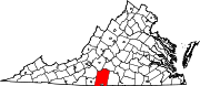
CDPs Blairs | Motley | Mount Hermon
Unincorporated
communitiesAjax | Andersons Mill | Bachelors Hall | Banister | Berry Hill | Beverly Heights | Birnam Wood | Brights | Brosville | Brutus | Buford | Callahans Hills | Callands | Cartersville | Cascade | Cedar Forest | Cedar Hill | Chalk Level | Climax | Coles Hill | Dry Fork | Dundee | Ebenezer | Eldon Knolls | Fairfield Park | Farmers | Flint Hill | Fox Hollow | Galveston | Gilmer Terrace | Glenland | Glenwood | Grady | Green Acres | Green Pond | Greenfield | Grit | Halifax Hills | Henrys Mill | Hermosa | Hill Grove | Hinesville | Hollys Mill | Hollywood | Hopewell | Java | Jones Mill | Keeling | Kentuck | Lakewood | Laniers Mill | Laurel Grove | Leaksville Junction | Level Run | Lucks | Lumpkin Forest | Markham | Motleys Mill | Mt. Airy | Mount Cross | Mountain Hill | Museville | Natal | New Mount Cross | Oak Hill | Oak Hills | Oak Ridge | Oakland | Olde Hunting Hills | Peytonsburg | Pickaway | Pickerel | Pine Ridge | Pittsville | Pleasant Gap | Pleasant Grove | Pullens | Ray | Red Oak Hollow | Redeye | Renan | Riceville | Ridgecrest | Ridgeway | Ringgold | Rondo | Sandy River | Sharon | Sheva | Shockoe | Smothers | Soapstone | Sonans | Spring Garden | Stony Mill | Straightstone | Surry Hills | Sutherlin | Swansons Mill | Swansonville | Sycamore | Tightsqueeze | Toshes | Transco Village | Turkey Fork | Vadens Mill | Vance | Vandola | Weal | West Fork | Whitfield | Whitmell | Whittles | Whittletown | Witt | Woodlake Park | Woodlawn | Woodlawn Heights | Worlds | Wyndover Woods
Coordinates: 36°56′35″N 79°11′32″W / 36.94306°N 79.19222°W
Categories:- Pittsylvania County, Virginia geography stubs
- Unincorporated communities in Virginia
- Populated places in Pittsylvania County, Virginia
- Danville, Virginia metropolitan area

Wikimedia Foundation. 2010.