- Devil's Millhopper Geological State Park
-
Devil's Millhopper Geological State Park IUCN Category V (Protected Landscape/Seascape)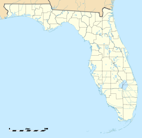

Location Alachua County, Florida, USA Nearest city Gainesville, Florida Coordinates 29°42′25″N 82°23′42″W / 29.70694°N 82.395°WCoordinates: 29°42′25″N 82°23′42″W / 29.70694°N 82.395°W Area 67 acres (270,000 m2) Established 1974 Governing body Florida Department of Environmental Protection  Boardwalk leading down to the sinkhole's observation deck
Devil's Millhopper Geological State Park is a Florida State Park located north-westernmost part of Gainesville, Florida, off County Road 232, northwest of the University of Florida.
The park is maintained by the Florida State Parks system, a division of the Florida Department of Environmental Protection. The park is adjacent to San Felasco County Park, and near the San Felasco Hammock Preserve State Park.
Contents
Geology
The cutaway, limestone sides of the sinkhole provide an easily visible geological record of the area. Twelve springs, some more visible than others, feed the pond at the bottom of the sinkhole. In the summer, the bottom of the sinkhole is dramatically cooler than the air at the surface due to the depth and shade from the canopy above. Significant fossil deposits include shark teeth, marine shells, and the fossilized remains of extinct land animals.[1]
Ecology
Even though the park is only 71 acres (290,000 m2), three distinct ecological environments exist in the park, based on exposure to sun, fire, and water. In the sandhill environment, the sandy soil and regular fires result in pine trees being the predominant vegetation. The moist soils of the hammocks support broadleaf trees and more low vegetation, while the swamp areas only support flora and fauna adapted to year-around wet conditions.
History
The 120 foot (40 m) deep, 500 foot (150 m) wide sinkhole got its name from its similar appearance to the hopper of a mill, along with the bones found at the bottom, suggesting animals entered it on the way to meeting the devil. The site was purchased by the state in 1974, and a set of 232 wooden steps, along with boardwalks and an observation deck at the bottom were completed in 1976.
See also
External links
- Devil's Millhopper State Geological Site at Florida State Parks
- Devil's Millhopper State Geological Site at Absolutely Florida
- Devil's Millhopper State Geological Site at Wildernet
- Devils's Millhopper from a Visitor's Perspective
References
- ^ Devils Millhopper Geological State Park http://www.floridastateparks.org/devilsmillhopper
Categories:- IUCN Category V
- Parks in Alachua County, Florida
- Florida state parks
- National Natural Landmarks in Florida
- Protected areas established in 1974
- Florida state park stubs


Wikimedia Foundation. 2010.