- Conímbriga
-
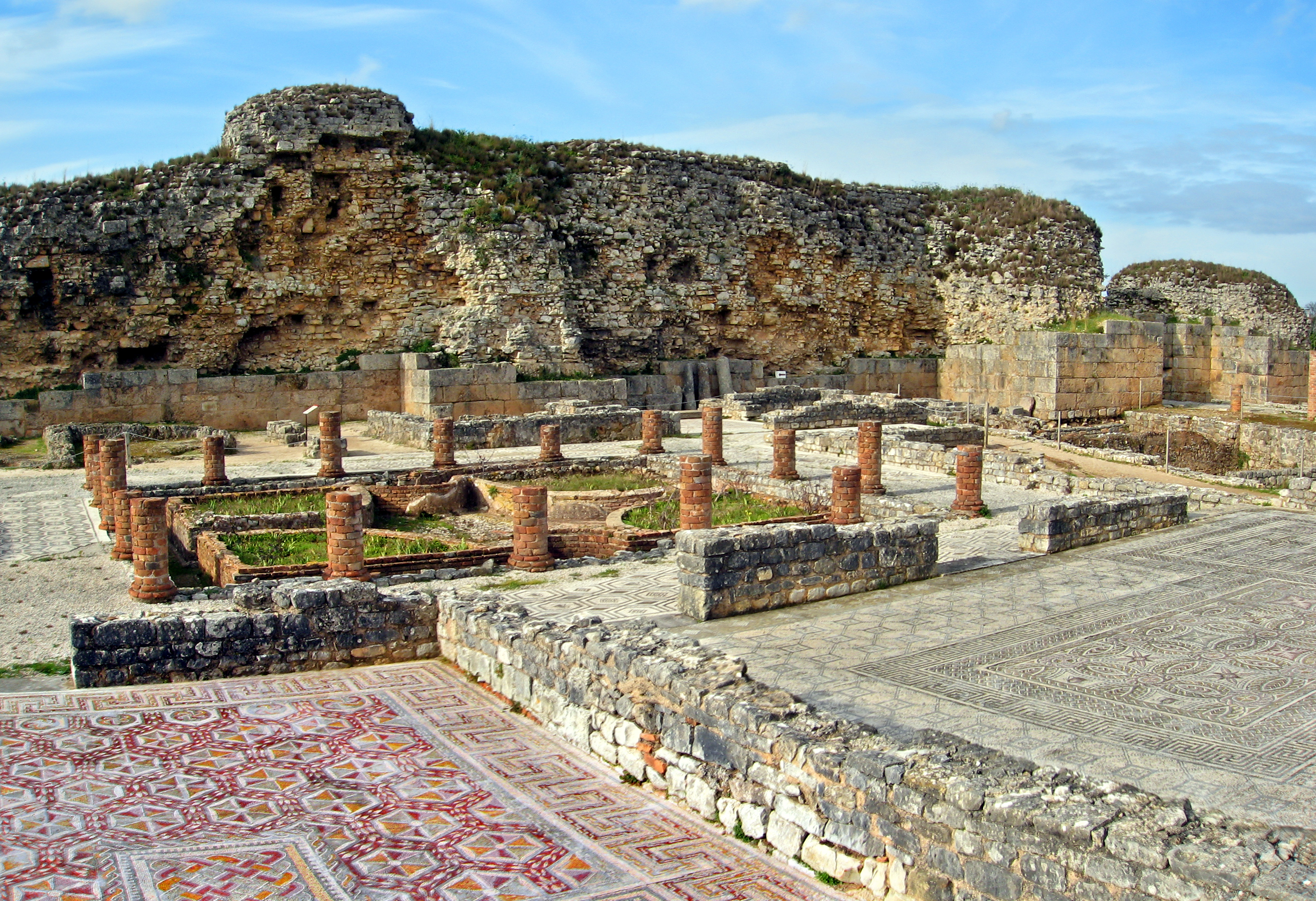
 Conímbriga Casa das fontes, house of the fountains
 Horsemen, one of several elaborate mosaic floors at Conímbriga.
Conímbriga is one of the largest Roman settlements in Portugal, and is classified as a National Monument. Conímbriga lies 16 km from Coimbra (the roman Aeminium) and less than 2 km from Condeixa-a-Nova. The site also has a museum that displays objects found by archaeologists during their excavations, including coins and surgical tools. A restaurant/café is in the museum, which also has a gift shop.
Contents
Roman Conimbriga
The name Conimbriga derives from an early, possibly pre-Indo-European element meaning "rocky height or outcrop" and the Celtic briga, signifying a defended place.[1]. Others think that the element coni may be related to the conii people.
Although Conimbriga was not the largest Roman city in Portugal, it is the best preserved. Archaeologists estimate that only 10 percent of the city has been excavated until the early 2000s. From this reseach, the following urban structure was discovered[2]:
Baths
 Great Southern Baths
In the baths, you can view the network of stone heating ducts beneath the now-missing floors. Three distinct structures were identified:
- Great Southern Baths
- Baths of the Wall
- Baths of the Aqueduct
Houses, Insula and other identified buildings
- House of Andercus
- House of Cantaber
- House of the Swastika
- House of Tancinus
- House of Valerius Daphinus
- House of the Apsidal Medianum
- House of the Trident and of the Sword
- House of the Skeletons
- House of the Fountains
- House of Solidi
- Buildings to North of the Forum
- Building to West of the House of Cantaber
- Buildings to West of the Baths
- Building of the patera Emanuel
- Building of the stone-quarry
- Building of the street of the patera Emanuel
- Building of the latrines of the Forum
- Building near the "Portas do Sol"
- Building of Condeixa-a-Velha
- Building of the sector JX
- Porticoed Building to East of the Forum
-
Insula to North of Baths
 Insula to North of Baths
 - Insula to West of the Forum
- Insula of the Phallus vase
- Insula of the Aqueduct
- Insula of the Viaduct
- Stores South of the Road
City walls
 Conimbriga city wall
The city walls are largely intact, and the mosaic floors and foundations of many houses and public buildings remain.
Amphitheater
Dating from the end of the julio-claudian period, taking advantage of a natural canyon that surrounded the city by the North [3]. The amphitheater area is scheduled to be excavated in 2012/2013 [4]. This monument measured originally 90x60x20 meters and is currently about 4 meters underground, with some rural houses built using part of the structure. It had an estimated capacity of 5000 spectators.
Forum
 Forum
ForumStructures of a great monument of the flavian era and, under these, the remains of constructions belonging to a previous phase that although, coinciding in the location of some elements ( the central square, for example), composed a completely different architectonic program[5].
History
Like many archaeological sites, Conímbriga was built in layers.
The archaeological evidence tells us that Conímbriga was inhabited, at least, between the 9th century BC and 7th / 8th century AD[6].
When the Romans arrived, in the first half of the 2nd century BC, Conímbriga was a flourishing village. Thanks to the peace established in Lusitania a quick Romanisation of the indigenous population took place and Conímbriga became a prosperous town. Judging by the capacity of the amphitheater, the city had an estimated population of 10600[7]. Colonists from the Italic peninsula like the Lucanus, Murrius, Vitellius and Aponia families, mixed with the previous local inhabitants such as the Turrania, Valeria, Alios and Maelo families.
Following the deep political and administrative crisis of the Empire, Conímbriga suffered the consequences of the barbaric invasions. In 465 and 468, Sueves captured and partially plundered the town already abandoned by part of its population, that fled to the nearby town of Aeminium.
Gallery
-

Conímbriga paved road
-

Column
-

Fishes mosaic
-
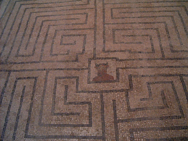
Maze mosaic
-

Conímbriga overview
-

Mosaic paved room
-

Overview
-

Bathing zone overview
See Also
References
- ^ University of Coimbra website[dead link]
- ^ http://www.conimbriga.pt/english/ruinas0.html
- ^ http://www.conimbriga.pt/english/ruinas01.html
- ^ http://sicnoticias.sapo.pt/vida/2011/11/06/escavacoes-em-conimbriga-vao-por-a-descoberto-anfiteatro-romano-unico-no-pais
- ^ http://www.conimbriga.pt/english/ruinas23.html
- ^ "Conimbriga - Ruínas, Museu monográfico". Conimbriga.pt. http://www.conimbriga.pt/portugues/ruinas.html. Retrieved 2011-10-28.
- ^ Jorge Alarcão (1999). Conímbriga - O Chão Escutado. Mem Martins: Edicarte, Edições e Comércio de Arte, Lda, p.95.
External links
- Conímbriga
- The Flavian Forum of Conímbriga
- Italica Romana - Reconstructions of Conímbriga
- O forum de Conimbriga e a evolução do centro urbano
- The Flavian Forum of Conimbriga in VRML
Coordinates: 40°05′58″N 8°29′36″W / 40.09944°N 8.49333°W

This Ancient Rome-related article is a stub. You can help Wikipedia by expanding it.