- Kapelle-op-den-Bos
-
Kapelle-op-den-Bos 
Coat of armsLocation in Belgium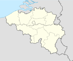
 Kapelle-op-den-Bos
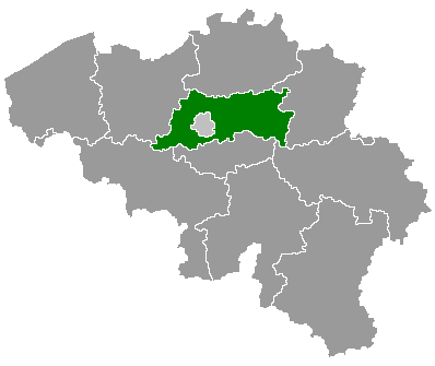
Coordinates: 51°01′N 04°22′E / 51.017°N 4.367°E Country Belgium Region Flemish Region Community Flemish Community Province Flemish Brabant Arrondissement Halle-Vilvoorde Government – Mayor Leo Peeters (sp.a) – Governing party/ies sp.a, CD&V Area – Total 15.25 km2 (5.9 sq mi) Population (1 January 2010)[1] – Total 9,027 – Density 591.9/km2 (1,533.1/sq mi) Postal codes 1880 Area codes 015, 02, 052, 03 Website www.kapelle-op-den-bos.be Map of Kapelle-op-den-Bos
Kapelle-op-den-Bos is a municipality located in the Belgian province of Flemish Brabant. The municipality comprises the towns of Kapelle-op-den-Bos proper, Nieuwenrode and Ramsdonk. On January 1, 2006 Kapelle-op-den-Bos had a total population of 8,904. The total area is 15.25 km² which gives a population density of 584 inhabitants per km².
Located at the intersection of the Willebroek to Brussels shipping canal and the Mechelen-Ghent railway line the town is home to the Etex Group NV group of companies which manufacture piping, roofing, gyprock and cement products. Numerous other industrial companies call Kapelle-op-den-Bos home and the General Secondary College Sint-Theresia College (STK) has a wide catchment extending beyond municipal boundaries.
The town was a target of heavy bombing during the First World War due to its proximity to transport routes. Among the many buildings destroyed the parish church of St. Nicholas was levelled however was rebuilt with a modern flavour - the nave retained its original arched windows however the steeple now appears as a crown.
References
- ^ Population per municipality on 1 January 2010 (XLS; 221 KB)
External links
- Official website - Only available in Dutch
Halle-Vilvoorde Affligem · Asse · Beersel · Bever · Dilbeek · Drogenbos · Galmaarden · Gooik · Grimbergen · Halle · Herne · Hoeilaart · Kampenhout · Kapelle-op-den-Bos · Kraainem · Lennik · Liedekerke · Linkebeek · Londerzeel · Machelen · Meise · Merchtem · Opwijk · Overijse · Pepingen · Roosdaal · Sint-Genesius-Rode · Sint-Pieters-Leeuw · Steenokkerzeel · Ternat · Vilvoorde · Wemmel · Wezembeek-Oppem · Zaventem · Zemst
Leuven Aarschot · Begijnendijk · Bekkevoort · Bertem · Bierbeek · Boortmeerbeek · Boutersem · Diest · Geetbets · Glabbeek · Haacht · Herent · Hoegaarden · Holsbeek · Huldenberg · Keerbergen · Kortenaken · Kortenberg · Landen · Leuven · Linter · Lubbeek · Oud-Heverlee · Rotselaar · Scherpenheuvel-Zichem · Tervuren · Tielt-Winge · Tienen · Tremelo · ZoutleeuwCategories:- Municipalities of Flemish Brabant
- Flemish Brabant geography stubs


Wikimedia Foundation. 2010.