- Auckland
-
This article is about the Auckland metropolitan area. For the wider region, see Auckland Region. For the local authority, see Auckland Council. For all other uses, see Auckland (disambiguation).
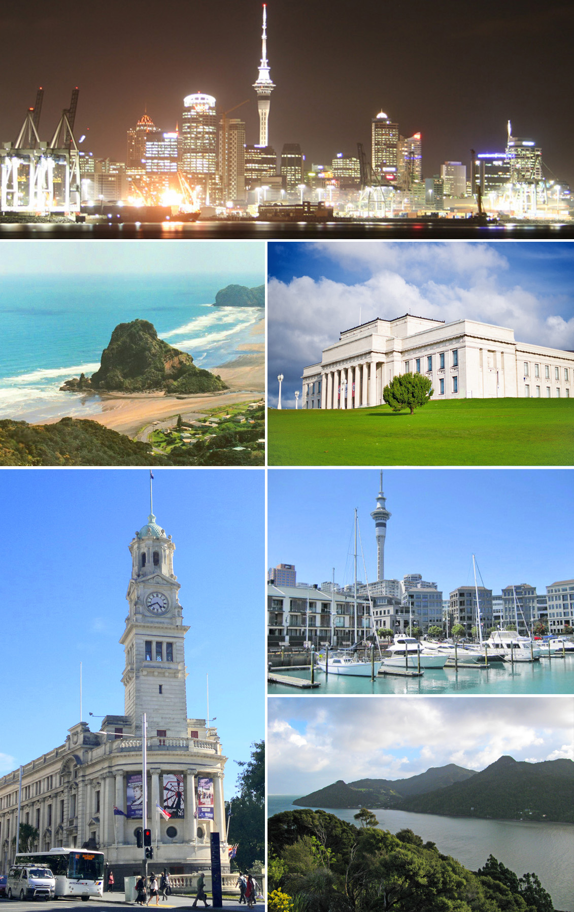
Auckland
Tāmaki Makaurau (Māori)— Main urban area — 
- top: Downtown Auckland
- upper left: Piha
- bottom left: Auckland Town Hall
- upper right: Auckland Museum
- centre right: Viaduct Harbour
- bottom right: Waitakere Ranges
Nickname(s): City of Sails,
SuperCity (sometimes ironically),
Queen City (rarely used now)
 Auckland
Coordinates ([1]): 36°50′25.50″S 174°44′23.53″E / 36.840417°S 174.7398694°ECoordinates: 36°50′25.50″S 174°44′23.53″E / 36.840417°S 174.7398694°E Country  New Zealand
Island North Island Region Auckland Territorial authority Auckland Settled by Māori c. 1350 Settled by Europeans 1840 Local boards List- Hibiscus and Bays
- Upper Harbour
- Kaipatiki
- Devonport-Takapuna
- Waitakere Ranges
- Henderson-Massey
- Whau
- Albert-Eden
- Puketapapa
- Waitemata
- Orakei
- Maungakiekie-Tamaki
- Mangere-Otahuhu
- Otara-Papatoetoe
- Howick
- Manurewa
- Papakura
Government – Mayor Len Brown Area – Urban 1,086 km2 (419.3 sq mi) – Metro 5,600 km2 (2,162.2 sq mi) Highest elevation 196 m (643 ft) Lowest elevation 0 m (0 ft) Population (June 2010 estimate)[2] – Urban 1,354,900 – Urban density 1,247.6/km2 (3,231.3/sq mi) – Metro 1,462,000 – Metro density 261.1/km2 (676.2/sq mi) – Demonym Aucklander, Jafa (often derogatory) Time zone NZST (UTC+12) – Summer (DST) NZDT (UTC+13) Postcode(s) 0500-2999 Area code(s) 09 Local iwi Ngāti Whātua, Tainui Website www.aucklandcouncil.govt.nz The Auckland metropolitan area (
 /ˈɔːklənd/), in the North Island of New Zealand, is the largest and most populous urban area in the country with 1,354,900 residents, 31 percent of the country's population.[2] Auckland also has the largest Polynesian population of any city in the world.[3] In Māori Auckland's name is Tāmaki Makaurau, or the transliterated version of Auckland, Ākarana.
The 2010 Mercer Quality of Living Survey ranked Auckland 4th equal place in the world on its list, while The Economist's World's Most Livable Cities index of 2010 ranked Auckland in 10th place. In 2010, Auckland was classified as a Beta World City in the World Cities Study Group’s inventory by Loughborough University.[4]
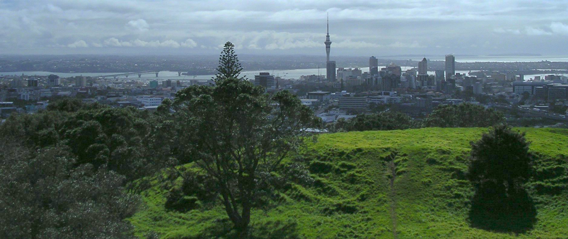
Auckland lies between the Hauraki Gulf of the Pacific Ocean to the east, the low Hunua Ranges to the south-east, the Manukau Harbour to the south-west, and the Waitakere Ranges and smaller ranges to the west and north-west. The central part of the urban area occupies a narrow isthmus between the Manukau Harbour on the Tasman Sea and the Waitemata Harbour on the Pacific Ocean. It is one of the few cities in the world to have harbours on two separate major bodies of water.
Contents
History
- Main article History of Auckland
Early Māori and Europeans
The isthmus was settled by Māori around 1350 and was valued for its rich and fertile land. Many pā (fortified villages) were created, mainly on the volcanic peaks. Māori population in the area is estimated at about 20,000 people before the arrival of Europeans.[5][6] The subsequent introduction of firearms, which began in Northland, upset the balance of power and led to devastating inter-tribal warfare, causing iwi who lacked the new weapons to seek refuge in areas less exposed to coastal raids. As a result, the region had relatively low numbers of Māori when European settlement of New Zealand began. There is, however, nothing to suggest that this was the result of a deliberate European policy.[7][8] On 27 January 1832, Joseph Brooks Weller, eldest of the Weller brothers of Otago and Sydney bought land including the sites of the modern cities of Auckland and North Shore and part of Rodney District, for "one large cask of powder" from "Cohi Rangatira".[9]
After the signing of the Treaty of Waitangi in February 1840, the new Governor of New Zealand, William Hobson, chose the area as his new capital, and named it after George Eden, Earl of Auckland, then Viceroy of India.[10] The land that Auckland was established on was gifted to the Governor by local Maori iwi Ngati Whatua, as a sign of goodwill and in the hope that the building of a city would attract commercial and political opportunities for the iwi. Auckland was officially declared New Zealand's capital in 1841,[11] and the transfer of the administration from Russell (now Old Russell) in the Bay of Islands was completed in 1842. However, even in 1840 Port Nicholson (later Wellington) was seen as a better choice for an administrative capital because of its proximity to the South Island and Wellington became the capital in 1865. Auckland was the principal city of the Auckland Province until the provincial system was abolished in 1876.
Growth up to today
 Concept design for the Elliot Tower (proposed building), a 232m tall apartment building.
In response to the ongoing rebellion by Hone Heke in the mid 1840s the government encouraged retired but fit British soldiers and their families to migrate to Auckland to form a defense line around the port settlement as garrison soldiers. By the time the first Fencibles arrived in 1848, the rebels in the north had been defeated, so the outlying defensive towns were constructed to the south stretching in a line from the port village of Onehunga in the West, to Howick in the east. Each of the 4 settlements had about 800 settlers, the men being fully armed in case of emergency but spent nearly all their time breaking in the land and establishing roads. In the early 1860s, Auckland became a base against the Māori King Movement. This, and continued road building towards the south into the Waikato, enabled Pākehā (European New Zealanders) influence to spread from Auckland. Its population grew fairly rapidly, from 1,500 in 1841 to 12,423 by 1864. The growth occurred similarly to other mercantile-dominated cities, mainly around the port and with problems of overcrowding and pollution. Auckland had a far greater population of ex soldiers than other settlements, many of whom were Irish. About 50% of the population was Irish which contrasted heavily with the majority English settlers in Wellington, Christchurch or New Plymouth. Most of the Irish, though not all were from Protestant Ulster. The majority of settlers in the early period were assisted by receiving a cheap passage to NZ.
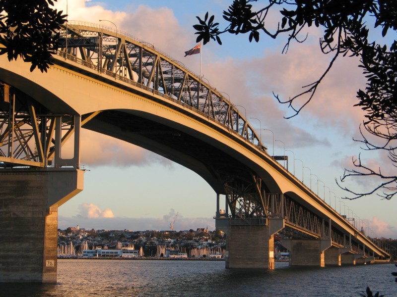
Trams and railway lines shaped Auckland's rapid expansion in the early first half of the 20th century, but soon afterward the dominance of the motor vehicle emerged and has not abated since; arterial roads and motorways have become both defining and geographically dividing features of the urban landscape. They also allowed further massive expansion that resulted in the growth of associated urban areas like the North Shore (especially after the construction of the Auckland Harbour Bridge), and Manukau City in the south.
A large percentage of Auckland is dominated by a very suburban style of building, giving the city a very low population density. Some services like public transport are costlier than in other higher-density cities, but Aucklanders are still able to live in single-family dwellings similar to the rest of the New Zealand population, although lot sizes tend to be smaller than in many other centres.
Geography and climate
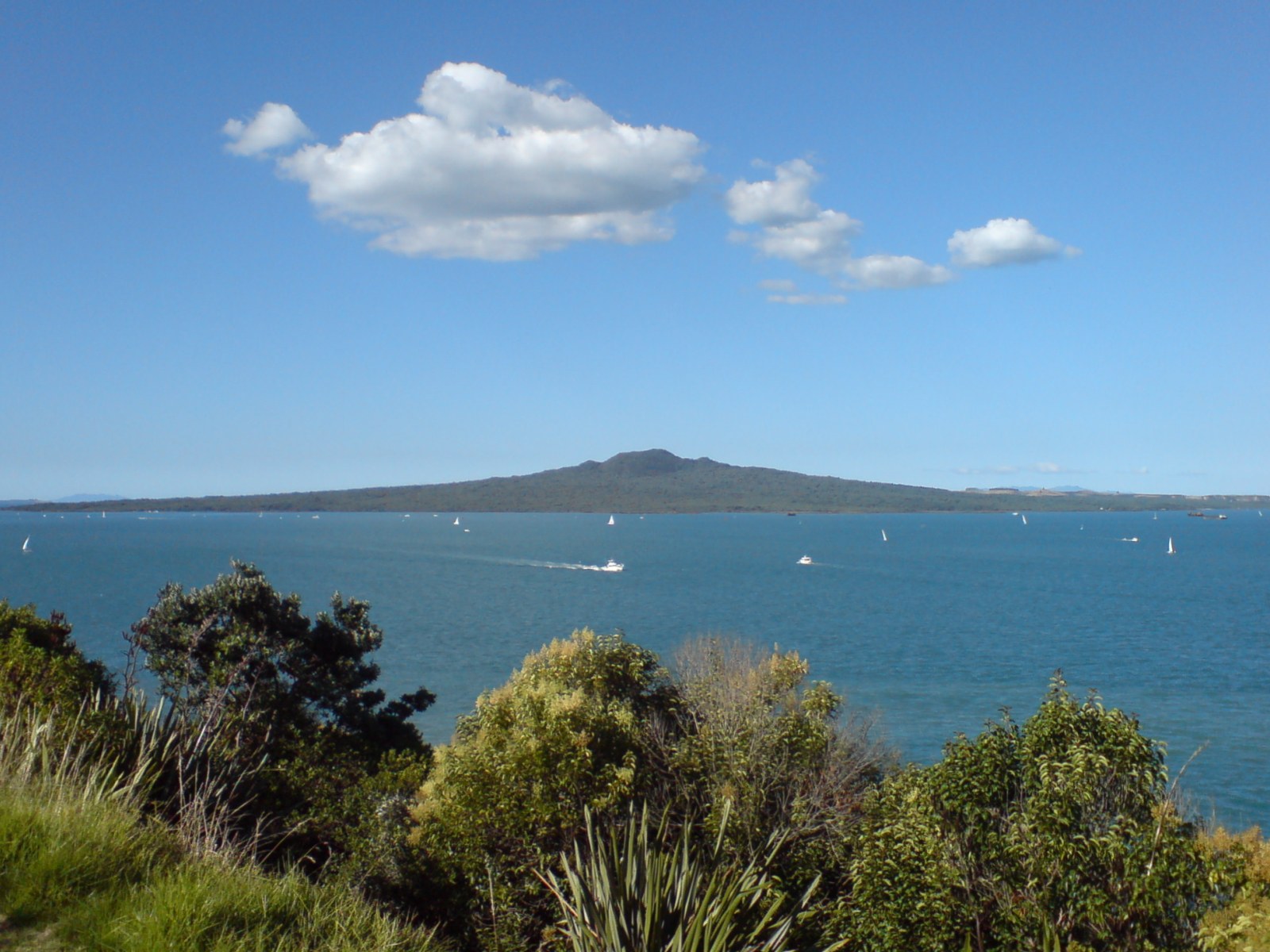
 Rangitoto island from North Head.
Volcanoes
Auckland straddles the Auckland Volcanic Field, which has produced about 50 volcanoes. These take the form of cones, lakes, lagoons, islands and depressions, and several have produced extensive lava flows. Most of the cones have been partly or completely quarried away. The individual volcanoes are all considered extinct, although the volcanic field itself is merely dormant. Auckland has at least 14 large lava tube caves which run from the volcanoes down towards the sea.
Unlike the explosive subduction-driven volcanism in the central North Island, such as at Mount Ruapehu and Lake Taupo, Auckland's volcanoes are fuelled entirely by basaltic magma.[12] The most recent and by far the largest volcano, Rangitoto Island, was formed within the last 1000 years, and its eruptions destroyed the Māori settlements on neighbouring Motutapu Island some 700 years ago. Rangitoto's size, its symmetry, its position guarding the entrance to Waitemata Harbour and its visibility from many parts of the Auckland region make it Auckland's most iconic natural feature. Few birds and insects inhabit the island because of the rich acidic soil and the type of flora growing out of the rocky soil.
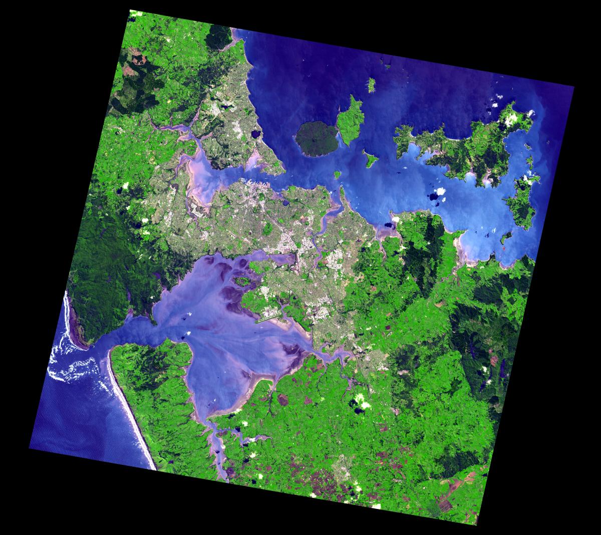
 Auckland and the inner Hauraki Gulf from space.
Harbours and gulf
Auckland lies on and around an isthmus, less than two kilometres wide at its narrowest point, between Mangere Inlet and the Tamaki River. There are two harbours in the Auckland urban area surrounding this isthmus: Waitemata Harbour to the north, which opens east to the Hauraki Gulf, and Manukau Harbour to the south, which opens west to the Tasman Sea.
Bridges span parts of both harbours, notably the Auckland Harbour Bridge crossing the Waitemata Harbour west of the Auckland Central Business District (CBD). The Mangere Bridge and the Upper Harbour Bridge span the upper reaches of the Manukau and Waitemata Harbours, respectively. In earlier times, portage paths crossed the narrowest sections of the isthmus.
Several islands of the Hauraki Gulf are administered as part of Auckland City, though they are not officially part of the Auckland metropolitan area. Parts of Waiheke Island effectively function as Auckland suburbs, while various smaller islands near Auckland are mostly zoned 'recreational open space' or are nature sanctuaries.
Climate
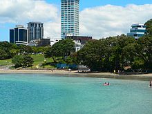
 View of the Auckland CBD.
Auckland has a warm-temperate climate, with warm, humid summers and mild, damp winters. Under Köppen's climate classification, the city has an oceanic climate. It is the warmest main centre of New Zealand and is also one of the sunniest, with an average of 2060 sunshine hours per annum.[13] The average daily maximum temperature is 23.7 °C (74.7°F) in February, and 14.5°C (58.1°F) in July. The absolute maximum recorded temperature is 32.4 °C (90.3°F) ,[14] while the absolute minimum is -2.5 °C (27.5°F).[13] High levels of rainfall occur almost year-round with an average of 1240 mm per year spread over 137 'rain days'.[13] Climatic conditions vary in different parts of the city owing to geography such as hills, land cover and distance from the sea, hence unofficial temperature records exist, such as a maximum of 34°C (93.2°F) in West Auckland.[14] Snowfall in Auckland is extremely rare; recorded instances include 27 July 1939[15] and 15 August 2011, although without any accumulation.[16]
The early morning calm on the isthmus during settled weather, before the sea breeze rises, was described as early as 1853: "In all seasons, the beauty of the day is in the early morning. At that time, generally, a solemn stillness holds, and a perfect calm prevails..." Many Aucklanders used this time of day to walk and run in parks.[17]
As car ownership rates are very high and emissions controls relatively weak, Auckland suffers from some air pollution, especially with regard to fine particles emissions.[18] There are also occasional breaches of guideline levels of carbon monoxide.[19] While maritime winds normally disperse the pollution relatively quickly it can sometimes become visible as smog, especially on calm winter days.[20] Precipitation is relatively abundant all year round, but peaks marginally in winter.
Climate data for Auckland Month Jan Feb Mar Apr May Jun Jul Aug Sep Oct Nov Dec Year Average high °C (°F) 23.3
(73.9)23.7
(74.7)22.4
(72.3)20.0
(68.0)17.4
(63.3)15.2
(59.4)14.5
(58.1)15.0
(59.0)16.2
(61.2)17.8
(64.0)19.6
(67.3)21.6
(70.9)18.9 Average low °C (°F) 15.3
(59.5)15.8
(60.4)14.6
(58.3)12.3
(54.1)10.0
(50.0)8.0
(46.4)7.1
(44.8)7.6
(45.7)8.9
(48.0)10.5
(50.9)12.1
(53.8)13.9
(57.0)11.3 Precipitation mm (inches) 75
(2.95)65
(2.56)94
(3.7)105
(4.13)103
(4.06)139
(5.47)146
(5.75)121
(4.76)116
(4.57)91
(3.58)93
(3.66)91
(3.58)1,240
(48.82)Sunshine hours 229 201 180 162 142 111 140 144 149 181 187 225 2,060 Source: NIWA Science climate data[21] People
Cultures
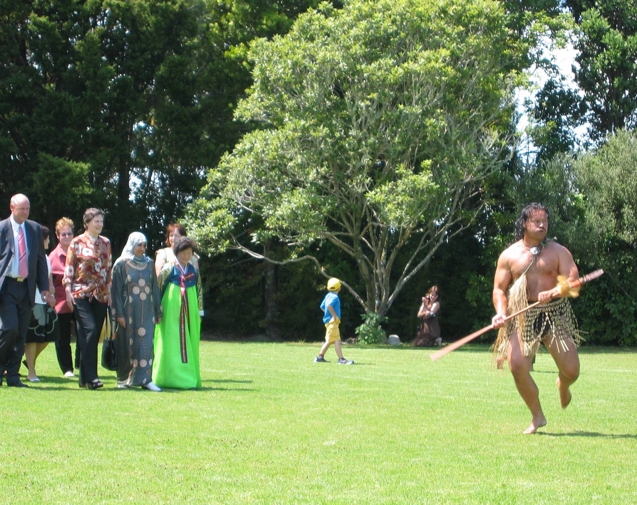
See also: Culture of New Zealand Helen Clark, Prime Minister in this 2006 photo, being welcomed onto Hoani Waititi Marae in Glen Eden.
Auckland is home to many cultures. The majority of inhabitants claim European - predominantly British - descent, but substantial Māori, Pacific Islander and Asian communities exist as well. Auckland has the largest Polynesian population of any city in the world and a higher proportion of people of Asian origin than the rest of New Zealand. Ethnic groups from all corners of the world have a presence in Auckland, making it by far the country's most cosmopolitan city.
Demographics
Main article: Demographics of AucklandThe proportion of Asians and other Non-European immigrants has increased during the last decades due to immigration,[22] and the removal of restrictions directly or indirectly based on race. Immigration to New Zealand is heavily concentrated towards Auckland (partly for job market reasons). This strong focus on Auckland has led the immigration services to award extra points towards immigration visa requirements for people intending to move to other parts of New Zealand.[23]
The following table shows the ethnic profile of Auckland's population, as recorded in the 2001 and 2006 New Zealand Census. The percentages add up to more than 100%, as some people counted themselves as belonging to more than one ethnic group. Figures for 2006 refer to the whole Auckland Region, not just the urban area. The substantial percentage drop of 'Europeans' was mainly caused by the increasing numbers of people from this group choosing to define themselves as 'New Zealanders' - even though this was not one of the groups listed on the census form.
Ethnic Group 2001 (%)[24] 2001 (people) 2006 (%)[25] 2006 (people) New Zealand European 66.9 684,237 56.5 698,622 Pacific Islander 14.9 152,508 14.4 177,936 Asian 14.6 149,121 18.9 234,222 Māori 11.5 117,513 11.1 137,133 Middle Easterners/Latin Americans/Africans n/a n/a 1.5 18,555 Others 1.3 13,455 0.1 648 'New Zealanders' n/a n/a 8.0 99,258 Total giving their ethnicity 1,022,616 (individuals) 1,237,239 (individuals) The 2006 Census also provides information about the multilinguality of the region. 867,825 people in the Auckland Region spoke one language only, 274,863 spoke two, and 57,051 three or more.[25]
Religion
Similar to the rest of the country, over half of Aucklanders profess Christianity, but fewer than 10% regularly attend church and almost 40% profess no religious affiliation (2001 census figures). The main denominations are Roman Catholic, Anglican and Presbyterian. Pentecostal and charismatic churches are the fastest growing. A small community of Coptic Orthodox Christians is also present.[26]
Recent immigration from Asia has added to the religious diversity of the city, and about 10% of the population follow such beliefs as Buddhism, Hinduism, Islam and Sikhism, although there are no figures on religious attendance.[27] There is also a small, long-established Jewish community.[28]
Lifestyle
Auckland's lifestyle is influenced by the fact that while it is 70% rural in land area, 90% of Aucklanders live in urban areas[29] - though large parts of these areas have a more suburban character than many cities in Europe and Asia.Positive aspects of Auckland life are its mild climate, plentiful employment and educational opportunities, as well as numerous leisure facilities. Meanwhile, traffic problems, the lack of good public transport, and increasing housing costs have been cited by many Aucklanders as among the strongest negative factors of living there,[30] together with crime.[31] Nonetheless, Auckland ranks 4th equal in a survey of the quality of life of 215 major cities of the world (2009 data).[32][33] In 2006, Auckland placed 23rd on the UBS list of the world's richest cities.[34]
In 2010, Auckland was ranked by the Mercer consulting firm as 149 of 214 centres for affordability, i.e. making it one of the most affordable cities world-wide to live in, based on the comparative cost of 200 aspects of life including housing, transport, food, clothing, household goods and entertainment.[35]
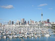 City of Sails - View over the Westhaven Marina.
 Aquarium tunnel at Kelly Tarlton's Underwater World.
Leisure
Auckland is popularly known as the "City of Sails" because the harbour is often dotted with hundreds of yachts and has more per capita than any other city in the world, with around 135,000 yachts and launches. Around 60,500 of the country's 149,900 registered yachtsmen come from the Auckland Region.[36][37] About one in three Auckland households owns a boat.[38]
Viaduct Basin also hosted two America's Cup challenges (2000 Cup and 2003 Cup), and its cafes, restaurants, and clubs add to Auckland's vibrant nightlife. With the sheltered Waitemata Harbour at its doorstep, Auckland sees many nautical events, and there are also a large number of sailing clubs in Auckland, as well as Westhaven Marina, the largest of the Southern Hemisphere.[37][39]
High Street, Queen Street, Ponsonby Road, and Karangahape Road are very popular with urban socialites. Newmarket and Parnell are up-market shopping areas, while Otara's and Avondale's fleamarkets offer a colourful alternative shopping experience. Newer shopping malls tend to be outside city centres, with Sylvia Park (Sylvia Park, Auckland City), Botany Town Centre (Howick, Manukau City) and Westfield Albany (Albany, North Shore) being the three largest.
The Auckland Town Hall and Aotea Centre host conferences and cultural events such as theatre, kapa haka, and opera. Auckland also boasts a full-time professional symphonic ensemble in the Auckland Philharmonia Orchestra.
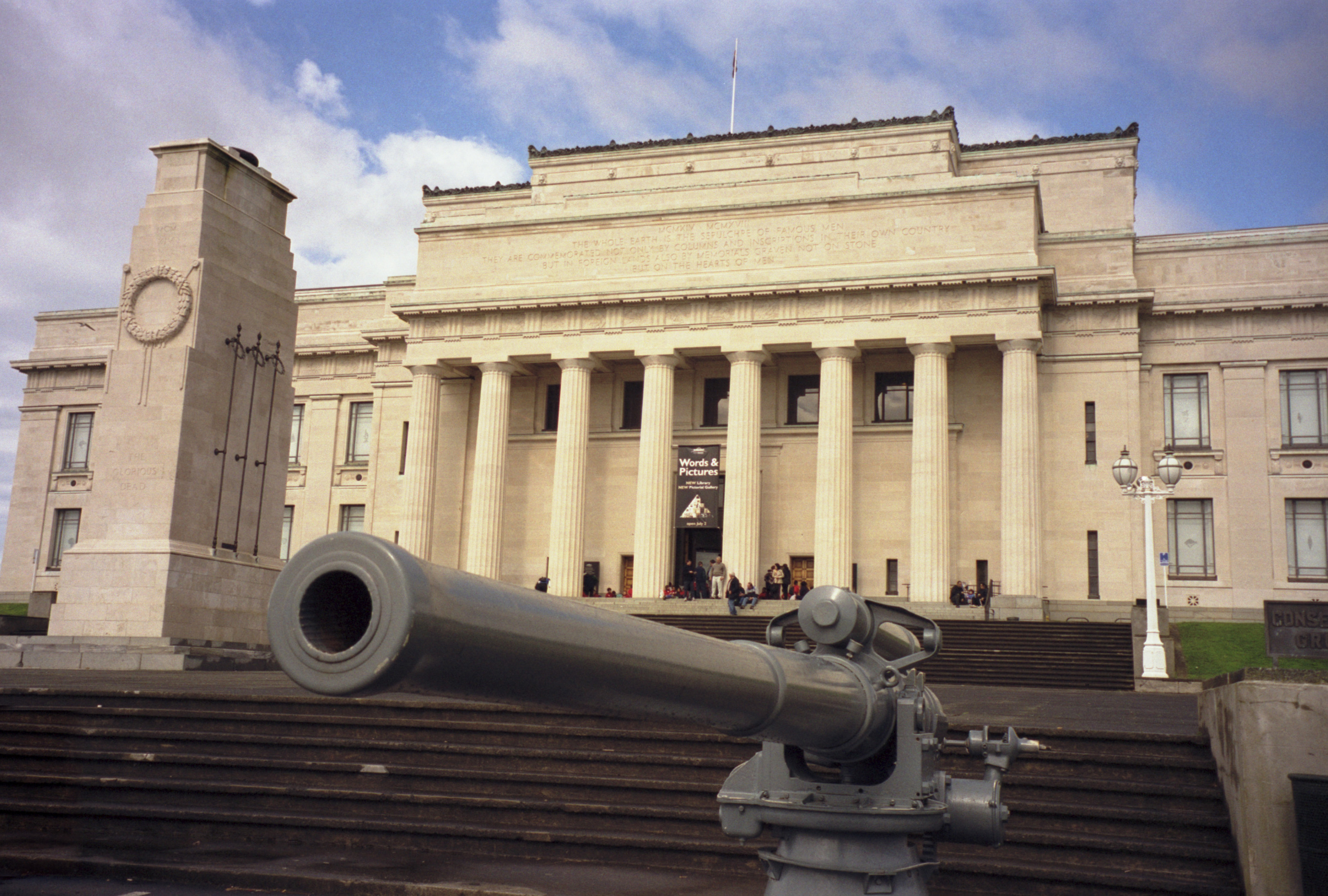
Many national treasures are displayed at the Auckland Art Gallery, such as the work of Colin McCahon, while many other significant cultural artefacts reside at the Auckland War Memorial Museum, the National Maritime Museum, or the Museum of Transport and Technology (MOTAT). Exotic creatures can be observed at the Auckland Zoo and Kelly Tarlton's Underwater World. Movies and rock concerts (notably, the "Big Day Out") are also well patronised.
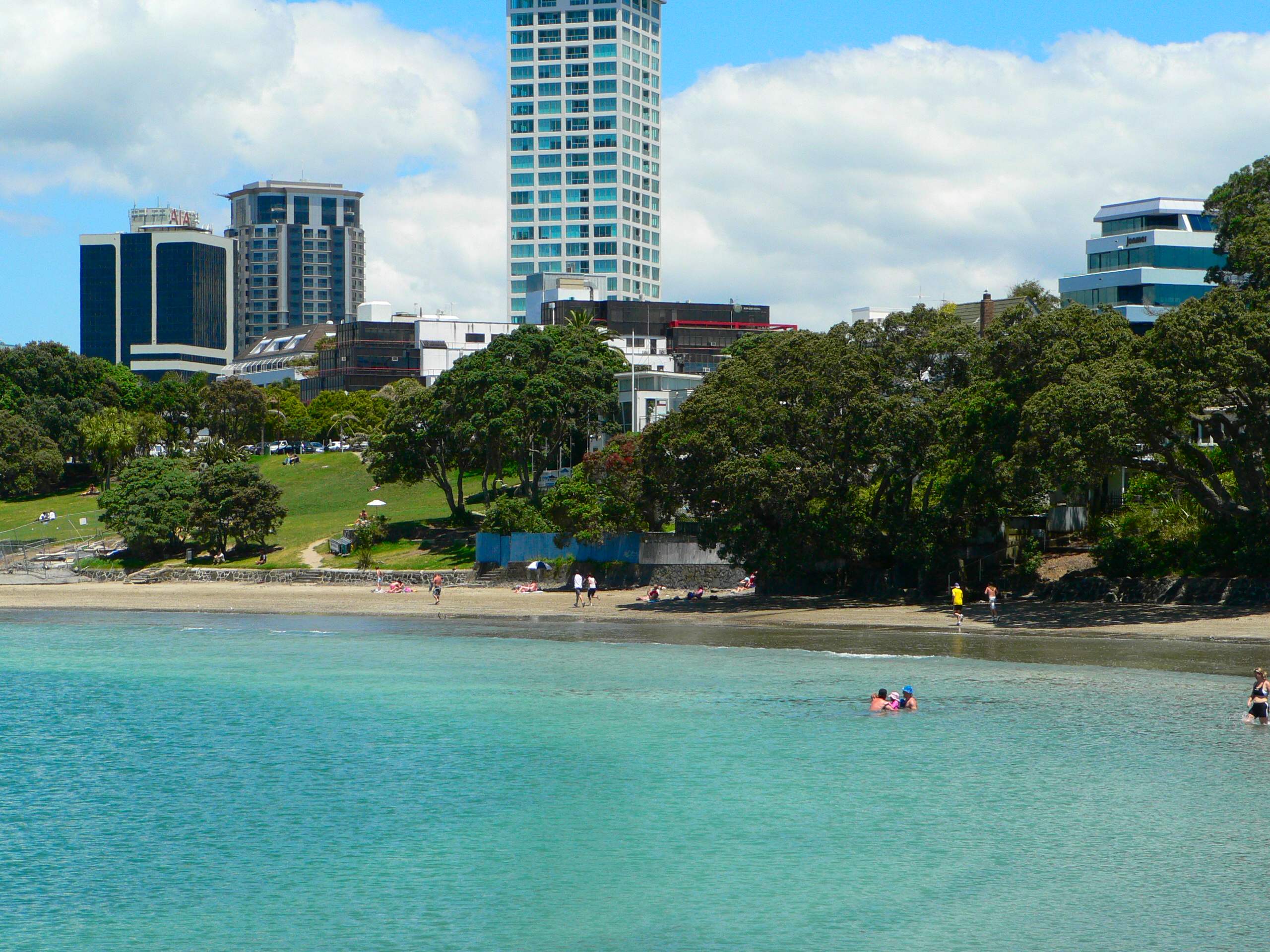
The Waitemata Harbour has popular swimming beaches at Mission Bay, Devonport, Takapuna, and the west coast has popular surf spots such as Piha and Muriwai. Many Auckland beaches are patrolled by surf lifesaving clubs, which are part of Surf Life Saving Northern Region.
Music and arts
The Auckland Festival is a biennial event that takes place throughout the Auckland region. It features local and international music, dance, theatre and visual arts.
The Auckland Philharmonia Orchestra is the region's resident full time symphony orchestra, performing its own series of concerts and accompanying opera, ballet and visiting artists like Luciano Pavarotti, Burt Bacharach, Meat Loaf, Nigel Kennedy and the orchestra's patron Dame Kiri Te Kanawa.
The Auckland Art Gallery Toi o Tāmaki, is considered the home of the visual arts in New Zealand with a collection of over 14,000 artworks, including prominent New Zealand artists and has been[when?] promised a gift of fifteen works of art by New York art collectors and philanthropists Julian and Josie Robertson—including well-known paintings by Paul Cézanne, Pablo Picasso, Henri Matisse, Paul Gauguin and Piet Mondrian. This is the largest gift ever made to an art museum in Australasia.
Parks and nature
 Albert Park, Auckland, located in downtown Auckland
 View from the top of Mount Eden/Maungawhau.
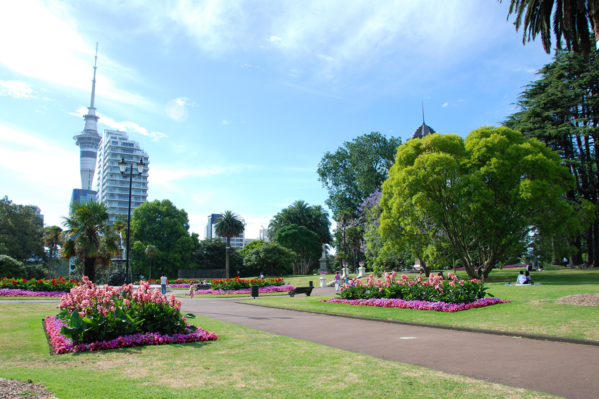
Auckland Domain is one of the largest parks in the city, close to the Auckland CBD and having a good view of the Hauraki Gulf and Rangitoto Island. Smaller parks close to the city centre are Albert Park, Myers Park, Western Park and Victoria Park.
While most volcanic cones in the Auckland Volcanic Field have been affected by quarrying, many of the remaining cones are now within parks, and retain a more natural character than the surrounding city. Prehistoric earthworks and historic fortifications are in several of these parks, including Mount Eden, North Head and One Tree Hill (Maungakiekie).
Other parks around the city are in Western Springs, which has a large park bordering the MOTAT museum and the Auckland Zoo. The Auckland Botanic Gardens are further south, in Manurewa.
Ferries provide transport to parks and nature reserves at Devonport, Waiheke Island, Rangitoto Island and Tiritiri Matangi. The Waitakere Ranges Regional Park to the west of Auckland offers beautiful and relatively unspoiled bush territory, as do the Hunua Ranges to the south.
Sport
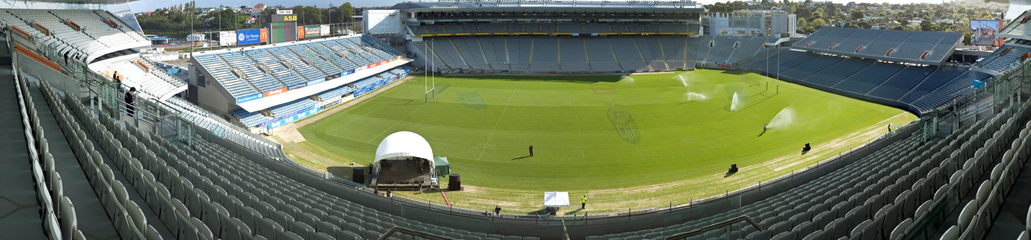
 Eden Park Stadium.
 Eden Park Stadium after redevelopment in 2011.
- Locations
Rugby union, rugby league, soccer, cricket and netball are widely played and followed. Auckland has a considerable number of rugby union and cricket grounds, and venues for motorsports, tennis, badminton, netball, swimming, soccer, rugby league, and many other sports.
- Eden Park is the city's primary stadium and a frequent home for international rugby union and cricket matches, in addition to Super Rugby matches where the Blues play their home games.
- North Harbour Stadium is mainly used for rugby union and soccer matches, but is also used for concerts.
- Mt Smart Stadium is used mainly for rugby league matches and is home to the New Zealand Warriors of the NRL, and is also used for concerts, hosting the Auckland stop of the Big Day Out music festival every January.
- ASB Tennis Centre is Auckland's primary tennis centre, hosting international tournaments for men (Heineken Open) and women (ASB Classic) in January each year.
- Vector Arena is an indoor arena. It is primarily used for concerts and international netball matches.
- Trusts Stadium is an indoor arena which primarily hosts netball matches, and is the home of the Northern Mystics of the ANZ Championship. It is also where the 2007 Netball World Championships were held.
- North Shore Events Centre is an indoor arena, primarily used for basketball. It is home to the New Zealand Breakers.
- Main teams
- Formerly the Auckland Blues, the Blues, a team in Super Rugby. Auckland is also home to three ITM Cup rugby teams: Auckland, North Harbour and Counties Manukau.
- Previously the Auckland Warriors, the New Zealand Warriors is a team in Australia's NRL competition. They play their home games at Mt Smart Stadium in Auckland.
- Auckland's first class cricket team, the Auckland Aces play their home matches at Colin Maiden Park.
- Auckland City and Waitakere United are football teams which play in the ASB Premiership.
- The Northern Mystics netball team compete in the ANZ Championship and play their home games at Trusts Stadium.
- The New Zealand Breakers is a team in the NBL and play their home matches at the North Shore Events Centre
- Major events
Annual sporting events include:
- The Heineken Open and ASB Classic men's and women's Tennis events, held annually in January.
- The Auckland Marathon (and half-marathon), an annual marathon which draws thousands of competitors.
- The Auckland Harbour Crossing Swim swim from the North Shore to the Viaduct Basin, Auckland CBD, is a yearly summer event, covering 2.8 km (often with some considerable counter-currents) and attended by over a thousand mostly amateur competitors. It is New Zealand's largest ocean swim.[40]
- The 'Round the Bays' fun-run, starting in the city and going 8.4 kilometres (5.2 mi) along the waterfront to the suburb of St Heliers. It attracts many tens of thousands of people and has been an annual March event since 1972.
Auckland hosted the 1950 British Empire Games and the 14th Commonwealth Games in 1990,[10] and will host a number of matches (including the semi-finals and the final) of the 2011 Rugby World Cup.[41]
Economy
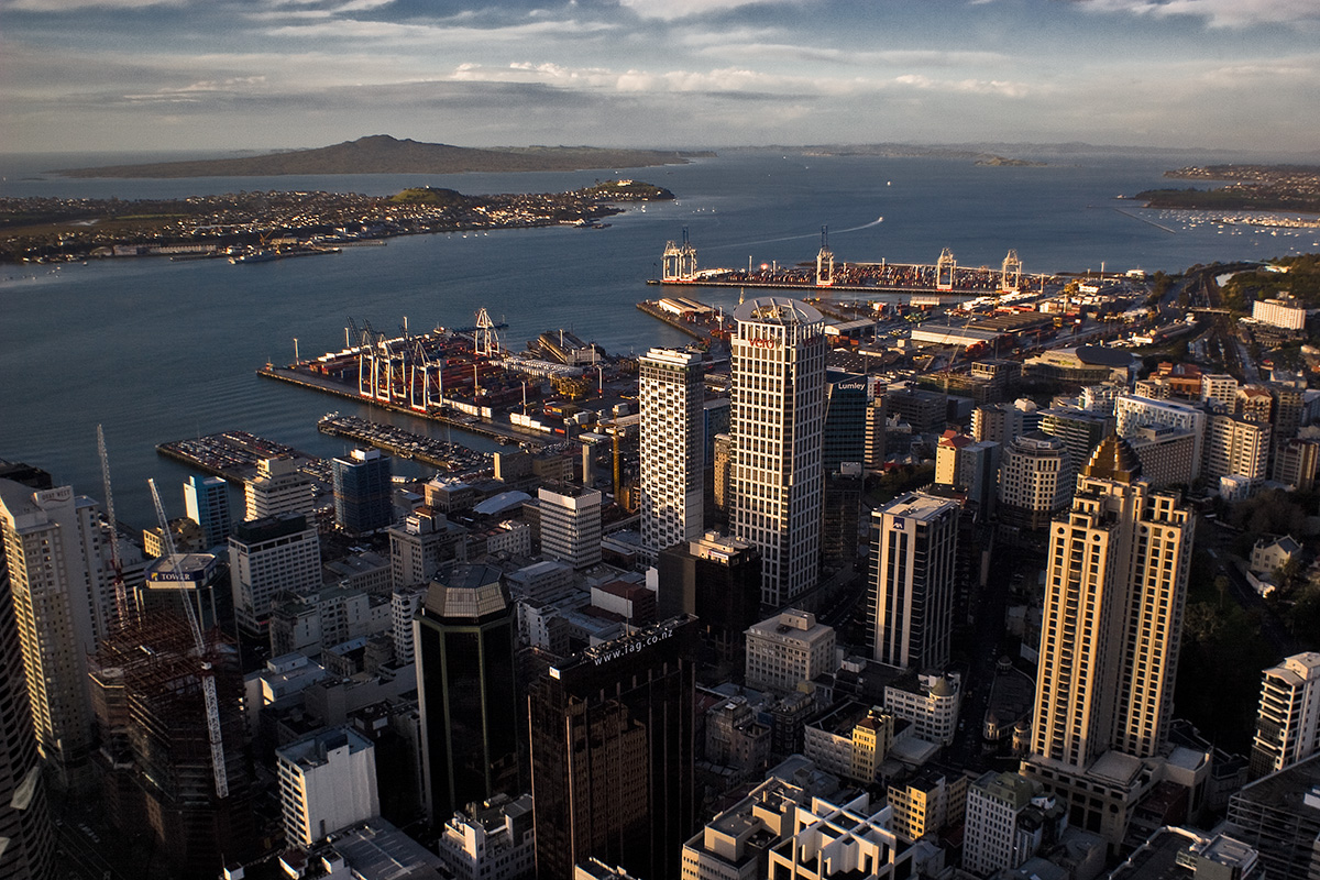
 View of Auckland CBD from Waitemata Harbour.
Most major international corporations have an Auckland office, as the city is the economic capital of the nation. The most expensive office space is around lower Queen Street and the Viaduct Basin in the Auckland CBD, where many financial and business services are located, which make up a large percentage of the CBD economy.[42] A large proportion of the technical and trades workforce is based in the industrial zones of South Auckland.
The largest commercial and industrial areas of Greater Auckland are in the southeast of Auckland City and the western parts of Manukau City, mostly bordering the Manukau Harbour and the Tamaki River estuary.
The sub-national GDP of the Auckland region was estimated at US$47.6 billion in 2003, 36% of New Zealand's national GDP, 15% greater than the entire South Island.[43]
Auckland's status as the largest commercial centre of the country reflects in the high median personal income (per working person, per year) which was NZ$44,304 (approx. US$33,000) for the region in 2005, with jobs in the Auckland CBD often earning more.[44] The median personal income (for all persons older than 15 years of age, per year) was NZ$22,300 (2001),[45] behind only North Shore City (also part of the Greater Auckland area) and Wellington. While office workers still account for a large part of Auckland's commuters, large office developments in other parts of the city, for example in Takapuna or Albany, both on the North Shore, are slowly becoming more common, reducing concentration on the Auckland CBD somewhat.
Education
 The University of Auckland clock tower building is a 'Category I' historic place, completed in 1926.[46]
Auckland has a number of important educational institutions, including some of the largest universities in the country. Auckland is a major centre of overseas language education, with large numbers of foreign students (particularly East Asians) coming to the city for several months or years to learn English or study at universities - although numbers New Zealand-wide have dropped substantially since peaking in 2003.[47] As of 2007, there are around 50 NZQA certified schools and institutes teaching English in the Auckland area.[48]
Amongst the more important tertiary educational institutes are the University of Auckland, Auckland University of Technology, Massey University, Manukau Institute of Technology and Unitec New Zealand.
Housing
Housing varies considerably between some suburbs having state owned housing in the lower income neighbourhoods, to palatial waterfront estates, especially on the Waitemata. Traditionally, the most common residence of Aucklanders was a bungalow on a 'quarter acre' (1,000 m²).[49] However, subdividing such properties with 'infill housing', has long been the norm. Aucklanders' housing preferences resulting from a lack of apartments and poor public transport has resulted in a large urban sprawl and reliance on motor vehicles. This will probably continue, as the vast majority of Aucklanders live in low-density housing, which is expected to remain at up to 70% of the total share even in 2050.[49]
In some areas, the Victorian villas are being increasingly torn down to make way for large plaster mansions with tennis courts and swimming pools. The demolition of the older properties is being combated by the Auckland City Council passing laws that cover heritage suburbs or streets. Auckland has been described as having 'the most extensive range of timbered housing with its classical details and mouldings in the world', many of them Victorian-Edwardian style houses.[50]
Government
Local
See also: Auckland Region and Auckland Council Auckland waterfront.
The Auckland Council is the local authority with jurisdiction over the city of Auckland, along with surrounding rural areas, parkland, and the islands of the Hauraki Gulf.
From 1989 to 2010 Auckland was governed by several separate city and district councils. In the late 2000s, New Zealand's central government and parts of Auckland's society felt that this large number of councils, and the lack of strong regional government (with the Auckland Regional Council having only limited powers) were hindering Auckland's progress. A Royal Commission on Auckland Governance was set up in 2007,[51][52] and in 2009 recommended a unified local governance structure for Auckland, amalgamating the councils.[53] Government subsequently announced that a "super city" would be set up with a single mayor by the time of New Zealand's local body elections in 2010.[54][55] Many aspects of the reorganisation were or are still controversial, from matters such as the form of representation for Maori, the inclusion or exclusion of rural council areas in the super city, to the role of council-controlled organisations that are intended to place much of the day to day business of council services at arms length from the elected Council.
In October 2010, Manukau City mayor Len Brown was elected the mayor of the amalgamated Auckland Council.
National
Between 1842 and 1865, Auckland was the capital city of New Zealand. Parliament met in what is now Old Government House on the University of Auckland's City campus. The capital was moved to Wellington in 1865.
Auckland, because of its large population, is covered by 21 general electorates and three Maori electorates. Prior to 2008, there were only 20 general electorates, with the new seat of Botany being created in 2008 due to the increase in population around Auckland. As of the 2008 election, thirteen of the seats are held by the governing National Party, eight seats (seven general, one Maori) being held by the opposing Labour Party, one seat by the ACT Party, and two seats (both Maori) by the Maori Party.
Table: Auckland Electorate Members of Parliament Electorate MP Party Auckland Central Nikki Kaye National Botany Pansy Wong National East Coast Bays Murray McCully National Epsom Rodney Hide ACT Helensville John Key National Hunua Paul Hutchison National Mangere Su'a William Sio Labour Manukau East Ross Robertson Labour Manurewa George Hawkins Labour Maungakiekie Peseta Sam Lotu-Iiga National Mt Albert David Shearer Labour Mt Roskill Phil Goff Labour New Lynn David Cunliffe Labour North Shore Wayne Mapp National Northcote Jonathan Coleman National Pakuranga Maurice Williamson National Papakura Judith Collins National Rodney Lockwood Smith National Te Atatu Chris Carter Labour Tāmaki Allan Peachey National Waitakere Paula Bennett National Hauraki-Waikato (Maori) Nanaia Mahuta Labour Tamaki Makaurau (Maori) Pita Sharples Maori Te Tai Tokerau (Maori) Hone Harawira Maori Other
The administrative offices of the Government of the Pitcairn Islands is situated in Auckland.[56]
Transport
 Ferry travel is a popular type of public transport for some Auckland destinations.
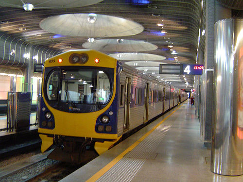
 A MAXX train at Britomart Transport Centre.
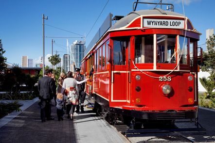
 Tram in the Wynyard Quarter on Auckland's waterfront.Main articles: Transport in Auckland and Public transport in Auckland
Travel modes
- Road and rail
Private vehicles are the main form of transportation within Auckland, with around 7% of journeys in the Auckland region being undertaken by bus (2006 data),[57] and 2% undertaken by train and ferry.[57] Usage is however heavily skewed towards travel to and from the Central Business District, where more than half of trips are undertaken by public transport.[58] Auckland still ranks quite low in this regard, having only 46 public transport trips per capita per year,[58][59] while Wellington has almost twice this number at 91, and Sydney has 114 trips.[60] This strong roading focus results in substantial traffic congestion during peak times.[61]
Bus services in Auckland are mostly radial, with few ring-routes, due to Auckland being on an isthmus. Late-night services (i.e. past midnight) are limited, even on weekends.
Regular trains operating along four lines travel between the CBD and the west, south and south-east of Auckland, with longer-distance options scarce. In 2007 approximately NZ$5.3 billion worth of large-scale projects were underway or planned (and budgeted for) in the Auckland area to improve rail and public transport patronage over the next decade, 31% of the transport budget.[62][63] However, policy changes in early 2009 by the incoming National government have meant a shift in emphasis to more highway construction, and have removed the provision of a regional fuel tax that was to pay for ARTA's public transport upgrades.[64] While the government has promised to fund the rail electrification, the process and associated tenders were delayed by approximately one year, and some rail station upgrades and the funding of the integrated ticketing upgrade were in doubt. The lack of future funding also forced ARTA to hand over the Auckland region's rail stations to government control.[65][66][67]
- Other modes
Auckland's ports are the largest of the country, and a large part of both inbound and outbound New Zealand commerce travels through them, mostly via the facilities northeast of Auckland CBD. Freight usually arrives at or is distributed from the port via road, though the port facilities also have rail access. Auckland is a major cruise ship stopover point, with the ships usually tying up at Princes Wharf. Auckland CBD is connected to coastal suburbs, to the North Shore and to outlying islands by ferry.
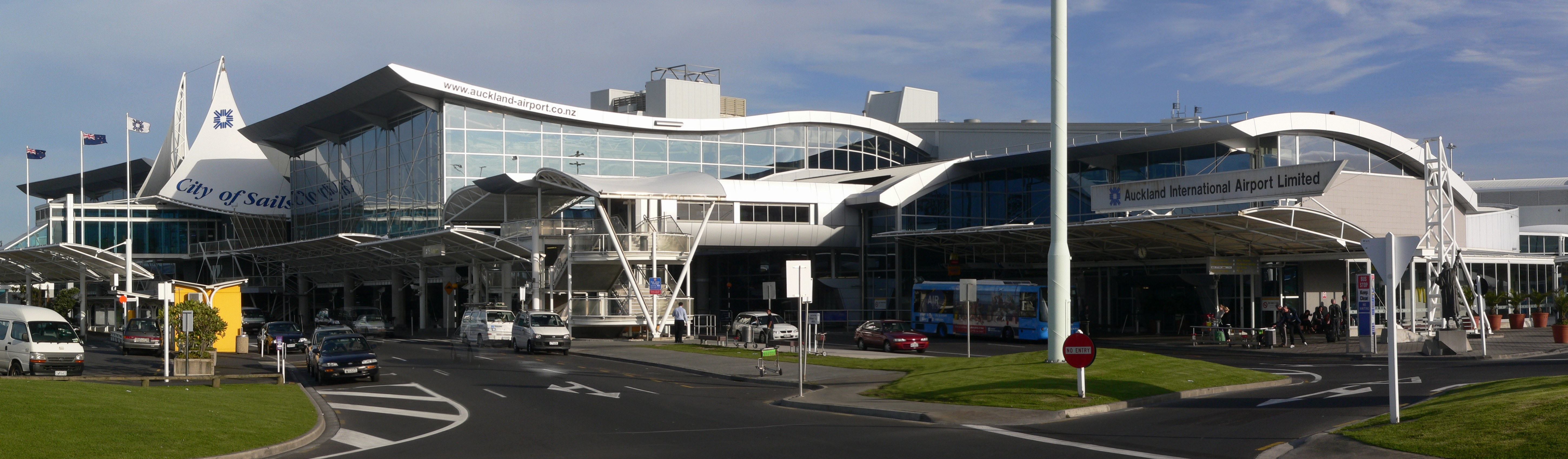
 The International Terminal at Auckland International Airport.
- Air
Auckland has various small regional airports and Auckland Airport, the busiest of the country. Auckland Airport, New Zealand's largest, is in the southern suburb of Mangere on the shores of the Manukau Harbour. There are frequent services to Australia, and to other New Zealand destinations. There are also direct connections to many locations in the South Pacific, to the United States, Asia and to Buenos Aires and Santiago in South America.[68]
- Policies
Research at Griffith University has indicated that in the last 50 years, Auckland has engaged in some of the most pro-automobile transport policies anywhere in the world.[69] With public transport declining heavily during the second half of the 20th century (a trend mirrored in most Western countries such as the US),[70] and increased spending on roads and cars, New Zealand (and specifically Auckland) now has the second-highest vehicle ownership rate in the world, with around 578 vehicles per 1000 people.[71] Auckland has also been called a very pedestrian- and cyclist-unfriendly city, though some efforts are being made to change this.[72] At the same, high-profile gaps in the network, such as the inability for pedestrians and cyclists to cross the Waitemata Harbour, will probably remain for the foreseeable future, with councils generally not considering the costs involved as sensible expense.[73]
 The harbour bridge from the North Shore.
Infrastructure
The State Highway network connects the cities in the Auckland urban area through the Northern, Southern, Northwestern and Southwestern Motorways.
The Auckland Harbour Bridge (Northern Motorway) is the main connection to the North Shore, and also a major traffic bottleneck. The Harbour Bridge does not provide access for rail, pedestrians or cyclists, which has repeatedly (most recently in 2008) led to campaigns for and investigations into retrofitting the structure.
The Central Motorway Junction, also called 'Spaghetti Junction' for its complexity, is the intersection between the two major motorways of Auckland (State Highway 1 and State Highway 16).
Two of the longest arterial roads within Greater Auckland are Great North Road and Great South Road - the main connections in those directions before the construction of the State Highway network.
Auckland has three main railway lines, serving the general western, southern, and central eastern directions from the Britomart Transport Centre in downtown Auckland. It is the terminal station for all lines, and connects them to ferry and bus services.
Electricity
Auckland is New Zealand's largest electricity consumer, consuming around 20% of the country's total electricity. National grid operator Transpower is responsible for the high voltage transmission lines into and across Auckland, while Vector, and in some areas Counties Power, being responsible for most of the sub-transmission and distribution lines. Several companies are responsible for electricity generation and retailing.
Auckland has two major electricity generation stations within the city, both of which are gas-fired turbine station. Otahuhu B is owned by Contact Energy and generates 380MW, while Southdown is owned by Mighty River Power and generates 175MW.
As there is not enough local generation to support the city's electricity needs, and there is very little generation north of the city, most of the electricity needs for the city has to be brought in from the south, mainly from Huntly Power Station and the Waikato River hydroelectric dams. Four major 220 kV transmission lines, and one smaller 110 kV line, bring electricity from the south into Otahuhu substation, where lines radiate out distributing electricity to the city and further north to Northland.
The city has been the site of many notable power outages, mainly caused by failures in aging infrastructure carrying increasing electrical loads as the city grows. The five-week long 1998 Auckland power crisis blacked out much of the CBD after a cascade failure on four underground cables supplying the central city, while the 2006 Auckland Blackout blacked out the CBD and many inner suburbs after an earth wire shackle at Otahuhu substation broke and short-circuited the lines supplying the inner city. In 2009, much of the northern and western suburbs, as well as Northland, experienced a blackout when a forklift accidentally came in contact with the only major line supplying the region.[74]
Transpower is currently spending $1.25 billion upgrading the electricity supply into and around Auckland, to relieve supply constraints and to improve redundancy. A new 220/400 kV line (the Whakamaru to Brownhill Road transmission line) is being built from the Whakamaru hydroelectric dam in South Waikato to Brownhill Road in Whitford, with 220 kV cables connecting it to Pakuranga substation.[75] A 220 kV is also being installed from Pakuranga across the Waitemata Harbour to Albany, via Penrose, and the CBD, to create an alternative route to the north of the city. [76]
Future growth
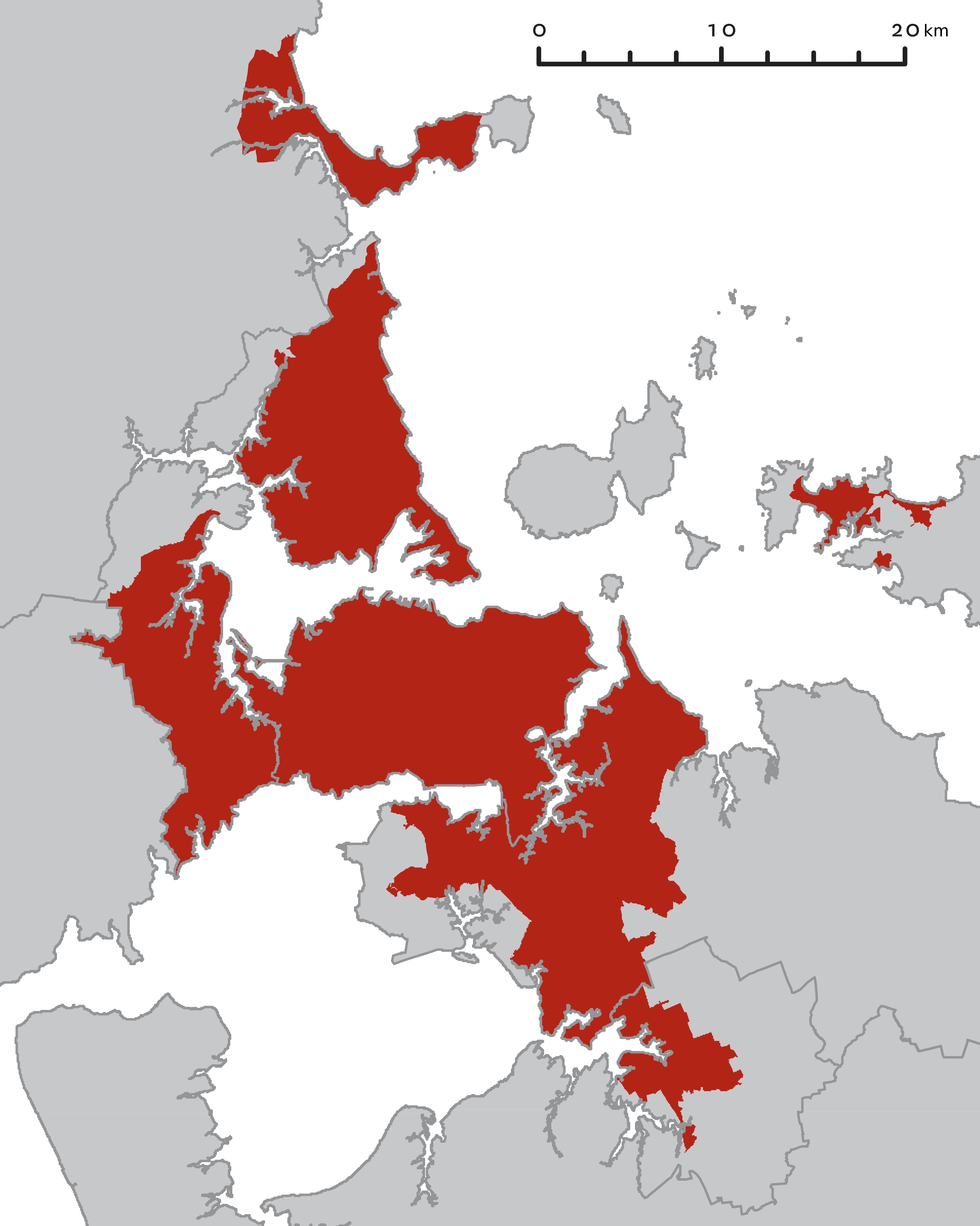
 The urbanised extent of Auckland (red), as of 2009.
Auckland is expecting substantial population growth via immigration and natural population increases (which contribute to growth at about one-third and two-thirds, respectively),[77] and is set to grow to an estimated 1.9 million inhabitants by 2031.[49][78] This substantial increase in population will have a major impact on transport, housing and other infrastructure that is in many cases already considered under pressure. It is also feared by some organisations, such as the Auckland Regional Council, that urban sprawl will result from the growth and, as a result, that it is necessary to address this proactively in planning policy.
A 'Regional Growth Strategy' has been adopted that sees limits on further subdivision and intensification of existing use as its main sustainability measures.[79] This policy is contentious, as it naturally limits the uses of private land, especially the subdivision of urban fringe properties,[80] by setting 'Metropolitan Urban Limits' in planning documents like the District Plan.[81]
According to the 2006 Census projections, the medium-variant scenario shows that the population is projected to continue growing, to reach 1.93 million by 2031. The high-variant scenario shows the region's population growing to over two million by 2031.[82]
Famous sights
 Viaduct Events Centre located on Auckland's waterfront.
Tourist attractions and landmarks in the Auckland metropolitan area include:
- Attractions and buildings
- Auckland Civic Theatre - a famous heritage atmospheric theatre in downtown Auckland. It was renovated in 2000 to its original condition.
- Harbour Bridge - connecting Central Auckland and the North Shore, an iconic symbol of Auckland.
- Auckland Town Hall - with its concert hall considered to have some of the finest acoustics in the world, this 1911 building serves both council and entertainment functions.
- Auckland War Memorial Museum - a large multi-exhibition museum in the Auckland Domain, known for its impressive neo-classicist style.
- Aotea Square - the hub of downtown Auckland beside Queen Street, it is the site of crafts markets, rallies and arts festivals.
- St Patrick's Cathedral - the Catholic Cathedral of Auckland.
- Britomart Transport Centre - the main downtown public transport centre in a historic Edwardian building.
- Eden Park - the city's primary stadium and a frequent home for All Blacks rugby union and Black Caps cricket matches. It was the location of the 2011 Rugby World Cup final.[83]
- Karangahape Road - known as "K' Road", a street in upper central Auckland famous for its bars, clubs, smaller shops and red-light district.
- Kelly Tarlton's Underwater World - a well-known aquarium and Antarctic environment in the eastern suburb of Mission Bay, built in a set of former sewage storage tanks, showcasing penguins, turtles, sharks, tropical fish, sting rays and other marine creatures.
- MOTAT - Auckland's Museum for Transport and Technology, at Western Springs.
- Mt Smart Stadium - a stadium used mainly for rugby league and soccer matches. Also the site of many concerts.
- New Zealand National Maritime Museum - features exhibitions and collections relating to New Zealand maritime history at Hobson Wharf, adjacent to the Viaduct Basin.
- Ponsonby - a suburb and main street immediately west of central Auckland known for arts, cafes, culture and historic villas.
- Queen Street - the main street of the city, from Karangahape Road down to the harbour.
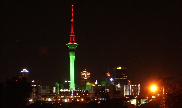
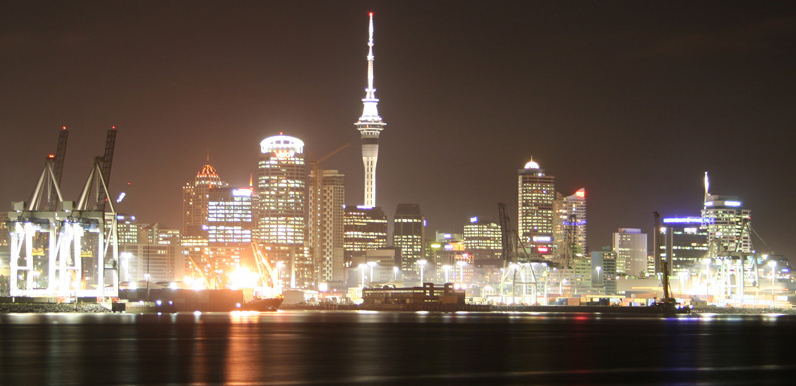
- Sky Tower - the tallest free-standing structure in the Southern Hemisphere, it is 328 m (1,076 ft) tall and has excellent panoramic views.
- Vector Arena - events centre in downtown Auckland completed in 2007. Holding 12,000 people, it is used for sports and concert events.
- Viaduct Basin - a marina and residential development in downtown Auckland, the venue for the America's Cup regattas in 2000 and 2003.
- Western Springs Stadium - a natural amphitheatre used mainly for speedway races, rock and pop concerts.
- Landmarks
- Auckland Domain - one of the largest parks of the city, close to the CBD and having a good view of the harbour and of Rangitoto Island.
- Mount Eden - a volcanic cone with a grassy crater. As the highest natural point in Auckland City, it offers 360-degree views of Auckland and is thus a favorite tourist outlook.
- Mount Victoria - a volcanic cone on the North Shore offering a spectacular view of downtown Auckland. A brisk walk from the Devonport ferry terminal, the cone is steeped in history, as is nearby North Head.
- One Tree Hill (Maungakiekie) - a volcanic cone that dominates the skyline in the southern, inner suburbs. It no longer has a tree on the summit (after a politically motivated attack on the old tree) but is still crowned by an obelisk.
- Rangitoto Island - guards the entrance to Waitemata Harbour, and forms a prominent feature on the eastern horizon.
- Waiheke Island - the second largest island in the Hauraki Gulf and is well known for its beaches, forests, vineyards and olive groves.
See also
- 1998 Auckland power crisis
- Auckland City
- East Auckland
- Jafa (slang term for Aucklander, article also contains a range of Aucklander stereotypes)
- South Auckland
- Suburbs of Auckland
References
- ^ "GEOnet Names Server (GNS)". http://earth-info.nga.mil/gns/html/cntry_files.html. Retrieved August 2006.
- ^ a b "Subnational population estimates at 30 June 2010 (boundaries at 1 November 2010)". Statistics New Zealand. 26 October 2010. http://www.stats.govt.nz/~/media/Statistics/Methods%20and%20Services/Tables/Subnational%20population%20estimates/subpopest2001-10.ashx. Retrieved 7 March 2011.
- ^ "Auckland and around". Rough Guide to New Zealand, Fifth Edition. http://www.roughguides.com/website/travel/destination/content/?titleid=83&xid=idh185804920_0099. Retrieved 16 February 2010.
- ^ http://www.lboro.ac.uk/gawc/world2010t.html | "The World According to GaWC 2008"
- ^ Ferdinand von Hochstetter (1867). New Zealand. pp. 243. http://www.enzb.auckland.ac.nz/document/1867_-_von_Hochstetter%2C_Ferdinand._New_Zealand/CHAPTER_XI%3A_The_Isthmus_of_Auckland.
- ^ Sarah Bulmer. "City without a state? Urbanisation in pre-European Taamaki-makau-rau (Auckland, New Zealand)". Archived from the original on 9 June 2007. http://web.archive.org/web/20070609204236/http://www.arkeologi.uu.se/afr/projects/BOOK/Bulmer/bulmer.pdf. Retrieved 3 October 2007.
- ^ "Ngāti Whātua - European contact". Te Ara Encyclopedia of New Zealand. http://www.teara.govt.nz/NewZealanders/MaoriNewZealanders/NgatiWhatua/3/en. Retrieved 3 October 2007.
- ^ Michael King (2003). The Penguin History of New Zealand. Auckland, N.Z.: Penguin Books. pp. 135. ISBN 0-14-301867-1.
- ^ George Weller’s Claim to lands in the Hauraki Gulf - transcript of original in National Archives, ms-0439/03 (A-H) HC.
- ^ a b What's Doing In; Auckland - The New York Times, 25 November 1990
- ^ Russell Stone (2002). From Tamaki-Makau-Rau to Auckland. University of Auckland Press. ISBN 1869402596.
- ^ Ian E.M. Smith and Sharon R. Allen, Volcanic Hazards: Auckland Volcanic Field, Volcanic Hazards Working Group, Civil Defence Scientific Advisory Committee. Accessed 13 April 2009.
- ^ a b c "Climate Summary for 1971-2000". National Institute of Water and Atmospheric Research. http://www.niwa.co.nz/education-and-training/schools/resources/climate.
- ^ a b "Auckland enjoys hottest day ever". The New Zealand Herald. 12 February 2009. http://www.nzherald.co.nz/nz/news/article.cfm?c_id=1&objectid=10556442. Retrieved 17 September 2011.
- ^ "Snowstorms (PDF)". http://www.civildefence.govt.nz/memwebsite.NSF/Files/Tephra2003-Snowstorms/$file/Tephra2003-Snowstorms.pdf. Retrieved August 2006.
- ^ Wade, Amelia (15 August 2011). "Snow falls in Auckland for first time in decades". The New Zealand Herald. http://www.nzherald.co.nz/nz/news/article.cfm?c_id=1&objectid=10745187. Retrieved 17 September 2011.
- ^ Auckland, the Capital of New Zealand - Swainson, William, Smith Elder, 1853
- ^ "Air pollutants - Fine particles (PM10 and PM2.5)". Auckland Regional Council. http://www.arc.govt.nz/albany/index.cfm?6901EAA9-14C2-3D2D-B939-BF1991A4D1E7. Retrieved 3 August 2009.
- ^ "Air pollutants - Carbon monoxide (CO)". Auckland Regional Council. http://www.arc.govt.nz/environment/air-quality/air-pollutants/carbon-monoxide.cfm. Retrieved 3 August 2009.
- ^ "Auckland's air quality". Auckland Regional Council. http://www.arc.govt.nz/environment/air-quality/aucklands-air-quality/aucklands-air-quality_home.cfm. Retrieved 3 August 2009.
- ^ "Climate Data and Activities". NIWA Science. http://www.niwascience.co.nz/edu/resources/climate/.
- ^ "New Zealand - A Regional Profile - Auckland" (PDF). Statistics New Zealand. 1999. pp. 19–20. Archived from the original on 25 October 2007. http://web.archive.org/web/20071025142501/http://www.stats.govt.nz/NR/rdonlyres/7F0D2AFF-54F4-4CE9-BE7C-974597403FCB/0/Auckland.pdf. Retrieved 3 October 2007.
- ^ Residence in New Zealand (PDF) (Page 8, from the Immigration New Zealand website. Accessed 20 May 2011.)
- ^ 2001 Regional Summary (from the Statistics New Zealand website)
- ^ a b Quickstats about Auckland Region
- ^ Pope Shenouda III visits New Zealand (from Te Ara Encyclopedia of New Zealand. Accessed 25 May 2008.)
- ^ "What we look like locally". Statistics New Zealand. p. 7. http://www.stats.govt.nz/NR/rdonlyres/D5B067F9-7A06-483D-A6B9-D438E81ABAC2/0/AucklandCity.pdf.
- ^ "Auckland Hebrew Community ~ Introduction page". Archived from the original on 26 May 2008. http://web.archive.org/web/20080526162039/http://www.ahc.org.nz/intro.php. Retrieved 18 September 2008.
- ^ "Auckland Council - History In The Making". Our Auckland. Auckland Council: p. 5. March 2011.
- ^ Central Transit Corridor Project (Auckland City website, includes mention of effects of transport on public satisfaction)
- ^ "Crime and safety profile - 2003". Auckland City Council. Archived from the original on 26 June 2007. http://web.archive.org/web/20070626092351/http://www.aucklandcity.govt.nz/auckland/introduction/safer/crimesafety/police.asp. Retrieved 8 June 2007.
- ^ City Mayors: Best cities in the world (Mercer)
- ^ Quality of Living global city rankings 2009 (Mercer Management Consulting, Accessed 2 May 2009).
- ^ City Mayors: World's richest cities (UBS via www.citymajors.com website, August 2006)
- ^ "Auckland, Wellington, among 'best value' cities in the world". The New Zealand Herald. 29 June 2010. http://www.nzherald.co.nz/business/news/article.cfm?c_id=3&objectid=10655269. Retrieved 9 July 2010.
- ^ Punters love City of Sails - The New Zealand Herald, Saturday 14 October 2006
- ^ a b Passion for boating runs deep in Auckland - The New Zealand Herald, Thursday 26 January 2006
- ^ "The Hauraki Gulf Marine Park, Part 2". Inset to The New Zealand Herald: p. 4. 2 March 2010.
- ^ [Sailing Club] directory (from the yachtingnz.org website)
- ^ Harbour Crossing (from the Auckland City Council website. Retrieved 24 October 2007.)
- ^ "Eden Park to host Final and Semi-Finals". 22 February 2008. http://www.nzrugbyworldcup.com/RugbyWorldCup.aspx.
- ^ Auckland's CBD at a glance (CBD website of the Auckland City Council)
- ^ "Regional Gross Domestic Product". Statistics New Zealand. 2007. http://www.stats.govt.nz/reports/analytical-reports/regional-gross-domestic-product.aspx. Retrieved 18 February 2010.
- ^ Auckland Regional Profile (from labourmarket.co.nz, composed from various sources)
- ^ Comparison of New Zealand's cities (from ENZ emigration consulting)
- ^ Heritage Sites to Visit: Auckland City. New Zealand Historic Places Trust. Retrieved 6 November 2008.
- ^ Survey of English Language Providers - Year ended March 2006 (from Statistics New Zealand. Auckland is assumed to follow national pattern)
- ^ English Language Schools in New Zealand - Auckland (list linked from the Immigration New Zealand website)
- ^ a b c Executive Summary (PDF) (from the Auckland Regional Growth Strategy document, ARC, November 1999. Retrieved 14 October 2007.)
- ^ Section 7.6.1.2 - Strategy (PDF) (from the Auckland City Council District Plan - Isthmus Section)
- ^ Auckland governance inquiry welcomed - NZPA, via 'stuff.co.nz', Tuesday 31 July 2007. Retrieved 29 October 2007.
- ^ Royal Commission of inquiry for Auckland welcomed - NZPA, via 'infonews.co.nz', Tuesday 31 July 2007. Retrieved 29 October 2007
- ^ Minister Releases Report Of Royal Commission - Scoop.co.nz, Friday 27 March 2009
- ^ Gay, Edward (7 April 2009). "'Super city' to be in place next year, Maori seats axed". The New Zealand Herald. http://www.nzherald.co.nz/nz/news/article.cfm?c_id=1&objectid=10565528.
- ^ "Making Auckland Greater" (PDF). 7 April 2009. http://media.nzherald.co.nz/webcontent/document/pdf/Making%20Ak%20Greater%20final%20media.pdf.
- ^ "Home." Government of the Pitcairn Islands. Retrieved on October 31, 2011.
- ^ a b Auckland Transport Plan - June 2007. Auckland Regional Transport Authority. 2007. pp. 8. http://www.arta.co.nz/assets/arta%20publications/publications%20page/Auckland%20Transport%20Plan%20June%202007%20-%20section%202.pdf.
- ^ a b http://www.arta.co.nz/assets/board%20papers/2010/MBR%20June%202010.pdf
- ^ http://www.stats.govt.nz/methods_and_services/access-data/tables/subnational-pop-estimates.aspx
- ^ Auckland's Transport Challenges (from the Draft 2009/10-2011/12 Auckland Regional Land Transport Programme, Page 8, ARTA, March 2009. Accessed 10 April 2009.
- ^ Welcome to our traffic nightmare - The New Zealand Herald, Sunday 29 July 2007
- ^ References provided in Transport in Auckland and Public transport in Auckland
- ^ Auckland Transport Plan landmark for transport sector (from the Auckland Regional Transport Authority website, 11 August 2007)
- ^ Hopes of electric trains for cup fade - The New Zealand Herald, Wednesday 18 March 2009
- ^ Council to give up its rail stations - The New Zealand Herald, Saturday 21 March 2009
- ^ The $2b road ahead - The Dominion Post, unknown date. Accessed 6 April 2009.
- ^ Rail 'trench' worries New Lynn - The New Zealand Herald, Friday 20 March 2009
- ^ Auckland Airport, http://www.aucklandairport.co.nz/
- ^ 2006.pdf Backtracking Auckland: Bureaucratic rationality and public preferences in transport planning - Mees, Paul; Dodson, Jago; Urban Research Program Issues Paper 5, Griffith University, April 2006
- ^ US Urban Personal Vehicle & Public Transport Market Share from 1900 (from publicpurpose.com, a website of the Wendell Cox Consultancy)
- ^ Sustainable Transport North Shore City Council website
- ^ Big steps to change City of Cars - The New Zealand Herald, Friday 24 October 2008
- ^ Cycleway for bridge could prove too pricey - The New Zealand Herald, Wednesday 3 September 2008
- ^ "Forklift sparks blackout for thousands - tvnz.co.nz". Television New Zealand. 30 October 2009. http://tvnz.co.nz/national-news/forklift-sparks-blackout-thousands-3102479. Retrieved 25 July 2011.
- ^ "North Island Grid Upgrade - Grid New Zealand". Transpower New Zealand Limited. http://www.gridnewzealand.co.nz/nigup-home. Retrieved 25 July 2011.
- ^ "North Auckland and Northland Grid Upgrade Project - Grid New Zealand". Transpower New Zealand Limited. http://www.gridnewzealand.co.nz/naan-home. Retrieved 25 July 2011.
- ^ Can We Stop growth? (from the ARC website)
- ^ Mapping Trends in the Auckland Region Statistics New Zealand, 2010. Retrieved 2010)
- ^ From Urban Sprawl to Compact City: an analysis of Auckland's Urban Growth Management Strategies - Arbury, Joshua - MA Thesis, University of Auckland
- ^ Green belt under siege - The New Zealand Herald, Saturday 28 April 2007
- ^ Growth Strategy: Glossary and References (PDF) (from the Auckland City Council)
- ^ "Mapping Trends in the Auckland Region". Statistics New Zealand. http://www.stats.govt.nz/Publications/PopulationStatistics/mapping-trends-in-the-auckland-region/population-change.aspx. Retrieved 11 March 2010.
- ^ "Venue allocation options a challenge". Official RWC 2011 Site. http://www.rugbyworldcup.com/destinationnewzealand/news/newsid=2026277.html. Retrieved 11 March 2010.
Further reading
- Gordon McLauchlan (1992). The Illustrated Encyclopedia of New Zealand. David Bateman Ltd, Glenfield, NZ. ISBN 1-86953-007-1.
- Settlers-NZ immigrants 1800-1945,J Phillips and T Hearn, Aulandk University Press,2008.
External links
- Auckland - Visitor-oriented official website
- Auckland Travel Guide - NewZealand.com (New Zealand's Official Visitor Guide and Information)
- Auckland in Te Ara the Encyclopedia of New Zealand
- Maps & Aerial Photos (from the ARC map website)
 New Zealand topics
History 
Geography Time zones · Environment · National Parks · Marine reserves · Islands · Lakes · Rivers · Caves · Cities · Towns · BiodiversityGovernance Politics Economy Society Culture Māori culture · Māori language · NZ English · Art · Cinema · Kiwi (people) · Literature · Music · Sport · Public holidaysMain cities Wellington (capital) · Auckland (largest) · Christchurch · Hamilton · Dunedin · Tauranga · Napier-Hastings · Palmerston NorthCommonwealth Games host cities 1930: Hamilton • 1934: London • 1938: Sydney • 1950: Auckland • 1954: Vancouver • 1958: Cardiff • 1962: Perth • 1966: Kingston • 1970: Edinburgh • 1974: Christchurch • 1978: Edmonton • 1982: Brisbane • 1986: Edinburgh • 1990: Auckland • 1994: Victoria • 1998: Kuala Lumpur • 2002: Manchester • 2006: Melbourne • 2010: Delhi • 2014: Glasgow • 2018: "Gold Coast •
Categories:- Host cities of the Commonwealth Games
- Auckland
- Populated places established in 1840
- Port cities in New Zealand
- Populated coastal places in New Zealand
- Isthmuses
- Former national capitals of New Zealand


Wikimedia Foundation. 2010.