- 2005 Pacific typhoon season
Infobox hurricane season
Basin=WPac
Year=2005
Track=2005 Pacific typhoon season summary.jpg
First storm formed=January 13 ,2005
Last storm dissipated=December 20 ,2005
Strongest storm name=Haitang
Strongest storm pressure=920
Strongest storm winds=140
Average wind speed=10
Total storms=23 official, 1 unofficial
Total hurricanes=13
Total intense=3 (unofficial)
Fatalities=328
five seasons=2003, 2004, 2005, 2006, 2007|}The 2005 Pacific typhoon season had no official bounds; it ran year-round in 2005, but mosttropical cyclones tend to form in the northwesternPacific Ocean between May and November. [http://www.typhoon2000.ph/garyp_mgtcs/may03sum.txt] These dates conventionally delimit the period of each year when most tropical cyclones form in the northwesternPacific Ocean .The scope of this article is limited to the Pacific Ocean, north of the equator and west of the
international date line . Storms that form east of the date line and north of the equator are called hurricanes; see2005 Pacific hurricane season . Tropical storms that form in the West Pacific basin are assigned a name by theJapan Meteorological Agency . Tropical depressions in this basin have the "W" suffix added to their number. Tropical depressions that enter or form in the Philippine area of responsibility are assigned a name by thePhilippine Atmospheric, Geophysical and Astronomical Services Administration or PAGASA. This can often result in the same storm having two names.This season, the circular list of 140 names, in use since
January 1 ,2000 , was recycled following the formation of Typhoons Saola; the final name on the list, and Damrey; the first name on the list.torms
Please note that on the following list, storms are listed by Tropical Depression number, and therefore Saola (18W), which is on the naming list before Damrey (17W), is listed after Damrey, having been the later storm to form, despite being the earlier to attain Tropical Storm status. Also, windspeed advisories differ from the Joint Typhoon Warning Center to the Japan Meteorological Agency as the JTWC uses the U.S. criteria of 1 minute mean to designate maximum sustained winds, while the JMA uses the 10-minute mean wind criteria to designate tropical cyclone maximum sustained winds. This difference generally means that JTWC maximum winds will appear to be higher than the maximum winds described by the JMA for the same cyclone.
evere Tropical Storm Kulap
Infobox Hurricane Small
Basin=WPac
Track=Kulap 2005 track.pngJanuary 15
Dissipated=January 19
10-min winds=50
1-min winds=65
Pressure=985rose .*University of Hawaii's tracking chart of [http://www.solar.ifa.hawaii.edu/Tropical/GifArchive/KULAP-05.gifTropical Storm Kulap] .
evere Tropical Storm Roke (Auring)
Infobox Hurricane Small
Basin=WPac
Track=Roke 2005 track.pngMarch 15
Dissipated=March 17
10-min winds=55
1-min winds=80
Pressure=980* Typhoon 2000's tracking chart of [http://www.typhoon2000.ph/stormarchives/2005/trax/auring05_01tx.gifTyphoon Roke (Auring)] .
Typhoon Sonca (Bising)
Infobox Hurricane Small
Basin=WPac
Track=Sonca 2005 track.pngApril 23
Dissipated=April 27
10-min winds=90
1-min winds=115
Pressure=935*Typhoon 2000's tracking chart of [http://www.typhoon2000.ph/stormarchives/2005/trax/bising05_02tx.gifTyphoon Sonca (Bising)] .
Typhoon Nesat (Dante)
Infobox Hurricane Small
Basin=WPac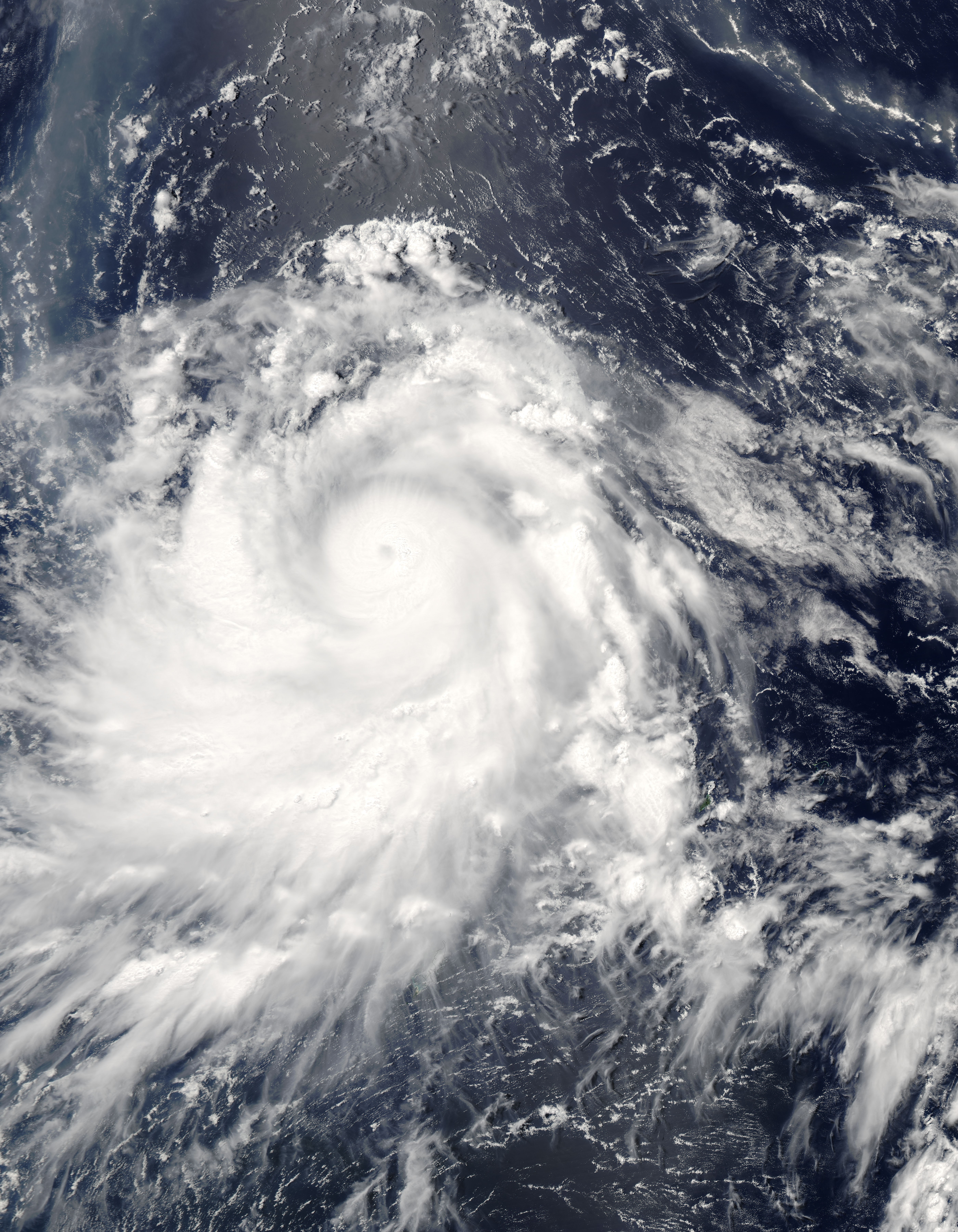
Track=Nesat 2005 track.pngMay 31
Dissipated=June 11
10-min winds=95
1-min winds=125
Pressure=930May 30 about 290 nautical miles (540 km) south-southeast of Guam as Tropical Depression 04W. It was quickly upgraded to Tropical Storm Nesat overnight at 1800 UTC (0200PHT May 31 ). "Nesat" is a Cambodian word for fisherman. On the evening ofJune 1 , it strengthened into Typhoon Nesat. OnJune 2 , it entered the Philippine area of responsibility and was assigned the name Dante for Philippine warnings. Typhoon Nesat (Dante) quickly grew to a Category 4 storm as it approached the Philippines, but it curved away to the northeast and did not pose a threat to land. Waxing and waning in strength it eventually became extratropical southeast of Honshū, Japan at tropical storm strength on the morning ofJune 10 at 0000 UTC (0900 JST).* Typhoon 2000's tracking chart of [http://www.typhoon2000.ph/stormarchives/2005/trax/dante05_04tx.gifTyphoon Nesat (Dante)] .
Typhoon Haitang (Feria)
Infobox Hurricane Small
Basin=WPac
Track=Haitang 2005 track.pngJuly 13
Dissipated=July 20
10-min winds=105
1-min winds=140
Pressure=920July 11 as a poorly organized depression about 110 nautical miles (280 km) west of Marcus Island, Japan at 1200 UTC (2000 JST). By 1800 UTC (0300 JSTJuly 13 ), it had reached tropical storm strength and was named Haitang, a Chinese name for flowering crabapple. It grew to typhoon strength at 1800 UTC (0300 JSTJuly 14 ) the following day. As it moved westward it continued to gain in strength, reaching Category three status as it entered the Philippine area of responsibility. PAGASA named the storm Feria for Philippine warnings onJuly 15 . ByJuly 16 , the storm continued tracking west and became a threat toTaiwan and Japan'sSakishima Islands . Haitang strengthened into a Category 5 super typhoon. OnJuly 17 it weakened to a Category 3 as it continued west, sparing Sakishima a direct hit but aiming directly for Taiwan. Typhoon Haitang made landfall nearHualien ,Taiwan at 0000 UTC (0800 HKT) on the morning ofJuly 18 . Taking a full day to cross the island and over the interior mountains, it caused flash floods and landslides killing four people. Weakening to a tropical storm as it entered the South China Sea, it reorganized into a minimal typhoon as it approached the southeast China coast. Haitang made landfall for the second time nearWenzhou China onJuly 19 at 1200 UTC (2000 HKT). Moving inland, it rapidly lost its strength and dissipated. PAGASA stopped issuing advisories for the storm nearJiangxi onJuly 20 .
* University of Hawaii's tracking chart of [http://www.solar.ifa.hawaii.edu/Tropical/GifArchive/HAITANG-05.gifSuper Typhoon Haitang (Feria)] .Tropical Storm Nalgae
Infobox Hurricane Small
Basin=WPac
Track=Nalgae 2005 track.pngJuly 20
Dissipated=July 24
10-min winds=45
1-min winds=55
Pressure=990Wake Island on the morning ofJuly 20 . "Nalgae" is a Korean word for wing. Nalgae did not reach typhoon intensity or threaten land. It turned to the north and then east, avoiding Japan.
* University of Hawaii's tracking chart of [http://www.solar.ifa.hawaii.edu/Tropical/GifArchive/NALGAE-05.gifTropical Storm Nalgae] .evere Tropical Storm Banyan
Infobox Hurricane Small
Basin=WPac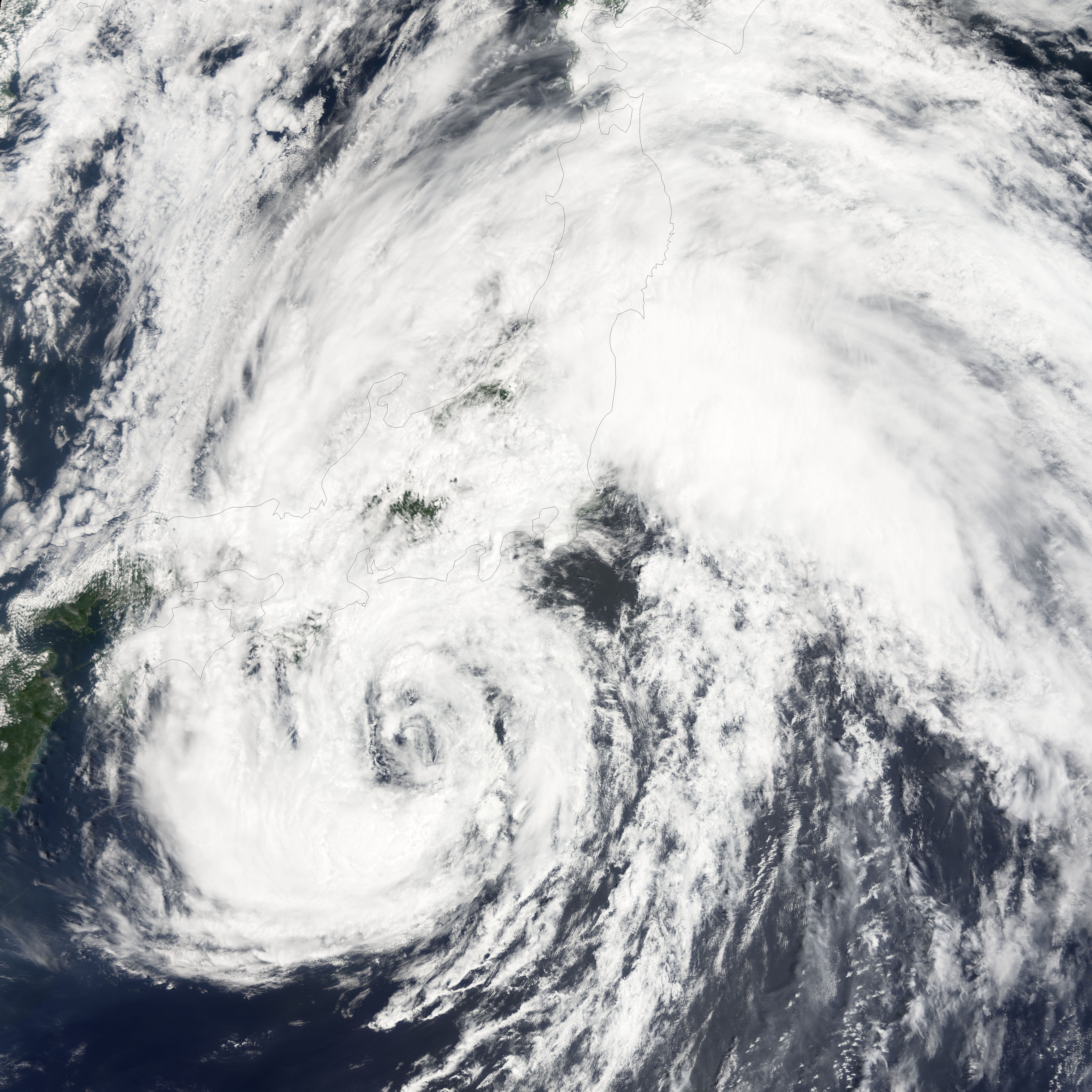
Track=Banyan 2005 track.pngJuly 21
Dissipated=July 28
10-min winds=55
1-min winds=60
Pressure=975Yap Island on the evening ofJuly 21 at 1200 UTC (2100 JST). "Banyan" is a tree common in India and southern China. Banyan brushed the southern and eastern coasts ofHonshū, Japan onJuly 26 . It became extratropical off the northeastern coast ofHonshū onJuly 27 .
* University of Hawaii's tracking chart of [http://www.solar.ifa.hawaii.edu/Tropical/GifArchive/BANYAN-05.gifTropical Storm Banyan] .Tropical Storm Washi
Infobox Hurricane Small
Basin=WPac
Track=Washi 2005 track.pngJuly 29
Dissipated=July 31
10-min winds=45
1-min winds=45
Pressure=985Hong Kong . "Washi" is a Japanese word for the constellation Aquila. The storm moved west towardsHainan . Tropical Storm Washi made its first landfall near Xinglong, Hainan. After re-entering the Gulf of Tonkin, the storm made its final landfall near Nam Dinh,Vietnam .* University of Hawaii's tracking chart of [http://www.solar.ifa.hawaii.edu/Tropical/GifArchive/WASHI-05.gifTropical Storm Washi] .
Typhoon Matsa (Gorio)
Infobox Hurricane Small
Basin=WPac
Track=Matsa 2005 track.pngJuly 31
Dissipated=August 7
10-min winds=80
1-min winds=90
Pressure=950Yap Island . "Matsa" is a Laotian name for a lady fish. Matsa formed east of and then moved into the Philippine area of responsibility. It has been assigned the name Gorio for Philippine advisories. Matsa passed betweenTaiwan andOkinawa with the center of the storm passing over theYaeyama Islands of Japan on the evening ofAugust 4 . The storm made landfall nearZhejiang ,Anhui ,Jiangsu andShanghai onmainland China on the morning ofAugust 6 with maximum sustainedwinds of 145km/h (90mph ). The storm rapidly dissipated inland over China but remnants brought heavy rain inland west of Shanghai.*Typhoon 2000's tracking chart of [http://www.typhoon2000.ph/stormarchives/2005/trax/gorio05_07tx.gifTyphoon Matsa (Gorio)] .
evere Tropical Storm Sanvu (Huaning)
Infobox Hurricane Small
Basin=WPac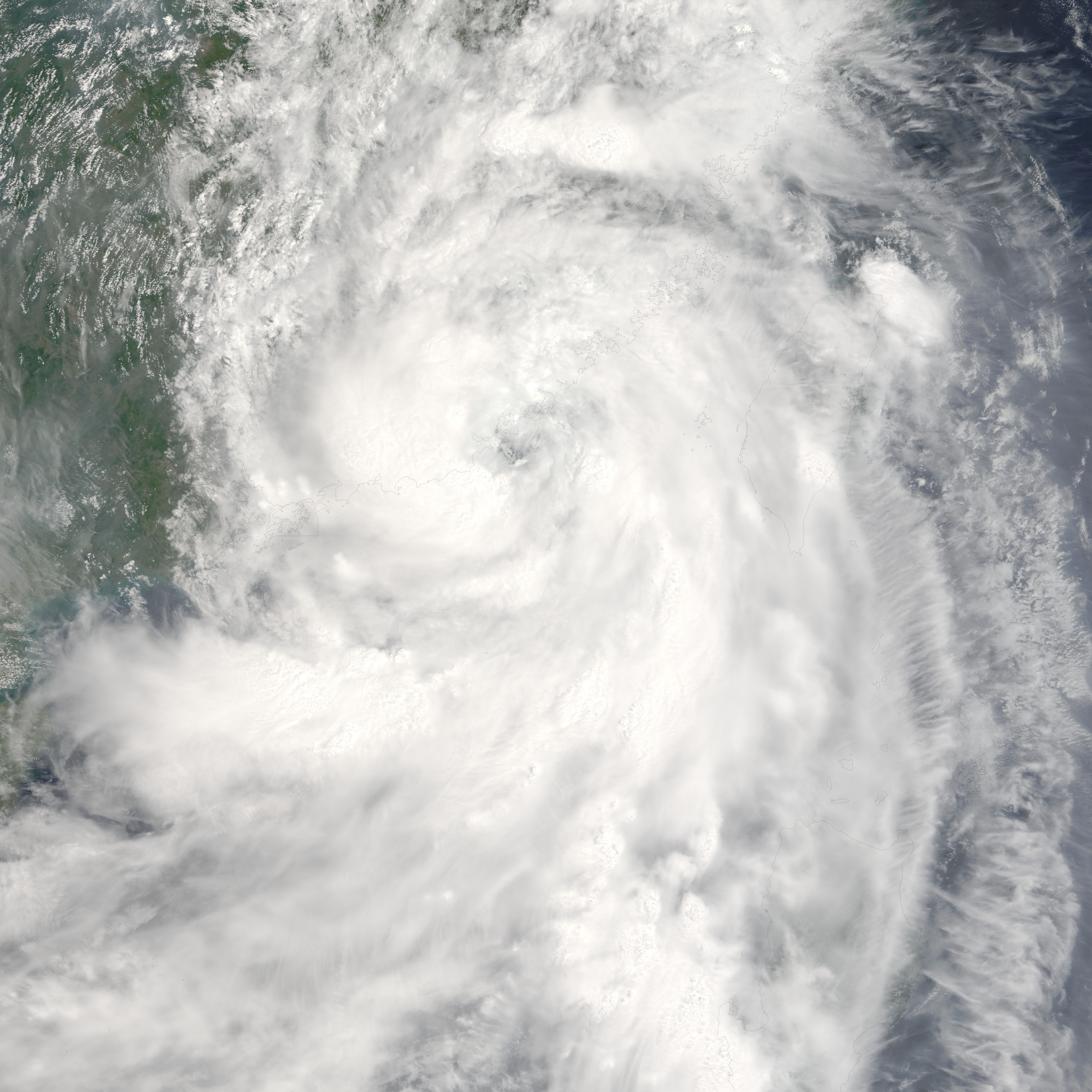
Track=Sanvu 2005 track.pngAugust 11
Dissipated=August 13
10-min winds=50
1-min winds=65
Pressure=985Typhoon Sanvu (Huaning) formed as a tropical depression on the morning of
August 10 at 0000 UTC (0800PHT ) 320 nautical miles east-northeast ofBorongan onSamar Island inside the Philippine area of responsibility. PAGASA assigns names to Tropical Depressions because they often bring heavy rains and mudslides to the Philippines. Storm was named Tropical Depression Huaning for Philippine warnings but within 24 hours received the more recognized name Sanvu when it became a Tropical Storm. Sanvu is a Chinese name for coral. Tropical Storm Sanvu (Huaning) passed over a peninsula inCagayan province on the island ofLuzon early on the morning ofAugust 12 . It was upgraded to a typhoon before making landfall in China the next day onAugust 13 . Sanvu (Huaning) rapidly dissipated after moving inland onAugust 14 .Sanvu was the first typhoon that necessitated a tropical cyclone signal for
Hong Kong .*Typhoon 2000's tracking chart of [http://www.typhoon2000.ph/sanvu05_trak.gifTyphoon Sanvu (Huaning)] .
Typhoon Mawar
Infobox Hurricane Small
Basin=WPac
Track=Mawar 2005 track.pngAugust 19
Dissipated=August 28
10-min winds=95
1-min winds=130
Pressure=930August 19 at 1200 UTC (2100 JST) 245 nautical miles (455 kilometers) southeast ofIwo Jima . Mawar is a Malay word for a rose. The storm intensified rapidly in two days to a Category 4 Super Typhoon but weakened as it approached Japan. Mawar made landfall onHonshū as a Category 2 Typhoon onAugust 25 at 1800 UTC (August 26 0300 JST) with winds of 95 mph (152 km/h). After moving inland to the northwest it was downgraded to a Category 1 before entering the Pacific Ocean. It was downgraded to a Tropical Storm onAugust 26 and became extratropical onAugust 27 . At least two people were killed by Mawar.*University of Hawaii's tracking chart of [http://www.solar.ifa.hawaii.edu/Tropical/GifArchive/MAWAR-05.gifSuper Typhoon Mawar] .
evere Tropical Storm Guchol
Infobox Hurricane Small
Basin=WPac
Track=Guchol 2005 track.pngAugust 21
Dissipated=August 25
10-min winds=55
1-min winds=65
Pressure=980August 20 at 0000 UTC (0900 JST) 190 nautical miles (350 kilometers) southwest ofMarcus Island , Japan. It reached Tropical Storm strength the next day and was named Guchol, a Yapese name for the spiceturmeric . Guchol curved to the northwest and never threatened land. It became extratropicalAugust 25 at 0000 UTC (0900 JST) 735 nautical miles (1,285 km) east-southeast ofNakashibetsu ,Hokkaidō ,Japan .*Weather Underground's tracking chart of [http://maps.wunderground.com/data/images/wp200512.gifTropical Storm Guchol] .
Typhoon Talim (Isang)
Infobox Hurricane Small
Basin=WPac
Track=Talim 2005 track.pngAugust 27
Dissipated=September 2
10-min winds=95
1-min winds=130
Pressure=925August 26 at 0600 UTC northeast of the island ofYap . Within 24 hours it was upgraded to Tropical Storm Talim and the next day became a Typhoon. Talim is a Philippine name for a knife or sharp cutting edge. Typhoon Talim was assigned the name Typhoon Isang for Philippine warnings when it entered the Philippine area of responsibility onAugust 29 . Typhoon Talim (Isang) made landfall at 1800 UTCAugust 31 (0200PHT September 1 ) as a Category 3 storm. Talim dissipated over southeasternChina onSeptember 1 . Typhoon Talim left at least 110 people dead and 23 missing inFujian ,Zhejiang ,Jiangxi &Anhui provinces, with at least 40 people dead in the latter province due to landslides. It also left 7 dead in Taiwan. [http://news.yahoo.com/news?tmpl=story&u=/afp/20050903/wl_afp/chinaweather_050903153304]*Typhoon 2000's tracking chart of [http://typhoon2000.ph/talim05_trak.gifTyphoon Talim (Isang)] .
Typhoon Nabi (Jolina)
Infobox Hurricane Small
Basin=WPac
Track=Nabi 2005 track.pngAugust 29
Dissipated=September 8
10-min winds=95
1-min winds=140
Pressure=925August 29 at 0600 UTC (1600AEST ) east ofSaipan . 18 hours later it was upgraded to Tropical Storm Nabi. Nabi is a Korean word for abutterfly . It strengthened into a Typhoon onAugust 30 and passed near the islands ofSaipan andGuam onAugust 31 .After passing near theMarianas Islands , the storm continued to strengthen until reaching Category 5 intensity onSeptember 1 . Typhoon Nabi was assigned the name Jolina for Philippine warnings when it entered the Philippine area of responsibility onSeptember 3 . Typhoon Nabi (Jolina) passed to the east of the island ofOkinawa ,Japan , and made landfall in theKagoshima Prefecture ofJapan onSeptember 6 as a Category 2 storm. It dissipated shortly after that.Twenty-one deaths have been reported in Japan. On
September 8 , five people were missing in South Korea and fifty in Japan as a result of the storm. Japan also reported 143 injured. The storm damaged 10,000 homes in Japan, where 31 of 47 prefectures reported some damage. Eighty-eight roads in Japan were damaged and 168 landslides were reported there. The heaviest damage was inMiyazaki prefecture on the island ofKyūshū . There were no deaths in the Marianas Islands. Saipan did experience heavy wind gusts of 120km/h (75mph ).Guam experienced gale-force wind gusts in addition to approximately 75 mm (3 in) of rain. [http://www.kpua.net/news.php?id=6120]Typhoon Khanun (Kiko)
Infobox Hurricane Small
Basin=WPac
Track=Khanun 2005 track.pngSeptember 7
Dissipated=September 13
10-min winds=85
1-min winds=115
Pressure=945Yap onSeptember 6 . It strengthened into a tropical storm later that day. The system was classified as a tropical storm by theJoint Typhoon Warning Center onSeptember 6 , while theJapan Meteorological Agency , the agency responsible for naming typhoons, did not upgrade the system until a day later. Tropical Storm 15W entered the Philippine area of responsibility onSeptember 7 . It was named Kiko by PAGASA first before being named Khanun by the JMA. Khanun is the Thai name forjackfruit . Typhoon Khanun (Kiko) made landfall in eastern China onSeptember 11 at 0600 UTC (1400 HKT). Khanun dissipated the next day,September 12 .More than 800,000 people were evacuated from their homes as the storm neared. Many people, evacuated by the army, were taken to schools, railway stations, hotels and other solid buildings to take shelter from the approaching storm.
The city of city-state|Taizhou|Zhejiang bore the initial brunt of the storm as it was close the where the storm made landfall, 220 km south of
Shanghai . Other coastal cities braced for the typhoon as it headed north. At least 14 people were killed and 1 went missing in Zhejiang province.Japan 's southern Ryūkyū Islands suffered strong winds, high waves and heavy rains as the storm passed. Opening hours at some polling stations were altered to make sure citizens could still vote in the Japanese general election despite the weather.*JTWC's Tracking Chart of [https://metocph.nmci.navy.mil/jtwc/warnings/wp1505.gifTyphoon Khanun (Kiko)] .
Tropical Storm Vicente
Infobox Hurricane Small
Basin=WPac
Track=Vicente 2005 track.pngSeptember 16
Dissipated=September 18
10-min winds=45
1-min winds=50
Pressure=985Dong Tac ,Vietnam on the morning ofSeptember 16 . It reached Tropical Storm strength overnight local time and was named Vicente, a Chamorro male name. Shortly after forming, Vicente interacted with a tropical disturbance west of Luzon and made a cyclonic loop. Vicente then absorbed the disturbance before passing just south of Hainan Island. Eventually, Vicente tracked into the Vietnam coast northwest ofHue onSeptember 18 and gradually dissipated.As the pressure gradient between Vicente and a ridge of high pressure over southeastern China brought a strong easterly airstream to the coastal areas of Guangdong and caused rough seas with swells, a swimmer was drowned on
September 17 . Another one drowned the following day in rough seas at Sai Kung,Hong Kong .Also, a ship from China struck a reef between Shangchuan and Xiachuan Islands. All seventeen crew members were rescued.In Vietnam, about 5 people were killed or reported missing.
*Weather Underground's tracking chart of [http://maps.wunderground.com/data/images/wp200516.gifTropical Storm Vicente]
Typhoon Saola
Infobox Hurricane Small
Basin=WPac
Track=Saola 2005 track.pngSeptember 20
Dissipated=September 26
10-min winds=80
1-min winds=100
Pressure=950Marcus Island ,Japan at 0000 UTC (0900 JST),September 20 . The depression was upgraded to Tropical Storm Saola 18 hours later as it continued to strengthen moving westward. The name Saola comes fromsaola , a newly discovered endangered species inVietnam . Saola was further upgraded to a typhoon at 0300 UTC (1200 JST)September 22 . Saola became extratropical convert|370|nmi|km northeast of Tokyo four days later.*Weather Underground's tracking chart of [http://maps.wunderground.com/data/images/wp200518.gifTyphoon Saola] .
Typhoon Damrey (Labuyo)
Infobox Hurricane Small
Basin=WPac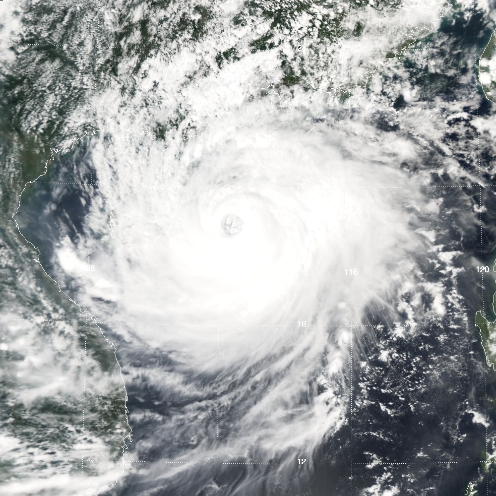
Track=Damrey 2005 track.pngSeptember 21
Dissipated=September 27
10-min winds=80
1-min winds=90
Pressure=955Philippines , PAGASA assigned it the name Labuyo and began issuing advisories on a disturbed area of tropical weather to the east of the islands onSeptember 19 . OnSeptember 20 it was classified as Tropical Depression 17W by theJoint Typhoon Warning Center . OnSeptember 21 , it was upgraded to Tropical Storm Damrey. It strengthened into a typhoon onSeptember 24 . Damrey is a Cambodian word for elephant.Typhoon Damrey (Labuyo) made landfall at
Wanning , in China'sHainan province at 2000 UTC,September 25 (0400September 26 local time) with maximum sustained winds up to 180 km/h. This made Damrey the strongest typhoon to strike Hainan since Typhoon Marge in September 1973.At least 16 people are believed to have died in China, and the entire province of Hainan suffered power outages. Damrey then went on to impact
Vietnam before losing tropical characteristics while a Tropical Storm. The Joint Typhoon Warning Center ceased advisories with the final one at 0900 UTCSeptember 27 with the system convert|90|nmi|km south-southwest ofHanoi , Vietnam.*Weather Underground's tracking chart of [http://maps.wunderground.com/data/images/wp200517.gifTyphoon Damrey (Labuyo)] .
Typhoon Longwang (Maring)
Infobox Hurricane Small
Basin=WPac
Track=Longwang 2005 track.pngSeptember 26
Dissipated=October 3
10-min winds=95
1-min winds=125
Pressure=930Iwo Jima ,Japan onSeptember 26 . TheJoint Typhoon Warning Center initiated a warning for it at 0000 UTC the same day, and was upgraded to Tropical Storm Longwang six hours later. Longwang is Chinese for Dragon King. At 0300 UTCSeptember 27 , the Joint Typhoon Warning Center upgraded it to a typhoon. It continued to increase in strength as it tracked west to west-northwest towardsTaiwan , and was upgraded to a super typhoon onSeptember 29 . PAGASA named the storm Maring for Philippine warnings onSeptember 29 . Longwang made landfall at 0515 local time onOctober 2 south ofHualien City ,Taiwan as a Category 4 storm. Half a day later, at 2135 local time (1335 UTC), it made second landfall in Fujian Province, China as a minimal typhoon. Longwang dissipated on the next day.Despite its intensity, Longwang caused mostly property damage, and claimed only one life in Taiwan.
*Weather Underground's tracking chart of [http://maps.wunderground.com/data/images/wp200519.gifTyphoon Longwang (Maring)] .
Typhoon Kirogi (Nando)
Infobox Hurricane Small
Basin=WPac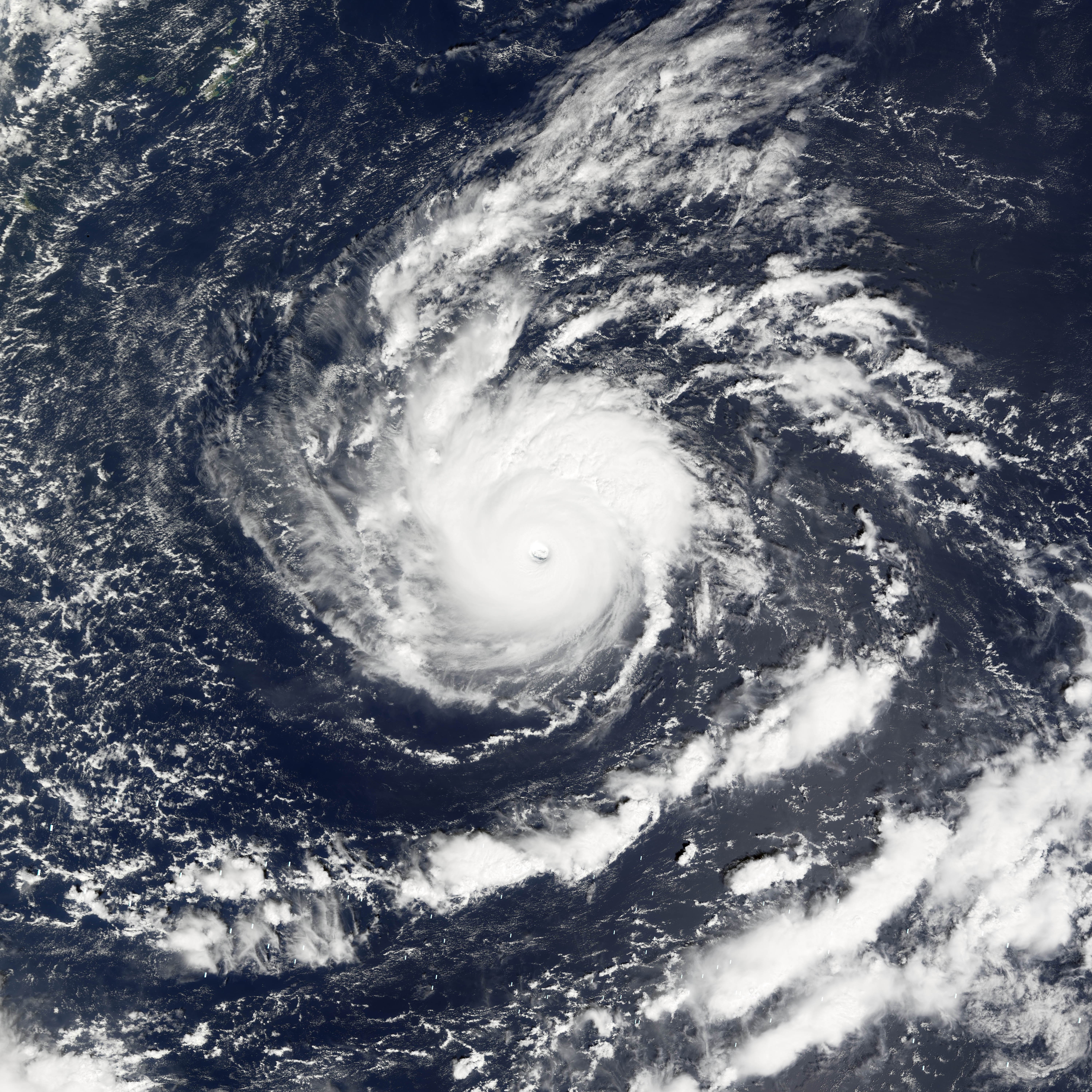
Track=Kirogi 2005 track.pngOctober 10
Dissipated=October 19
10-min winds=100
1-min winds=115
Pressure=930Okinawa at 1200 UTC,October 9 and assigned the name Kirogi to it at 0600 UTC next day. Prior to becoming a Tropical Storm it entered the Philippine area of responsibility and was assigned the name Nando by PAGASA for Philippine warnings. JTWC finally issued a warning for Kirogi at 0900 UTC,October 10 , despite listing it as a Tropical Depression. It was upgraded to a typhoon at 0000 UTCOctober 12 , and reached Category 4 strength about nine hours later. Kirogi is a Korean word for a type of migrating bird that lives inNorth Korea from autumn to spring. Kirogi was declared extratropical at 0300 UTCOctober 19 .Typhoon Kai-Tak
Infobox Hurricane Small
Basin=WPac
Track=Kai-Tak 2005 track.pngOctober 29
Dissipated=November 2
10-min winds=80
1-min winds=85
Pressure=950October 28 . Fifteen hours later, the Joint Typhoon Warning Center issued the number 22W to the system. The next day it was upgraded to Tropical Storm Kai-Tak. Kai-Tak was a name submitted by Hong Kong in honor of their former airport. OnOctober 30 it was upgraded to a Typhoon. Kai-Tak made landfall north ofHue, Vietnam , early on the morning ofNovember 2 .*UNISYS track chart of [http://weather.unisys.com/hurricane/w_pacific/2005/KAI_TAK/track.gifTyphoon Kai-Tak]
Tropical Storm Tembin (Ondoy)
Infobox Hurricane Small
Basin=WPac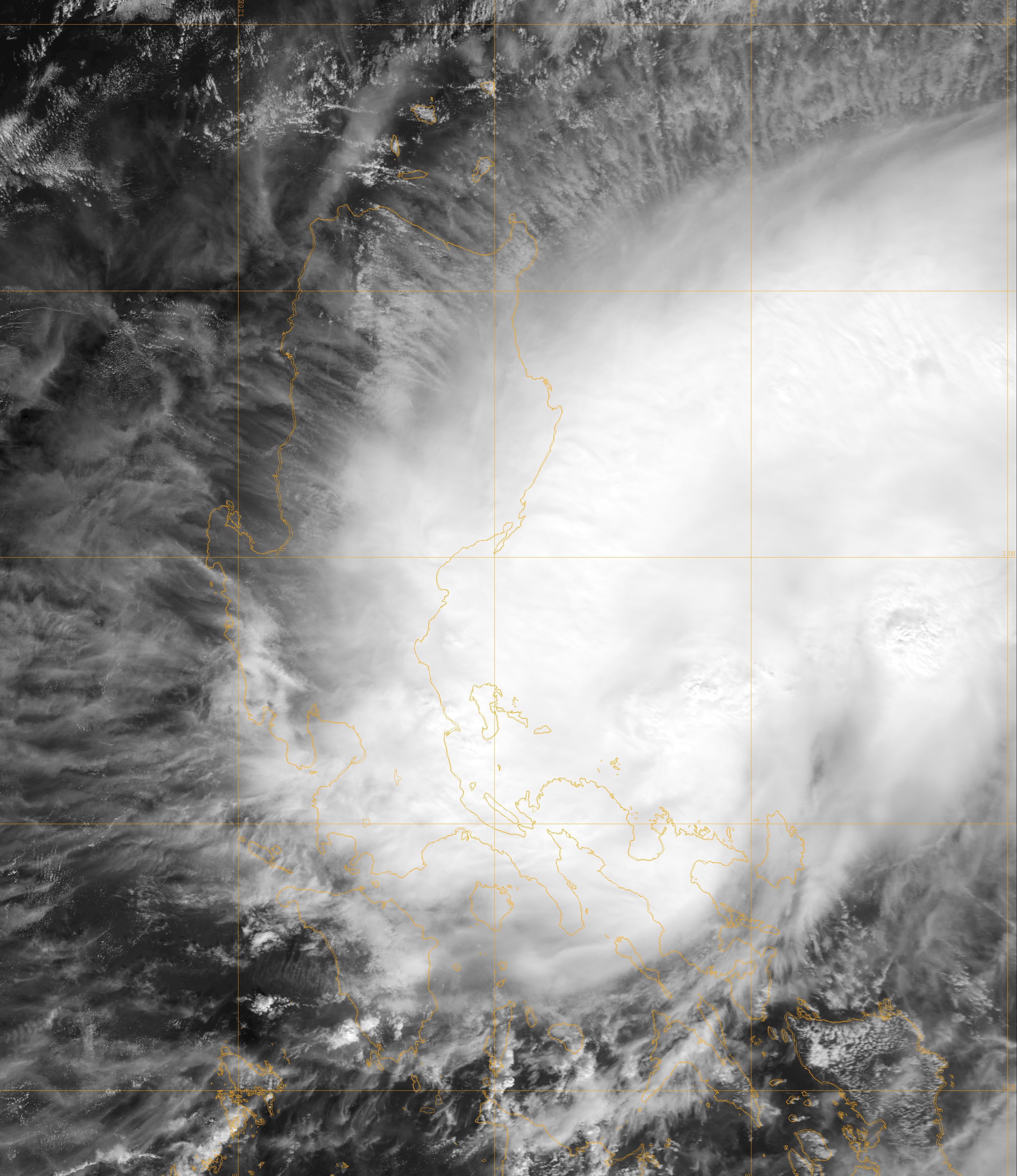
Track=Tembin 2005 track.pngNovember 10
Dissipated=November 10
10-min winds=35
1-min winds=45
Pressure=1002November 7 , north-northwest of theMicronesia n island ofYap . The storm gained enough power to warrant upgrading to a Tropical Storm 12 hours later. The system entered the Philippine area of responsibility on the morning ofNovember 8 and was named Ondoy by PAGASA. The storm encountered shear as it moved west, and lost organisation onNovember 8 , being downgraded to a tropical depression. OnNovember 9 it regained tropical storm strength and had a better LLCC (low-level circulation centre). OnNovember 10 it was named Tembin by the JMA. Tembin is a Japanese constellation for the group of stars known in the west as Libra. Tembin then made landfall near midnightNovember 11 local time in the northern Philippines and lost much of its circulation and convection. Tembin dissipated rapidly the next day.*Weather Underground's tracking chart of [http://maps.wunderground.com/data/images/wp200523.gifTropical Storm Tembin]
evere Tropical Storm Bolaven (Pepeng)
Infobox Hurricane Small
Basin=WPac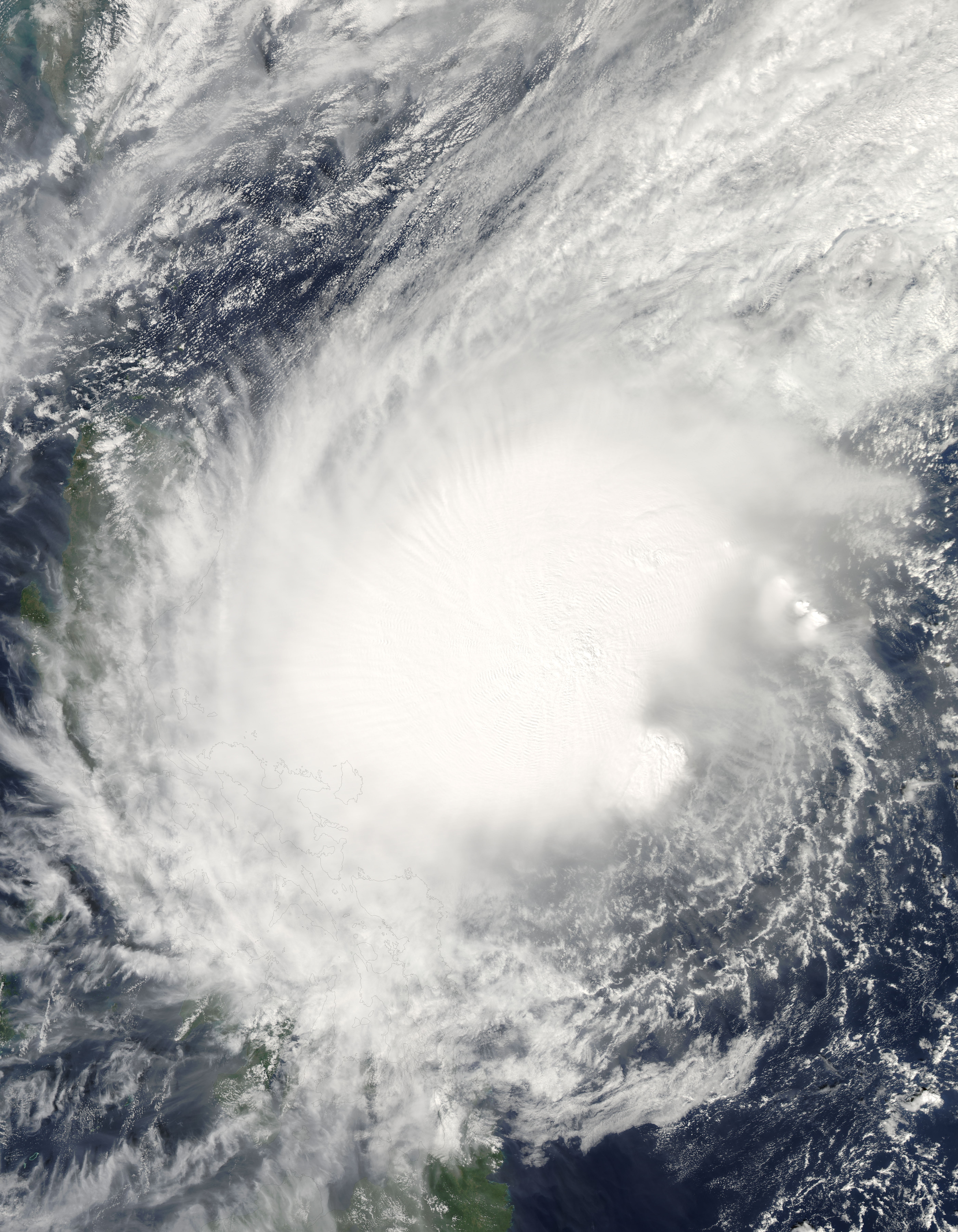
Track=Bolaven 2005 track.pngNovember 16
Dissipated=November 20
10-min winds=55
1-min winds=70
Pressure=985Palau late onNovember 12 . This was upgraded to a tropical depression the next afternoon, 290 nautical miles (550 km) west of Palau. Forming inside the Philippine area of responsibility it has been named Pepeng by PAGASA. It was named Bolaven onNovember 16 by the JMA. Bolaven is a Laotian word meaning plateau or mesa. Although it strengthened into a Category 1 typhoon onNovember 17 , it weakened to a tropical storm before making landfall onNovember 20 at about 800 local time in Cagayan Valley in the northern Philippines. Bolaven rapidly dissipated that same day north of the Philippines.*Weather Underground's tracking chart of [http://maps.wunderground.com/data/images/wp200524.gifTyphoon Bolaven]
Other Storms
These systems were not officially named as tropical storms by the JMA, although the JMA might have monitored them as tropical depressions. They were, however, designated as tropical cyclones by the Philippines (PAGASA), China (CMA), and/or the Joint Typhoon Warning Center (JTWC).
PAGASA Tropical Depression Crising
Infobox Hurricane Small
Basin=WPac
WarningCenter=PAGASA
Formed=May 16
Dissipated=May 17
10-min winds=30
Pressure=1006A short lived tropical depression formed near the Philippines onMay 16 at 0000 UTC (0800PHT ) 180nautical mile s (330 km) east ofSurigao onMindanao Island . It was assigned the name Crising by PAGASA. The storm never organized into a tropical storm and did not receive the more recognized International name for West Pacific storms. The storm drifted northwest then southwest and began losing convection. PAGASA stopped tracking the storm 24 hours later on the 17th at 0000 UTC (0800PHT ) 145 nautical miles (270 km) east of Surigao.
* Typhoon 2000's tracking chart of [http://www.typhoon2000.ph/stormarchives/2005/trax/crising05_03tx.gifTropical Depression 96W(Crising)] .PAGASA Tropical Depression Emong
Infobox Hurricane Small
Basin=WPac
WarningCenter=PAGASA
Formed=July 4
Dissipated=July 6
10-min winds=30
Pressure=1000A tropical depression formed near the Philippines onJuly 4 at 0600 UTC (1400PHT ) about 35 nautical miles (65 km) northeast ofCatarman onSamar Island . It was assigned the name Emong by PAGASA. The storm never organized into a tropical storm and did not receive the more recognized International name for West Pacific storms. As a poorly organized depression it drifted overLuzon onJuly 5 . Upper-level shear and the depression's landfall caused the storm to lose organization onJuly 6 while located about 40 nautical miles (75 km) south of Hong Kong.* Typhoon 2000's tracking chart of [http://www.typhoon2000.ph/stormarchives/2005/trax/emong05_05tx.gifTropical Depression 93W(Emong)] .
JTWC Tropical Depression 20W
Infobox Hurricane Small
Basin=WPac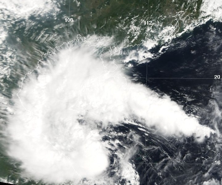
Formed=October 7
Dissipated=October 8
1-min winds=30
Pressure=1000The meteorological agencies of Guangdong and Hainan upgraded a low-pressure center over South China Sea to a tropical depression at 0800 local time,October 6 . The Hong Kong Observatory followed suit 30 hours later. The JTWC finally issued a warning for this system at 1500 UTCOctober 7 (2300 local time), and tropical depression number 20W was issued to the system. The JTWC issued its final advisory on the system just six hours later, convert|55|nmi|km west-northwest ofHue, Vietnam . As the system never reached Tropical Storm strength, it was not given a name from the list. The only damage it did, if any, however, was that massive rainfall amounts were recorded - over 230 mm (9 inches) were recorded in some parts ofHainan .JTWC Tropical Storm 25W (Quedan)
Infobox Hurricane Small
Basin=WPac
WarningCenter=PAGASA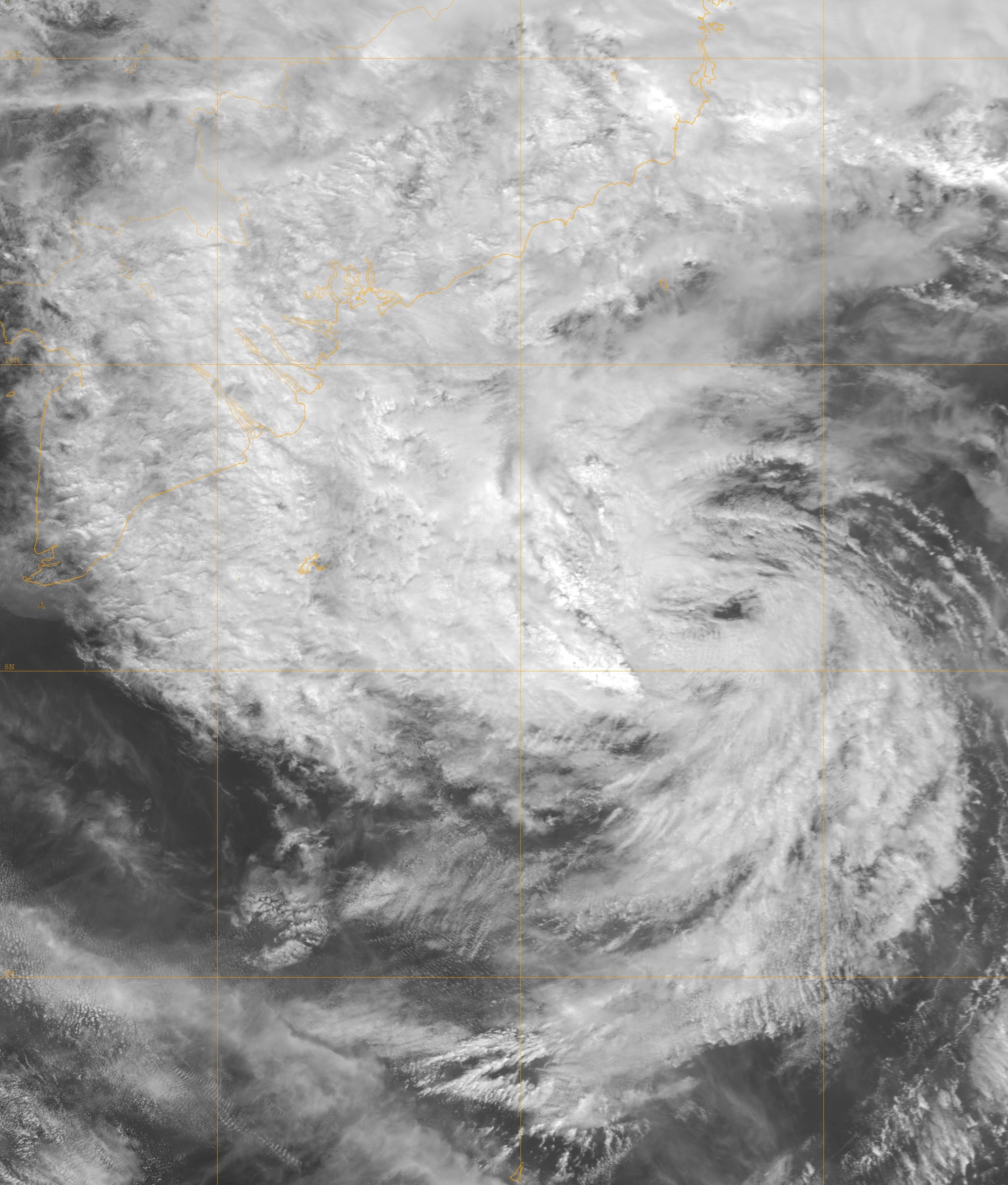
Formed=December 18
Dissipated=December 21
10-min winds=30
1-min winds=45
Pressure=991OnDecember 16 , 95W.INVEST developed in the Philippine area of responsibility, and was given the name Quedan for Philippine warnings. 95W organized into Tropical Depression 25W onDecember 18 off the northern coast of Borneo. OnDecember 19 , the JTWC classified it as a Tropical Storm. The JMA issued gale warnings on it as a Tropical Depression for 18 hours betweenDecember 19 andDecember 20 , but never upgraded it to a tropical storm, marking only the 11th time since the current naming conventions began in 2000 that the JTWC and the JMA had disagreed over naming a tropical storm after two storms each in 2002, 2003, 2004, as well as three in 2001 and one in the first year. The storm dissipated early onDecember 20 aswind shear increased on the system.torm names
Western North Pacific tropical cyclones are named by the RSMC Tokyo-Typhoon Center of the
Japan Meteorological Agency . Names are selected from the following sequential list, there is no annual list. Names were contributed by 13 members of theESCAP/WMO Typhoon Committee , except forSingapore . The 13 nations or territories, along withMicronesia , each submitted 10 names, which are used in alphabetical order by the English name of the country. Unused names are marked in grey. The first storm for 2005 was Kulap.Philippines The
Philippine Atmospheric, Geophysical and Astronomical Services Administration (PAGASA) uses its own naming scheme for tropical cyclones within its area of responsibility. Lists are recycled every four years. This is the same list used in 2001 with the exceptions of Bising, Dante, Nando and Pepeng, which replace Barok, Darna, Nanang and Pabling. Unused names are marked in gray.Retirement
Three names were retired from this season: "Matsa", "Nabi" and "Longwang". [ [http://www.disaster.go.th/html/ricb/foreign/2006/tc/typhoon38.html 38th session ] ] The replacement were to be submitted at the 2006 meeting of the Typhoon Committee; "Pakhar", "Doksuri" and "Haikui" were selected respectively. [http://bbs.typhoon.gov.cn/simple/index.php?t10579.html (Chinese)]
ee also
*
List of Pacific typhoon seasons
*2005 Pacific hurricane season
*2005 Atlantic hurricane season
*2005 North Indian Ocean cyclone season
*South-West Indian Ocean cyclone seasons: 2004-05, 2005-06
*Australian region cyclone seasons: 2004-05, 2005-06
*South Pacific cyclone seasons: 2004-05, 2005-06References
External links
* [http://www.typhoon2000.ph Typhoon2000 Philippine typhoon website]
* [https://metocph.nmci.navy.mil/jtwc.html Joint Typhoon Warning Center]
* [http://www.jma.go.jp/jma/jma-eng/jma-center/rsmc-hp-pub-eg/tyname.html Meaning of typhoon names (JMA)]
* [http://www.jma.go.jp/en/typh/ Japan Meteorological Agency - Tropical Cyclone Information] [http://www.jma.go.jp/jp/typh/ (日本語)]
* [http://agora.ex.nii.ac.jp/digital-typhoon/ Digital Typhoon - Typhoon Images and Information]
Wikimedia Foundation. 2010.
Timeline of the 2005 Pacific typhoon season — The 2005 Pacific typhoon season has no official bounds; it runs year round in 2005, but most tropical cyclones tend to form in the northwestern Pacific Ocean between June and December. These dates conventionally delimit the period of each year… … Wikipedia
2005 Pacific hurricane season — Infobox hurricane season Basin=EPac Year=2005 Track=2005 Pacific hurricane season map.png First storm formed=May 17, 2005 Last storm dissipated=October 20, 2005 Strongest storm name=Kenneth Strongest storm pressure=947 Strongest storm winds=115… … Wikipedia
Timeline of the 2005 Pacific hurricane season — ImageSize = width:800 height:200PlotArea = top:10 bottom:80 right:20 left:20 DateFormat = dd/mm/yyyyPeriod = from:01/05/2005 till:31/10/2005TimeAxis = orientation:horizontalScaleMinor = grid:black unit:month increment:1 start:01/05/2005Colors =… … Wikipedia
2006 Pacific typhoon season — Infobox hurricane season Basin=WPac Year=2006 Track=2006 Pacific typhoon season summary.jpg First storm formed=May 9, 2006 Last storm dissipated=December 19, 2006 Strongest storm name=Yagi Strongest storm winds=105 Strongest storm pressure=910… … Wikipedia
2004 Pacific typhoon season — Infobox hurricane season Basin=WPac Year=2004 Track=2004 Pacific typhoon season summary.jpg First storm formed=April 5, 2004 Last storm dissipated=December 21, 2004 Strongest storm name=Chaba Strongest storm pressure=910 Strongest storm winds=110 … Wikipedia
1982 Pacific typhoon season — Infobox hurricane season Basin=WPac Year=1982 Track=1982 Pacific typhoon season summary.jpg First storm formed=March 16 Last storm dissipated=December 10 Strongest storm name= Mac Strongest storm winds=140 Strongest storm pressure=895 Total… … Wikipedia
1959 Pacific typhoon season — Infobox hurricane season Basin=WPac Year=1959 Track=1959 Pacific typhoon season summary.jpg First storm formed=February 27, 1959 Last storm dissipated=January 2, 1960 Strongest storm name=Super Typhoon Joan Strongest storm pressure=891 Total… … Wikipedia
1976 Pacific typhoon season — Infobox hurricane season Track=1976 Pacific typhoon season summary.jpg Basin=WPac Year=1976 First storm formed=January 27, 1976 Last storm dissipated=December 9, 1976 Strongest storm name=Louise Strongest storm pressure=895 Strongest storm… … Wikipedia
2007 Pacific typhoon season — Infobox hurricane season Basin=WPac Year=2007 First storm formed=March 31, 2007 Last storm dissipated=November 28, 2007 Strongest storm name=Sepat Strongest storm pressure=910 Strongest storm winds=110 Average wind speed=10 Total depressions=29… … Wikipedia
2003 Pacific typhoon season — Infobox hurricane season Basin=WPac Year=2003 Track=2003 Pacific typhoon season summary.jpg First storm formed=January 18, 2003 Last storm dissipated=December 2, 2003 Strongest storm name=Maemi Strongest storm winds=105 Strongest storm… … Wikipedia
2005 Pacific typhoon season

18+
© Academic, 2000-2024
- Contact us: Technical Support, Advertising
Dictionaries export, created on PHP, Joomla, Drupal, WordPress, MODx.