- National Register of Historic Places listings in Manhattan below 14th Street
-
List of the National Register of Historic Places listings in Manhattan below 14th Street
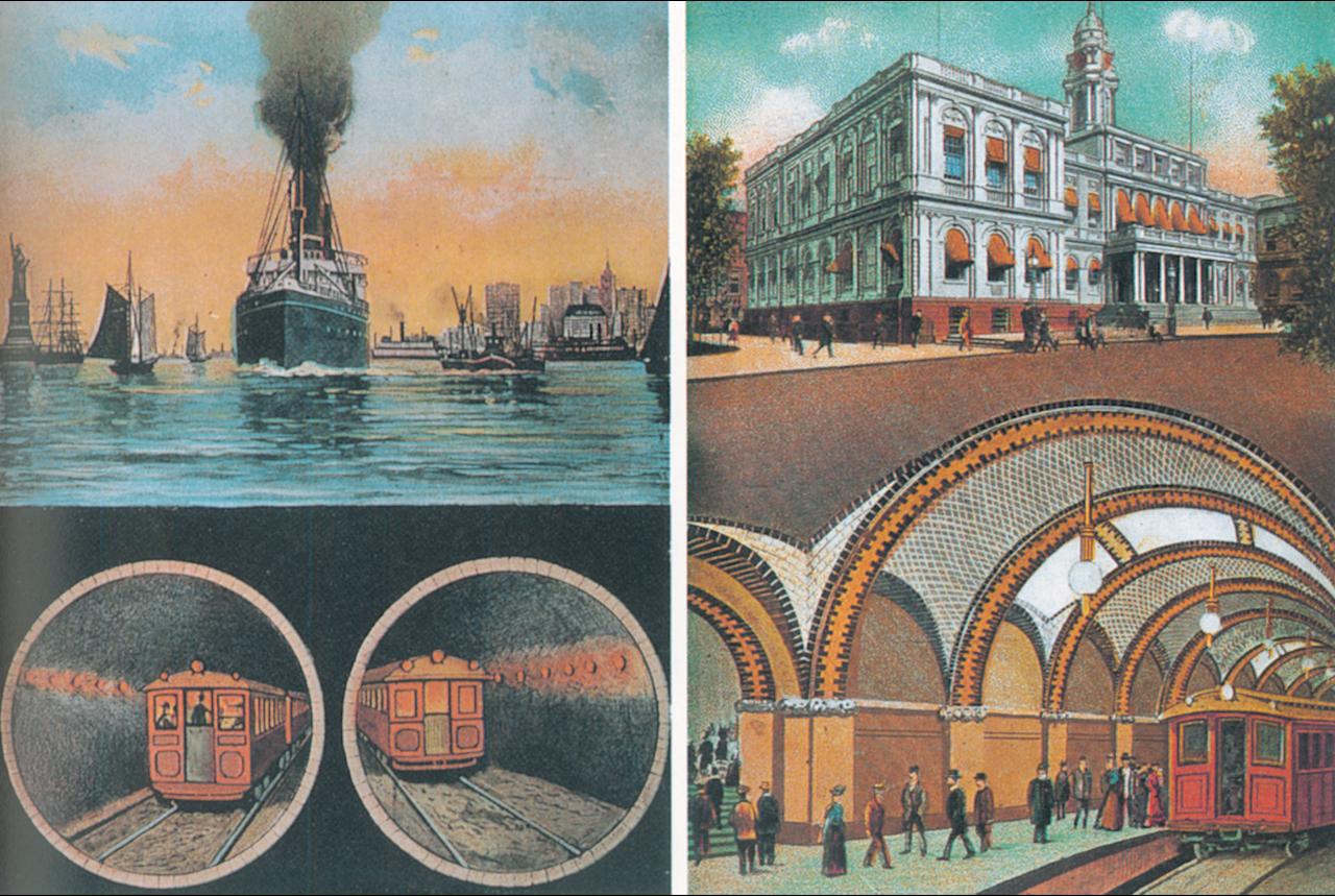
This is intended to be a complete list of properties and districts listed on the National Register of Historic Places in Manhattan below 14th Street, which is a large portion of New York County, New York. For properties and districts in other parts of Manhattan and the other islands of New York County, see National Register of Historic Places listings in New York County, New York. The locations of National Register properties and districts (at least for all showing latitude and longitude coordinates below) may be seen in a Google map by clicking on "Map of all coordinates".[1]
There are 177 properties and districts, including eight ships.
-
- This National Park Service list is complete through NPS recent listings posted November 18, 2011.[2]
Contents: Counties in New York Albany (Albany) – Allegany – Bronx – Broome – Cattaraugus – Cayuga – Chautauqua – Chemung – Chenango – Clinton – Columbia – Cortland – Delaware – Dutchess – Erie (Buffalo) – Essex – Franklin – Fulton – Genesee – Greene – Hamilton – Herkimer – Jefferson – Kings (Brooklyn) – Lewis – Livingston – Madison – Monroe (Rochester) – Montgomery – Nassau – New York (Manhattan – Below 14th Street, 14th to 59th Streets, 59th to 110th Streets, Above 110th Street, Islands) – Niagara – Oneida – Onondaga (Syracuse) – Ontario – Orange – Orleans – Oswego – Otsego – Putnam – Queens – Rensselaer – Richmond (Staten Island) – Rockland – Saratoga – Schenectady – Schoharie – Schuyler – Seneca – St. Lawrence – Steuben – Suffolk – Sullivan – Tioga – Tompkins – Ulster – Warren – Washington – Wayne – Westchester (New Rochelle, Peekskill, Yonkers) – Wyoming – Yates Listings in Manhattan below 14th Street
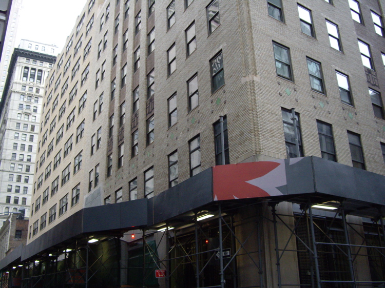
Landmark name Image Date listed Location Neighborhood Summary 1 75 Murray Street Building 
April 3, 1973 75 Murray St.
40°42′53″N 74°0′40″W / 40.71472°N 74.01111°WNew York One of the earliest cast iron façades; created by James Bogardus; built in 1858 2 Admiral Dewey (tugboat) 
December 27, 2002 Pier 16, East River
40°42′19″N 74°0′11″W / 40.70528°N 74.00306°WNew York 3 African Burial Ground 
April 19, 1993 Vicinity of Broadway and Reade St.
40°42′49″N 73°59′38″W / 40.71361°N 73.99389°WNew York Site containing the remains of over 400 Africans buried during the 17th and 18th centuries 4 Ambrose (lightship) 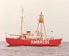
September 7, 1984 Pier 16, East River, Manhattan
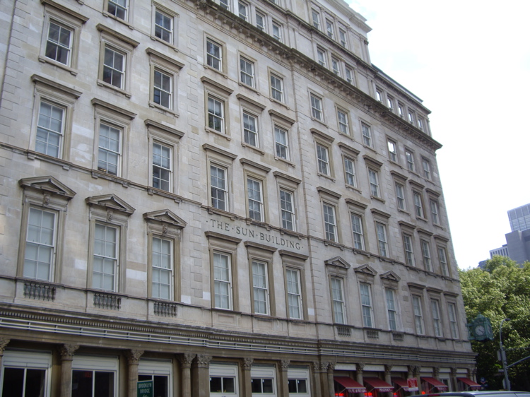
40°42′17″N 74°0′9″W / 40.70472°N 74.0025°WNew York Beacon for New York Harbor, 1908-1933; now at South Street Seaport Museum 5 American Bank Note Company Building 
November 30, 1999 70 Broad St.
40°42′17″N 74°0′45″W / 40.70472°N 74.0125°WLower Manhattan 1908 home of American Bank Note Company, engravers. Now owned by Global Financial Capital of New York, founded by the Maharishi Mahesh Yogi. 6 American Stock Exchange 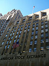
June 2, 1978 86 Trinity Pl.
40°42′30″N 74°0′48″W / 40.70833°N 74.01333°WLower Manhattan Built in 1921; houses the American Stock Exchange 7 American Thread Building 
January 20, 2005 260 W. Broadway
40°43′14″N 74°0′22″W / 40.72056°N 74.00611°WNew York 8 Astor Place Subway station (4 6 <6> trains) 
September 17, 2004 Jct. of Bowery, Astor Place and Lafayette St.
40°43′48″N 73°59′30″W / 40.73°N 73.99167°WEast Village Completed in 1904; one of the original twenty-eight stations 9 Bank of New York Building 
August 28, 2003 48 Wall St.
40°42′23″N 74°0′34″W / 40.70639°N 74.00944°WNew York Built in 1928; land used by the bank since the 1797; modified to house the Museum of American Finance 10 Battery Park Control House (4 5 trains) 
May 6, 1980 State St. and Battery Pl.
40°42′14″N 74°0′54″W / 40.70389°N 74.015°WNew York Built in 1929; brick and stone structures meant to resemble garden pavilions; "Control house" refers to controlling the passenger flow 11 Bayard-Condict Building 
December 8, 1976 65-69 Bleecker St.
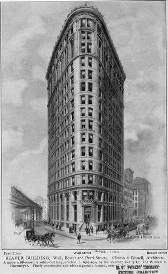
40°43′35″N 73°59′43″W / 40.72639°N 73.99528°WGreenwich Village Only work of architect Louis Sullivan in New York City; built between 1897 and 1899; Chicago School style 12 Beaver Building 
July 6, 2005 82-92 Beaver St.
40°42′18″N 74°0′32″W / 40.705°N 74.00889°WNew York Triangular-shaped building; designed by Clinton and Russell; completed in 1904 13 Bell Telephone Laboratories 
May 15, 1975 463 West St.
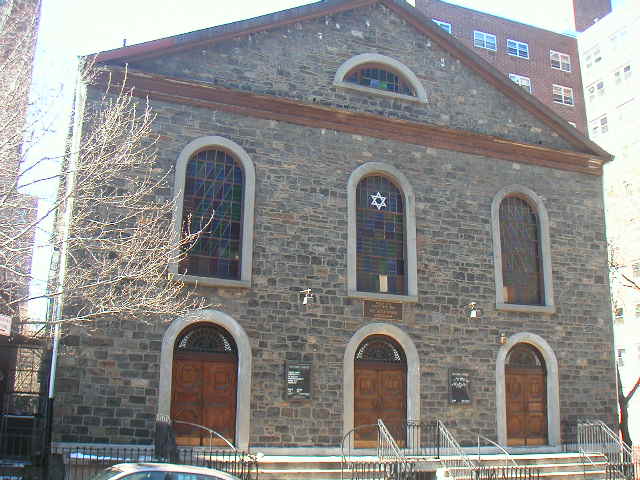
40°44′12″N 74°0′35″W / 40.73667°N 74.00972°WNew York 13 building complex; home of Bell Telephone Laboratories between 1898 and 1966 14 Beth Hamedrash Hagodol Synagogue 
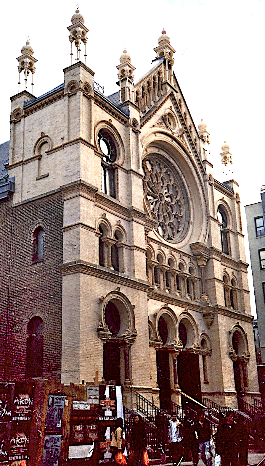
November 30, 1999 60-64 Norfolk St.
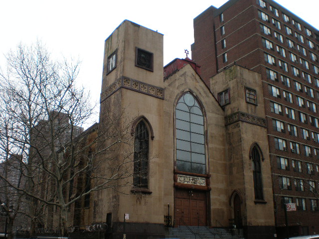
40°43′1″N 73°59′18″W / 40.71694°N 73.98833°WNew York Orthodox synagogue; oldest Orthodox Russian Jewish congregation in the United States; Gothic Revival structure; 1850 15 Bialystoker Synagogue 
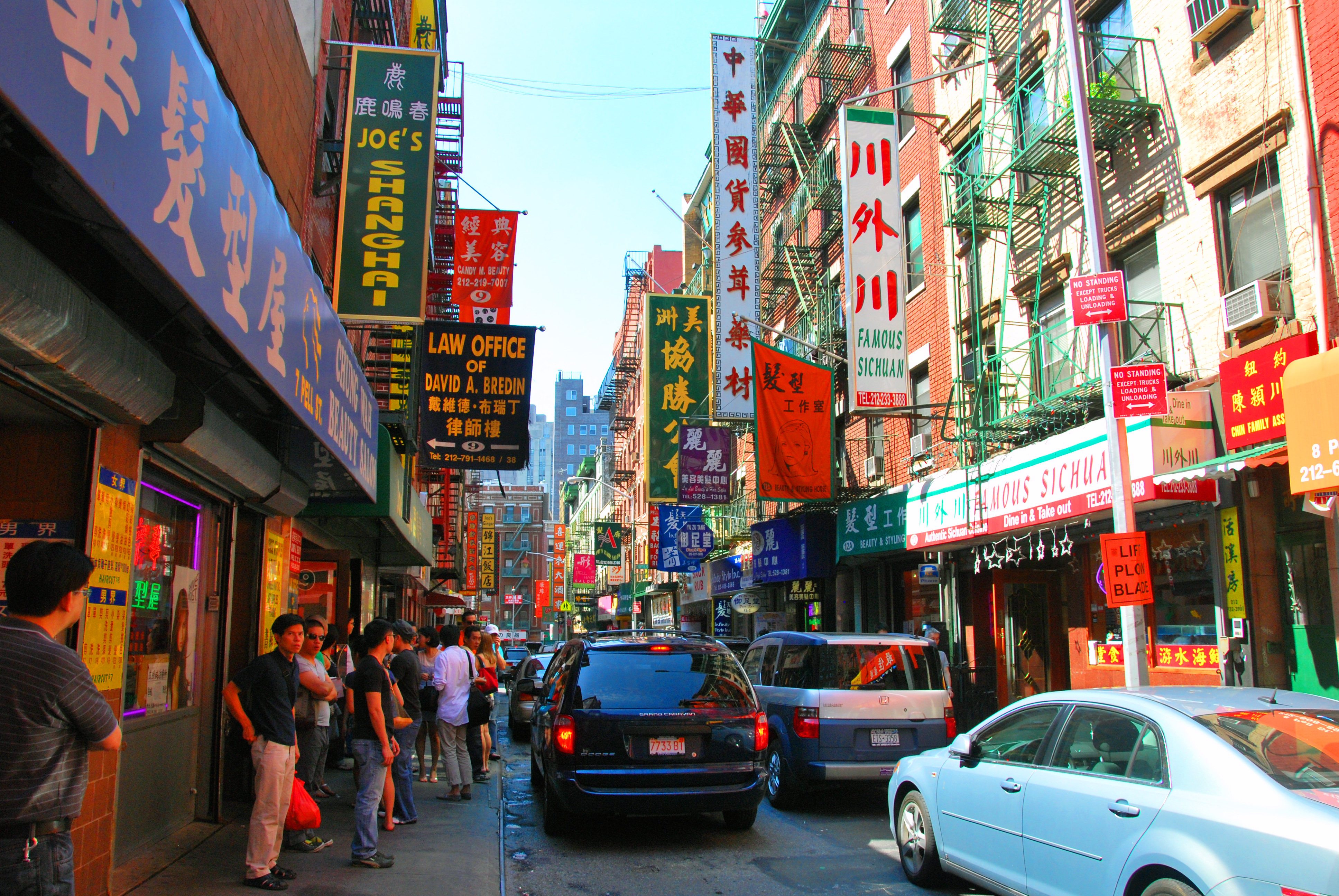
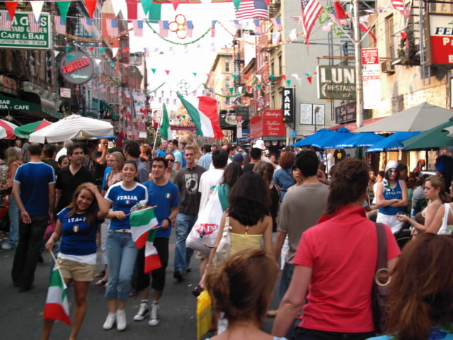
April 26, 1972 7-13 Willett St.
40°42′56″N 73°59′1″W / 40.71556°N 73.98361°WNew York Fieldstone building; built in 1826; late Federal style architecture; originally Methodist Episcopal Church; now an Orthodox Jewish synagogue 16 Bleecker Street Subway station (4 6 <6> trains) 
September 17, 2004 Jct. of Bleecker and Lafayette Sts.
40°43′35″N 73°59′43″W / 40.72639°N 73.99528°WNew York Features typical IRT mosaics; two styles of small mosaics made by the Grueby Faience Company in 1904 17 Bouwerie Lane Theater 
April 23, 1980 330 Bowery
40°43′32″N 73°59′11″W / 40.72556°N 73.98639°WNew York Designed by Henry Engelbert; constructed from 1873-74; originally the Bond Street Saving Bank; cast iron building; French Second Empire style; converted to a theater in 1963 18 Bowery Savings Bank 
April 23, 1980 130 Bowery St.
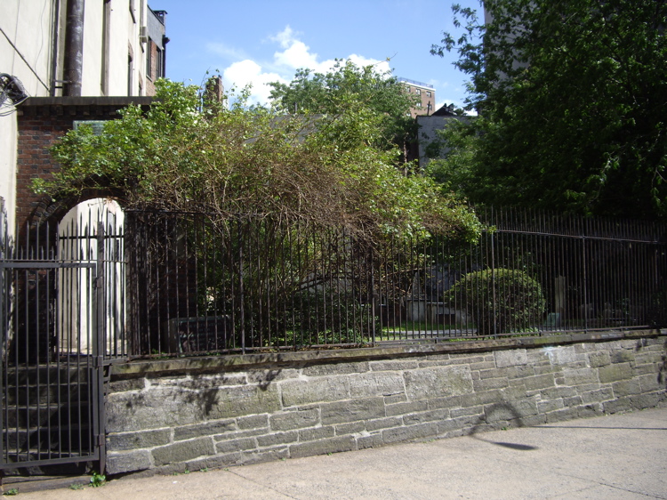
40°43′7″N 73°59′44″W / 40.71861°N 73.99556°WNew York First headquarters of the Bowery Savings Bank; designed by Stanford White; built in 1893 19 Bowling Green Fence and Park 
April 9, 1980 Broadway and Beaver Sts.
40°42′18″N 74°0′51″W / 40.705°N 74.01417°WNew York Small public park in Lower Manhattan; oldest existing public park in New York City; origin point for ticker-tape parades 20 Broad Exchange Building 
April 13, 1998 25 Broad St.
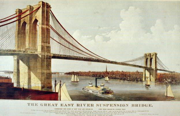
40°42′21″N 74°0′41″W / 40.70583°N 74.01139°WNew York 1902 build was the largest office building in the Financial District. It is now a luxury residential building. 21 Brooklyn Bridge 
October 15, 1966 Across the East River from Brooklyn to Manhattan
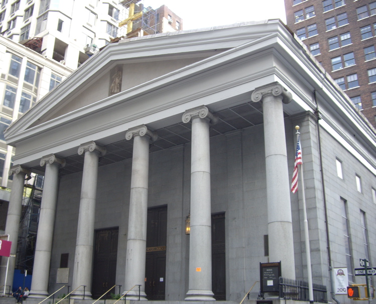
40°42′23″N 73°59′51″W / 40.70639°N 73.9975°WNew York One of the oldest suspension bridges in the United States; 5,989 feet (1825 m) long; iconic part of the New York skyline 22 Brooklyn Bridge – City Hall Subway station (4 5 6 <6> trains) 
July 6, 2005 Under Centre St. bet. Chambers and Frankfort Sts.
40°42′47″N 74°0′16″W / 40.71306°N 74.00444°WNew York Station on the IRT Lexington Avenue Line of the New York City Subway 23 James Brown House 
August 11, 1983 326 Spring St.
40°43′33″N 74°0′35″W / 40.72583°N 74.00972°WNew York Rare example of Federal architecture in New York; built before 1812; home of James Brown, Revolutionary War veteran; site of one of the oldest bars in the City 24 Building at 19 Rector St. 
May 22, 2002 19 Rector St., 88 Greenwich St.
40°42′28″N 74°0′52″W / 40.70778°N 74.01444°WNew York 25 Building at 21 West Street 
March 12, 1999 21 West St.
40°42′22″N 74°0′57″W / 40.70611°N 74.01583°WNew York 26 Building at 254-260 Canal Street 
June 7, 2006 254-260 Canal St.
40°43′6″N 74°0′5″W / 40.71833°N 74.00139°WNew York 27 Building at 376-380 Lafayette Street 
December 28, 1979 376-380 Lafayette Street
40°43′38″N 73°59′41″W / 40.72722°N 73.99472°WNew York 28 Building at 361 Broadway 
September 15, 1983 361 Broadway
40°43′2″N 74°0′15″W / 40.71722°N 74.00417°WNew York 29 Building at 85 Leonard Street 
April 23, 1980 85 Leonard St.
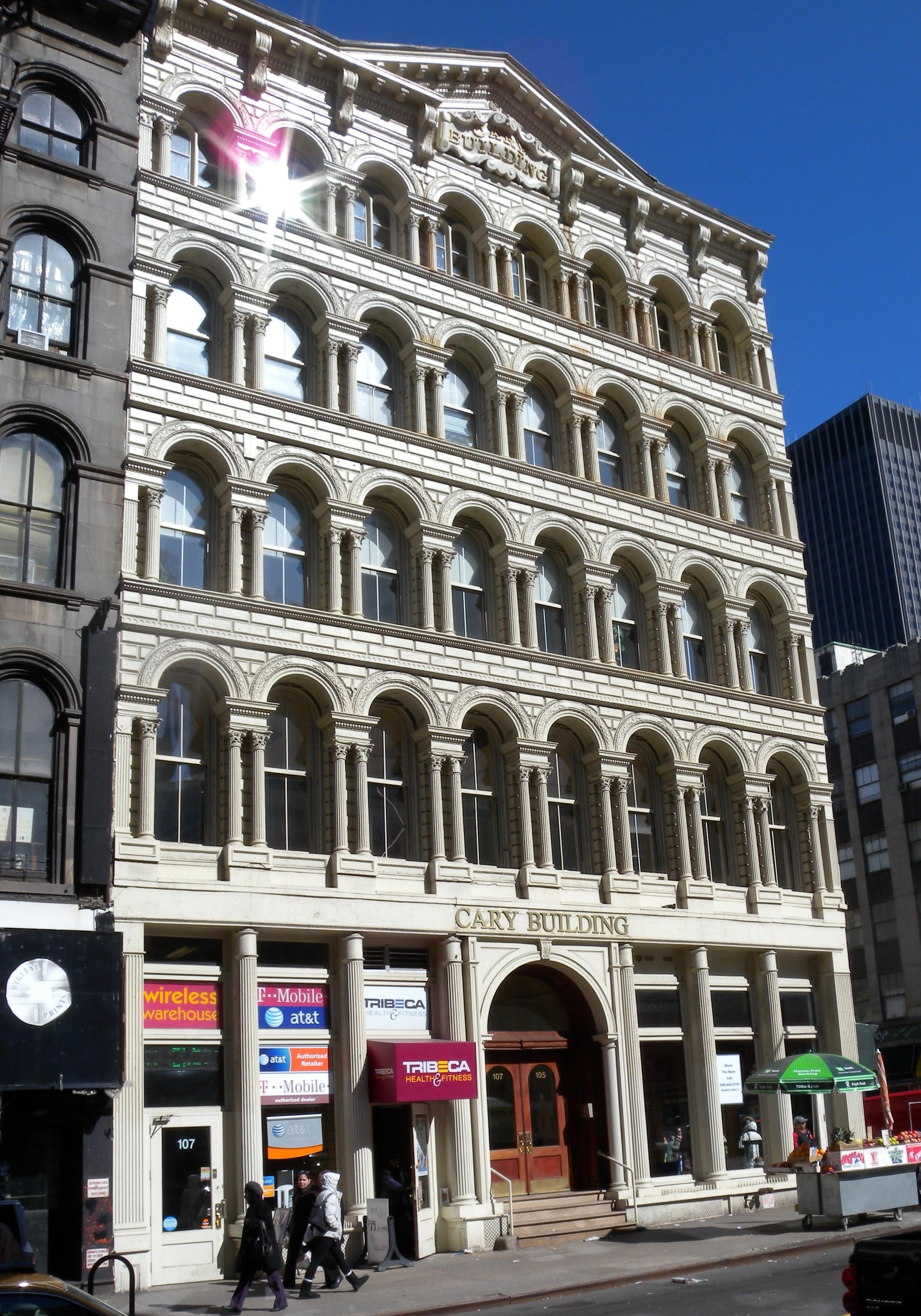
40°43′3″N 74°0′19″W / 40.7175°N 74.00528°WNew York 30 Cary Building 
September 15, 1983 105-107 Chambers St.
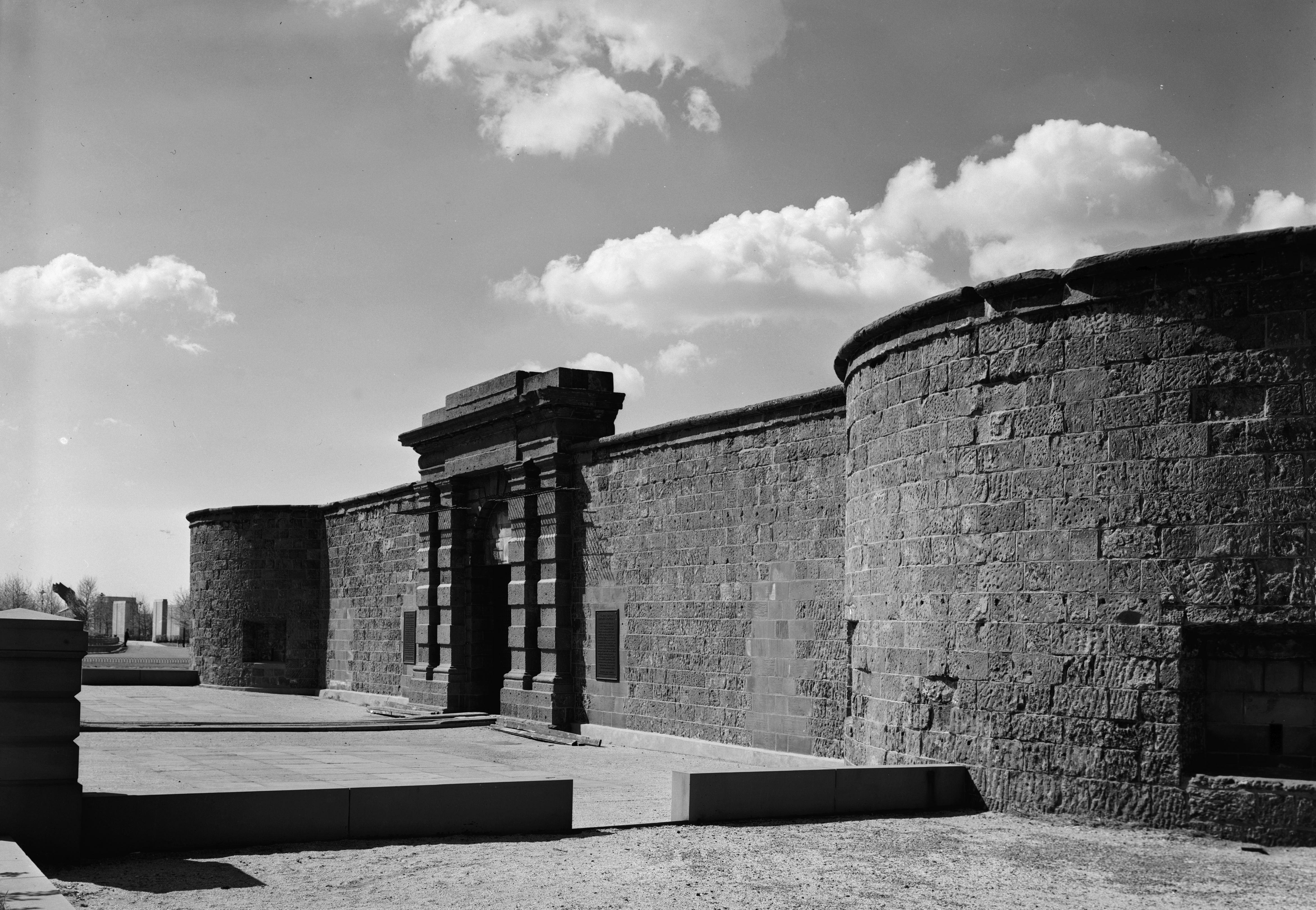
40°42′55″N 74°0′30″W / 40.71528°N 74.00833°WNew York 31 Castle Clinton National Monument 
October 15, 1966 South Ferry
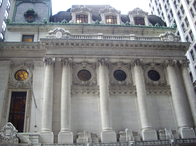
40°42′12″N 74°1′1″W / 40.70333°N 74.01694°WNew York 32 Chamber of Commerce 
February 6, 1973 65 Liberty St.
40°42′32″N 74°0′36″W / 40.70889°N 74.01°WNew York 33 Chambers Street Subway station (J Z trains) 
July 6, 2005 Beneath the Municipal Building at Chambers, Centre and Duane Sts. and Lafayette Plaza
40°42′47″N 74°0′14″W / 40.71306°N 74.00389°WNew York 34 Chambers Street Subway station (1 2 3 trains) 
March 30, 2005 Under West Broadway bet WArren, Chambers and Reade Sts.
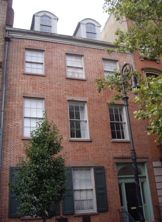
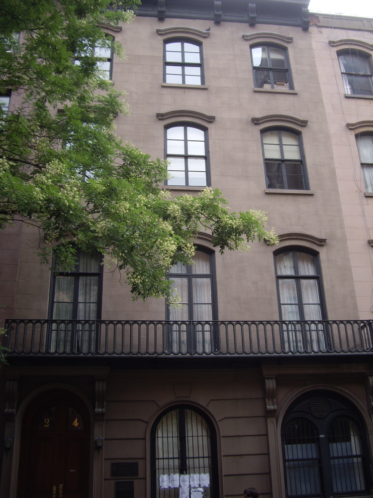
40°42′56″N 74°0′35″W / 40.71556°N 74.00972°WNew York 35 Charles Street House at No. 131 
November 3, 1972 131 Charles St.
40°44′4″N 74°0′28″W / 40.73444°N 74.00778°WNew York 36 Charlton-King-Vandam Historic District 
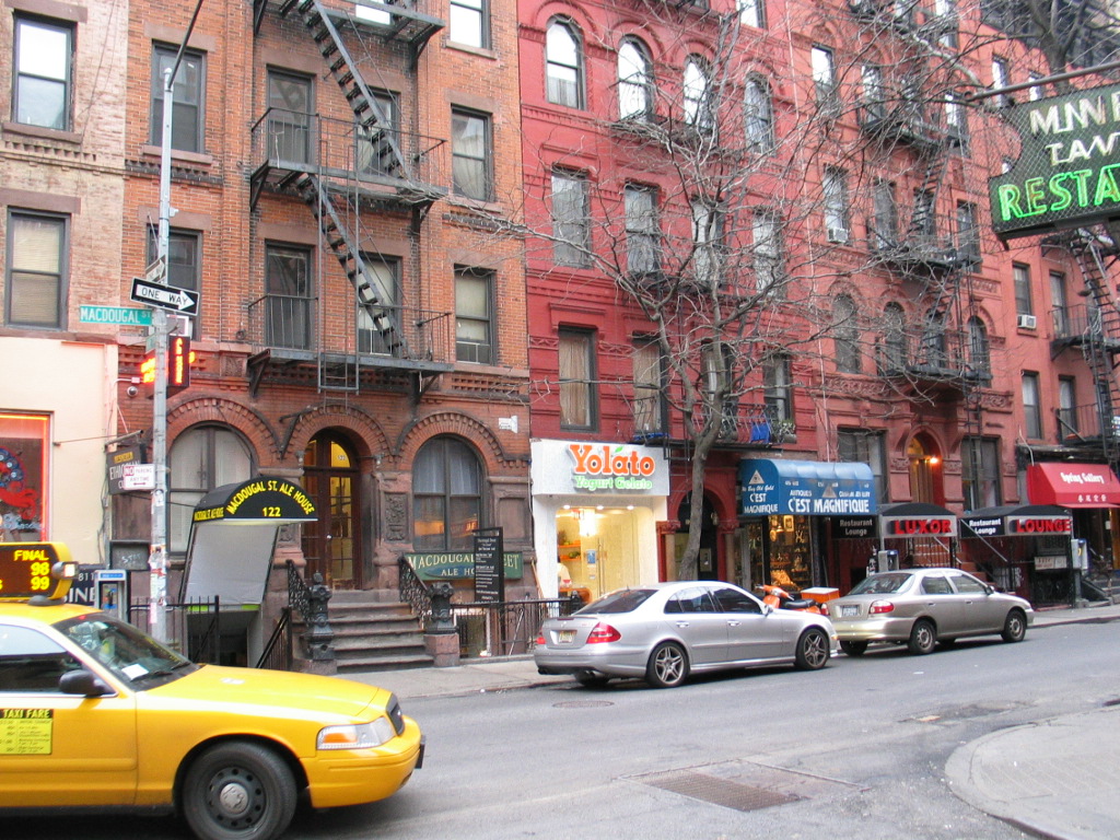
July 20, 1973 Roughly bounded by Varick, Vandam, MacDougal and King Sts.
40°43′38″N 74°0′15″W / 40.72722°N 74.00417°WNew York 37 Chinatown and Little Italy Historic District 

February 12, 2010 Roughly bounded by Baxter St., Centre St., Cleveland Pl. and Lafayette St. to the W; Jersey St. and E. Houston
40°43′11.28″N 73°59′54.8″W / 40.7198°N 73.998556°WNew York Two of the city's most significant ethnic enclaves 38 Christodora House 
March 20, 1986 147 Ave. B
40°43′35″N 73°58′50″W / 40.72639°N 73.98056°WNew York 39 Church of the Ascension (Protestant Episcopal) 
December 23, 1987 36-38 Fifth Ave.
40°44′1″N 73°59′46″W / 40.73361°N 73.99611°WNew York 40 Church of the Transfiguration (Mott Street, New York, New York) 
April 16, 1980 25 Mott St.
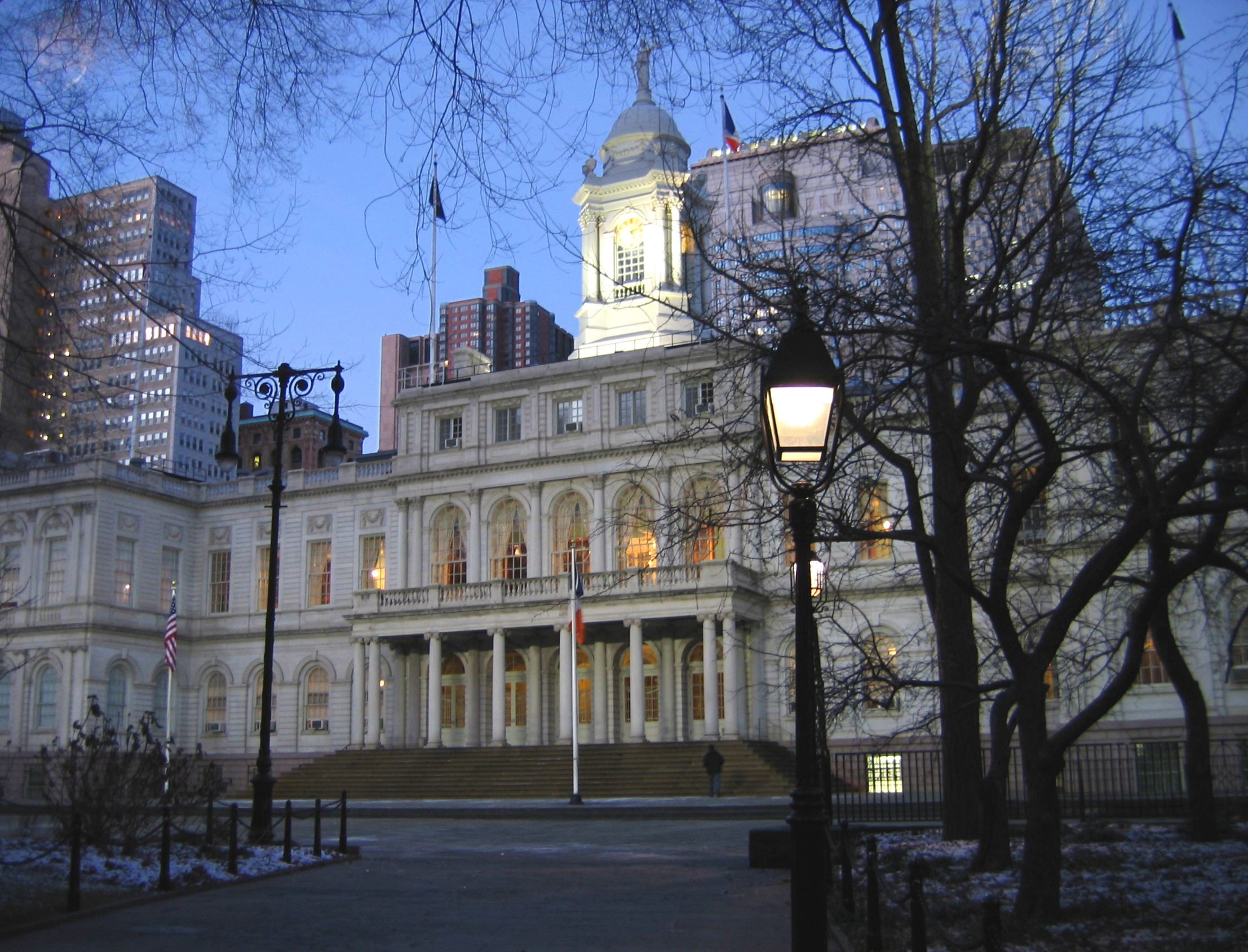
40°42′53″N 73°59′57″W / 40.71472°N 73.99917°WNew York 41 City Hall 
October 15, 1966 Broadway and Chambers St.
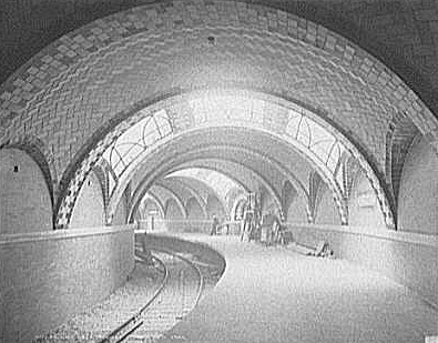
40°42′48.23″N 74°0′19.99″W / 40.7133972°N 74.0055528°WLower Manhattan 42 City Hall Subway station (closed) 
September 17, 2004 Park Row and City Hall Park
40°42′42″N 74°0′26″W / 40.71167°N 74.00722°WLower Manhattan 43 City Pier A 
June 27, 1975 S end of Battery Pl. at Hudson River
40°42′15″N 74°1′6″W / 40.70417°N 74.01833°WBattery Park 44 Cooper Union 
October 15, 1966 Cooper Square, 7th St., and 4th Ave.
40°43′45″N 73°59′27″W / 40.72917°N 73.99083°WNew York 45 Corbin Building 
December 18, 2003 192 Broadway
40°42′36″N 74°0′34″W / 40.71°N 74.00944°WNew York 46 Devinne Press Building 
September 14, 1977 393-399 Lafayette St.
40°43′40″N 73°59′36″W / 40.72778°N 73.99333°WNew York 47 Eldridge Street Synagogue 
March 28, 1980 12-16 Eldridge St.
40°42′53″N 73°59′39″W / 40.71472°N 73.99417°WNew York 48 Empire Building 
August 28, 1998 71 Broadway
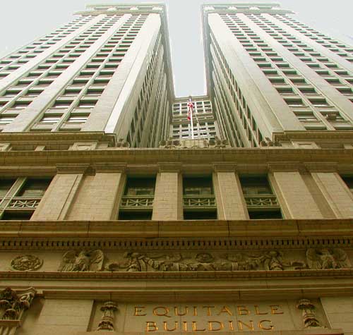
40°42′26″N 74°0′47″W / 40.70722°N 74.01306°WNew York 49 Equitable Building 
June 2, 1978 120 Broadway
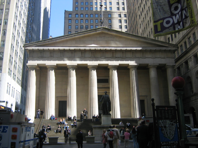
40°42′29″N 74°0′39″W / 40.70806°N 74.01083°WNew York 50 Federal Hall National Memorial 
October 15, 1966 Wall and Nassau Sts.
40°42′26″N 74°0′38″W / 40.70722°N 74.01056°WNew York 51 Federal Office Building 
August 30, 1974 641 Washington St.
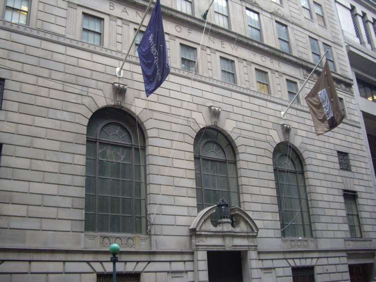
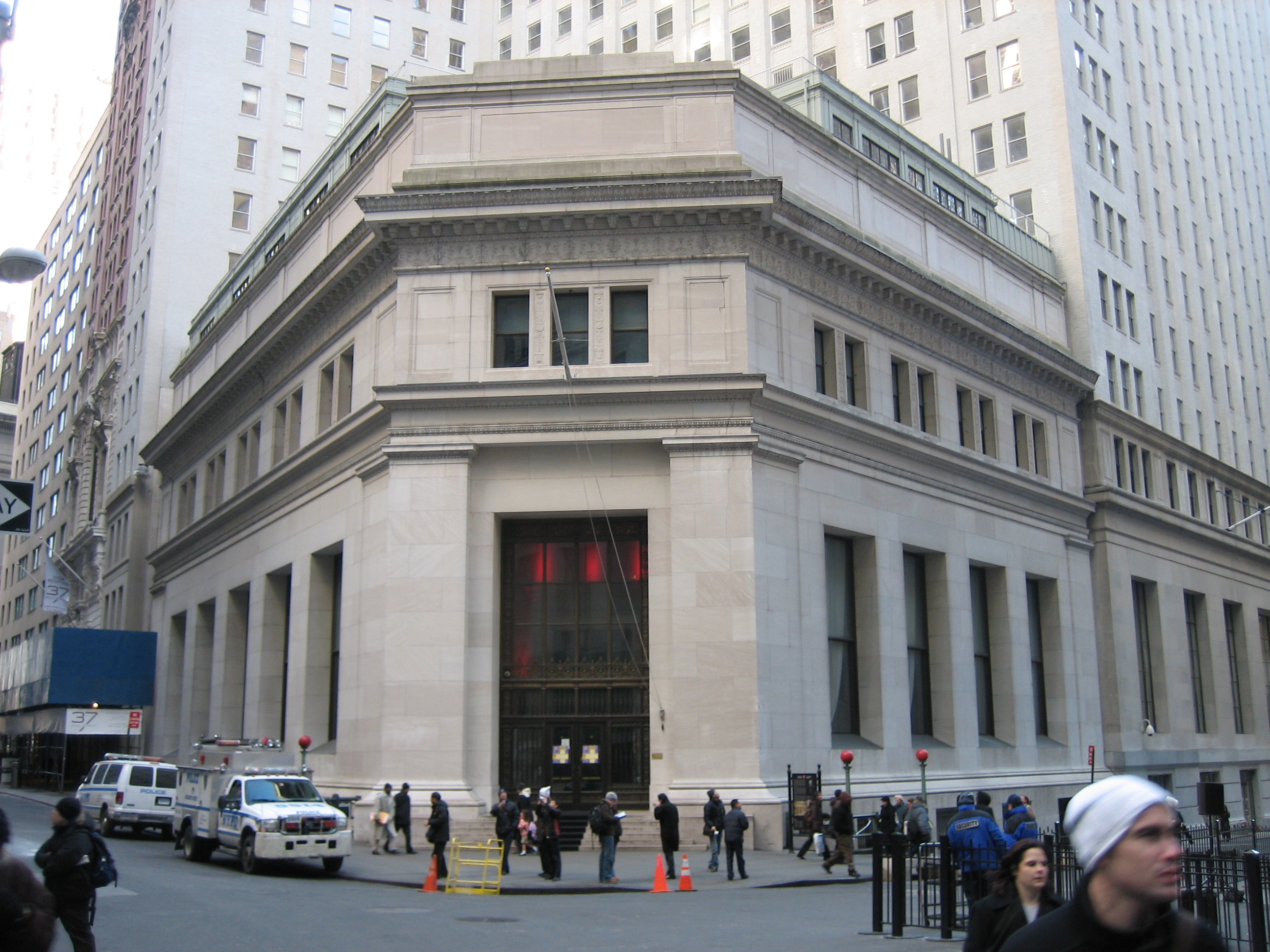
40°43′56″N 74°0′31″W / 40.73222°N 74.00861°WNew York 52 Federal Reserve Bank of New York 
May 6, 1980 33 Liberty St.
40°42′33″N 74°0′36″W / 40.70917°N 74.01°WNew York 53 Firehouse, Engine Company 31 
January 20, 1972 87 Lafayette St.
40°43′2″N 74°0′5″W / 40.71722°N 74.00139°WNew York 54 Firehouse, Engine Company 33 
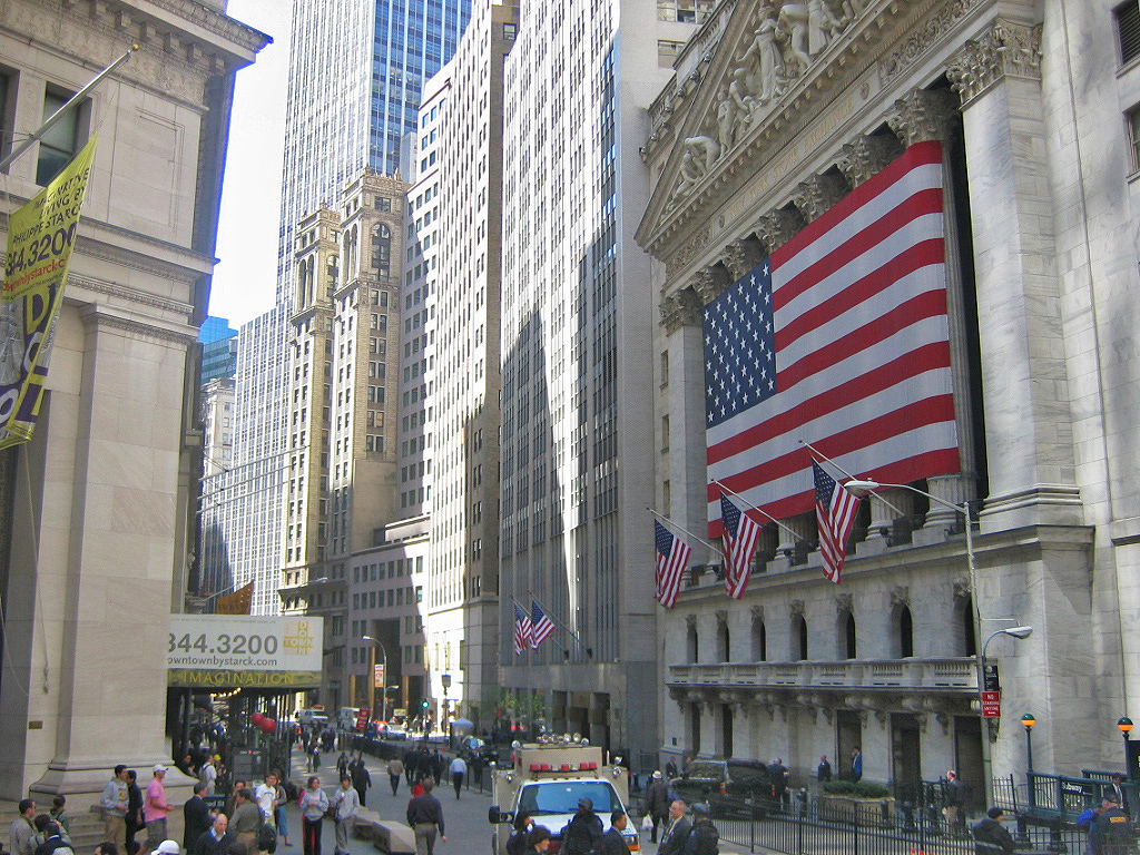
March 16, 1972 44 Great Jones St.
40°43′37″N 73°59′35″W / 40.72694°N 73.99306°WNew York 55 First Houses 
December 18, 1979 E. 3rd St. and Ave. A
40°43′25″N 73°59′9″W / 40.72361°N 73.98583°WNew York 56 First National City Bank 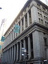
August 18, 1972 55 Wall St.
40°42′22″N 74°0′36″W / 40.70611°N 74.01°WNew York 57 First Police Precinct Station House 
October 29, 1982 South St. and Old Slip
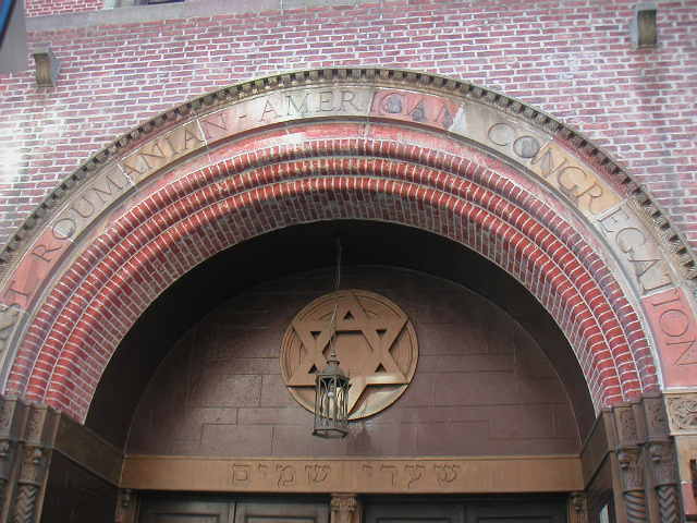
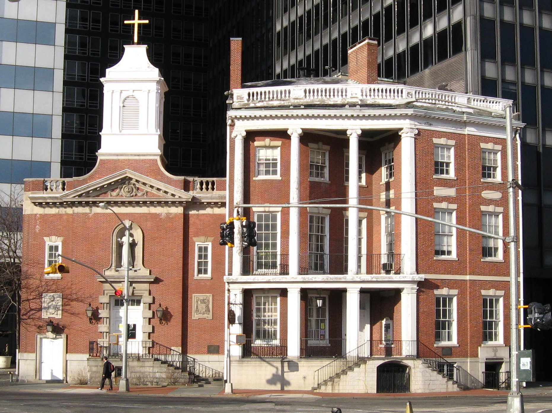
40°42′12″N 74°0′31″W / 40.70333°N 74.00861°WNew York 58 First Romanian-American Congregation Synagogue 
March 12, 1998 89-93 Rivington St.
40°43′12″N 73°59′21″W / 40.72°N 73.98917°WNew York 59 First Shearith Israel Graveyard 
April 17, 1980 55-57 St. James Pl.
40°42′46″N 73°59′56″W / 40.71278°N 73.99889°WNew York 60 Hamilton Fish House 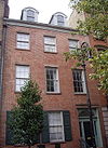
July 31, 1972 21 Stuyvesant St.
40°43′49″N 73°59′20″W / 40.73028°N 73.98889°WNew York 61 Former Emigrant Industrial Savings Bank 
February 25, 1982 51 Chambers St.
40°42′50″N 74°0′19″W / 40.71389°N 74.00528°WNew York 62 Former New York Life Insurance Company Building 
June 28, 1982 346 Broadway
40°42′58″N 74°0′13″W / 40.71611°N 74.00361°WNew York 63 Former Police Headquarters Building 
March 28, 1980 240 Centre St.
40°43′12″N 73°59′56″W / 40.72°N 73.99889°WLittle Italy 64 Fourteenth Ward Industrial School 
January 27, 1983 256-258 Mott St.
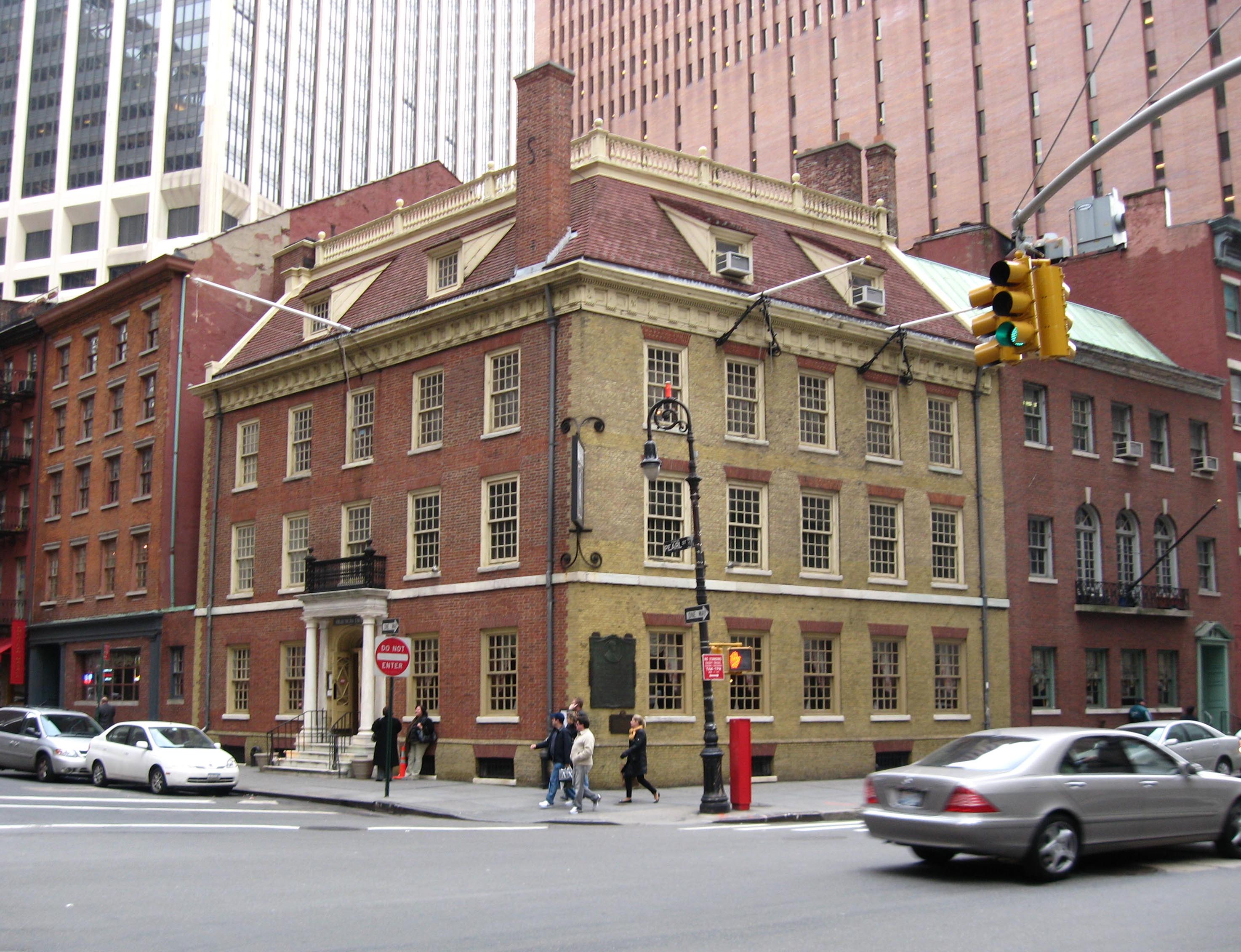
40°43′25″N 73°59′41″W / 40.72361°N 73.99472°WNew York 65 Fraunces Tavern Block 
April 28, 1977 Bounded by Pearl, Water, Broad Sts. and Coenties Slip
40°42′12″N 74°0′41″W / 40.70333°N 74.01139°WNew York 66 Fraunces Tavern 
March 6, 2008 54 Pearl Street
40°42′12.62″N 74°0′41.55″W / 40.7035056°N 74.0115417°WNew York 67 Fulton-Nassau Historic District 
September 7, 2005 Roughly bounded by Broadway and Park Row, Nassau, Dutch and William Sts, Ann and Spruce Sts. and Liberty St.
40°42′37″N 74°0′29″W / 40.71028°N 74.00806°WNew York 68 Gansevoort Market Historic District 
May 30, 2007 Roughly bounded by W 16th St., Ninth Ave., and Hudson St., Gansevoort St.; West St. and Eleventh Ave.
40°44′27.55″N 74°0′27.4″W / 40.7409861°N 74.007611°WNew York 69 German Evangelical Lutheran Church of St. Mark 
April 15, 2004 323 E. 6th St.
40°43′37″N 73°59′15″W / 40.72694°N 73.9875°WNew York 70 Gouverneur Hospital 
October 29, 1982 621 Water St.
40°42′39″N 73°59′5″W / 40.71083°N 73.98472°WNew York 71 Grace Church and Dependencies 
June 28, 1974 Broadway, 10th St., and 4th Ave.
40°43′55″N 73°59′28″W / 40.73194°N 73.99111°WNew York 72 Greenwich Village Historic District 
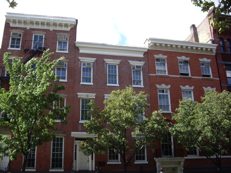
June 19, 1979 Roughly bounded by W. 13th St., St. Luke's Pl., University Pl., and Washington St.
40°44′2″N 74°0′4″W / 40.73389°N 74.00111°WNew York 73 E. V. Haughwout Building 
August 28, 1973 488-492 Broadway
40°43′24″N 74°0′10″W / 40.72333°N 74.00278°WNew York Home of the world's first successful passenger elevator, a hydraulic lift designed for the building by Elisha Graves Otis 74 Henry Street Settlement and Neighborhood Playhouse 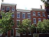
September 13, 1974 263-267 Henry St. and 466 Grand St.
40°42′50″N 73°59′7″W / 40.71389°N 73.98528°WNew York 75 Holland Tunnel 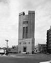
November 4, 1993 Connecting Lower Manhattan and Jersey City, running under the Hudson R.
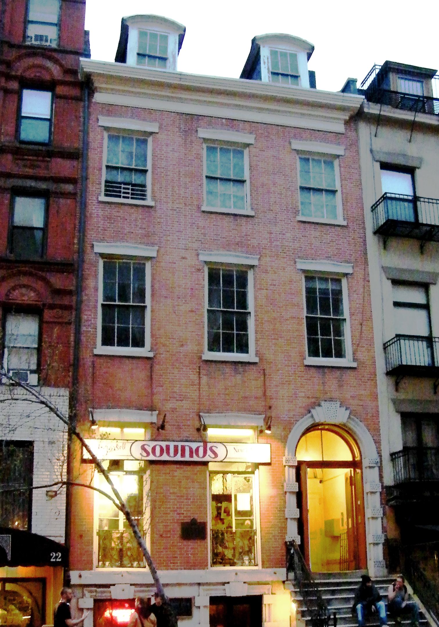
40°43′38″N 74°0′41″W / 40.72722°N 74.01139°WNew York 76 Houses at 26, 28 and 30 Jones Street 
June 3, 1982 26, 28 and 30 Jones St.
40°43′53″N 74°0′10″W / 40.73139°N 74.00278°WNew York 77 Isaac T. Hopper House 
May 22, 1986 110 Second Ave.
40°43′39″N 73°59′19″W / 40.7275°N 73.98861°WNew York 78 House at 203 Prince Street 
May 26, 1983 203 Prince St.
40°43′37″N 74°0′12″W / 40.72694°N 74.00333°WNew York 79 Samuel GTredwell Skidmore House at 37 East 4th Street 
January 3, 1980 37 E. 4th St.
40°43′39″N 73°59′32″W / 40.7275°N 73.99222°WNew York 80 House at 51 Market Street 
July 29, 1977 51 Market St.
40°42′42″N 73°59′42″W / 40.71167°N 73.995°WNew York 81 Houses at 83 and 85 Sullivan Street 
November 17, 1980 83-85 Sullivan St.
40°43′29″N 74°0′14″W / 40.72472°N 74.00389°WNew York 82 Insurance Company of North America Building 
November 30, 1999 99 John St.
40°42′30″N 74°0′23″W / 40.70833°N 74.00639°WNew York 83 International Mercantile Marine Company Building 
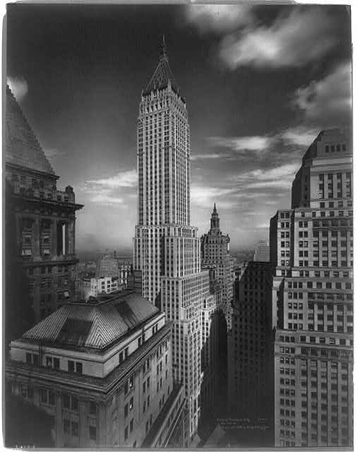
March 2, 1991 1 Broadway
40°42′17″N 74°0′54″W / 40.70472°N 74.015°WNew York 84 J. P. Morgan & Co. Building 
June 19, 1972 23 Wall St.
40°42′27″N 74°0′42″W / 40.7075°N 74.01167°WNew York 85 John A. Lynch (ferryboat) 
September 7, 1984 Pier 15, East River, Manhattan
40°42′18″N 74°0′8″W / 40.705°N 74.00222°WNew York No longer docked at Pier 15 86 John Street Building No. 170-176 
May 13, 1971 170-176 John St.
40°42′21″N 74°0′17″W / 40.70583°N 74.00472°WNew York 87 John Street Methodist Church 
June 4, 1973 44 John St.
40°42′33″N 74°0′31″W / 40.70917°N 74.00861°WNew York 88 Joralemon Street Tunnel (4 5 trains) 
February 9, 2006 Tunnel beneath East River from Bowling Green (State St.) to Joralemon St. and Willow Place
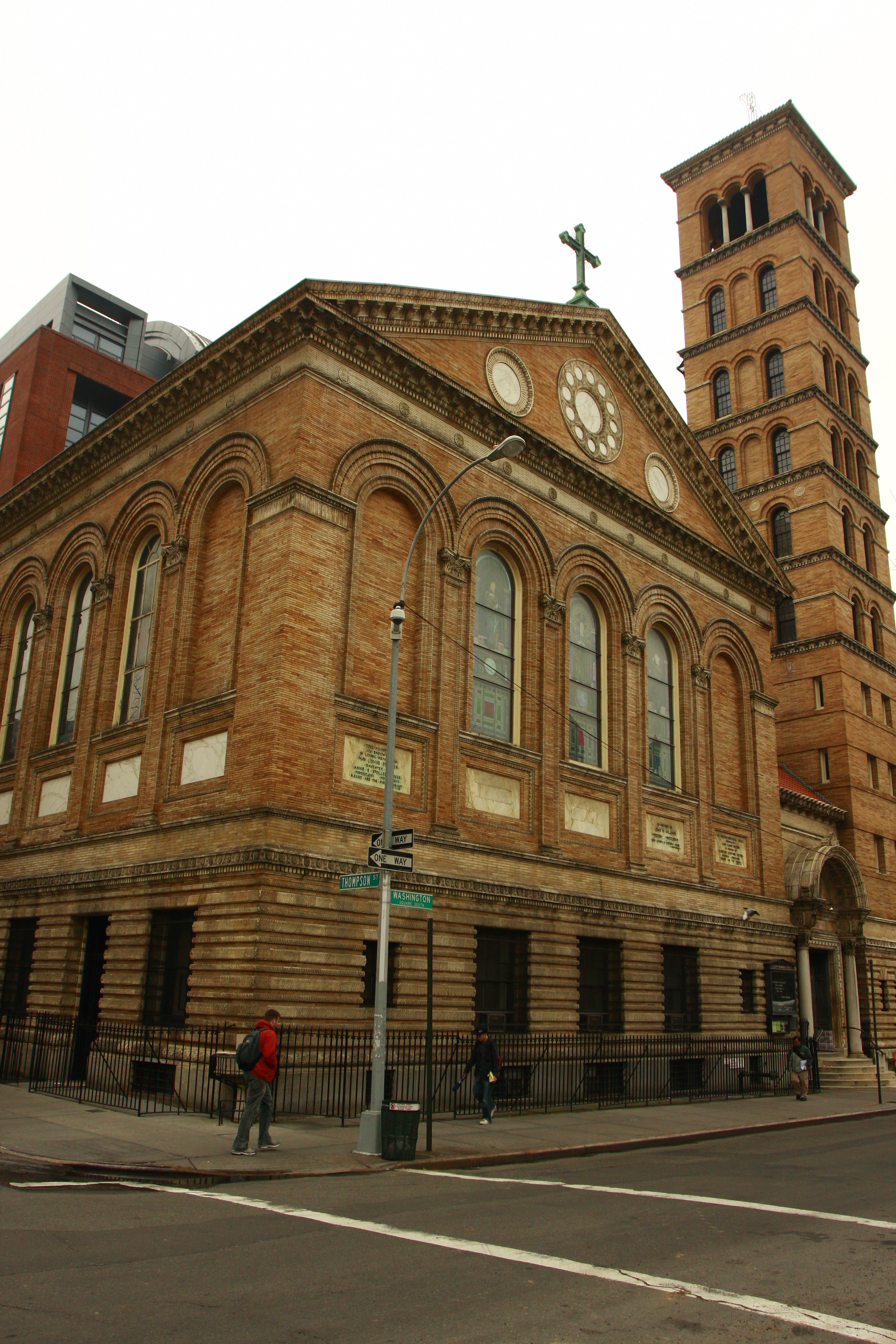
40°41′53″N 74°0′27″W / 40.69806°N 74.0075°WNew York 89 Judson Memorial Church, Campanile, and Judson Hall 
October 16, 1974 Washington Sq. at Thompson St.
40°43′50″N 73°59′51″W / 40.73056°N 73.9975°WNew York 90 Kehila Kedosha Janina Synagogue 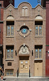
November 30, 1999 280 Broome St.
40°43′7″N 73°59′30″W / 40.71861°N 73.99167°WNew York 91 LaGrange Terrace 
December 12, 1976 428-434 Lafayette St.
40°43′46″N 73°59′34″W / 40.72944°N 73.99278°WNew York Known also as Colonnade Row 92 Lee, Higginson & Company Bank Building 
June 7, 2006 41 Broad St.
40°42′20″N 74°0′41″W / 40.70556°N 74.01139°WNew York 93 Daniel LeRoy House 
October 29, 1982 20 St. Mark's Pl.
40°43′43″N 73°59′20″W / 40.72861°N 73.98889°WNew York 94 Lettie G. Howard (schooner) 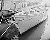
September 7, 1984 South Street Seaport Museum
40°42′17″N 74°0′15″W / 40.70472°N 74.00417°WNew York 95 Liberty Tower 
September 15, 1983 55 Liberty St.
40°42′31″N 74°0′35″W / 40.70861°N 74.00972°WNew York 96 Lilac, United States Lighthouse Tender 
January 7, 2005 Pier 40
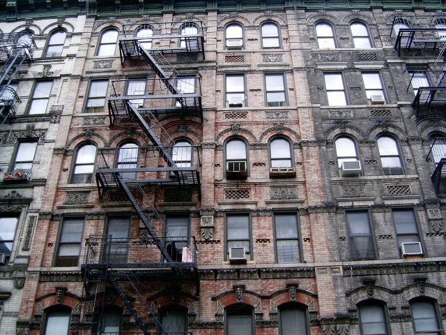
40°43′58″N 74°0′46″W / 40.73278°N 74.01278°WNew York 97 Lower East Side Historic District 
September 7, 2000 Roughly bounded by Allen St., E. Houston, Essex St., Canal St., Eldridge St., E. Broadway, and Grand St.
40°43′2″N 73°59′23″W / 40.71722°N 73.98972°WNew York 98 MacDougal-Sullivan Gardens Historic District 
June 30, 1983 74-76 MacDougal St., 170-188 Sullivan St.
40°43′42″N 74°0′10″W / 40.72833°N 74.00278°WNew York 99 Machigonne (ferry) 
December 3, 1992 Pier 25
40°43′18″N 74°0′57″W / 40.72167°N 74.01583°WNew York 100 Macmillan Building 
November 1, 2006 60-62 Fifth Ave.
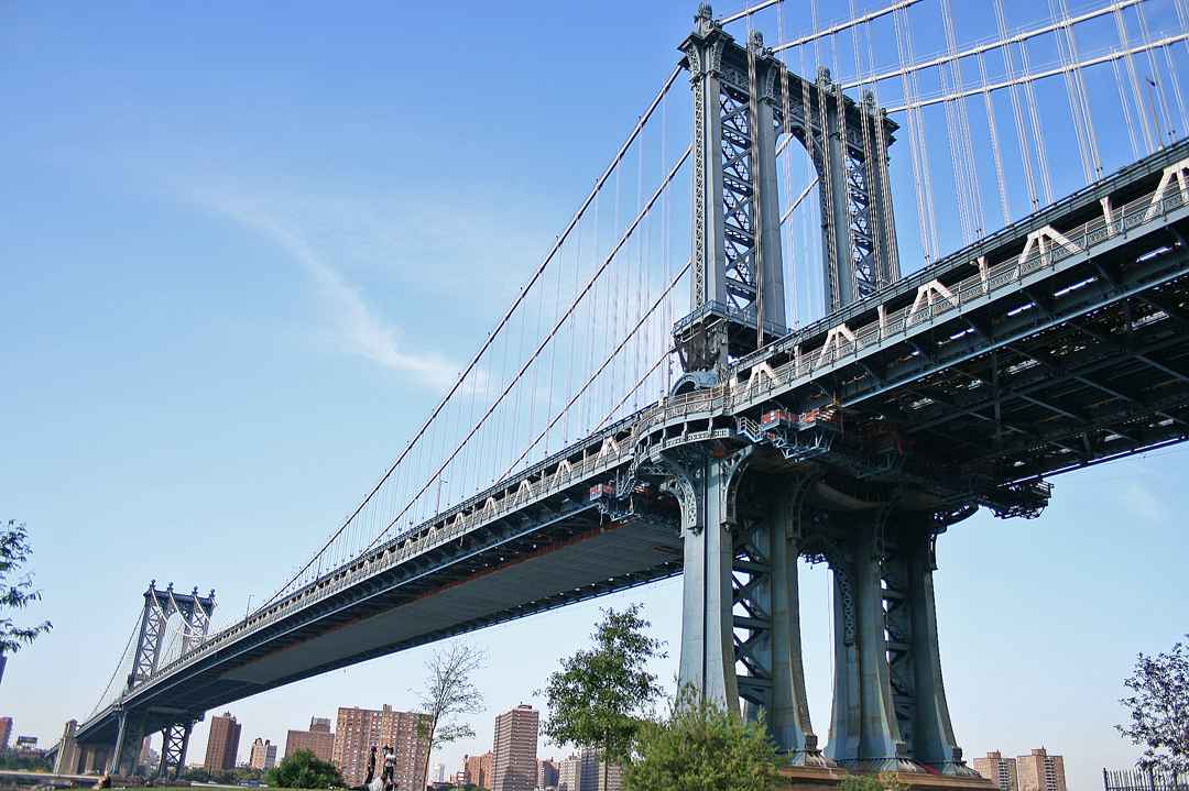
40°44′6″N 73°59′43″W / 40.735°N 73.99528°WNew York Now used by Forbes Magazine 101 Manhattan Bridge 
August 30, 1983 Spans East River between Front and Canal St.
40°42′36″N 73°59′18″W / 40.71°N 73.98833°WNew York 102 Manhattan Company Building 
June 16, 2000 40 Wall St.
40°42′25″N 74°0′36″W / 40.70694°N 74.01°WNew York 103 Mariner's Temple 
April 16, 1980 12 Oliver St.
40°42′46″N 73°59′54″W / 40.71278°N 73.99833°WNew York 104 Metropolitan Savings Bank Building 
December 12, 1976 9 E. 7th St.
40°43′44″N 73°59′26″W / 40.72889°N 73.99056°WNew York 105 Edward Mooney House 
December 12, 1976 18 Bowery
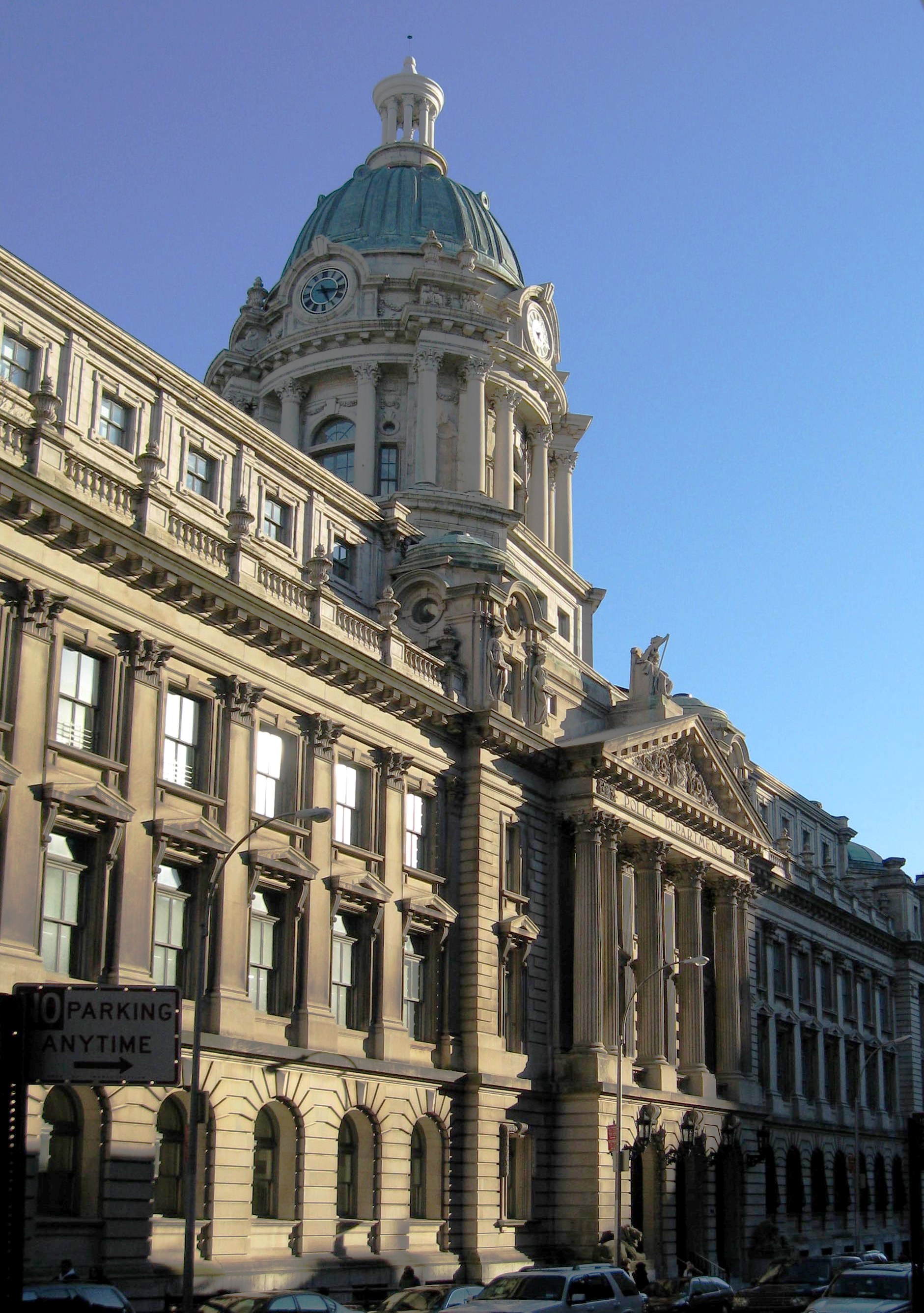
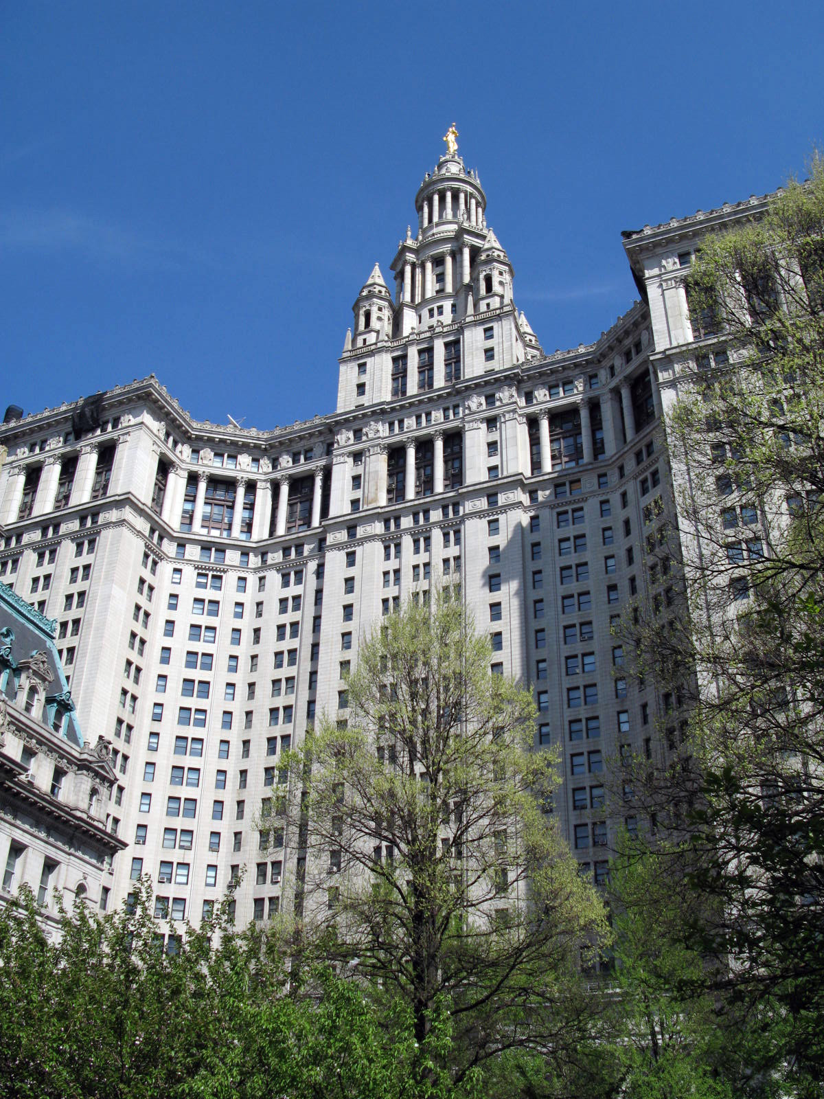
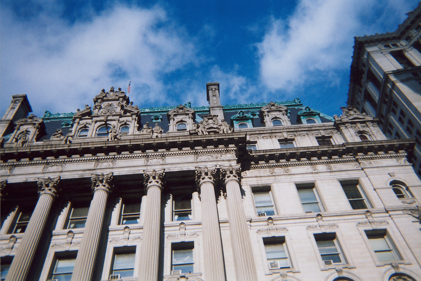
40°42′52″N 73°59′53″W / 40.71444°N 73.99806°WNew York 106 Municipal Building 
October 18, 1972 Chambers at Centre St.
40°42′47″N 74°0′14″W / 40.71306°N 74.00389°WNew York 107 Municipal Ferry Pier 
December 12, 1976 11 South St.
40°42′3″N 74°0′43″W / 40.70083°N 74.01194°WNew York 108 National City Bank June 2, 1978 55 Wall St.
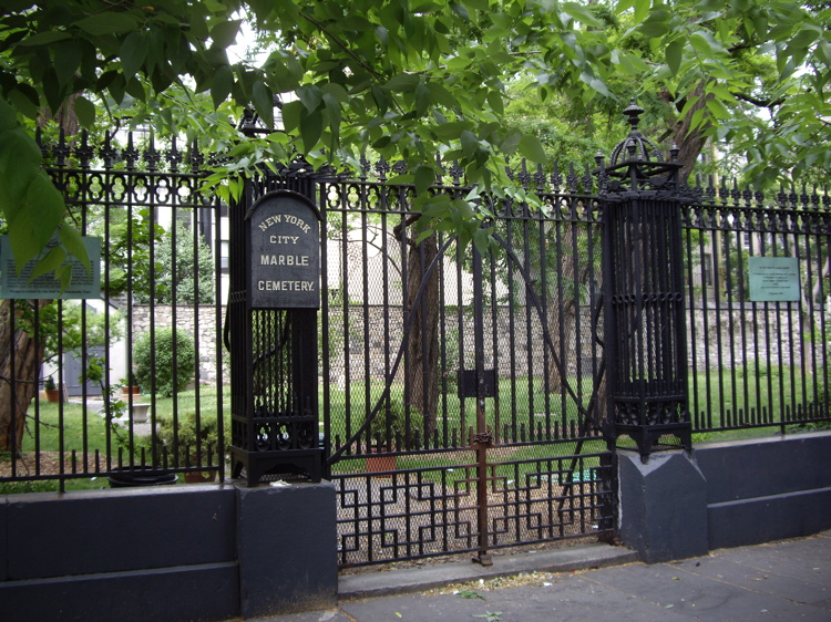
40°42′21″N 74°0′35″W / 40.70583°N 74.00972°WNew York 109 New York City Marble Cemetery 
September 17, 1980 52-74 E. 2nd St.
40°43′28″N 73°59′23″W / 40.72444°N 73.98972°WNew York 110 New York Cotton Exchange 
January 7, 1972 1 Hanover Sq.
40°42′16″N 74°0′37″W / 40.70444°N 74.01028°WNew York 111 New York County Lawyers Association Building 
October 29, 1982 14 Vesey St.
40°42′43″N 74°0′35″W / 40.71194°N 74.00972°WNew York 112 New York Evening Post Building 
September 22, 2000 75 West St.
40°42′32″N 74°0′54″W / 40.70889°N 74.015°WNew York 113 New York Marble Cemetery 
September 17, 1980 Between East 2nd and 3rd Sts.,2nd Ave. and Bowery
40°44′4″N 73°59′29″W / 40.73444°N 73.99139°WNew York 114 New York Shakespeare Festival Public Theater 
December 2, 1970 425 Lafayette St.
40°43′41″N 73°59′33″W / 40.72806°N 73.9925°WNew York 115 New York Stock Exchange 
June 2, 1978 11 Wall St.
40°42′24″N 74°0′42″W / 40.70667°N 74.01167°WNew York 116 New York Studio School of Drawing, Painting and Sculpture 
April 27, 1992 8-14 W. 8th St.
40°43′57″N 73°59′53″W / 40.7325°N 73.99806°WNew York 117 New York Telephone Company Building 
April 30, 2009 140 West St.
40°42′49.51″N 74°0′46.5″W / 40.7137528°N 74.012917°WNew York 118 No. 8 Thomas Street Building 
April 30, 1980 8 Thomas St.
40°42′57″N 74°0′22″W / 40.71583°N 74.00611°WNew York 119 Odd Fellows Hall (New York, New York) 
September 22, 1983 165-171 Grand St.
40°43′11″N 73°59′53″W / 40.71972°N 73.99806°WNew York 120 Old Merchant's House 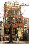
October 15, 1966 29 E. 4th St.
40°43′40″N 73°59′33″W / 40.72778°N 73.9925°WNew York Known also as Merchant's House Museum 121 Old New York Evening Post Building 
August 16, 1977 20 Vessy St.
40°42′43″N 74°0′36″W / 40.71194°N 74.01°WNew York 122 Old St. Patrick's Cathedral Complex 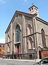
August 29, 1977 Mott and Prince Sts.
40°43′25″N 73°59′44″W / 40.72361°N 73.99556°WNew York 123 Ottendorfer Public Library and Stuyvesant Polyclinic Hospital 
July 22, 1979 135 and 137 2nd Ave.
40°43′47″N 73°59′15″W / 40.72972°N 73.9875°WNew York 124 Park Row Building 
November 16, 2005 15 Park Row
40°42′40″N 74°0′30″W / 40.71111°N 74.00833°WNew York 125 Charlie Parker Residence 
April 7, 1994 151 Charlie Parker Pl. (Avenue B)
40°43′36″N 73°58′50″W / 40.72667°N 73.98056°WNew York 126 Puck Building 
July 21, 1983 295-309 Lafayette St.
40°43′28″N 73°59′46″W / 40.72444°N 73.99611°WNew York 127 Robbins & Appleton Building 
October 29, 1982 1-5 Bond St.
40°43′36″N 73°59′45″W / 40.72667°N 73.99583°WNew York 128 St. Augustine's Chapel 
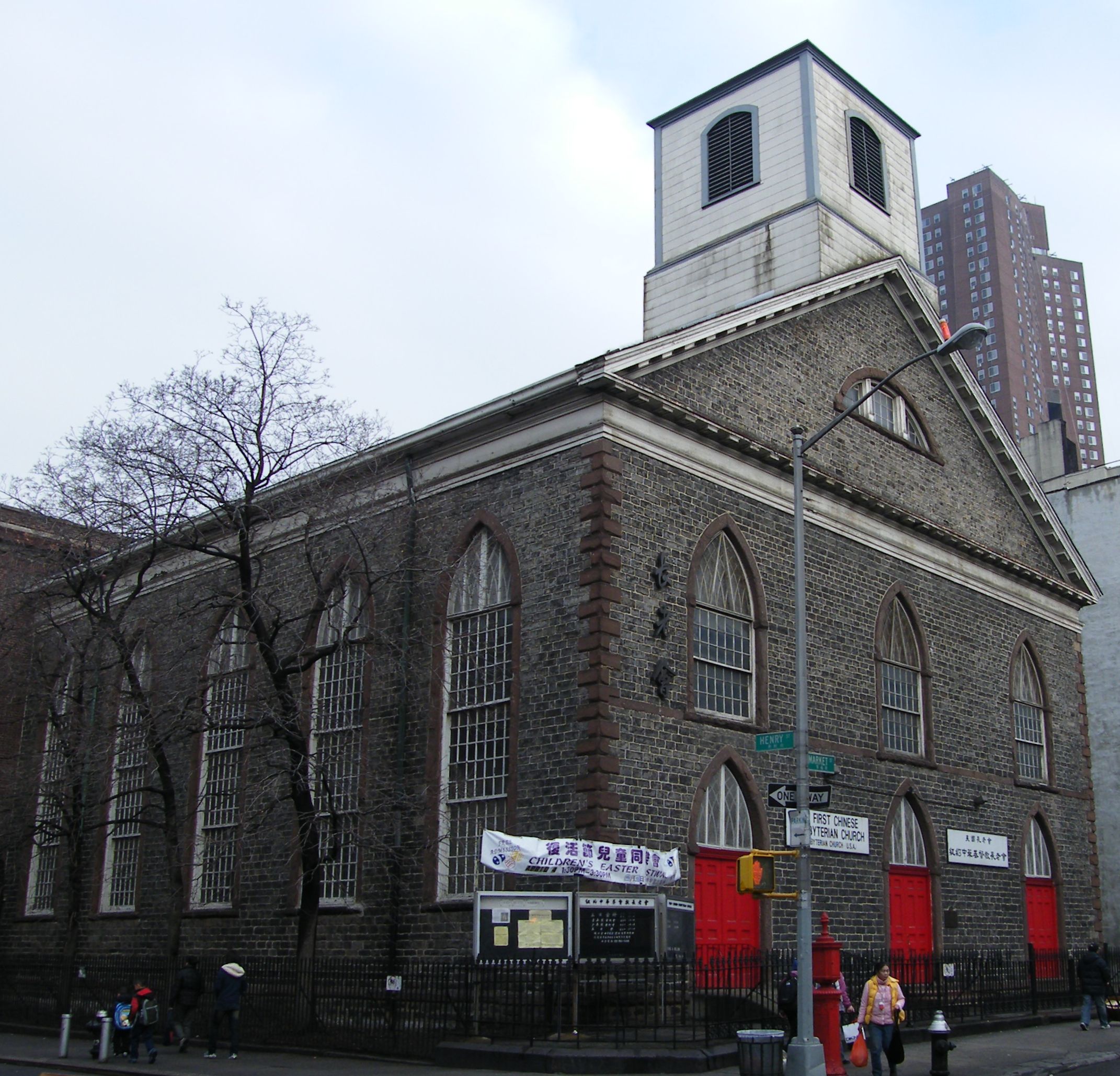
May 6, 1980 290 Henry St.
40°42′48″N 73°59′2″W / 40.71333°N 73.98389°WNew York (also known as All Saints Free Church) 129 St. James Church 
July 24, 1972 32 James St.
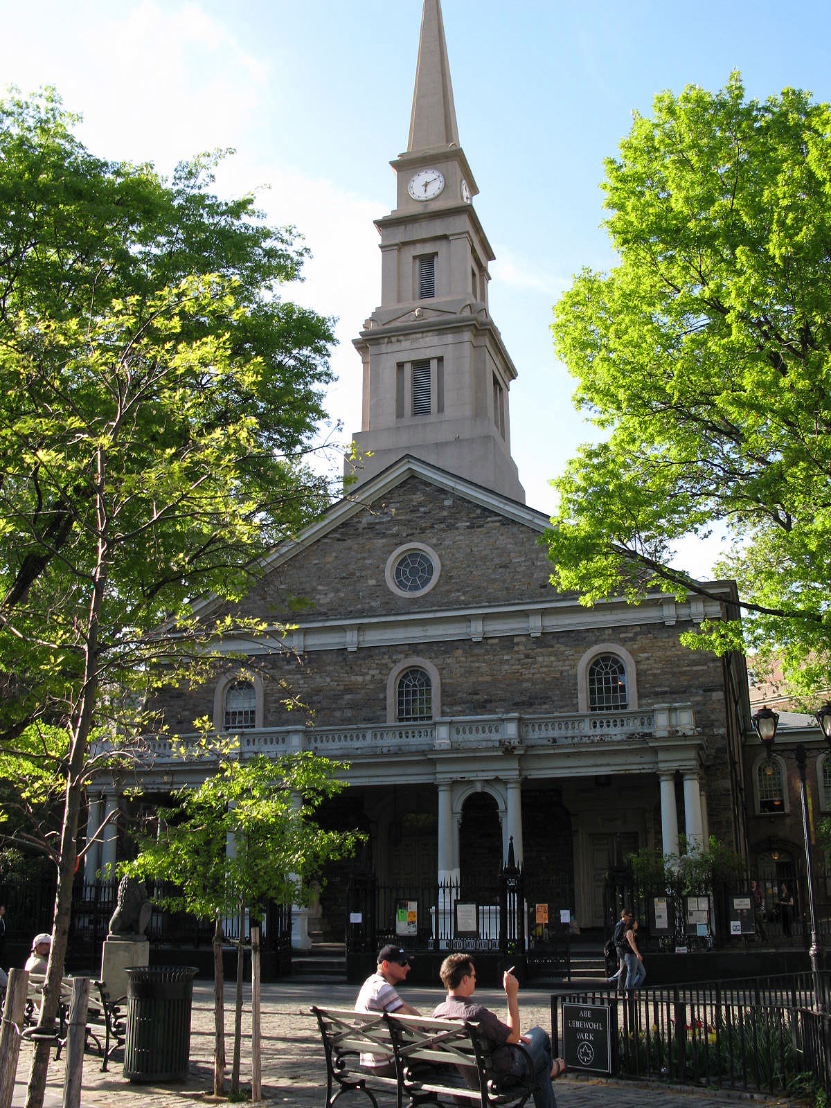
40°42′44″N 73°59′57″W / 40.71222°N 73.99917°WNew York 130 St.-Marks-In-The-Bowery 
June 19, 1972 E. 10th St. and 2nd Ave.
40°43′49″N 73°59′15″W / 40.73028°N 73.9875°WEast Village 131 St. Mark's Historic District 
November 13, 1974 Roughly bounded by 2nd and 3rd Aves. and E. 9th and 11th Sts.
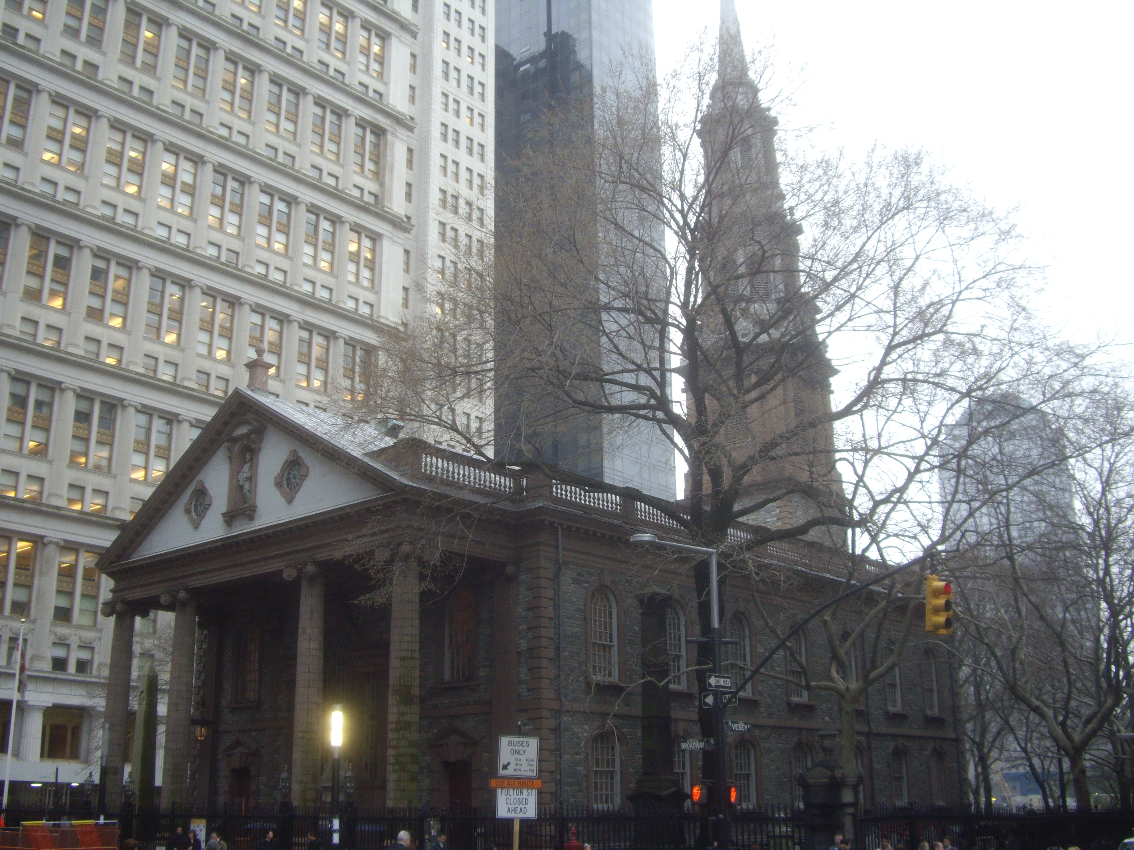
40°43′50″N 73°59′17″W / 40.73056°N 73.98806°WNew York 132 St. Paul's Chapel 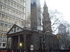
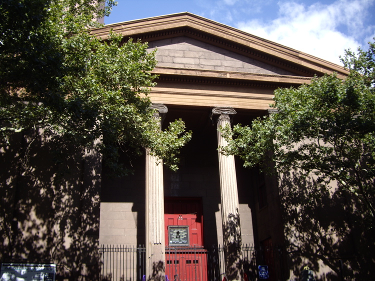
October 15, 1966 209 Broadway, between Fulton and Vesey Sts.
40°42′41″N 74°0′36″W / 40.71139°N 74.01°WNew York 133 St. Peter's Roman Catholic Church 
April 23, 1980 22 Barclay St.
40°42′44″N 74°0′36″W / 40.71222°N 74.01°WNew York 134 Schermerhorn Row Block 
February 18, 1971 Block bounded by Front, Fulton, and South Sts., and Burling Slip
40°42′17″N 74°0′23″W / 40.70472°N 74.00639°WSouth Street Seaport 135 Gen. Winfield Scott House 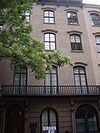
November 7, 1973 24 W. 12th St.
40°44′6″N 73°59′48″W / 40.735°N 73.99667°WGreenwich Village 136 Sea and Land Church 
April 9, 1980 61 Henry St.
40°42′46″N 73°59′42″W / 40.71278°N 73.995°WNew York (near the Manhattan Bridge) 137 Shearwater (schooner) 
March 9, 2009 North Cove Marina
40°42′46″N 74°1′2″W / 40.71278°N 74.01722°WNew York 138 Alfred E. Smith House 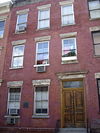
November 28, 1972 25 Oliver St.
40°42′44″N 73°59′55″W / 40.71222°N 73.99861°WNew York 139 Fleming Smith Warehouse 
May 26, 1983 451-453 Washington St.
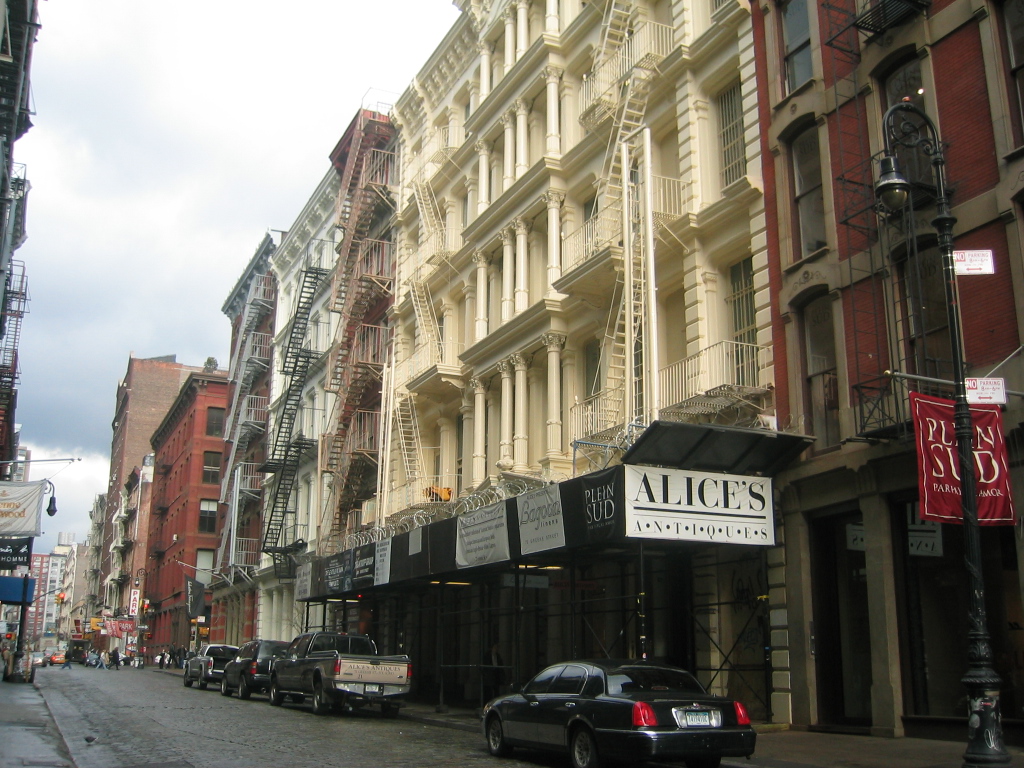
40°43′26″N 74°0′38″W / 40.72389°N 74.01056°WNew York 140 SoHo 
June 29, 1978 Roughly bounded by W. Broadway, Houston, Crosby, and Canal Sts.
40°43′23″N 74°0′3″W / 40.72306°N 74.00083°WNew York 141 South Street Seaport 
October 18, 1972 Bounded by Burling (John St.) and Peck Slips, and Water and South Sts.
40°42′22″N 74°0′12″W / 40.70611°N 74.00333°WNew York 142 South Street Seaport Historic District 
December 12, 1978 Roughly bounded by East River, Brooklyn Bridge, Fletcher Allry, Pearl, and South Sts.
40°42′24″N 74°0′10″W / 40.70667°N 74.00278°WNew York 143 Stanton Street Shul 
October 10, 2002 180 Stanton St.
40°43′12″N 73°59′4″W / 40.72°N 73.98444°WNew York 144 A. T. Stewart Company Store 
June 2, 1978 280 Broadway
40°42′51″N 74°0′22″W / 40.71417°N 74.00611°WNew York 145 Stone Street Historic District 
November 12, 1999 Stone, Pearl and S. William Sts. and Mill Ln.
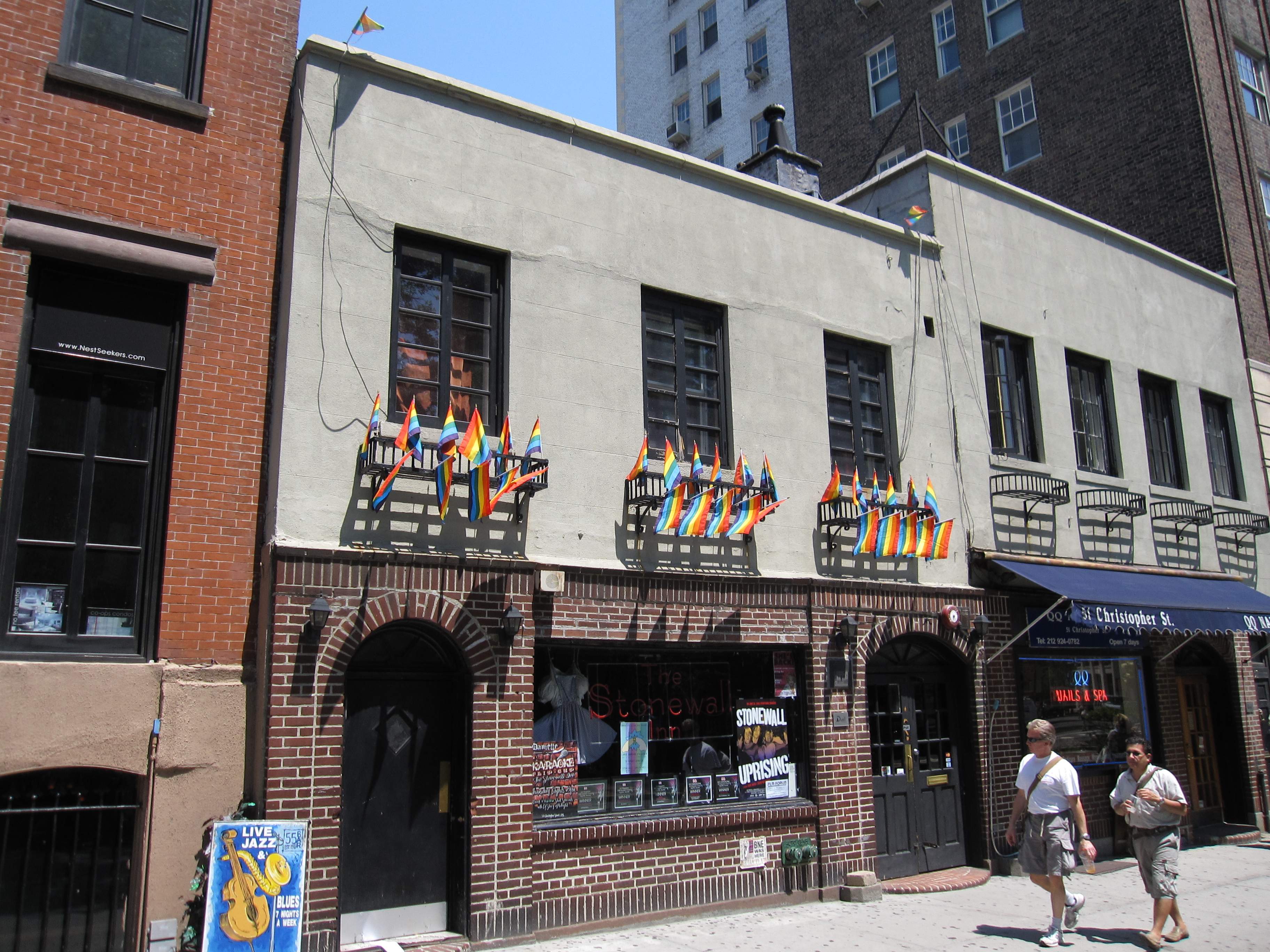
40°42′15″N 74°0′38″W / 40.70417°N 74.01056°WNew York 146 Stonewall 
May 27, 1999 Roughly bounded by Greenwich Ave., Seventh Ave., Washington St., and Sixth Ave.
40°44′2″N 74°0′4″W / 40.73389°N 74.00111°WNew York 147 Substation 235 
February 9, 2006 23 W. 13th St.
40°44′20″N 74°0′10″W / 40.73889°N 74.00278°WGreenwich Village 148 Substation 409 
February 9, 2006 163 Essex St.
40°43′17″N 73°59′15″W / 40.72139°N 73.9875°WNew York 149 Surrogate's Court 
January 29, 1972 31 Chambers St.
40°42′49″N 74°0′17″W / 40.71361°N 74.00472°WNew York 150 Tenement Building at 97 Orchard Street 
May 19, 1992 97 Orchard St.
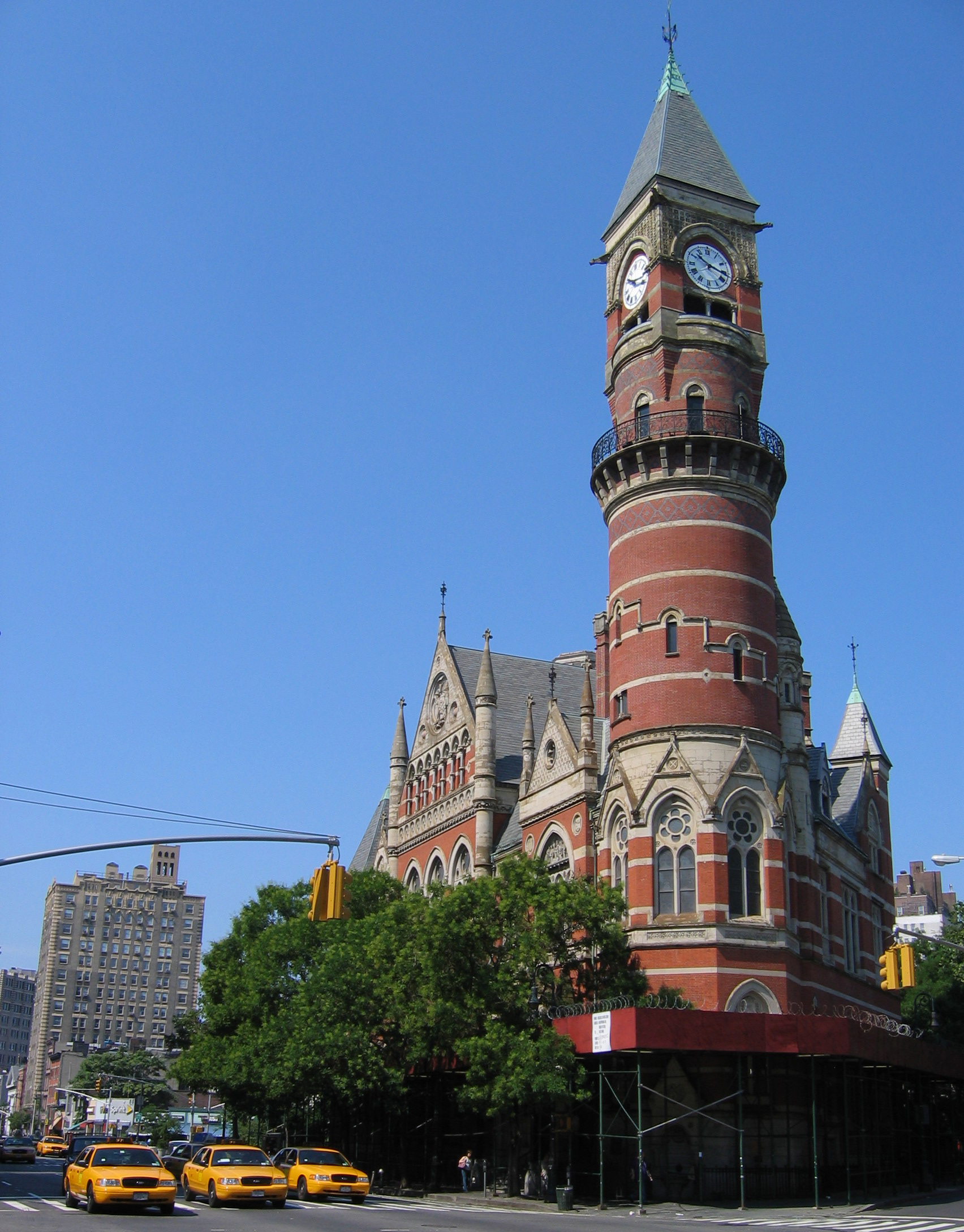
40°43′7″N 73°59′28″W / 40.71861°N 73.99111°WNew York Operated as Lower East Side Tenement National Historic Site 151 Third Judicial District Courthouse 
November 9, 1972 425 Avenue of the Americas
40°44′5″N 74°0′41″W / 40.73472°N 74.01139°WGreenwich Village Now known as Jefferson Market Library 152 Triangle Shirtwaist Factory 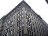
July 17, 1991 23-29 Washington Pl.
40°43′48″N 73°59′45″W / 40.73°N 73.99583°WGreenwich Village Site of the Triangle Shirtwaist Factory fire which led to workplace safety reforms. Now the Brown Building of Science, part of NYU 153 Trinity Church and Graveyard 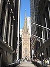
December 8, 1976 Broadway and Wall St.
40°42′28″N 74°0′45″W / 40.70778°N 74.0125°WNew York 154 Tweed Courthouse 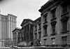
September 25, 1974 52 Chambers St.
40°42′47″N 74°0′22″W / 40.71306°N 74.00611°WCivic Center, Manhattan 155 Two Bridges Historic District 
August 29, 2003 Roughly bounded by E. Broadway, Market St., Cherry St., Catherine St., Madison St., and St. James Place
40°42′43″N 73°59′47″W / 40.71194°N 73.99639°WLower East Side 156 US Courthouse 
September 2, 1987 40 Foley Sq.
40°42′49″N 74°0′10″W / 40.71361°N 74.00278°WNew York 157 U.S. Customhouse 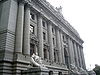
January 31, 1972 Bowling Green
40°42′15.98″N 74°0′49.4″W / 40.7044389°N 74.013722°WLower Manhattan Now operated as National Museum of the American Indian 158 US Post Office-Canal Street Station 
May 11, 1989 350 Canal St.
40°44′18″N 74°0′14″W / 40.73833°N 74.00389°WNew York 159 US Post Office-Church Street Station 
May 11, 1989 90 Church St.
40°42′45″N 74°0′40″W / 40.7125°N 74.01111°WNew York 160 US Post Office-Cooper Station 
May 11, 1989 96 Fourth St.
40°43′55″N 73°59′24″W / 40.73194°N 73.99°WEast Village 161 US Post Office--Knickerbocker Station 
May 11, 1989 130 E. Broadway
40°42′50″N 73°59′31″W / 40.71389°N 73.99194°WNew York 162 University Settlement House 
September 11, 1986 184 Eldridge St.
40°43′14″N 73°59′27″W / 40.72056°N 73.99083°WNew York 163 Stephen Van Rensselar House 
June 16, 1983 149 Mulberry St.
40°43′8″N 73°59′53″W / 40.71889°N 73.99806°WNew York 164 Van Tassell and Kearney Horse Auction Mart 
November 29, 2007 126-128 E 13th St.
40°43′58″N 73°59′21″W / 40.73278°N 73.98917°WNew York 165 W. O. Decker (tugboat) 
September 13, 1996 207 Front St., Pier No. 16
40°42′19″N 74°0′11″W / 40.70528°N 74.00306°WSouth Street Seaport 166 Wall and Hanover Building 
November 16, 2005 63 Wall St.
40°42′20″N 74°0′33″W / 40.70556°N 74.00917°WWall Street 167 Wall Street Historic District 
February 20, 2007 Roughly bounded by Cedar St. and Maiden Ln., Pearl St., Bridge and S. William St., and Greenwich St. and Trinity Pl.
40°42′23.44″N 74°0′39.61″W / 40.7065111°N 74.0110028°WNew York 168 Wall Street Subway station (4 5 trains) 
September 17, 2004 Under Broadway at Wall, Pine, Rector Sts. and Exchange Place
40°42′27″N 74°0′44″W / 40.7075°N 74.01222°WNew York 169 Wallace Building 
August 28, 2003 56-58 Pine St.
40°42′24″N 74°0′32″W / 40.70667°N 74.00889°WNew York 170 James Watson House 
July 24, 1972 7 State St.
40°42′9″N 74°0′51″W / 40.7025°N 74.01417°WNew York 171 Wavertree 
June 13, 1978 Pier 17, foot of Fulton St.
40°42′20″N 74°0′10″W / 40.70556°N 74.00278°WNew York 172 West Fourth Street – Washington Square Subway station (A B C D E F M trains) 
March 30, 2005 Under Sixth Ave. Bet W 3rd St. and Waverly Place
40°43′54″N 74°0′5″W / 40.73167°N 74.00139°WNew York 173 West Street Building 
January 25, 2007 90 West St.
40°42′36″N 74°0′53″W / 40.71°N 74.01472°WNew York 174 Westbeth December 8, 2009 55 Bethune Street
40°44′13″N 74°0′30.31″W / 40.73694°N 74.0084194°WNew York Industrial buildings turned into space for artists is one of first instances of adaptive reuse in U.S. 175 Westchester House 
March 20, 1986 541-551 (East?) Broome St. (southwest corner of Broome and Bowery)
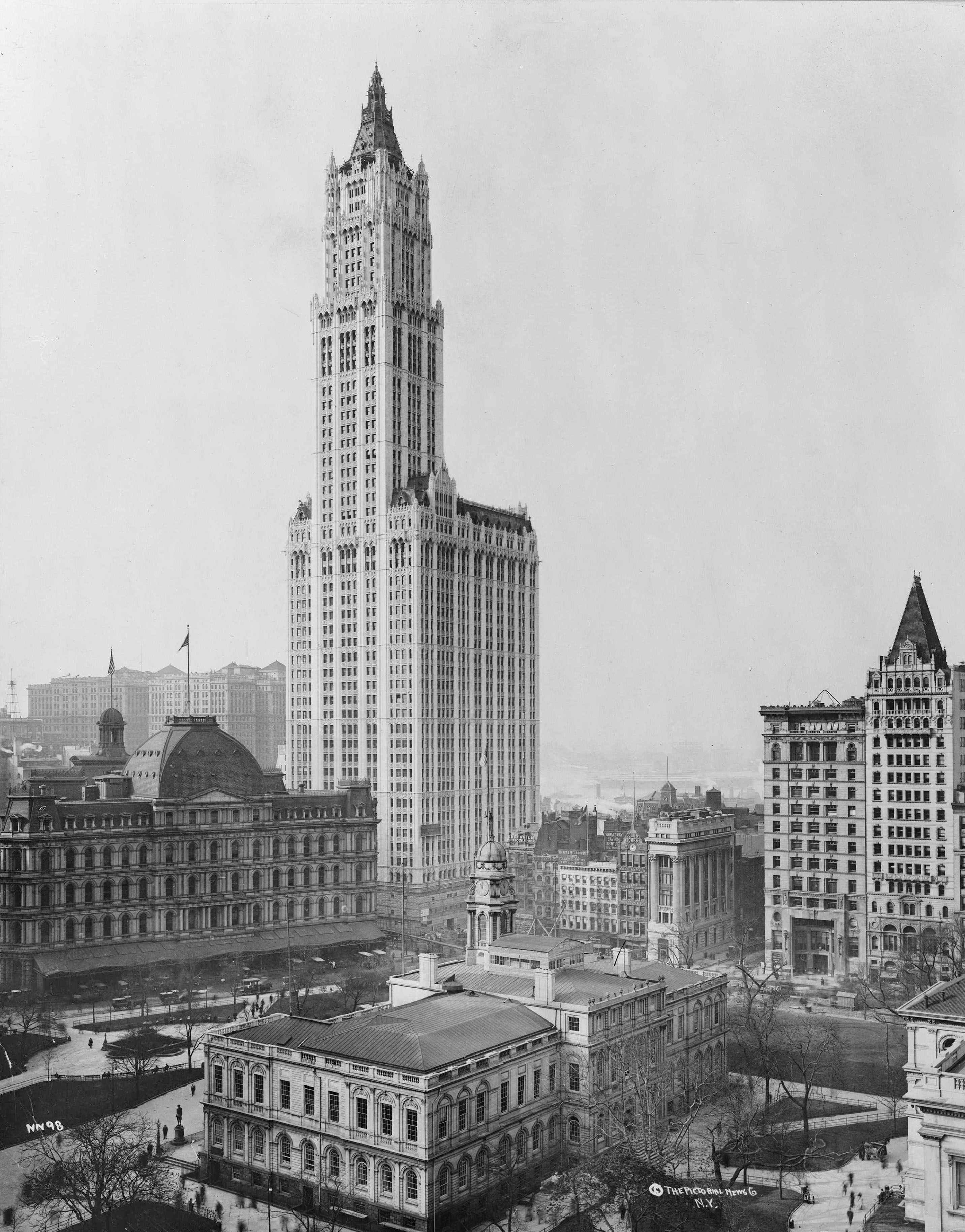
40°43′10″N 73°59′41″W / 40.719429°N 73.994615°WNew York (Also known as Pioneer Hotel) 176 Woolworth Building 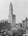
November 13, 1966 233 Broadway
40°42′45″N 74°0′30″W / 40.7125°N 74.00833°WNew York 177 Yiddish Art Theatre 
September 19, 1985 189 Second Ave.
40°43′51″N 73°59′11″W / 40.73083°N 73.98639°WNew York See also
- County: National Register of Historic Places listings in New York County, New York
- State: National Register of Historic Places listings in New York
- Municipal: List of New York City Designated Landmarks in Manhattan below 14th Street
References
- ^ The latitude and longitude information provided in this table was derived originally from the National Register Information System, which has been found to be fairly accurate for about 99% of listings. For about 1% of NRIS original coordinates, experience has shown that one or both coordinates are typos or otherwise extremely far off; some corrections may have been made. A more subtle problem causes many locations to be off by up to 150 yards, depending on location in the country: most NRIS coordinates were derived from tracing out latitude and longitudes off of USGS topographical quadrant maps created under the North American Datum of 1927, which differs from the current, highly accurate WGS84 GPS system used by Google maps. Chicago is about right, but NRIS longitudes in Washington are higher by about 4.5 seconds, and are lower by about 2.0 seconds in Maine. Latitudes differ by about 1.0 second in Florida. Some locations in this table may have been corrected to current GPS standards.
- ^ "National Register of Historic Places: Weekly List Actions". National Park Service, United States Department of the Interior. Retrieved on November 18, 2011.
Categories:- National Register of Historic Places in Manhattan
-


Wikimedia Foundation. 2010.