- Lake Titicaca
-
Lake Titicaca 
View of the Lake from the Bolivian shore. Coordinates 15°45′S 69°25′W / 15.75°S 69.417°WCoordinates: 15°45′S 69°25′W / 15.75°S 69.417°W Lake type Mountain Lake Primary inflows 27 rivers Primary outflows Desaguadero River
EvaporationCatchment area 58,000 km2 (22,400 sq mi)[1] Basin countries Bolivia
PeruMax. length 190 km (118 mi) Max. width 80 km (50 mi) Surface area 8,372 km2 (3,232 sq mi)[1] Average depth 107 m (351 ft)[1] Max. depth 281 m (922 ft)[1] Water volume 893 km3 (214 cu mi)[1] Residence time 1343 years[1] Shore length1 1,125 km (699 mi)[1] Surface elevation 3,812 m (12,507 ft)[1] Frozen never[1] Islands 42+ (see article) Sections/sub-basins Wiñaymarka Settlements Copacabana, Bolivia
Puno, PeruReferences [1] 1 Shore length is not a well-defined measure.  View from space, May 1985 (North is at right)
Lake Titicaca is a lake located on the border of Peru and Bolivia. It sits 3,811 m (12,500 ft) above sea level, making it the highest commercially navigable lake in the world.[2] By volume of water, it is also the largest lake in South America[3][4] (Lake Maracaibo has a larger surface area, but it is often disregarded as it is directly connected to the sea).
Contents
Overview
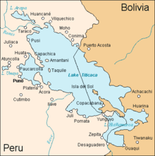
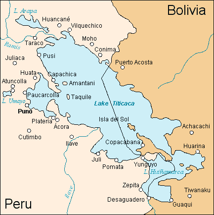
The lake is located at the northern end of the endorheic Altiplano basin high in the Andes on the border of Peru and Bolivia. The western part of the lake lies within the Puno Region of Peru, and the eastern side is located in the Bolivian La Paz Department.
 Map of Lake Titicaca
The lake is composed of two nearly separate sub-basins that are connected by the Strait of Tiquina which is 800 m (2,620 ft) across at the narrowest point. The larger sub-basin, Lago Grande (also called Lago Chucuito) has a mean depth of 135 m (443 ft) and a maximum depth of 284 m (932 ft). The smaller sub-basin, Wiñaymarka (also called Lago Pequeño, "little lake") has a mean depth of 9 m (30 ft) and a maximum depth of 40 m (131 ft).[5] The overall average depth of the lake is 107 m (351 ft).[1]
Five major river systems feed into Lake Titicaca.[6] In order of their relative flow volumes these are Ramis, Coata, Ilave, Huancané, and Suchez.[3] More than 20 other smaller streams empty into Titicaca, and the lake has 41 islands, some of which are densely populated.
Having only a single season of free circulation, the lake is monomictic,[7][8] and water passes through Lago Huiñaimarca and flows out the single outlet at the Rio Desaguadero,[9] which then flows south through Bolivia to Lake Poopó. This only accounts for about 10% of the lake's water balance. Evapotranspiration, caused by strong winds and intense sunlight at altitude, balances the remaining 90% of the water input. It is nearly a closed lake.[3][5][10]
Since 2000 Lake Titicaca has experienced constantly receding water levels. Between April and November 2009 alone the water level has sunk by 81 cm and has now reached the lowest level since 1949. This drop is caused by shortened raining seasons and the melting of glaciers feeding the tributaries of the lake.[11][12]
Temperature
The cold sources and winds over the lake give it an average surface temperature of 10 to 14 °C (50 to 57 °F). In the winter (June–September), mixing occurs with the deeper waters, which are always between 10 to 11 °C (50 to 52 °F).[13]
Name
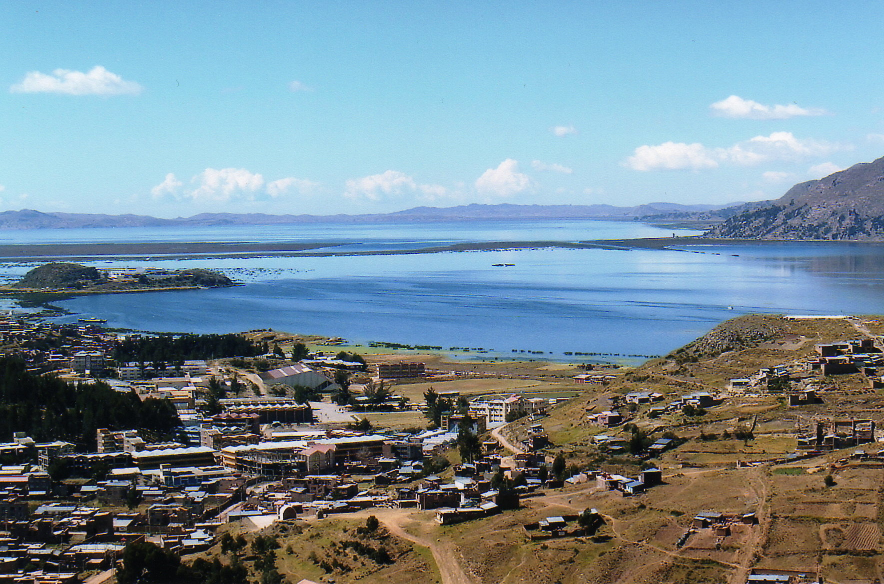
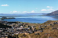 A view of Lake Titicaca taken from the town of Puno
The origin of the name Titicaca is unknown. It has been translated as "Rock Puma," as local communities have traditionally interpreted the shape of the lake to be that of a puma hunting a rabbit. "Titicaca" combines words from the local languages Quechua and Aymara. The word is also translated as "Crag of Lead." Locally, the lake goes by several names. Because the southeast quarter of the lake is separate from the main body (connected only by the Strait of Tiquina), the Bolivians call it Lago Huiñaymarca (Quechua: Wiñay Marka) and the larger part Lago Chucuito. In Peru, these smaller and larger parts are referred to as Lago Pequeño and Lago Grande, respectively.
Ecology
Lake Titicaca holds large populations of water birds and was designated as a Ramsar Site on August 26, 1998. Several threatened species such as the huge Titicaca Water Frog and the flightless Titicaca Grebe are largely or entirely restricted to the lake, and the Titicaca Orestias has gone extinct due to competition and predation by various introduced species of trouts and silversides.
Geology
The Tinajani Basin, in which Lake Titicaca lies, is an intermontane basin. This basin is pull apart basin[14] created by strike-slip movement along regional faults starting in the late Oligocene and ending latest Miocene. The initial development of the Tinajani Basin is indicated by volcanic rocks, which accumulated between 27 and 19 million years ago within this basin. They lie upon an angular unconformity cuts across pre-basin strata. Lacustrine sediments of the Lower Tinajani Formation, which are exposed within the Tinajani Basin, demonstrate the presence of a pre-Quaternary, ancestral Lake Titicaca within it between 18 and 14 million years ago.[15] Little is known about the prehistory of Lake Titicaca between 14 million years ago and 370,000 BP because the lake sediments dating to this period lie buried beneath the bottom of Lake Titicaca and have not yet been sampled by continuous coring.[16]
The Lake Titicaca drilling project[16] recovered a 136-m-long drill core of sediments from the bottom of Lake Titicaca at a depth of 235 m and at a location just east of Isla del Sol. This core contains a continuous record of lake sedimentation and paleoenvironmental conditions for Lake Titicaca back to about 370,000 BP. For this period of time, Lake Titicaca was typically fresher and had higher lake levels during periods of expanded regional glaciation that corresponded to global glacial periods. During periods of reduced regional glaciation that corresponded to global interglacial periods, Lake Titicaca had typically low lake levels.[16]
Lacustrine sediments and associated terraces provide evidence for the past existence of five major prehistoric lakes that occupied the Tinajani Basin during the Pliocene and Pleistocene. Within the northern Altiplano (Tinajani Basin), these prehistoric lakes were Lake Mataro at an elevation of 3,950 m, Lake Cabana at an elevation of 3,900 m, Lake Ballivián at an elevation of 3,860 m, Lake (North) Minchin at an elevation of 3,825 m, and Lake (North) Tauca at an elevation 3,815 m. The age of Lake Mataro is uncertain and may be as old as Late Pliocene. Lake Cabana possibly dates to the Middle Pleistocene. Lake Ballivián existed between 120,000 and 98,000 BP. Two high lake stands, between 72,000 - 68,000 BP and 44,000 - 34,000 BP, have been discerned for Lake Minchin within the Altiplano. The high lake levels of Lake Tauca have been dated as having occurred between 18,100 and 14,100 BP.[17][18][19]
Climate
Lake Titicaca has an Alpine climate with cool to cold temperatures for most of the year. The average annual precipitation is 610 mm. Winters are dry with very cold nights and mornings and warm afternoons. Below is the average temperatures of the town Juliaca in the northern part of the lake.
Climate data for Juliaca, Peru (1961-1990) Month Jan Feb Mar Apr May Jun Jul Aug Sep Oct Nov Dec Year Average high °C (°F) 16.7
(62.1)16.7
(62.1)16.5
(61.7)16.8
(62.2)16.6
(61.9)16.0
(60.8)16.0
(60.8)17.0
(62.6)17.6
(63.7)18.6
(65.5)18.8
(65.8)17.7
(63.9)17.08
(62.75)Average low °C (°F) 3.6
(38.5)3.5
(38.3)3.2
(37.8)0.6
(33.1)−3.8
(25.2)−7
(19.4)−7.5
(18.5)−5.4
(22.3)−1.4
(29.5)0.3
(32.5)1.5
(34.7)3.0
(37.4)−0.78
(30.59)Precipitation mm (inches) 133.3
(5.248)108.7
(4.28)98.5
(3.878)43.3
(1.705)9.9
(0.39)3.1
(0.122)2.4
(0.094)5.8
(0.228)22.1
(0.87)41.1
(1.618)55.3
(2.177)85.9
(3.382)609.4
(23.992)Source: Hong Kong Observatory,[20] Islands
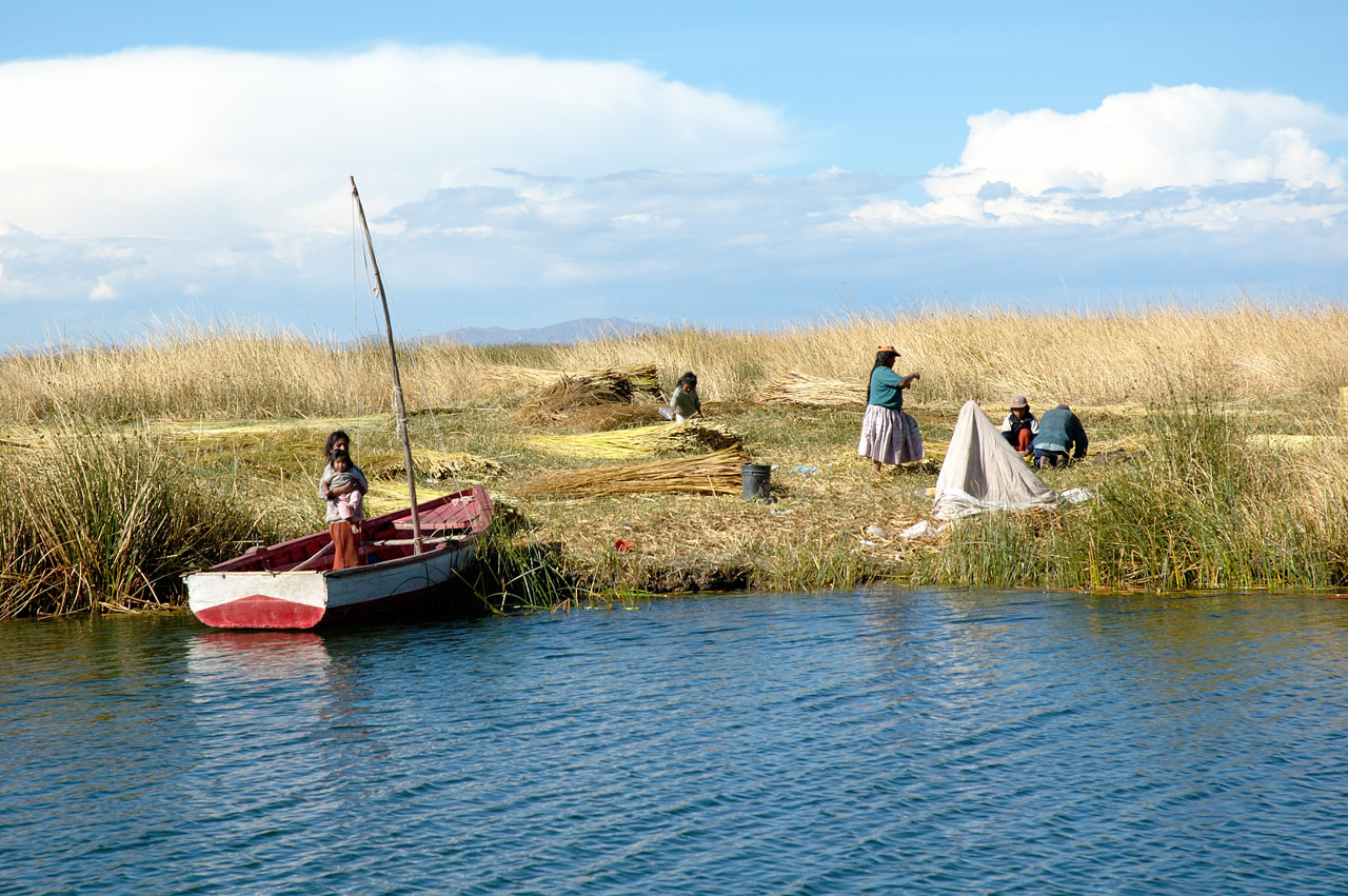
Uros
Titicaca is notable for a population of people who live on the Uros, a group of 44 or so artificial islands made of floating reeds (totora, a reed that abounds in the shallows of the lake). These islands have become a major tourist attraction for Peru, drawing excursions from the lakeside city of Puno. Their original purpose was defensive, and they could be moved if a threat arose. Many of the islands contain watchtowers largely constructed of reeds.
Amantaní
 Amantaní island as seen from Taquile island.
Amantaní is another small island on Lake Titicaca populated by Quechua speakers. About 800 families live in six villages on the roughly circular 15 square kilometres (6 sq mi) island. There are two mountain peaks, called Pachatata (Father Earth) and Pachamama (Mother Earth), and ancient ruins on the top of both peaks. The hillsides that rise up from the lake are terraced and planted with wheat, potatoes, and vegetables. Most of the small fields are worked by hand. Long stone fences divide the fields, and cattle, sheep, and alpacas graze on the hillsides.
There are no cars on the island and no hotels. Since machines are not allowed on the island, all agriculture is done by hand. A few small stores sell basic goods, and there is a health clinic and school. Electricity was produced by a generator and provided limited power a couple of hours each day, but with the rising price of the petroleum, they no longer use the generator. Most families use candles or flashlights powered by batteries or hand-cranks. Small solar panels have recently been installed on some homes.
Some of the families on Amantaní open their homes to tourists for overnight stays and provide cooked meals, arranged through tour guides. The families who do so are required to have a special room set aside for the tourists and must fit a code by the tour companies that help them. Guests typically take food staples (cooking oil, rice, sugar) as a gift or school supplies for the children on the island. They hold nightly traditional dance shows for the tourists where they offer to dress them up in their traditional clothes and participate.
Taquile
 Taquile Island
Taquile is a hilly island located 45 kilometers east of Puno. It is narrow and long and was used as a prison during the Spanish Colony and into the 20th century. In 1970 it became property of the Taquile people, who have inhabited the island since then (current population around 2,200. The taquiean Island is 5.5 by 1.6 km in size (maximum measurements), with an area of 5.72 km². The highest point of the island is 4,050 meters above sea level and the main village is at 3,950 m. Pre-Inca ruins are found on the highest part of the island, and agricultural terraces on hillsides. From the hillsides of Taquile you have a view over the white snow tops of the Bolivian mountains. The inhabitants, known as Taquileños, are southern Quechua speakers.
Life on Taquile is still largely unchanged by mainland modernity’s. There are no cars on the island and no hotels and a few small stores sell basic goods. Most families use candles or flashlights powered by batteries or hand-cranks. Small solar panels have recently been installed on some homes. On clear nights, Taquile is a perfect place for star gazing and you furthermore experience much lightning in the horizon due to electric activity in the area.
Culture is very much alive on Taquile, which can be seen in the traditional cloths everyone wears. Taquile is especially known for its handicraft tradition which is regarded as among the highest quality handicrafts not only in Peru but in the world. "Taquile and Its Textile Art" were honored by being proclaimed "Masterpieces of the Oral and Intangible Heritage of Humanity" by UNESCO. Knitting is exclusively performed by males, starting at age eight. The women exclusively make yarn and weave.
Taquileans are also known for having created an innovative, community-controlled tourism model, offering home stays, transportation, and restaurants to tourists. Ever since tourism started coming to Taquile in the seventies the taquleans have slowly lost control over the mass day-tourism operated by non-Taquileans. The Taquileans have thus developed alternative tourism models, including lodging for groups, cultural activities and local guides, who have recently completed a 2-year training program. Furthermore the local Travel Agency Munay Taquile has been established to regain control over tourism.
The Taquileños run their society based on community collectivism and on the Inca moral code ama sua, ama llulla, ama qhilla, (do not steal, do not lie, do not be lazy). The island is divided into six sectors or suyus for crop rotation purposes. The economy is based on fishing, terraced farming horticulture based on potato cultivation, and tourist-generated income from the approximately 40,000 tourists who visit each year.
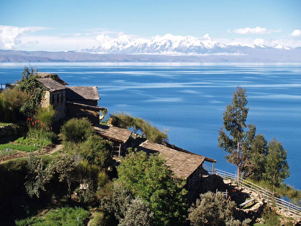
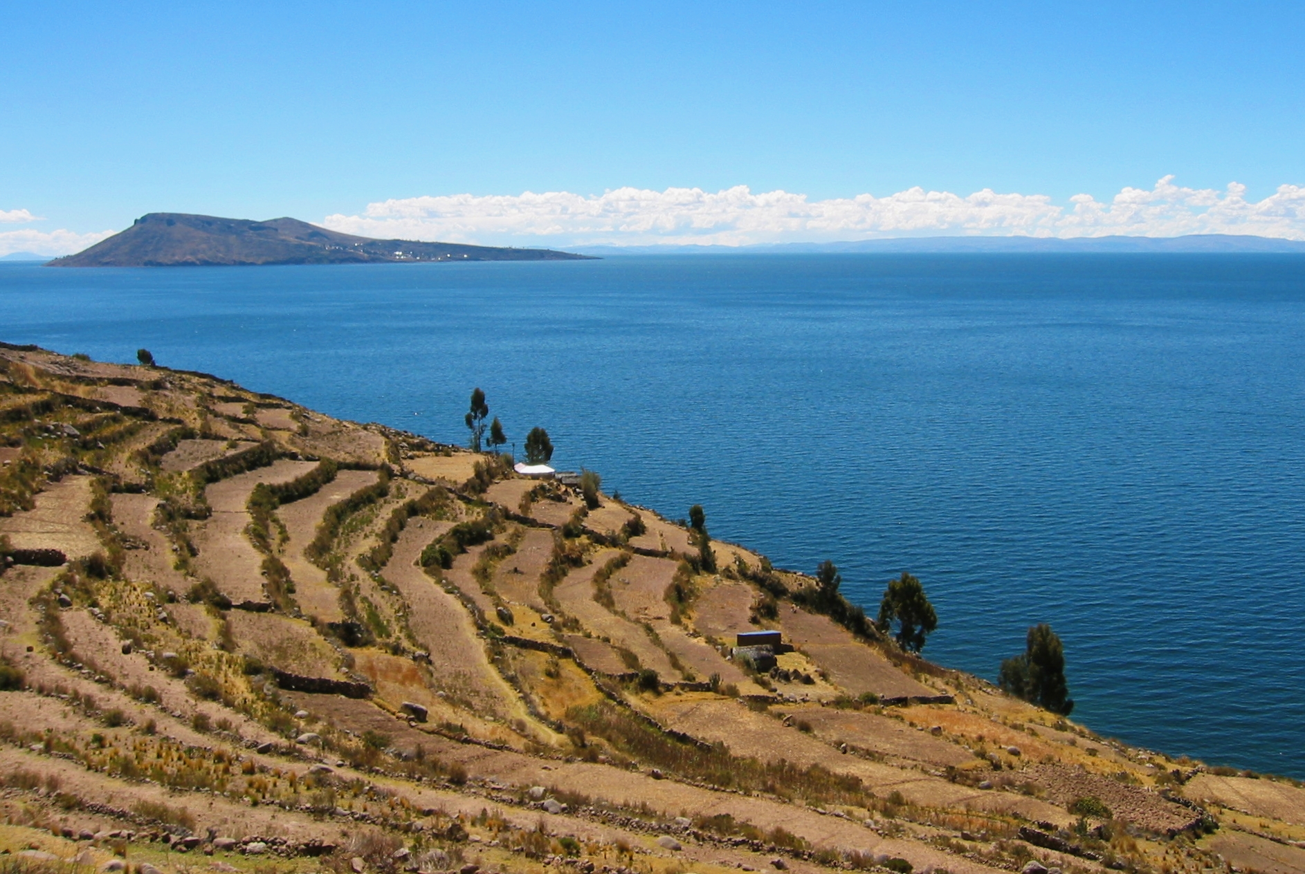
Isla del Sol
Situated on the Bolivian side of the lake with regular boat links to the Bolivian town of Copacabana, Isla del Sol ("Island of the sun") is one of the lake's largest islands. Geographically, the terrain is harsh; it is a rocky, hilly island. There are no motor vehicles or paved roads on the island. The main economic activity of the approximately 800 families on the island is farming, with fishing and tourism augmenting the subsistence economy.
There are over 180 ruins on the island. Most of these date to the Inca period circa the 15th century AD. Many hills on the island contain agricultural terraces, which adapt steep and rocky terrain to agriculture. Among the ruins on the island are the Sacred Rock, a labyrinth-like building called Chicana, Kasa Pata, and Pilco Kaima. In the religion of the Incas, it was believed that the sun god was born here.[citation needed]
During 1987-92 Johan Reinhard directed underwater archaeological investigations off of the Island of the Sun, recovering Inca and Tiahuanaco offerings. These artifacts are currently on display in the site museum of the village of Challapampa.[21]
Isla de la Luna
 Isla de la Luna and Cordillera Real.
Isla de la Luna is situated east from the bigger Isla del Sol. According to legends that refer to Inca mythology Isla de la Luna ("Island of the Moon") is where Viracocha commanded the rising of the moon. Ruins of a supposed Inca nunnery occupy the oriental shore.[22]
Suriqui
Suriqui lies in the Bolivian part of lake Titicaca (in the southeastern part also known as lake Huiñamarca).[23]
Suriqui is thought to be the last place where the art of reed boat construction survives, at least as late as 1998. Craftsmen from Suriqui helped Thor Heyerdahl in the construction of several of his projects, such as the reed boats Ra II and Tigris, and a balloon gondola.[23]
Transport
The dual gauge car float Manco Capac links PeruRail's 1,435 mm (4 ft 8 1⁄2 in) standard gauge line at Puno with the Bolivian railways' 1,000 mm (3 ft 3 3⁄8 in) meter gauge line at Guaqui.[24]
History
The lake has had a number of steamships, each of which was built in the United Kingdom in "knock down" form with bolts and nuts, disassembled into many hundreds of pieces, transported to the lake, and then riveted together and launched.
In 1862 Thames Ironworks on the River Thames built the iron-hulled sister ships SS Yavari and SS Yapura under contract to the James Watt Foundry of Birmingham.[25] The ships were designed as combined cargo, passenger and gunboats for the Peruvian Navy.[25] After several years' delay in delivery from the Pacific coast to the lake, Yavari was launched in 1870 and Yapura in 1873.[25] Yavari was 100 feet (30 m) long but in 1914 her hull was lengthened for extra cargo capacity and she was re-engined as a motor vessel.[25]
In 1892 William Denny and Brothers at Dumbarton on the River Clyde in Scotland built SS Coya.[26] She was 170 feet (52 m) long and was launched on the lake in 1893.[26]
In 1905 Earle's Shipbuilding at Kingston upon Hull on the Humber built SS Inca.[27][28] By now a railway served the lake so the ship was delivered in kit form by rail.[28] At 220 feet (67 m) long and 1,809 tons Inca was the lake's largest ship thus far.[28] In the 1920s Earle's supplied a new bottom for the ship, which also was delivered in kit form.[28]
Trade continued to grow so in 1930 Earle's built SS Ollanta.[27][28] Her parts were landed at the Pacific Ocean port of Mollendo and brought by rail to the lake port of Puno.[28] At 260 feet (79 m) long and 2,200 tons she was considerably larger than the Inca, so first a new slipway had to be built to build her.[28] She was launched in November 1931.[28]
In 1975 Yavari and Yapura were returned to the Peruvian Navy, who converted Yapura into a hospital ship and renamed her BAP Puno.[25] The Navy discarded Yavari but in 1987 charitable interests bought her and started restoring her.[25] She is now moored at Puno Bay and provides static tourist accommodation while her restoration continues.[25] Coya was beached in 1984 but restored as a floating restaurant in 2001.[27] Inca survived until 1994 when she was broken up.[27] Ollanta is no longer in scheduled service but PeruRail has been leasing her for tourist charter operations.[29]
Military presence
The Bolivian Naval Force uses the lake to carry out naval exercises, maintaining an active navy despite being a landlocked country.
See also
- Chiripa
- Taraco Peninsula
- Titicaca National Reservation
- Tourism in Peru
- Yampupata Peninsula
References
- ^ a b c d e f g h i j k "Data Summary: Lago Titicaca (Lake Titicaca)". International Lake Environment Committee Foundation - ILEC. http://www.ilec.or.jp/database/sam/dsam04.html. Retrieved 2009-01-03.
- ^ Drews, Carl (13 September 2005). "The Highest Lake in the World". http://www.highestlake.com/highest-lake-world.html. Retrieved 2006-12-02.
- ^ a b c Grove, M. J., P. A. Baker, S. L. Cross, C. A. Rigsby and G. O. Seltzer 2003 Application of Strontium Isotopes to Understanding the Hydrology and Paleohydrology of the Altiplano, Bolivia-Peru. Palaeogeography, Palaeoclimatology, Palaeoecology 194:281-297.
- ^ Rigsby, C., P. A. Baker and M. S. Aldenderfer 2003 Fluvial History of the Rio Ilave Valley, Peru, and Its Relationship to Climate and Human History. Palaeogeography, Palaeoclimatology, Palaeoecology 194:165-185.
- ^ a b Dejoux, C. and A. Iltis (editors) 1992 Lake Titicaca: A Synthesis of Limnological Knowledge. 68. Kluwer Academic Publishers, Boston.
- ^ Roche, M. A., J. Bourges, J. Cortes and R. Mattos 1992 Climatology and Hydrology of the Lake Titicaca Basin. In Lake Titicaca: A Synthesis of Limnological Knowledge, edited by C. Dejoux and A. Iltis, pp. 63-88. Monographiae Biologicae. vol. 68, H. J. Dumont and M. J. A. Werger, general editor. Kluwer Academic Publishers, Boston.
- ^ Cross, S. L., P. A. Baker, G. O. Seltzer, S. C. Fritz and R. B. Dunbar 2001 Late Quaternary Climate and Hydrology of Tropical South America Inferred from an Isotopic and Chemical Model of Lake Titicaca, Bolivia and Peru. Quaternary Research 56(1):1-9.
- ^ Mourguiart, P., T. Corrége, D. Wirrmann, J. Argollo, M. E. Montenegro, M. Pourchet and P. Carbonel 1998 Holocene Palaeohydrology of Lake Titicaca Estimated from an Ostracod-Based Transfer Function. Palaeogeography, Palaeoclimatology, Palaeoecology 143:51-72.
- ^ Baucom, P. C. and C. A. Rigsby 1999 Climate and Lake Level History of the Northern Altiplano, Bolivia, as Recorded in Holocene Sediments of the Rio Desaguadero. Journal of Sedimentary Research 69(3):597-611.
- ^ Talbi, A., A. Coudrain, P. Ribstein and B. Pouyaud 1999 Computation of the Rainfall of Lake Titicaca Catchment During the Holocene. Géosciences de Surface 329:197-203.
- ^ Carlos Valdez: Lake Titicaca at dangerously low level - website of the Sydney Morning Herald (accessed 2009-11-28)
- ^ Lake Titicaca evaporating away (video) - report by al Jazeera (accessed 2009-11-28)
- ^ http://www.ilec.or.jp/database/sam/sam-04.html
- ^ Pull-apart basins, also called strike-slip basins, are regional topographic depressions created by lateral movement at a bend or discontinuity within in strike slip fault.
- ^ Marocco, R., R. Baudino, and A. Lavenu, 1995, Intermontane Late Paleogene–Neogene Basins of the Andes of Ecuador and Peru: Sedimentologic and Tectonic Characteristics. in A.J. Tankard, R. Suárez Soruco, and H.J. Welsink, eds., pp. 597-613, Petroleum basins of South America: Memoir no. 62. American Association of Petroleum Geologists, Tulsa, Oklahoma.
- ^ a b c Fritz, S. C. , P. A. Baker, G. O. Seltzer, A. Ballantyne, P. Tapia, H. Cheng, and R. L. Edwards, 2007, Quaternary glaciation and hydrologic variation in the South American tropics as reconstructed from the Lake Titicaca drilling project. Quaternary Research 68(3):410-420.
- ^ Clapperton, C. M., 1993, Quaternary Geology and Geomorphology of South America. Elsevier Science, Amsterdam, 779 pp.
- ^ Rouchy, J. M., M. Servant, M. Fournier, and C. Causse, 1996, Extensive carbonate algal bioherms in Upper Pleistocene saline lakes of the central Altiplano of Bolivia: Sedimentology 43(6):973–993.
- ^ Placzek, C., J. Quade, and P. J. Patchett, 2006, Geochronology and stratigraphy of Late Pleistocene lake cycles on the Southern Bolivian Altiplano: implications for causes of tropical climate change. Geological Society of America Bulletin 118(5-6):515–532.
- ^ "ClClimatological Information for Juliaca, Peru". Hong Kong Observatory. http://www.weather.gov.hk/wxinfo/climat/world/eng/s_america/ec_per/juliaca_e.htm.
- ^ Reinhard, Johan (1992) "Underwater Archaeological Research in Lake Titicaca, Bolivia." In Ancient America: Contributions to New World Archaeology, N. Saunders (ed.), Oxford: Oxbow Books, pp. 117-143.
- ^ Bolivia, Lonely Planet 2007, ISBN 1-74104-557-6
- ^ a b Box, Ben (1998). South American Handbook. Footprint Handbooks. pp. 292. ISBN 0-8442-4886-X.
- ^ Southern Peru Railroads
- ^ a b c d e f g "The Yavari Story". Yavari - Lake Titicaca - Peru. The Yavari Project. http://www.yavari.org/. Retrieved 2011-05-20.
- ^ a b Cameron, Stuart; Robinson, George; Strathdee, Paul. "SS Coya". Clyde-built Database. http://www.clydesite.co.uk/clydebuilt/viewship.asp?id=10696. Retrieved 2011-05-20.
- ^ a b c d "The Lake Steamers - Post 1900". Yavari - Lake Titicaca - Peru. The Yavari Project. http://www.yavari.org/lake-steamers.html. Retrieved 2011-05-21.
- ^ a b c d e f g h Grace, Michael L (2009-11-16). "The SS Ollanta". Cruising the Past. http://cruiselinehistory.com/?p=4478. Retrieved 2011-05-20.
- ^ Dickinson, Rob. "Steam in Peru 2001". International Steam Pages. http://www.internationalsteam.co.uk/trains/peru03.htm. Retrieved 2011-05-20.
External links
Categories:- Mountain lakes
- Ramsar sites in Bolivia
- Ramsar sites in Peru
- Lake Titicaca
- Lakes of Bolivia
- Lakes of Peru
- Geography of La Paz Department
- Bolivia–Peru border
- International lakes of South America
- Puno Region


Wikimedia Foundation. 2010.