- Davidstow
-
Coordinates: 50°39′19″N 4°37′03″W / 50.6552°N 4.6176°W
Davidstow Cornish: Lanndhewi 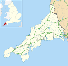
 Davidstow
Davidstow shown within CornwallPopulation 470 (Civil Parish, 2001) OS grid reference SX151872 Parish Davidstow Unitary authority Cornwall Ceremonial county Cornwall Region South West Country England Sovereign state United Kingdom Post town CAMELFORD Postcode district PL32 Dialling code 01840 Police Devon and Cornwall Fire Cornwall Ambulance South Western EU Parliament South West England UK Parliament North Cornwall List of places: UK • England • Cornwall Davidstow (Cornish: Lanndhewi) is a civil parish and village in north Cornwall, United Kingdom. The village is north of Bodmin Moor straddling the A395 road about 3 miles north of Camelford.[1]
'Davidstow' and 'Cathedral City' brands of cheese are produced at Davidstow Creamery which is operated by Dairy Crest using water ultimately from St David's Holy Well, next to the parish church.
A military airfield, RAF Davidstow Moor, was built near the village during the Second World War and was later used as a motor racing circuit.
Contents
Parish Church
'Davidstow' means David's Place and according to legend the church was founded by Saint David in the 6th century, whilst visiting his mother at nearby Altarnun. The church is large but was very much restored in 1875 so that little original work remains inside. Both the nave and the east windows are wider than usual in a Cornish church; a few benchends are interesting, one portrays a bagpiper.[2] The parish is part of the group in the charge of the Rector of Boscastle.
Gallery
-

Davidstow Church
-

Davidstow Creamery
-

Davidstow Creamery
References
- ^ Ordnance Survey: Landranger map sheet 190 Bude & Clovelly ISBN 978-0-319-23145-6
- ^ Pevsner, N. (1970) Cornwall, 2nd ed. Penguin Books; p. 62
External links
Geography of Cornwall Cornwall Portal Unitary authorities Major settlements Bodmin • Bude • Callington • Camborne • Camelford • Falmouth • Fowey • Hayle • Helston • Launceston • Liskeard • Looe • Lostwithiel • Marazion • Newlyn • Newquay • Padstow • Par • Penryn • Penzance • Porthleven • Redruth • Saltash • St Austell • St Blazey • St Columb Major • St Ives • St Just-in-Penwith • St Mawes • Stratton • Torpoint • Truro • Wadebridge
See also: Civil parishes in CornwallRivers Topics History • Status debate • Flag • Culture • Places • People • The Duchy • Diocese • Politics • Hundreds/shires • Places of interest • full list...Civil parishes of North Cornwall constituency  Advent • Altarnun • Blisland • Bodmin • Boyton • Bude–Stratton • Camelford • Cardinham • Davidstow • Egloshayle • Egloskerry • Forrabury and Minster • Helland • Jacobstow • Kilkhampton • Laneast • Lanhydrock • Lanivet • Launceston • Launcells • Lawhitton Rural • Lesnewth • Lewannick • Lezant • Marhamchurch • Michaelstow • Morwenstow • North Hill • North Petherwin • North Tamerton • Otterham • Padstow • Poundstock • South Petherwin • St Breock • St Breward • St Clether • St Endellion • St Ervan • St Eval • St Gennys • St Issey • St Juliot • St Kew • St Mabyn • St Merryn • St Minver Highlands • St Minver Lowlands • St Stephens by Launceston Rural • St Teath • St Thomas the Apostle Rural • St Tudy • Stoke Climsland • Tintagel • Tremaine • Treneglos • Tresmeer • Trevalga • Trewen • Wadebridge • Warbstow • Week St Mary • Werrington • Whitstone • Withiel
Cornwall Portal Categories:- Villages in Cornwall
- Civil parishes in Cornwall
- Holy wells
- Bodmin Moor
- Cornwall geography stubs
-


Wikimedia Foundation. 2010.