- Muirkirk, Maryland
-
Muirkirk — Unincorporated area — Location within the state of Maryland
 Muirkirk
Coordinates: 39°03′42″N 76°53′07″W / 39.06167°N 76.88528°WCoordinates: 39°03′42″N 76°53′07″W / 39.06167°N 76.88528°W Country United States State Maryland County Prince George's Time zone Eastern (EST) (UTC-5) - Summer (DST) EDT (UTC-4) ZIP codes FIPS code GNIS feature ID 597797 Muirkirk is an unincorporated area in northern Prince George's County, Maryland, United States, located between Baltimore and Washington, D.C. in the central part of the state.[1]
It is located along U.S. 1 between Beltsville and Laurel. It has a stop on the MARC commuter rail (on the Camden line).
History
Muirkirk was the historic location of Muirkirk Furnace, from which the area takes its name. The ironworks were established before the American Civil War. After the conflict began, the US government hired a manager from the North to ensure the works were kept under federal control.
Located along Old Muirkirk Road near Muirkirk station is the historic African-American community of Rossville, originally composed mostly of families of men who labored at the ironworks. It has existed for more than 100 years. In 1868 after the Civil War, six black men purchased property for a church and cemetery, forming the Queens Chapel Methodist Episcopal Church in the rural enclave colloquially referred to as "Swamp Poodle." Part of the property was already in use as a burial ground. They intended to use the church building, originally a small log structure, as a school for their children. This was the start of a postwar cohesive black community in which freedmen established a church independent of white supervision.[2]
Around 1885, the estate of landowner Mark Duvall, who owned considerable property in the Vansville area, provided for the sale of 28.5 acres (115,000 m2) just east of Queen's Chapel. The twelve lots made available were quickly settled by African Americans, many of whom worked at nearby Muirkirk Furnace. Augustus Ross, after whom the community was named, built one of the first houses.
The largest lot was purchased by Rebecca Lodge #6, Benevolent Sons and Daughters of Abraham, a black fraternal organization whose members established the historic Abraham Hall. The lodge hall functioned for years as the community school for black children, as the state had segregated facilities. In 1922 the black community raised matching funds and gained white school board members' approval to build a Rosenwald School to improve the educational facilities for black children. Historically black schools were underfunded.[3]
Historic sites
The following is a list of historic sites in Rossville, near Muirkirk, identified by the Maryland-National Capital Park and Planning Commission:[4][3]
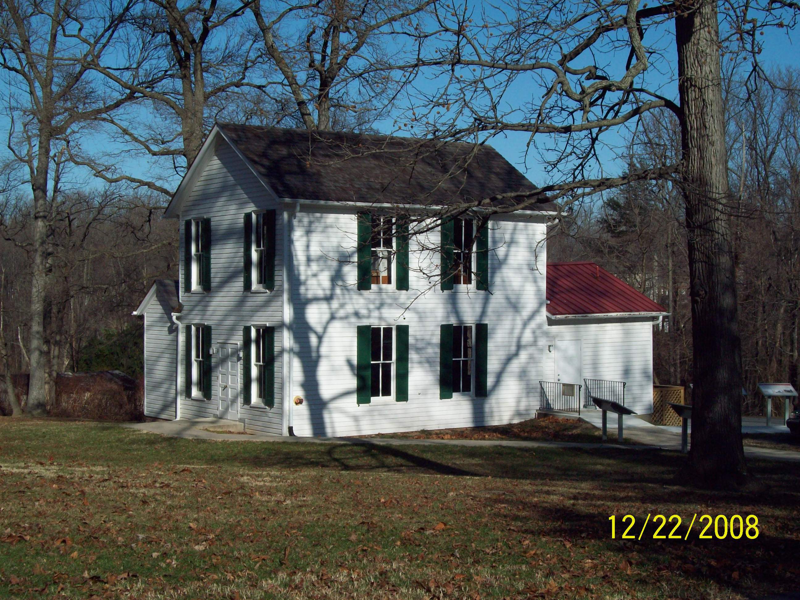
Site Name Image Location M-NCPPC Inventory Number Comment 1 Abraham Hall 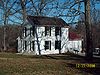
7612 Old Muirkirk Rd. 62-023-07 Located at Rossville. Listed on the National Register of Historic Places, 2005-03-14 2 Thomas Matthews House 7700 Old Muirkirk Road 62-23-17 Located at Rossville. 3 Muirkirk School 7813 Muirkirk Road 62-23-20 Located at Rossville. 4 Queen's Chapel Methodist Episcopal Church Site and Cemetery 7410 Old Muirkirk Road 62-23-21 Located at Rossville. References
- ^ U.S. Geological Survey Geographic Names Information System: Muirkirk, Maryland
- ^ "Queen's Chapel and Burial Grounds", Determination of Eligibility, Maryland Historical Trust, 13 Sep 2002, MNCPPC, accessed 17 Mar 2010
- ^ a b M-NCPPC African-American Heritage Survey, October 1996: Properties Within or Closely Associated With Historic Communities (Prince George's County, Maryland), 1996.
- ^ M-NCPPC Illustrated Inventory of Historic Sites (Prince George's County, Maryland), 2006.
Categories:- Unincorporated communities in Maryland
- Populated places in Prince George's County, Maryland
- African American history in Maryland
- Maryland geography stubs


Wikimedia Foundation. 2010.