- Altmark
-
- See German tanker Altmark for the ship named after Altmark and Stary Targ for a Polish Pomeranian village.
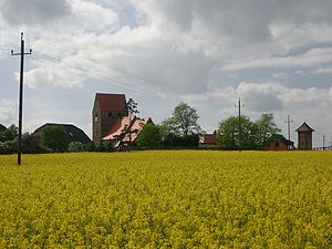 Altmark at Schernikau
The Altmark (English:Old March[1]) is a historic region in Germany, comprising the northern third of Saxony-Anhalt. As the initial territory of the Brandenburg margraves, it is sometimes referred to as the "Cradle of Prussia", as by Otto von Bismarck, a native from Schönhausen near Stendal.
Contents
Geography
 Topography of the Altmark
The Altmark is located west of the Elbe river between the cities of Hamburg and Magdeburg, mostly included in the present-day[update] districts of Altmarkkreis Salzwedel and Stendal. In the west the Drawehn hill range and the Drömling depression separate it from the Lüneburg Heath in Lower Saxony; the Altmark also borders the Wendland region in the north and the Magdeburg Börde in the south. Adjacent east of the Elbe is the historical Prignitz region.
The population is small. The cultural landscape within the North European Plain is rural and widely covered with forests and heathlands. The largest towns are Stendal, with a population of 39,000, and Salzwedel.
The most famous native is Chancellor Otto Von Bismarck, born at Schonhausen, in the Altmark, April 1, 1815.
History
Before the Migration Period of 300 to 700 CE, the Lombards had settled the Altmark. Subsequently Old Germanic Saxon tribes lived in the northwest and Polabian Slavs in the eastern territories along the Elbe. After the Saxon Wars waged by Charlemagne from 772 to 804, the lands were incorporated into the Carolingian Empire. They were part of the Eastphalian territory of the Duchy of Saxony, from 843 onwards the eastern borderlands of East Francia under Louis the German. The Saxon population was Christianized by the bishops of Verden and Halberstadt.
In 936 the German king Otto I allotted the territory of the later Altmark to the Saxon Count Gero, in order to subdue the West Slavic Wends settling on the Elbe. Gero thereafter campaigned the Slavic lands far beyond the river and thereafter established the Saxon Marca Geronis stretching up to the Oder in the east. Upon Gero's death in 965, his marca was split and the Northern March was bequested to Dietrich of Haldensleben, who nevertheless turned out to be an incapable ruler and again lost all territories east of the Elbe in the Slavic Lutici uprising of 983. He only retained margravial title and the initial land basis of his predecessor Gero's conquests west of the river.
For further one and a half centuries, the lands east of the Elbe defied German control, until in 1134 Emperor Lothair of Supplinburg bestowed the Northern March to the Ascanian count Albert the Bear. Albert was able to sign an inheritance contract with the Slavic Hevelli prince Pribislav and in 1150 succeeded him in his eastern territory around the fortress of Brandenburg an der Havel, which became the nucleus of his newly established Margraviate of Brandenburg in 1157.
 Brandenburg under the Ascanians, 1320
As the Brandenburg margraves over the following centuries expanded their territory in the course of the Ostsiedlung into new territories, such as the Mittelmark and the Neumark beyond the Oder river, the original western territory of the Northern March became known as the Altmark (literally "Old March"); it was first mentioned in 1304 as Antiqua Marchia.
The Altmark remained with the Brandenburg margraviate, since 1415 held by the House of Hohenzollern, and thereby became part of rising Brandenburg-Prussia and of the Kingdom of Prussia upon its creation in 1701. After Prussia's defeat at the hands of Napoleon in 1806, the territory was lost under the terms of the Treaty of Tilsit and included within the new Kingdom of Westphalia. It was restored upon Napoleon's defeat under Article XXIII of the Final Act of the Congress of Vienna, however the separation from Brandenburg lasted, as the Altmark then was attached the new Prussian Province of Saxony in 1815.[1] Within Prussian Saxony, the Altmark was subdivided into the districts of Salzwedel, Gardelegen, Osterburg, and Stendal, all administered within the Regierungsbezirk of Magdeburg.
After World War II the Altmark, east of the inner German border, became part of the new state of Saxony-Anhalt in the Soviet occupation zone. The regional administration of East Germany saw it administered within Bezirk Magdeburg from 1952–90. With German reunification in 1990, the Altmark became part of a reconstituted Saxony-Anhalt.
Rivers and lakes
 Aland floodplain near Wanzer
The region is drained by the Elbe, joined by the Havel at Havelberg, and its left tributaries of the Milde-Biese-Aland system and the Jeetzel river.
The largest natural lake of the Altmark is the Arendsee.
Transport
Road
The Altmark is located off the main traffic routes. The Bundesautobahn 14 leads to the Bundesautobahn 2 from Hanover to Berlin, it however ends north of Magdeburg. A continuation through the Altmark towards Schwerin is planned. Beside which the Federal roads B71, B107, B188, B189, B190, B248 run through the region.
Rail
Stendal station is a stop on the Hanover–Berlin high-speed railway. Other lines include:
- Stendal-Salzwedel-Uelzen
- Wittenberge-Salzwedel-Oebisfelde
- Magdeburg-Stendal-Wittenberge
- Bismark-Kalbe (Milde)
- Stendal-Tangermünde
Towns
 Roland statue at Stendal
- Salzwedel
- Oebisfelde
- Arendsee
- Seehausen
- Diesdorf
- Beetzendorf
- Klötze
- Mieste
- Gardelegen
- Kalbe (Milde)
- Bismark
- Osterburg
- Stendal
- Havelberg
- Tangermünde
- Tangerhütte
- Uchtspringe
External links
- Altmarkwiki, the regional wiki for the Altmark
Notes and references
Coordinates: 52°43′N 11°24′E / 52.717°N 11.4°E
Altmark | Anhalt-Wittenberg | Chemical Triangle | Elbe-Börde Heath | Harz | Eastphalia | Mansfelder Land |
Saale-Unstrut Region Categories:
- History of Brandenburg
- Regions of Saxony-Anhalt


Wikimedia Foundation. 2010.