- Paramushir
Infobox Islands
name = Paramushir
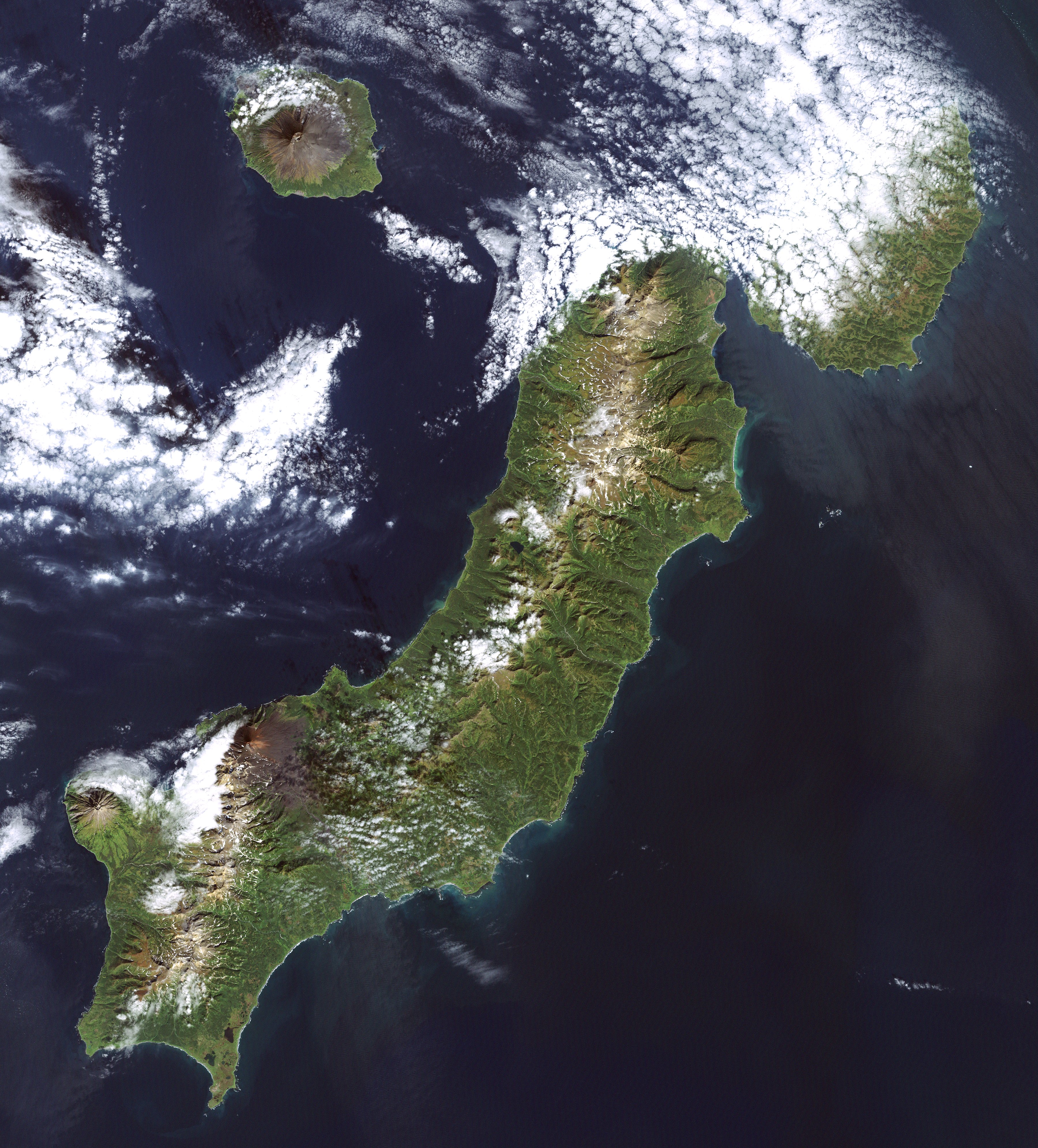
image caption = Paramushir Island (Landsat 7 image)
image size =
locator
Location map|Russia|lat=50.333333|long=155.75
map_custom = yes
native name = Парамушир
native name link = Russian language
nickname =
location =Pacific Ocean
coordinates = coord|50|20|N|155|45|E|display=inline
archipelago = Kuril Island
total islands =
major islands =
area = convert|2053|km2|sqmi
length = convert|100|km|mi
width = convert|20|km|mi
highest mount =Chikurachki
elevation = convert|1816|m|ft
country = Russia
country admin divisions title = Oblast
country admin divisions =Sakhalin Oblast
country admin divisions title 1 = District
country admin divisions 1 = Severo-Kurilsky
country admin divisions title 2 =
country admin divisions 2 =
country largest city =Severo-Kurilsk
country largest city population = 2592
population =
population as of =
density =
ethnic groups =
additional info =Paramushir ( _ru. Парамушир) or Paramushiro, from the Ainu for "broad island") is a Russian island in the Kuril Island chain. At 100 km in length an average around 20 km across and with an area of 2,053 km², it is the largest of the Northern Group of islands and second only to
Iturup in area. It is separated fromShumshu by the very narrow second Kuril strait in the northeast (2.5 km), fromAntsiferov Island by the Luzhina strait (15 km) to the southwest, fromAtlasov Island in the northwest by 20 km, and fromOnnekotan Island in the south by the 40 km wide fourth Kuril strait. It's northern tip is 39 km fromCape Lopatka at the southern tip of the Kamchatka peninsula.Paramushir belongs to the
Severo-Kurilsky district of theSakhalin Oblast .Severo-Kurilsk (population: 2592 in 2002 census, 5180 in the 1989 census), the administrative center of the Severo-Kurilsky district, is the only permanently populated settlement on Paramashir island. The town is the largest settlement on all the Kuril Islands, however it is followed closely byKurilsk onIturup (pop. approxuimately 2200 in 2005). Other villages that once lined the coast of Paramushir are now mainly ghost towns. This is due in part to the crash of the formerly lucrativeherring fishery, to the extremely destructiveKamchatka peninsula tsunami of 1952, which claimed an estimated 2300 lives, and general economic hardships in the more remote reaches of Russia since the fall of theSoviet Union .Geography and natural history
Geologically, Paramushir is a continuous chain of 23
volcanoes . At least five of them are active:Chikurachki (1,816m),Fuss Peak (1,772m),Tatarinova ,Karpinsky Group (1,345m), andEbeko (1,156m).Chikurachki, the highest peak on Paramushir, erupted in 2003, 2003, 2005, 2007 and 2008. During the most recent eruption in August 2008, the volcanic ash reached the town of
Severo-Kurilsk located 60km north-east [http://www.newsru.com/russia/07aug2008/vulkan.html] . The previous eruption took place on March 4, 2007, when a 1.5 km high plume of ash was emitted that trailed for several hundred kilometers into the neighboring waters.Paramushir has a sub-actic climate strongly modulated by the cooling effects of the North Pacific
Oyashio Current . The arboreal flora of Paramushir is consequently limited to dense, stunted copses ofSiberian dwarf pine and shrubbyalder . Thealpine tundra which dominates the landscape produces plentiful ediblemushrooms andberries , especiallylingonberry ,Arctic raspberry ,whortleberry andcrowberry .Red fox ,Arctic hare andermine are notably abundant and hunted by the inhabitants. The island also supports a population ofgrizzly bear s. The straits between Paramushir and Shumshu island support a notably dense population ofsea otters and harbor seals are similarly common.Several species of
charr andPacific salmon spawn in its rivers, notably in the Tukharka river, at 20 km the longest river on the island.History
Paramushir, along with the rest of the Kuril (or Kurile) Islands, was claimed by Japan at the end of the 19th century. Paramushir was home to the northernmost Japanese military bases until the end of
World War II . These bases were subject to sporadic air raids from the the US Air Force and US Navy based in the Aleutian Islands from 1943 until the end of the war. It also hosted at least one POW camp. In August 1945, theSoviet Union invaded Paramushir. After the war, theSoviet Union took possession of Paramushir along with the rest of theKuril Islands .External links
* [http://artedi.fish.washington.edu/okhotskia/ikip/Gallery/Map/North/Param/Param.htm Images of Paramushir from the International Kuril Island Project (IKIP)]
* [http://land.worldcitydb.com/sakhalinskaya_ã¢â€â™_in_russian_federation_state.html Sakhalin Oblast]References
Wikimedia Foundation. 2010.