- Cave Hill Cemetery
Infobox nrhp
name = Cave Hill Cemetery
nrhp_type = nrhp
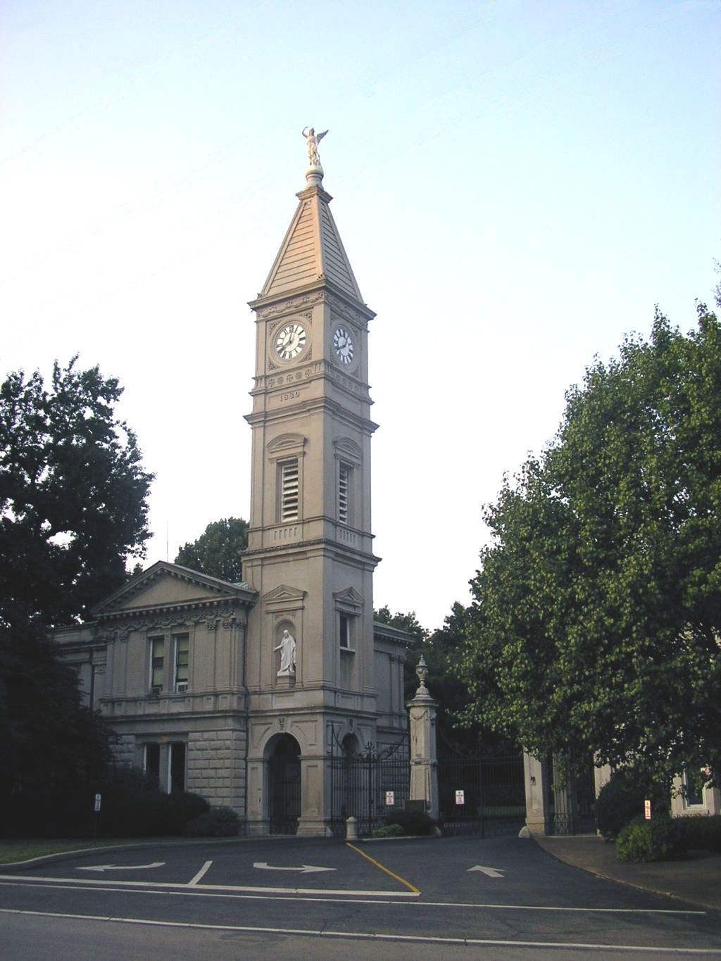
caption = Main entrance on Baxter Avenue
location =Louisville, Kentucky
nearest_city = | lat_degrees = 38 | lat_minutes = 14 | lat_seconds = 44.00 | lat_direction = N
long_degrees = 85 | long_minutes = 42 | long_seconds = 57.00 | long_direction = W
area = convert|296|acre|km2
built = 1848-1913
architect = Various
architecture = Corinthian, Victorian, other
added = 1979
visitation_num =
visitation_year =
refnum = 79000999
mpsub =
governing_body = PrivateCave Hill Cemetery is a convert|296|acre|km2|sing=on
Victorian era National Cemetery andarboretum located at 701 Baxter Avenue,Louisville, Kentucky . It is open daily to the public from 8:00 AM to 4:45 PM (weather permitting). Its main entrance is on Baxter Avenue and there is a secondary one on Grinstead Drive. Both former Louisville mayors for whom these streets are named (James F. Grinstead and John G Baxter), are buried in Cave Hill Cemetery. It is the largest cemetery by area and number of burials in Louisville.Cave Hill was listed on the
National Register of Historic Places in 1979. Cave Hill National Cemetery, containing military graves, is also on the National Register, added in 1998.History
Cave Hill was chartered in 1848 on what was William Johnston's Cave Hill Farm, then a rural property some distance east of Louisville. Johnston, who died in 1798, had built the first brick house in Louisville on the grounds circa 1788. City officials had purchased part of the land in the 1830s in anticipation of building a railroad through it, and a workhouse was built there. The railroad was built elsewhere, and the land was leased to local farmers.
In 1846, Mayor
Frederick A. Kaye began investigating the possibility of developing a garden-style cemetery on the grounds, a popular concept at the time.Hartford, Connecticut civil engineer Edmund Francis Lee was hired, who planned a cemetery with winding paths, graves across the tops of hills, and lakes and ponds in the valleys. The Cave Hill Cemetery Co. was chartered in February 1848, and the cemetery was dedicated onJuly 25 ,1848 . Before the era of large municipal parks, it was common for cities to promote a garden cemetery as a green oasis and recreation destination, and Louisville was no exception. This largely ended with the opening ofCherokee Park in 1892. [cite journal|title=Living History: The Physical City as Artifact and Teaching Tool|journal=The History Teacher|volume=8|issue=4|year=1975|month=August|author=Goldfield, David R.|doi=10.2307/492666|pages=535]After administrators sold several acres of land for the burial of Union soldiers during the Civil War, local Confederate supporters purchased nearby land as well. Several deceased patients from the
Brown General Hospital and other nearby army medical facilities were interred in Cave Hill Cemetery.Johnston's farmhouse (in what is now sections 33 and 34) was converted to the city's
pesthouse , and was demolished in 1872. Also in 1872, Beechhurst Sanitarium was built near the pesthouse and the modern Grinstead entrance. Beechurst was torn down in 1936.The grounds were expanded and remapped in 1888 to their modern size of nearly convert|300|acre|km2. In the 1980s
razor wire was added to the brick walls surrounding Cave Hill to keep out after-hours visitors.The first scenic overlook for the cemetery, Twin Lakes Scenic Overlook, opened on August 20, 2008. [cite news |title=Cave Hill Cemetery opens new scenic overlook |url=http://www.courier-journal.com/apps/pbcs.dll/article?AID=/20080821/ZONE01/80821024/ |publisher="
The Courier-Journal " |date=2008-08-21 |accessdate=2008-08-21]Buildings and grounds
The signature Baxter Avenue entrance was completed in 1892. The Corinthian-style building includes a 2,000 pound bell in its
clock tower . The tower, once the tallest structure for miles, was frequently hit by lightning and last renovated in 2001. The Grinstead Drive entrance was built in 1913.There is a third public entrance on the residential street of Dearing Court. It was closed as of 2007. Another public entrance, also no longer in use, was built off Payne Street in 1910, closest to the military sections. There are several service entrances around the perimeter. Other buildings include the stone office building near the lake, and the Rustic Shelter House built in 1892 at a cost of $565.
The middle fork of
Beargrass Creek runs through Cave Hill, and a source stream flowing into the creek roughly divides the cemetery in new (eastern) and old (western) sections. That stream flows from a spring near the cave that gave the property its name. The cave can be entered for about convert|30|ft|m, and then there is a marginal amount of crawl space beyond that, however the cave is officially off limits. There are also five man-made lakes.The cemetery currently features more than 500 species of trees and shrubs, and contains monuments and graves of three Union generals. The
32nd Indiana Monument , also known as the "August Bloedner Monument", is separately on the National Register.Interments
There were about 120,000 people interred by 2002, with space remaining for 22,000 more graves.
More than 200 Confederate soldiers are buried in Section "O" of the cemetery, with 30-40 buried in a row in the National Cemetery. The original wooden markers in Section "O" were replaced with stone markers in 1880-1881. A number of markers are marked as unknown. Included in the Section "O" burials is a Confederate
Brigadier General ,Alpheus Baker . There are two other Confederate generals buried in other locations in the cemetery. In the addition to Section "O" (lot 267 1/2) are a number of residents of theKentucky Confederate Home , who died after the war around the turn of the century. The Confederate Flag flies over the area.Gallery
Documents
Notes
References
*Thomas, Samuel W., "Cave Hill Cemetery: A Pictorial Guide and Its History", Cave Hill Cemetery Company, Louisville, Kentucky 1985
*cite web|url=http://politicalgraveyard.com/geo/KY/JF5.html|title=The Political Graveyard (Jefferson County, Kentucky)|accessdate=2006-05-20ee also
*
History of Louisville, Kentucky
*List of attractions and events in Louisville, Kentucky
*List of botanical gardens in the United States
*List of mayors of Louisville, Kentucky
*Louisville in the American Civil War External links
* [http://www.cavehillcemetery.com/ Cemetery website]
* [http://maps.google.com/maps?q=louisville,+kentucky&ll=38.246303,-85.717049&spn=0.015593,0.030088&hl=en Map of the Cemetery]
* [http://stevelutzphoto.smugmug.com/gallery/617731/ Photos of selected graves with GPS coordinates]
* [http://www.geocities.com/Pentagon/Quarters/1864/cavehillcs.htm Confederate Burials]
* [http://www.geocities.com/Pentagon/Quarters/1864/cavehillcs2.htm Confederate Burials in the Cave Hill National Cemetery]
Wikimedia Foundation. 2010.