Charlotte Street, Brisbane
- Charlotte Street, Brisbane
-

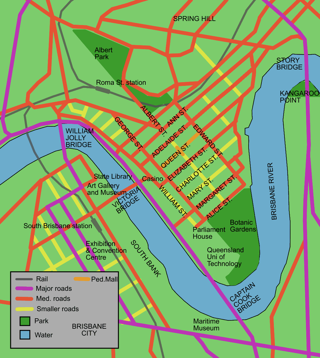
Map of Brisbane City streets
Charlotte Street is a road in the central business district of Brisbane. The street is one of a number that were named after female queens and princesses of the royal family shortly after the penal colony was settled. Mary Street runs parallel to the south and Elizabeth Street is the next street to the north.
The one-directional road begins at a T-intersection where Creek Street becomes Eagle Street, close to the Brisbane River. Charlotte Street ends at another T-intersection with George Street. Here lies the 111 George Street tower containing mostly government offices.
Charlotte Towers and Festival Towers are two tall residential buildings in Charlotte Street. The Elizabeth Arcade, St Stephens Cathedral, Comalco Place and The Pancake Manor are some of the other notable buildings located on Charlotte Street.
A number of multi-storey car parks have been built on the road. A police station once located on the Queen Street Mall was transferred to Charlotte Street. The iconic Victory Hotel, also on Charlotte Street, closed on 27 July 2008 after a fire destroyed the premises.[1] It has since re-opened in its original form.
See also
References
Coordinates: 27°28′14.54″S 153°01′38.40″E / 27.4707056°S 153.027333°E / -27.4707056; 153.027333
Categories:
- Australia road stubs
- Streets in Brisbane
Wikimedia Foundation.
2010.
Look at other dictionaries:
Creek Street, Brisbane — The view south, down Creek Street Map of Brisbane Cit … Wikipedia
Margaret Street, Brisbane — Map of Brisbane City streets Margaret Street is a major road in the central business district of Brisbane. The street is one of a number that were named after female members of the royal family shortly after the penal colony was settled. Alice… … Wikipedia
Mary Street, Brisbane — Map of Brisbane City streets Mary Street is a major road in the Brisbane central business district. The street is one of a number that were named after female queens and princesses of the royal family shortly after the penal colony was settled.… … Wikipedia
William Street, Brisbane — William Street is a small, relatively quiet road in the uptown part of the Brisbane central business district. The street is historical significant to the city s early development as a penal colony. The first convict buildings were built along… … Wikipedia
Brisbane — Saltar a navegación, búsqueda Este artículo trata sobre la ciudad de Brisbane. Para saber más sobre el río, véase Río Brisbane. Brisbane … Wikipedia Español
Brisbane Ferries — This page deals with Brisbane ferry history, this covers non operational ferry services and private operational passenger and vehicular services such as Dutton Park Ferry, Moggill Vehicular Ferry and Bulimba Vehicular Ferry and pre translink… … Wikipedia
Brisbane — This article is about the Australian metropolis. For the local government area, see City of Brisbane. For other uses, see Brisbane (disambiguation). Brisbane Queensland … Wikipedia
Street View — Google Street View La couverture de Google Street View dans le Monde (septembre 2009) Actuelle Future Pas de couverture … Wikipédia en Français
Cathédrale Saint-Étienne de Brisbane — Cette cathédrale n’est pas la seule cathédrale Saint Étienne. Cathédrale Saint Étienne de Brisbane … Wikipédia en Français
Sebel Suites Brisbane (The) (Brisbane) — Sebel Suites Brisbane (The) country: Australia, city: Brisbane (City) Sebel Suites Brisbane (The) Whether for business or pleasure, you will appreciate the spaciousness of your suite and enjoy the convenience of The Sebel s city centre location.… … International hotels

 Intersection with Edward Street