- Daniel Boone National Forest
-
Daniel Boone National Forest IUCN Category VI (Managed Resource Protected Area)

Location Kentucky, USA Nearest city Winchester, Kentucky Coordinates 37°17′17″N 83°52′31″W / 37.28806°N 83.87528°WCoordinates: 37°17′17″N 83°52′31″W / 37.28806°N 83.87528°W Area 2,100,000 acres (8,500 km2) (proclamation boundary); 706,000 acres (2,860 km2) (Forest Service) Established 1937 Visitors 2,507,000 (in 2004) Governing body U.S. Forest Service Daniel Boone National Forest is the only national forest completely within the boundary of Kentucky. Established in 1937, it was originally named the Cumberland National Forest, after the core region called the Cumberland Purchase Unit. About 2,100,000 acres (8,500 km2) are contained within its current proclamation boundary, of which 706,000 acres (2,860 km2) are owned and managed by the United States Department of Agriculture Forest Service (as of April 2006), up from around 620,000 acres (2,500 km2) in the early to mid-1990s.
The forest was named after Daniel Boone, a frontiersman and explorer in the late 18th century who contributed greatly to the exploration and settlement of Kentucky.
Contents
Notable features
Daniel Boone National Forest surrounds or contains a variety of popular and notable features, including:
- One of the world's largest concentrations of caves. The counties of Wayne, Pulaski, and Rockcastle alone have 173 miles (278 km) of mapped passageways [1][2]
- Cave Run Lake - a USACE reservoir
- Laurel River Lake - a USACE reservoir
- Buckhorn Lake - a USACE reservoir
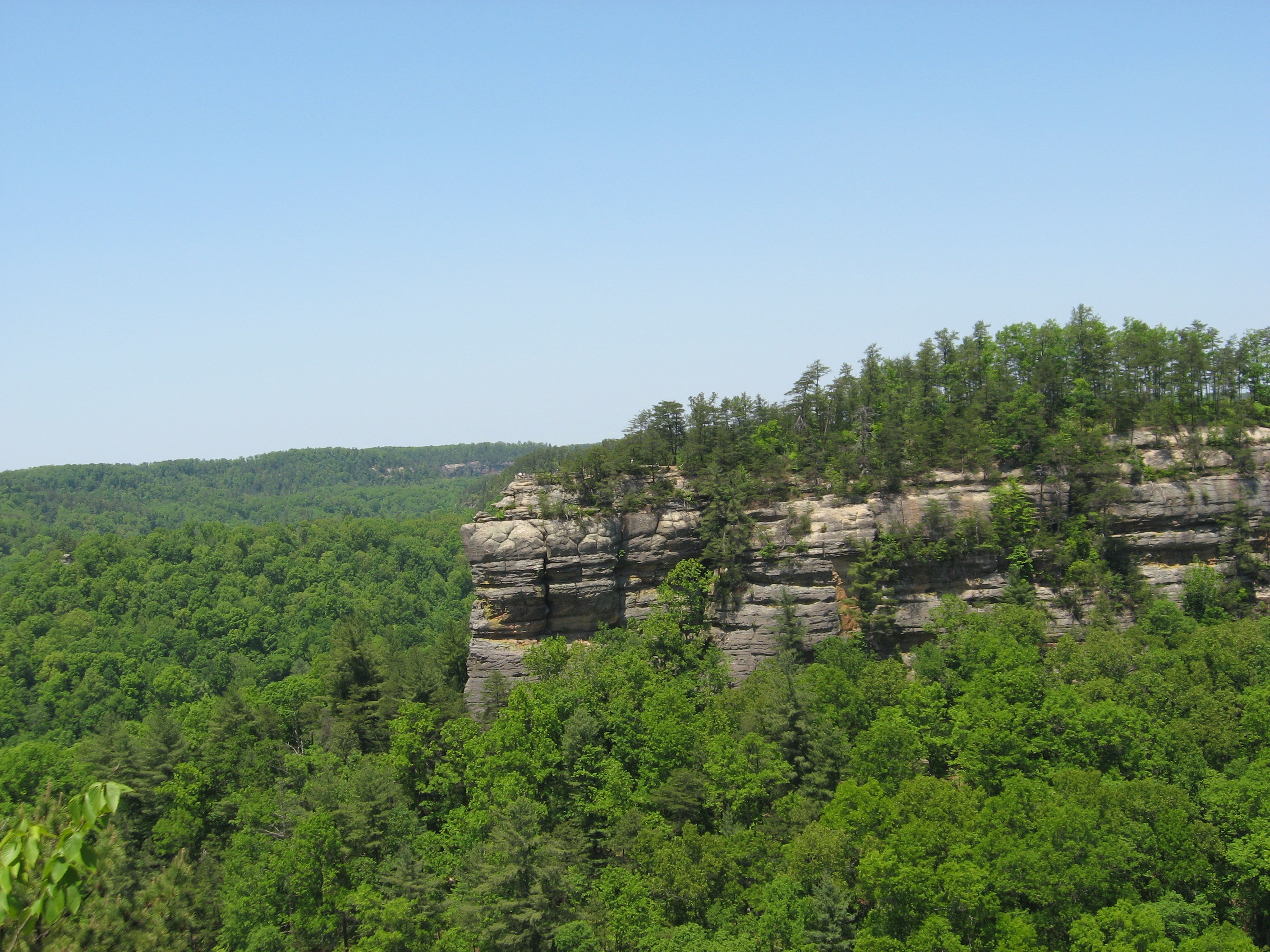
- Red River Gorge Geologic Area - popular with hikers, campers, and rock climbers
- Sheltowee Trace Trail
- Natural Bridge State Park (Kentucky)
- Yahoo Arch
- Yahoo Falls
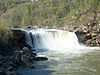
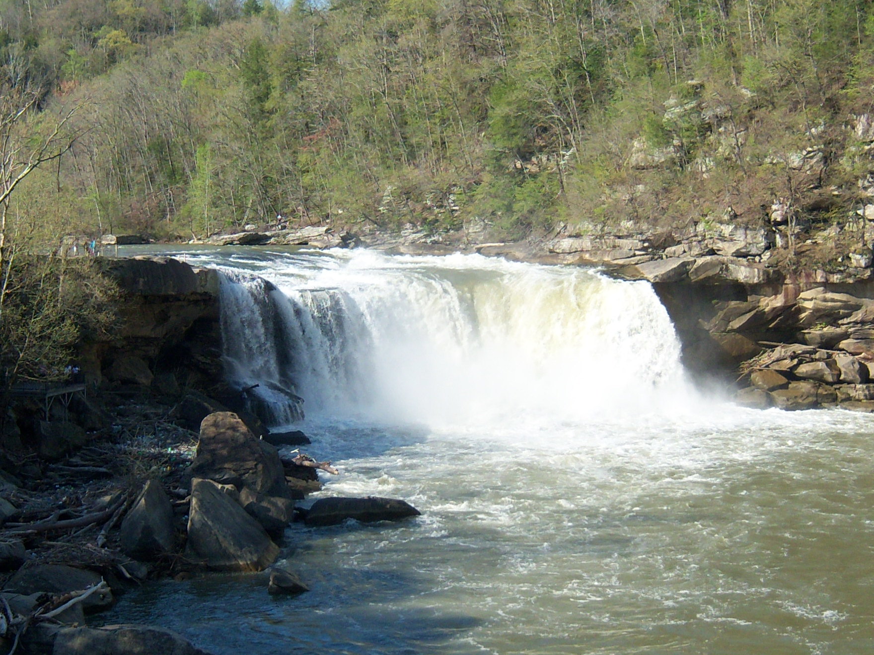
- Cumberland Falls
There are two areas designated as Wilderness:
- Clifty Wilderness
- Beaver Creek Wilderness
History
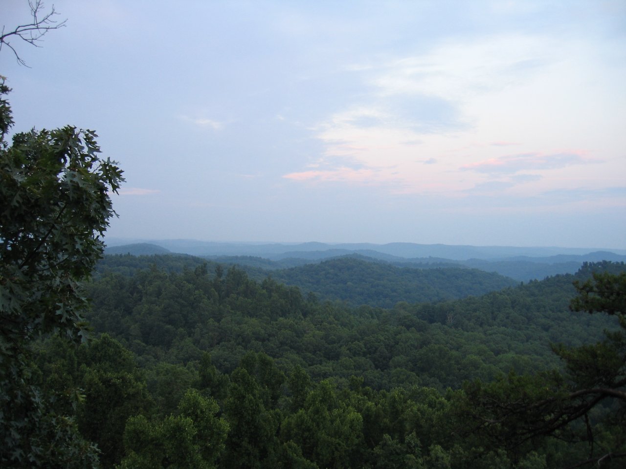
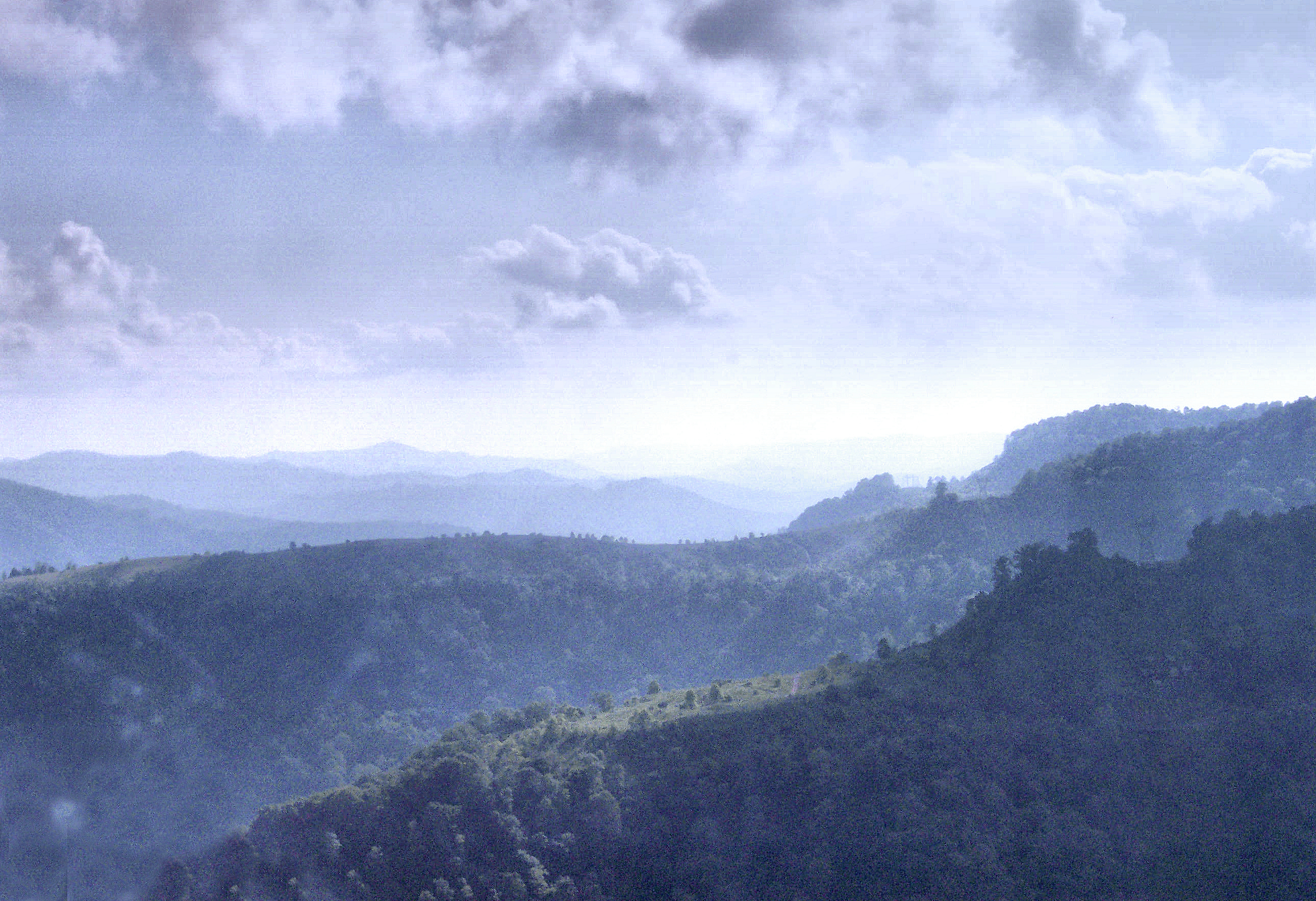
 View from the Tater Knob in the Daniel Boone National Forest.
In 1937, a national forest was established containing 1,338,214 acres (5,416 km2) within its proclamation boundary. As of June 1937, the Forest Service had purchased only 336,692 acres (1,363 km2). Most early purchases were large, isolated tracts owned by lumber and coal companies with but few inhabitants. The Forest Service has since had difficulty acquiring more land within the proclamation boundary, the bulk of which was, and still remains, small owner-operated farms.
Due in part to World War II, funds for land acquisition were curtailed in the early 1940s. Substantial acquisition efforts could not resume until the mid-1960s. The lengthy cessation of land acquisitions, except for period during the forest's renaming, caused a highly fragmented ownership pattern.
Naming the forest entailed considerable debate. The name 'Daniel Boone National Forest' was advocated by various groups, and was favored by most local leaders in Kentucky, before the area's formal designation as the Cumberland National Forest soon after its inception. Protests began immediately after the national forest was named.
The naming issue was reopened in the late 1950s. The Forest Service investigated the name 'Cumberland', and found it came to Kentucky in 1750 when Thomas Walker named the Cumberland River in honor of Prince William Augustus, Duke of Cumberland. The Duke had defeated the Scottish Highlanders in 1746 at the Battle of Culloden, an especially brutal conflict. Many Scottish families fled to America and ultimately Kentucky as a result of the event. The Forest Service found that for their descendants still living in eastern Kentucky, the name 'Cumberland' was particularly distasteful.[3]
In addition, the Forest Service noted the influence of history on the names of places in Kentucky. While the settlement of the region began before the American Revolution, the population grew dramatically after the Revolutionary War, when many veterans received land grants in reward for military service. During this period of time, place names with British connotations fell out of favor and changes were made. For example, prior to the Revolution, the Kentucky River was called the Louisa River (or Levisa), after the wife of the Duke of Cumberland.
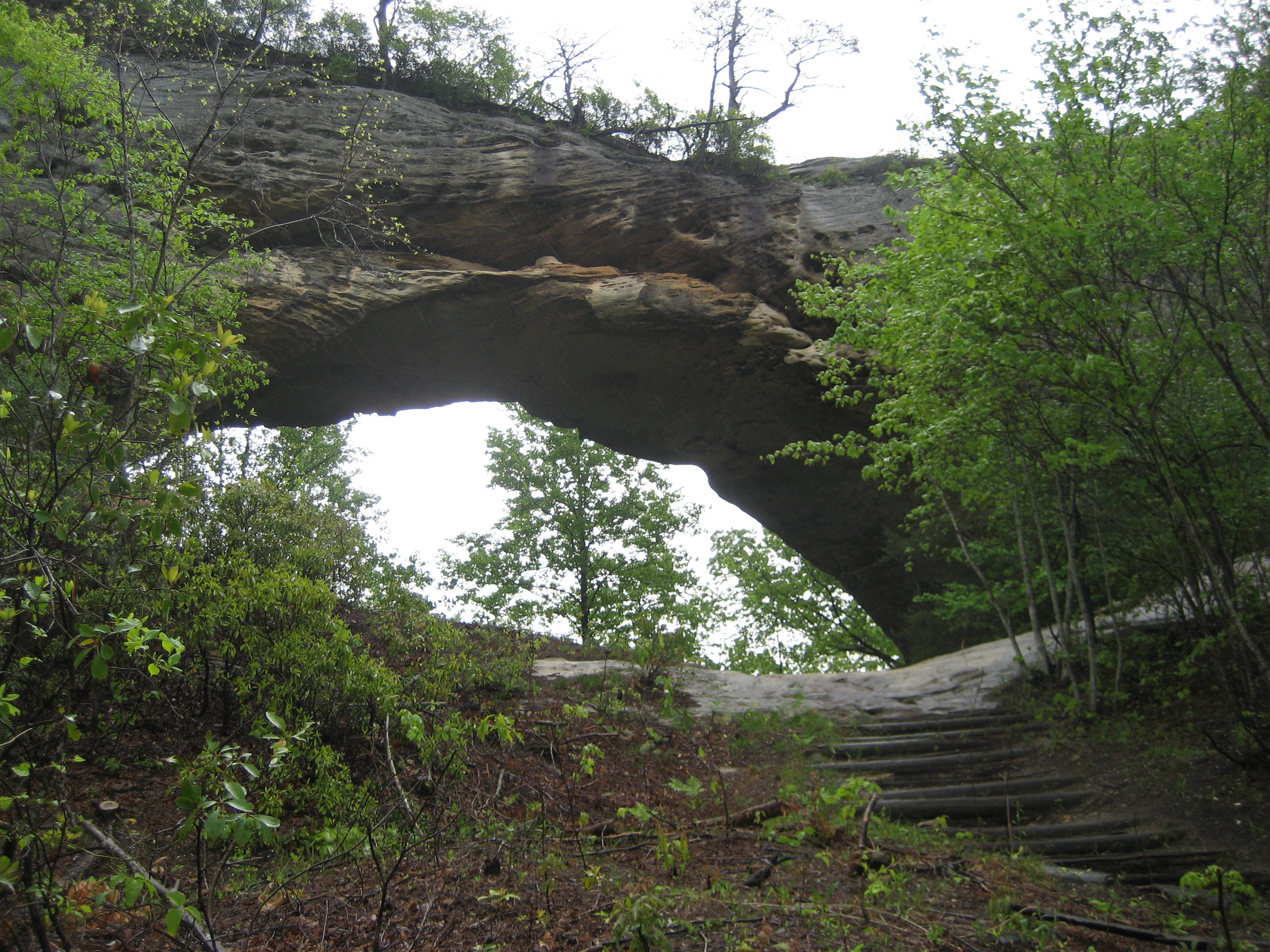
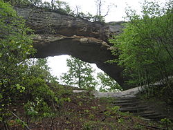 Natural Arch
During the 1960s, a new movement to rename the national forest took place. The Kentucky Senate passed a resolution in 1966 urging the Forest Service to change the name to 'Daniel Boone National Forest', and President Lyndon B. Johnson signed a proclamation so renaming the forest in 1966.
Also during the 1960s, part of the national forest was designated a Primitive Weapons Area (renamed Pioneer Weapons Area) and set apart for hunting with longbow, crossbow, or muzzle-loading firearms (either flintlock or percussion). In 1970, this was the only US area where deer could legally be hunted with crossbows. The park remains unique still for allowing only muzzle-loaded firearms.
In 1967, a large and disconnected addition to the national forest was created, called the Redbird Purchase Unit, after a key purchase from the Red Bird Timber Company. According to Robert F. Collins of the Forest Service, Thomas R. Frazier (born July 7, 1931; died February 1, 2008) was the first District Ranger of the Redbird Purchase Unit, and is credited as being a major factor in the success of the Redbird land purchasing unit ("A History of the Daniel Boone National Forest", dedication page, 1975).
Recent controversies
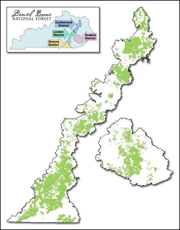
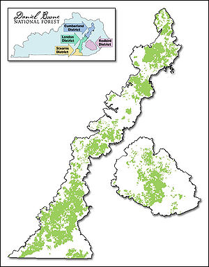 Map of Daniel Boone National Forest as of March 15, 2006. The black line is the proclamation boundary. The green represents land managed by the Forest Service. White areas within the proclamation boundary are held privately or by county, state, schools, etc. The inset map shows the ranger districts, including the relatively new Redbird District.
About a third of the land within the national forest proclamation boundary is owned or managed by the Forest Service. The pattern of land ownership is highly fragmented and changes relatively frequently. One of the goals of the Forest Service is to consolidate holdings into larger blocks, which is often done by trading tracts with other organizations. The boundaries of Forest Service lands are marked in various ways, including red paint on trees. The shifting boundaries and growing size of Forest Service lands sometimes results in local complaints and boundary disputes. In addition, it can be difficult for recreational users to know whether they are on Forest Service lands or not. "No Trespassing" signs are frequently used by landowners, and conflicts between landowners and recreational users are not uncommon.
As is common in many national forests, some recreational users trespass on private property, sometimes leaving litter, campfire rings, and causing other damage. In contrast, the population of eastern Kentucky has long been strong proponents of property rights. Feelings of local ownership traditionally extended into nearby public lands, used as woodlots, for hunting and herb gathering, and other such uses. The conflict between long-term local residents and recreational users is exacerbated by the highly fragmented pattern of land ownership.
On many commercially available maps, the whole region within the proclamation boundary is shown as solid green, but the national forest is actually a patchwork of tracts intermingled with private, county, and state properties. Tracts are often shuffled through swaps, barters and exchange, or purchase. One example is the nearly un-forested quarry tracts swapped near Clearfield's Clack Mountain for land on the Licking River in Rowan County.
Boundary disputes are often not contested in court when landowners find the commercial value of disputed land is less than the legal cost of fighting the Forest Service. Some of those affected claim the government takes advantage of archaic deed language and vague border markers or descriptions to shave away property in favor of forest holdings. Local county governments receive permanent fund payments in lieu of property taxes from the USDA, which not only provides revenue but can increase their bond rating, providing further financial incentives for the process to continue.
Issues such as logging and wildlife protection have resulted in lawsuits. Concerns have been raised about organizations promoting the introduction and population growth of animals such as bears, cougars, and red wolves. The successful introduction of red wolves to nearby Great Smoky Mountains National Park, as well as failed attempts at other nearby areas, such as the Land Between the Lakes, has generated concern and debate throughout the Appalachian region. The controversy over logging and loss of wildlife habitat has resulted in several lawsuits.
Counties
The forest covers parts of 16 counties in eastern Kentucky. They are listed here in descending order of Forest Service land area. [1]
- Clay County
- McCreary County
- Laurel County
- Rowan County
- Jackson County
- Menifee County
- Whitley County
- Pulaski County
- Bath County
- Rockcastle County
- Wolfe County
- Powell County
- Morgan County
- Lee County
- Estill County
- Owsley County
- Wayne County
References
- ^ url=http://www.ksscaves.org/projects/Kentucky%20Long%20Cave%20List-2.html
- ^ url=http://www.caverbob.com/wlong.htm
- ^ Collins, Robert F. (1975). Ellison, Betty B.. ed. A History of the Daniel Boone National Forest 1770-1970. United States Department of Agriculture, Forest Service, Southern Region.
Further reading
- Kathy Dobie (July 2008). "Crimes against nature : the many uses of the Daniel Boone National Forest". Harper's 317 (1898): 54–64.
External links
Visitor Attractions of the Eastern Mountain Coal Fields Parks StateBuckhorn Lake • Carr Creek • Carter Caves • Cumberland Falls • Dr. Thomas Walker • Fishtrap Lake • Grayson Lake • Greenbo Lake • Jenny Wiley • Kingdom Come • Levi Jackson Wilderness Road • Natural Bridge • Paintsville Lake • Pine Mountain • Pine Mountain Trail • Yatesville Lake
FederalInterstate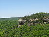


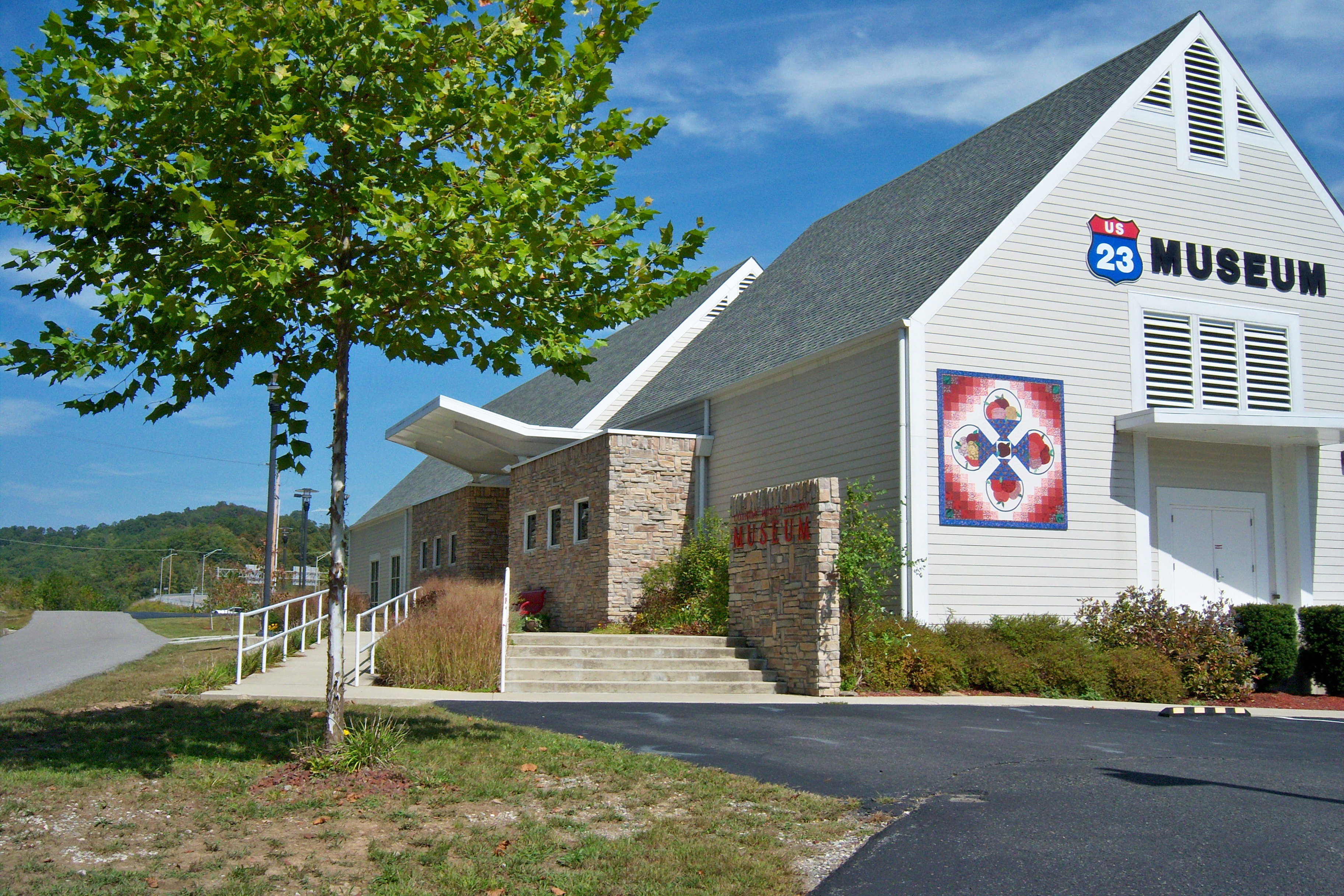
Museums Barthell Coal Mining Camp • Bell County Coal House & Museum • Bell County Historical Society Museum • Big Sandy Heritage Center • Blue Heron Coal Mining Camp • Bobby Davis Museum and Park • Breathitt County Museum • C.B. Caudill Store & History Center • Cloverfork Museum • Coal Miners' Museum • Cumberland Inn Museum • David A. Zegeer Coal-Railroad Museum • East Kentucky Science Center • Elkhorn City Railroad Museum • Harland Sanders Café & Museum • Highlands Museum and Discovery Center • Kentucky Coal Mining Museum • Kentucky Folk Art Center • Knox Historical Museum • Magoffin County Pioneer Village and Museum • Marie Stewart Museum & Craft Shop • McCreary County Museum • Morgan County History Museum • Mountain Homeplace • Mountain Life Museum • Northeastern Kentucky Museum • Swamp Valley Museum • U.S. 23 Country Music Highway Museum • Wolfe County History Museum
Forests Daniel Boone • Dewey Lake • Jefferson • Kentenia • Kentucky Ridge • Robinson • Tygarts
Reservoirs Buckhorn Lake • Carr Creek Lake • Cave Run Lake • Cranks Creek Lake • Lake Cumberland • Dewey Lake • Fishtrap Lake • Grayson Lake • Greenbo Lake • Laurel River Lake • Martins Fork Lake • Paintsville Lake • Yatesville Lake
Natural features Black Mountain • Cumberland Falls • Cumberland Gap • Eagle Falls • Middlesboro crater • Pine Mountain • Pound Gap • Raven Rock • Red River Gorge • Tri-State Peak • Yahoo Arch • Yahoo Falls
Miscellaneous Bad Branch Falls State Nature Preserve • Bat Cave and Cascade Caverns State Nature Preserves • Big South Fork Scenic Railway • Black Mountain Off-Road Adventure Area • Cumberland Gap Tunnel • Mayo Mansion • Middle Creek Battlefield • Pikeville Cut-Through • Samuel May House • Sheltowee Trace Trail
Categories:- IUCN Category VI
- National Forests of Kentucky
- Protected areas established in 1937
- Protected areas of Clay County, Kentucky
- Protected areas of McCreary County, Kentucky
- Protected areas of Laurel County, Kentucky
- Protected areas of Rowan County, Kentucky
- Protected areas of Jackson County, Kentucky
- Protected areas of Menifee County, Kentucky
- Protected areas of Whitley County, Kentucky
- Protected areas of Pulaski County, Kentucky
- Protected areas of Bath County, Kentucky
- Protected areas of Rockcastle County, Kentucky
- Protected areas of Wolfe County, Kentucky
- Protected areas of Powell County, Kentucky
- Protected areas of Morgan County, Kentucky
- Protected areas of Lee County, Kentucky
- Protected areas of Estill County, Kentucky
- Protected areas of Owsley County, Kentucky
- Protected areas of Wayne County, Kentucky

Wikimedia Foundation. 2010.