- Jiangsu
-
Coordinates: 32°54′N 119°48′E / 32.9°N 119.8°E
Jiangsu Province Chinese : 江苏省 Jiāngsū Shěng Abbreviations: simplified Chinese: 苏; traditional Chinese: 蘇 (pinyin: Sū) 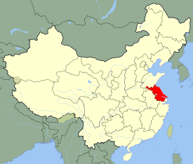
Origin of name 江 jiāng - Jiangning (now Nanjing)
苏 sū - SuzhouAdministration type Province Capital
(and largest city)Nanjing CPC Ctte Secretary Liang Baohua Governor Luo Zhijun Area 102,600 km2 (39,600 sq mi) (24th) - Latitude 30° 46' to 35° 07' N - Longitude 116° 22' to 121° 55' E Population (2010)
- Density78,659,903 (5th)
736 /km2 (1,910 /sq mi) (4th)GDP (2010)
- per capitaCNY 4.05 trillion ($US612 billion)[1] (2rd)
CNY 52,448 ($US 7,945) (5th)HDI (2008) 0.837 (high) (6th) Ethnic composition Han - 99.6%
Hui - 0.2%Spoken dialects Mandarin Chinese, Wu Chinese Prefectural level 13 divisions County level 106 divisions Township level* 1488 divisions ISO 3166-2 CN-32 Official website
http://www.jiangsu.gov.cn/Source for population and GDP data: 《中国统计年鉴—2005》 China Statistical Yearbook 2005Source for nationalities data:
ISBN 7503747382《2000年人口普查中国民族人口资料》 Tabulation on nationalities of 2000 population census of China*As at December 31, 2004
ISBN 7105054255Template ■ Discussion ■ WikiProject China  Jiangsu (help·info) (simplified Chinese: 江苏; traditional Chinese: 江蘇; pinyin: Jiāngsū; Wade–Giles: Chiang-su; Postal map spelling: Kiangsu) is a province of the People's Republic of China, located along the east coast of the country. The name comes from jiang, short for the city of Jiangning (now Nanjing), and su, for the city of Suzhou. The abbreviation for this province is "苏" (sū), the second character of its name.[2] It is the province with the highest population density in China, though provincial level municipalities like Shanghai, Beijing, and Tianjin have a higher density.
Jiangsu Traditional Chinese 江蘇 Simplified Chinese 江苏 Transcriptions Mandarin - Hanyu Pinyin Jiāngsū - Wade–Giles Chiang-su Wu - Romanization kaon su Jiangsu borders Shandong in the north, Anhui to the west, and Zhejiang and Shanghai to the south. Jiangsu has a coastline of over one thousand kilometers along the Yellow Sea, and the Yangtze River passes through its southern parts. Since the inception of economic reforms in 1978, Jiangsu has been a hot spot for economic development, and is now one of China's most prosperous provinces. The wealth divide between the rich southern regions and the north, however, remains a prominent issue in the province.
Jiangsu is home to many of the world’s leading exporters of electronic equipment, chemicals and textiles.[3] It has also been China’s largest recipient of foreign direct investment since 2006.
Contents
History
During the earliest Chinese dynasties, the area in what is now Jiangsu was far removed from the center of Chinese civilization, which was in the northwest Henan; it was home of the Huai Yi (淮夷), an ancient ethnic group. During the Zhou Dynasty more contact was made, and eventually the state of Wu (centered at Gusu, now Suzhou) appeared as a vassal to the Zhou Dynasty in south Jiangsu, one of the many hundreds of states that existed across northern and central China at that time. Near the end of the Spring and Autumn Period, Wu became a great power under King Helu of Wu, and was able to defeat in 484 BC the state of Qi, a major power in the north in modern-day Shandong province, and contest for the position of overlord over all states of China. The state of Wu was subjugated in 473 BC by the state of Yue, another state that had emerged to the south in modern-day Zhejiang province. Yue was in turn subjugated by the powerful state of Chu from the west in 333 BC. Eventually the state of Qin swept away all the other states, and established China as a unified nation in 221 BC.
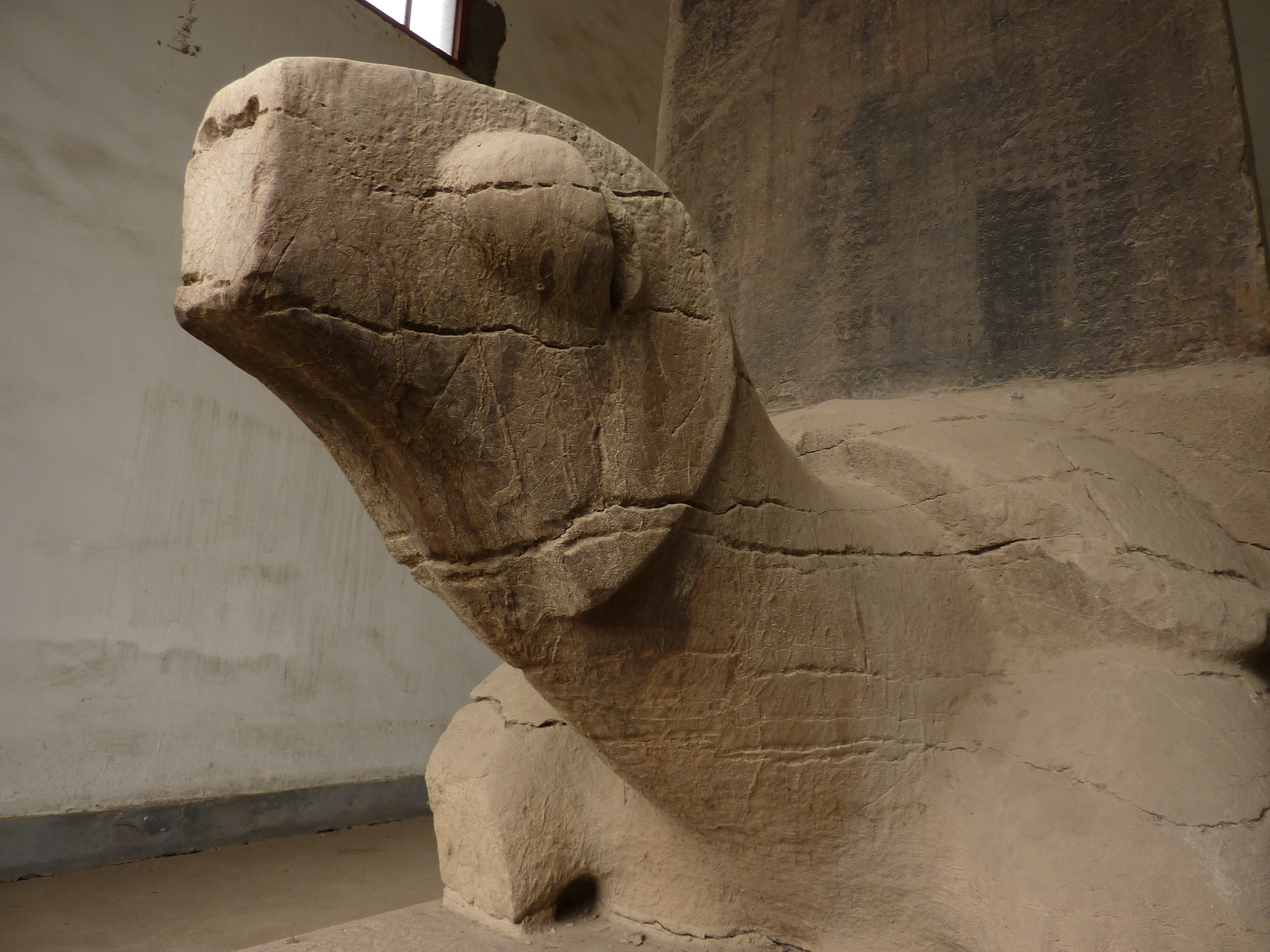
 One of the tortoise stelae of Xiao Dan (478—522), a member of the Liang royal family. Ganjiaxiang, Qixia District, near Nanjing
Under the reign of the Han Dynasty (206 BC to 220 AD), which brought China to its first golden age, Jiangsu was a relative backwater, far removed from the centers of civilization in the North China Plain. Jiangsu was at that time administered under two zhou (provinces): Xuzhou Province in the north, and Yangzhou Province in the south. Although south Jiangsu was eventually the base for the kingdom of Wu (one of the Three Kingdoms from 222 to 280), it did not become significant role until the invasion of northern nomads during the Western Jin Dynasty, starting from the fourth century. As northern nomadic groups established kingdoms across the north, ethnic Han Chinese aristocracy fled southwards and set up a refugee Eastern Jin Dynasty in 317, in Jiankang (modern day Nanjing). From then until 581 (a period known as the Southern and Northern Dynasties), Nanjing in south Jiangsu was the base of four more ethnic Han Chinese dynasties facing off with northern barbarian (but increasingly sinicized) dynasties. In the meantime, north Jiangsu was a buffer of sorts between north and south; it initially started as a part of southern dynasties, but as northern dynasties gained more ground, it became part of northern dynasties.

In 581 unity was reestablished again, and under the Tang Dynasty (618 to 907) China once more went through a golden age, though Jiangsu at this point was still rather unremarkable among the different parts of China. It was during the Song Dynasty (960-1279), which saw the development of a wealthy mercantile class and emergent market economy in China, that south Jiangsu emerged as a center of trade. From then onwards, south Jiangsu, especially major cities like Suzhou or Yangzhou, would be synonymous with opulence and luxury in China. Today south Jiangsu remains one of the richest parts of China, and Shanghai, arguably the wealthiest and most cosmopolitan of mainland China cities, is a direct extension of south Jiangsu culture.
The Jurchen Jin Dynasty gained control of North China in 1127, and Huai River, which used to cut through north Jiangsu to reach the Yellow Sea, was the border between the north, under the Jin, and the south, under the Southern Song Dynasty. The Mongols took control of China in the thirteenth century. The Ming Dynasty, which was established in 1368 after driving out the Mongols who had occupied China, initially put its capital in Nanjing. Following a coup by Zhu Di (later, the Yongle Emperor), however, the capital was moved to Beijing, far to the north. (The naming of the two cities continue to reflect this: "Nanjing" literally means "southern capital", "Beijing" literally means "northern capital.) The entirety of modern day Jiangsu as well as neighbouring Anhui province kept their special status, however, as territory-governed directly by the central government, and were called Nanzhili (南直隸 "Southern directly-governed"). Meanwhile, South Jiangsu continued to be an important center of trade in China; some historians see in the flourishing textiles industry at the time incipient industrialization and capitalism, a trend that was however aborted, several centuries before similar trends took hold in the West.
 The Beisi Pagoda of Suzhou, built between 1131 and 1162 during the Song Dynasty, 76 m (243 ft) tall.
The Qing Dynasty changed this situation by establishing Nanzhili as Jiangnan province; in 1666 Jiangsu and Anhui were split apart as separate provinces, and Jiangsu was given borders approximately the same as today. With the start of the Western incursion into China in the 1840s, the rich and mercantile south Jiangsu was increasingly exposed to Western influence; Shanghai, originally an unremarkable little town of Jiangsu, quickly developed into a metropolis of trade, banking, and cosmopolitanism, and was split out later as an independent municipality. South Jiangsu also figures strongly in the Taiping Rebellion (1851 – 1864), a massive and deadly rebellion that attempted to set up a Christian theocracy in China; it started far to the south in Guangdong province, swept through much of South China, and by 1853 had established Nanjing as its capital, renamed as Tianjing (天京 "Heavenly Capital").
The Republic of China was established in 1912, and China was soon torn apart by warlords. Jiangsu changed hands several times, but in April 1927 Chiang Kai-Shek established a government at Nanjing; he was soon able to bring most of China under his control. This was however interrupted by the second Sino-Japanese War, which began full-scale in 1937; on December 13, 1937, Nanjing fell, and the combined atrocities of the occupying Japanese for the next 3 months would come to be known as the Nanjing Massacre. Nanjing was the seat of the collaborationist government of East China under Wang Jingwei, and Jiangsu remained under occupation until the end of the war in 1945.
After the war, Nanjing was once again the capital of the Republic of China, though now the Chinese Civil War had broken out between the Kuomintang government and Communist forces, based further north, mostly in Manchuria. The decisive Huaihai Campaign was fought in northern Jiangsu; it resulted in Kuomintang defeat, and the communists were soon able to cross the Yangtze River and take Nanjing. The Kuomintang fled southwards, and eventually ended up in Taipei, from which the Republic of China government continues to administer Taiwan and its neighboring islands, though it also continues to claim (technically, at least) Nanjing as its rightful capital.
After communist takeover, Beijing was made capital of China and Nanjing was demoted to be the provincial capital of Jiangsu. The economic reforms of Deng Xiaoping initially focused on the south coast of China, in Guangdong province, which soon left Jiangsu behind; starting from the 1990s they were applied more evenly to the rest of China. Suzhou and Wuxi, two southern cities of Jiangsu in close proximity to neighboring Shanghai Municipality, have since become particularly prosperous, being among the top 10 cities in China in gross domestic product and outstripping the provincial capital of Nanjing. The income disparity between north Jiangsu and south Jiangsu however remains large.
Geography
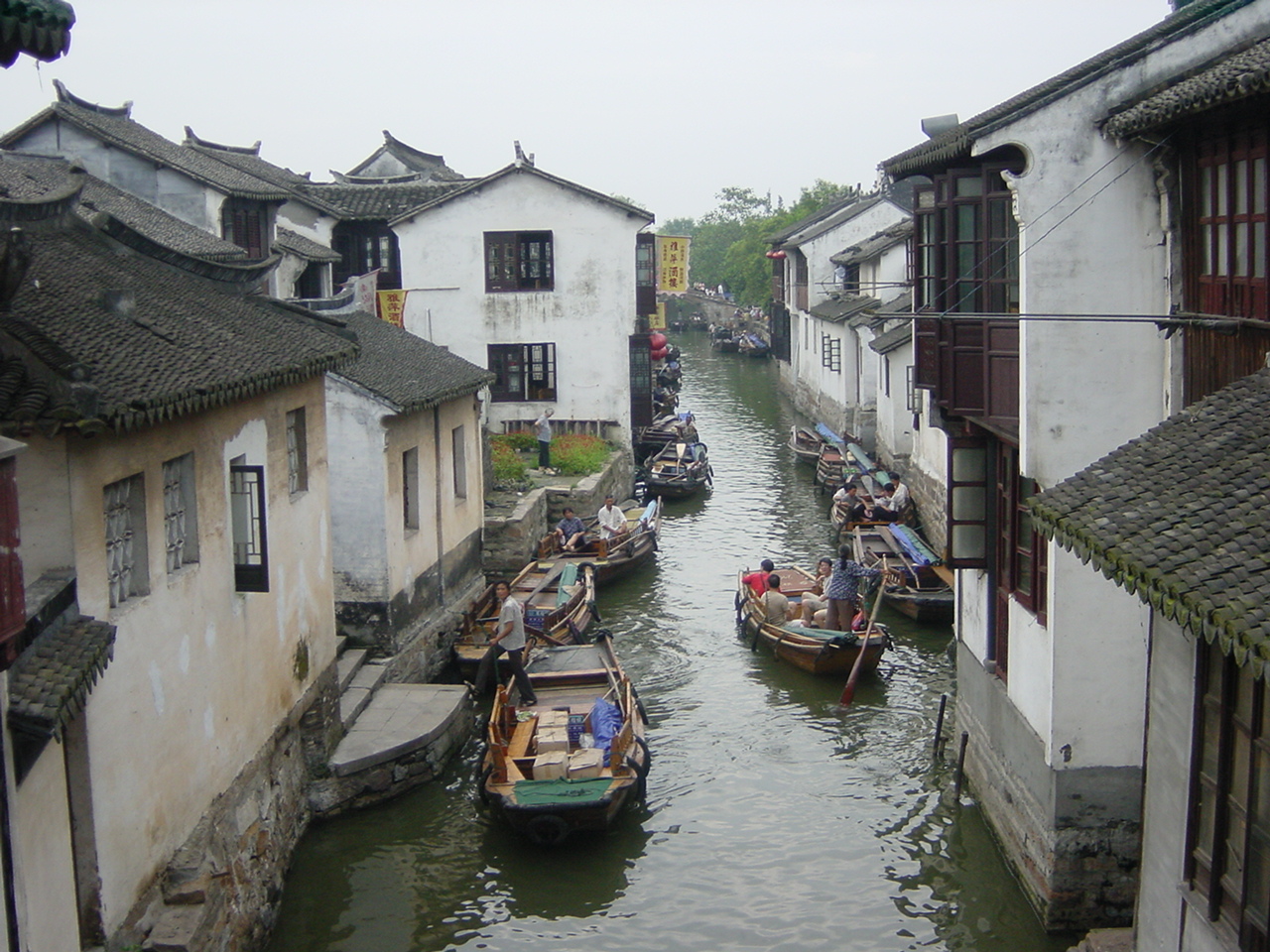
 Town of Zhouzhuang in Kunshan City. Southern Jiangsu is famed for its towns crisscrossed by canals.
Jiangsu is very flat and low-lying, with plains covering 68 percent of its total area (water covers another 18 percent), and most of the province stands not more than fifty meters above sea level. Jiangsu is also laced with a well-developed irrigation system, which earned it (especially the southern half) the moniker of 水乡 (shuǐxiāng "land of water"); the southern city of Suzhou is so crisscrossed with canals that it has been dubbed "Venice of the East" or the "Venice of the Orient".[4][5] The Grand Canal of China cuts through Jiangsu from north to south, traversing all the east-west river systems. Jiangsu also borders the Yellow Sea. The Yangtze River, the longest river of China, cuts through the province in the south and reaches the East China Sea. Mount Yuntai near the city of Lianyungang is the highest point in this province, with an altitude of 625 meters. Large lakes in Jiangsu include Lake Taihu (the largest), Lake Hongze, Lake Gaoyou, Lake Luoma, and Lake Yangcheng.
Historically, the river Huai He, a major river in central China and the traditional border between North China and South China, cut through north Jiangsu to reach the Yellow Sea. However, from 1194 AD the Yellow River further to the north changed its course several times, running into the Huai He in north Jiangsu each time instead of its other usual path northwards into Bohai Bay. The silting caused by the Yellow River was so heavy that after its last episode of "hijacking" the Huai He ended in 1855: the Huai He was no longer able to go through its usual path into the sea. Instead it flooded, pooled up (thereby forming and enlarging Lake Hongze and Lake Gaoyou), and flowed southwards through the Grand Canal into the Yangtze. The old path of the Huai He is now marked by a series of irrigation channels, the most significant of which is the North Jiangsu Irrigation Main Channel (苏北灌溉总渠), which channels a small amount of the water of the Huai He alongside south of its old path into the sea.
 On the Grand Canal near Yangzhou
Jiangsu Province spans the warm-temperate/humid and subtropical/humid climate zones, and has clear-cut seasonal changes, with temperatures at an average of -2 to 4°C in January and 26 to 30°C in July. Rain falls frequently between spring and summer (meiyu), typhoons with rainstorms occur in late summer and early autumn. The annual average rainfall is 800 to 1200 mm, concentrated mostly in summer when the southeast monsoon carries rainwater into the province.
Major cities:
Administrative divisions
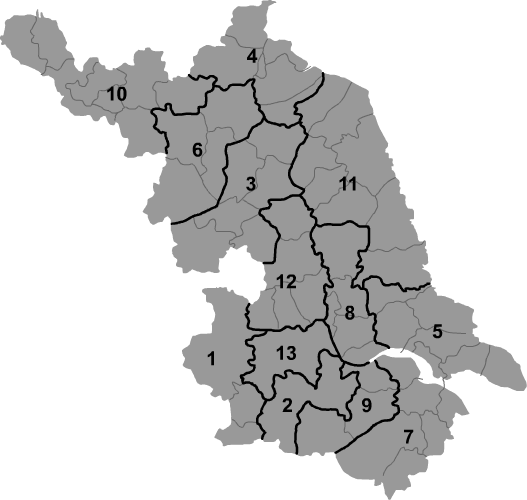
Jiangsu is divided into thirteen prefecture-level divisions, all prefecture-level cities:
Map # Name Hanzi Hanyu Pinyin Administrative Seat 
— Sub-provincial city — 1 Nanjing 南京市 Nánjīng Shì Xuanwu District — Prefecture-level city — 2 Changzhou 常州市 Chángzhōu Shì Zhonglou District 3 Huai'an 淮安市 Huái'ān Shì Qinghe District 4 Lianyungang 连云港市 Liányúngǎng Shì Xinpu District 5 Nantong 南通市 Nántōng Shì Chongchuan District 6 Suqian 宿迁市 Sùqiān Shì Sucheng District 7 Suzhou 苏州市 Sūzhōu Shì Jinchang District 8 Taizhou 泰州市 Tàizhōu Shì Hailing District 9 Wuxi 无锡市 Wúxī Shì Chong'an District 10 Xuzhou 徐州市 Xúzhōu Shì Yunlong District 11 Yancheng 盐城市 Yánchéng Shì Tinghu District 12 Yangzhou 扬州市 Yángzhōu Shì Guangling District 13 Zhenjiang 镇江市 Zhènjiāng Shì Jingkou District The thirteen prefecture-level divisions of Jiangsu are subdivided into 106 county-level divisions (54 districts, 27 county-level cities, and 25 counties). Those are in turn divided into 1488 township-level divisions (1078 towns, 122 townships, one ethnic township, and 287 subdistricts).
See List of administrative divisions of Jiangsu for a complete list of county-level divisions.
Politics
Main article: Politics of JiangsuThe politics of Jiangsu is structured in a one party (Communist) government system like all other governing institutions in mainland China.
The Governor of Jiangsu is the highest ranking official in the People's Government of Jiangsu. However, in the province's dual party-government governing system, the Governor has less power than the Jiangsu Communist Party of China Provincial Committee Secretary, colloquially termed the "Jiangsu CPC Party Chief".
Economy
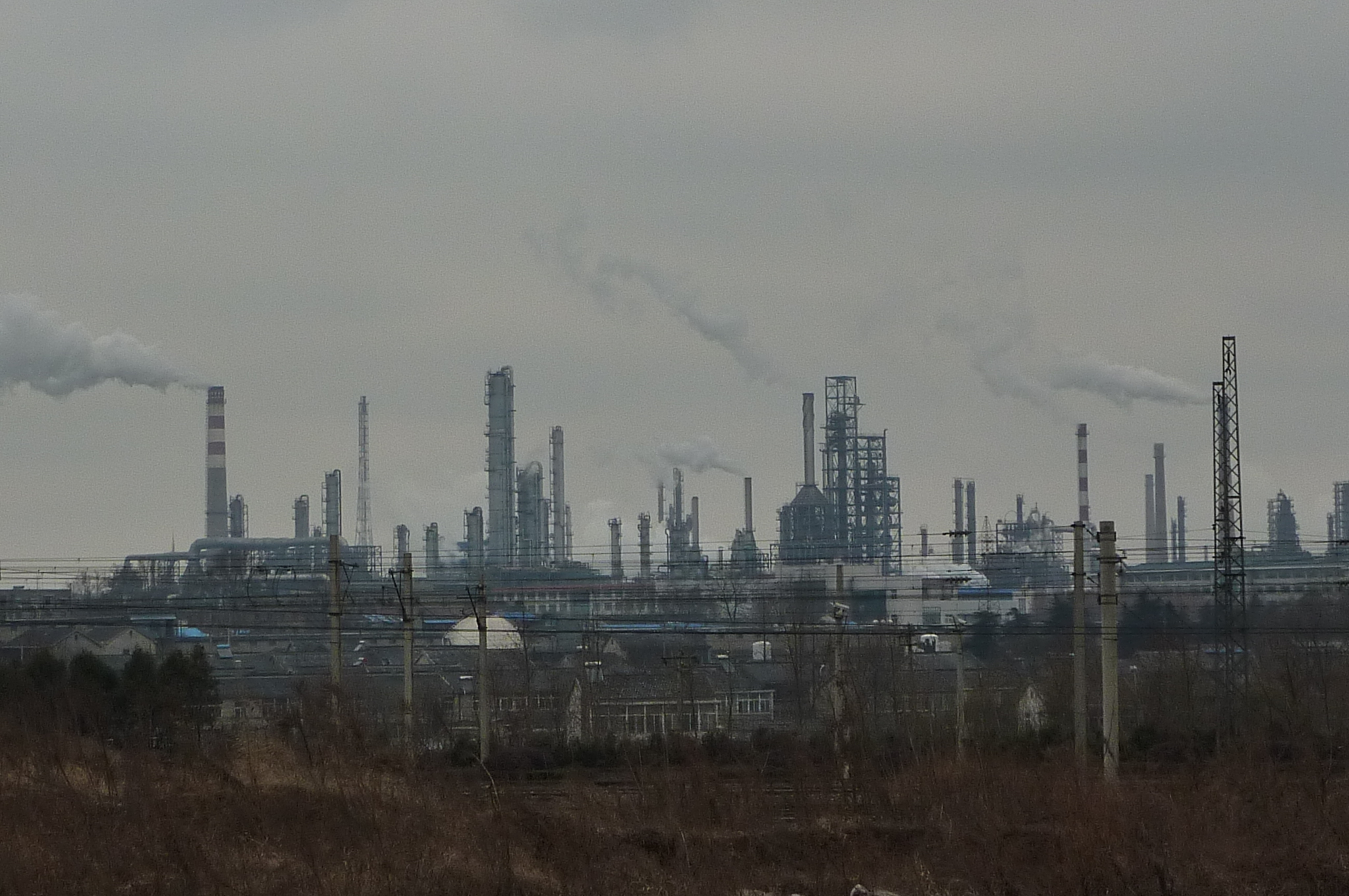
 An industrial landscape in Ganjiaxiang, Qixia District, Nanjing
Jiangsu has an extensive irrigation system supporting its agriculture, which is based primarily on rice and wheat, followed by maize and sorghum. Main cash crops include cotton, soybeans, peanuts, rape, sesame, ambary hemp, and tea. Other products include peppermint, spearmint, bamboo, medicinal herbs, apples, pears, peaches, loquats, ginkgo. Silkworms also form an important part of Jiangsu's agriculture, with the Lake Taihu region to the south a major base of silk production in China. Jiangsu is also an important producer of freshwater fish and other aquatic products.
Jiangsu has coal, petroleum, and natural gas deposits, but its most significant mineral products are non-metal minerals such as halite (rock salt), sulfur, phosphorus, and marble. The salt mines of Huaiyin have more than 0.4 trillion tonnes of deposits, one of the greatest collections of deposits in China.
Jiangsu is historically oriented towards light industries such as textiles and food industry. Since 1949, Jiangsu has also developed heavy industries such as chemical industry and construction materials. Jiangsu's important industries include machinery, electronic, chemicals, and automobile.[6] [7] Recently the government has worked hard to promote the solar industry and hopes by 2012 the solar industry will be worth 100 Billion RMB.[8] The economic reforms of Deng Xiaoping have greatly benefited southern cities, especially Suzhou and Wuxi, which outstrip the provincial capital Nanjing in total output. In the eastern outskirts of Suzhou, Singapore has built the Suzhou Industrial Park, a flagship of PRC-Singapore cooperation and the only industrial park in China that is in its entirety the investment of one single foreign country.
Jiangsu is very wealthy among the provinces of China, with the second highest total GDP, after Guangdong Province. Its GDP per capita was 44,232 yuan in 2009, but a wealth gap between the prosperous south and poorer north has led to unequal economic growth.[9] Cities likeNanjing, Suzhou and Wuxi have GDP per capita around twice the provincial average, making south Jiangsu one of the most prosperous regions in China.
In 2010, Jiangsu's nominal GDP was 4.05 trillion yuan (US$612 billion), making it the second largest GDP of all the provinces and an annual growth rate of 12.4%. Its per capita GDP was 52,448 yuan (US$7,945). In 2009, the share of GDP of Jiangsu's primary, secondary, and tertiary industries were 6.4%, 54.1%, and 39.5% respectively.
Economic and Technological Development Zones
- Changzhou Export Processing Zone
Changzhou Export Processing Zone was approved to be established in June 2005, with a planning area of 1.66 km2. In October 2006, it started operation. It is near Shanghai and Nanjing, where it enjoys convenient transportation. Investors can enjoy a series of preferential policies, and handle all the export procedures inside the export processing zone. It focuses on electronic information, electromechanical integration and new materials.[10]
- Changzhou National Hi-Tech District
Changzhou National Hi-Tech District (CND) is a state level high-tech industrial development zone. It is located in the northern part of Changzhou city. With a population of 500,000 and an area of 439 square km, CND is 160 km away from Shanghai to the east and 110 km away from Nanjing to the west. CND represents the highest-level and most sophisticated industrial park in Changzhou, and more than 1,300 foreign companies and over 5,000 local industrial enterprises have been registered within CND. Among these investments, around 40% are from European and American countries. Industries encouraged include Engineering Machinery, Transformer & Transmission Equipment, Automotive, Locomotive & its components, Parts, Precision Machinery, Biotechnology/Pharmaceuticals, PV and New Materials, Chemistry, Garment and Textiles Production, Computer Software, Research and Development. Some major investors include Terex, Komatsu, Ashland Chemical, Johnson, Caltex Oil Corp., Disa, +GF+, Rieter and General Electronics.[11]
- Kunshan Economic and Technological Development Zone
Kunshan Economic & Technical Development Zone (KETD) was founded in 1985, and was upgraded by the State Council to a State-level development zone in 1992. Kunshan locates in the south of Yangtze River Delta, with Shanghai to its east and Suzhou to its west. KETD has spent over RMB13 billion on the public infrastructure in terms of roads, telecommunication, water supply, energy and environmental protection.[12]
- Kunshan Export Processing Zone
Kunshan Export Processing Zone was established on April 2000 upon approval from the state government. It is located in Kunshan Economic and Technological Development Zone and it has a planned area of 2.86 square km. In the zone, there are electronic information, optical, precision machinery industry and bonded logistics industry clusters. It enjoys convenient transportation: it is located 45 km from Shanghai Pudong Airport and 60 km from Shanghai Port.[13]
- Nanjing Baixia Hi-Tech Industrial Zone
Nanjing Baixia Hi-Tech Industrial Zone is a national hi-tech industrial zone with 16.5 square kilometers planned area. The zone is only 13.5 km away from Nanjing downtown and 50 km away from Nanjing Lukou Airport. Several expressways pass through here. It is well equipped with comprehensive facilities, and it provides a good investment environment for high-tech industries. Electronic industry, automobile, chemical, machinery, instruments and building materials are the encouraged industries in the zone.[14]
- Nanjing Economic and Technological Development Zone
Established in 1992, Nanjing Economic and Technological Development Zone is a national level zone surrounded by convenient transportation network. Nanjing is the capital of Jiangsu Province. Situated in the downstream of Yangtze River Drainage Basin and Yangtze River Delta economic zone, Nanjing has always been a national center of commerce, education, research, transportation and tourism in the East China region, preceded only by Shanghai. It is only 20 km away from Nanjing Port and 40 km away from Nanjing Lukou Airport. It is well equipped with basic facilities like electricity, water, communication, gas, steam and so on. It has formed four specialized industries, which are electronic information, bio-pharmaceutical, machinery and new materials industry.[15]
- Nanjing Export Processing Zone
On March 10, 2003 the State Council approved the establishment of this Export Processing Zone (EPZ) in Nanjing's Southern District. This EPZ is free from import/export duty area and provides 24-hour customs-bonded conditions. It has a planned area of 3 square km. The Central Government has given the special economic region preferential policies to attract more enterprises engaged in processing trade investment in the region. It is only 20 km from Nanjing Port and several expressways pass through here.[16]
- Nanjing New & High-Tech Industry Development Zone
Nanjing New & High-Tech Industry Development Zone was jointly founded by Jiangsu Provincial People's Government and Nanjing Municipal People's Government, and started to break ground of construction on September 1, 1988. It was established as a national new and high-tech industry development zone by the State Council on March 6, 1991. The zone is next to National Highway 104 and 312. Its pillar industries include electronic information, bio-engineering and pharmaceutical industry.[17]
- Nantong Economic & Technological Development Area
Established in 1984, Nantong Economic & Technological Development Area (NETDA) was one of the first state-level development zones approved by the Central Government and has been certified as an ISO 14000 National Demonstration Zone. The zone benefits from superior transportation facilities by both rail and road. NETDA has direct links to two railways - the Xinyi-Changxing Railway and the Nanjing-Qidong Railway. Su-Tong Yangtze River Bridge feeds into the center of NETDA and connects the Nanjing-Nantong and Yancheng-Nantong Expressways to the north, and Shanghai-Nanjiang and Suzhou-Jiaxing-Hangzhou Expressways and Riverside Expressways to the south.[18]
- Nantong Export Processing Zone
Nantong Export Processing Zone (NTEPZ) is situated in Nantong Economic and Technological Development Area with a planned area 2.98 square kilometers. The Tong-Qi canal marks its western and northern boundaries, the Dongfang Avenue and Fuxin Road marking its eastern and southern boundary respectively, the NTPEZ is located at a hub of communications, adjoining the main coastal artery of communications between north and south, close to the estuary of Yangze River, and only 8 kilometers to the Su(Suzhou)-Tong(Nangtong)Changjiang Bridge.[19]
- Lianyungang Economic & Technological Development Zone
Lianyungang Economic & Technological Development Zone (LETDZ) was approved by the State Council as one of the first batch of state-level development zones in December 1984,it is located in the eastern new seashore urban area of Liangyungang City. Distance to nearest airport, Liangyungang Airport is 10–20 km and distance to nearest highway G310 is 10–20 km. Distance to nearest port, Lianyungang port is 20–50 km.[20]
- Lianyungang Export Processing Zone
Lianyungang Export Processing Zone is located in Lianyungang Economic & Technological Development Zone (LETDZ).[21]
- Suzhou Industrial Park
Suzhou Industrial Park (SIP) is the largest cooperation project between the Chinese and Singaporean governments. It is located around Jinji Lake, which lies to the east of Suzhou Old city. On 26 February 1994, Vice Premier Li Lanqing and Senior Minister Lee Kuan Yew represented China and Singapore respectively in signing the Agreement to jointly develop Suzhou Industrial Park. The project officially commenced on 12 May in the same year. SIP has a total jurisdiction area of 288 km2, of which, the China-Singapore cooperation area covers 80 km2 with a planned residential population of 1.2 million.[22]
- Suzhou Industrial Park Export Processing Zone
The Suzhou Industrial Park Export Processing Zone was approved to be established by the government in April 2000, with a planning area of 2.9 km2. It is located in Suzhou Industrial Park set up by China and Singapore. Inside the Export Processing Zone, all the infrastructures are of high-standard. With the information platform and electronic methods, all the customs declaration and other procedures can be handled on line. Investors can enjoys many preferential policies.[23]
- Suzhou Hi-Tech Industrial Development Zone
The Suzhou Hi-Tech Industrial Development Zone was established in 1990. In Nov. 1992, the zone was approved to be the national-level hi-tech industrial zone. By the end of 2007, foreign-invested companies had a total registered capital worth of USD 13 billion, of which USD 6.8 billion was paid in. SND hosts now more than 1,500 foreign companies. Some 40 Fortune 500 companies set up 67 projects in the district.[24]
- Wuxi New District
Since it was established in 1992, Wuxi New District (WND) has evolved to be one of the major industrial parks in China. A wide variety of components, sub-systems and original equipments are made in WND. Approximately 1200 enterprises have been registered in WND by the end of 2008. Wuxi New District provides strong support for international manufacturing operations. The Zone focuses on formation of the five pillar industries of electronic information, precision machinery and mechanical and electrical integration, bio-pharmaceuticals, fine chemicals and new materials.[25]
- Wuxi Export Processing Zone
Established in 1992, Wuxi Export Processing Zone is located in Wuxi New District with a planned area of 2.98 sqkm. The encouraged industries include electronic information, optical-mechanical-electronic-integration, precision machinery, and new materials. It is situated near to Wuxi Airport and Changzhou Port.[26]
- Yixing Economic Development Zone
As a provincial-level industrial zone approved by Jiangsu Government, the zone is composed of Industrial Zone, Logistic Zone, and Executive Business Zone. The general planning area is 56.7 square kilometers. The developed coverage has reached up to 18.7 square kilometers and the five main industries of electric circuit, textile and clothes, fine chemical, electro-mechanization and auto parts have been formed in the zone. So far, you can find 719 different enterprises in the zone.[27]
- Zhenjiang Export Processing Zone
Zhenjiang Export Processing Zone was approved by the State Council on March 10, 2003 with a total planned area of 2.53 square kilometers. The first-phrase project completed in December 2003 covers 0.91 square kilometers and was certified by the Customs General Administration and other seven ministries for operation on Dec.24, 2003. Zhenjiang Export Processing Zone is located close to Changzhou Airport and Zhenjiang Port.[28]
- Zhangjiagang Free Trade Zone
Zhangjiagang Free Trade Zone, approved by the State Council in 1992, is the only inland river free trade zone in China. It is established to develop export-oriented economy in Zhangjiagang and fasten the links between the Chinese market and the international market. The zone possesses unique locational advantages of being connected with the Yangtze River and comprehensive infrastructure.[29]
- Zhangjiagang Bonded Logistics Park
Zhangjiagang Bonded Logistic Park was established by the government in August 2004, with a total area of 1.53 km2. In 2005, it became the third National Free Trade Logistic Zone. It has four functions: international transfer, distribution, purchase and trade. It is located in Zhangjiagang Free Trade Zone, and it enjoys complete infrastructure and convenient traffic.[30]
Demographics
The majority of Jiangsu residents are ethnic Han Chinese. Other minorities include the Hui and the Manchus.
- Demographic indicators in 2000
Population: 74.058 million (urban: 34.637 million; rural: 39.421 million) (2003)
Birth rate: 9.04 per 1000 (2003)
Death rate: 7.03 per 1000 (2003)
Sex ratio: 102.55 males per 100 females
Average family size: 3.25
Han Chinese proportion: 99.64%
Literacy rate: 97.88%Transportation
Jiangsu is home to one of the most extensive transportation networks in China.
Air
Xuzhou Airport, Yancheng Airport, and Lianyungang Airport serve as hubs in northern Jiangsu.
In the south, Nanjing Lukou International Airport (IATA: NKG, ICAO: ZSNJ) serves as the major airport in the province, with flights to Tokyo, Osaka, Hong Kong, Seoul-Incheon, Frankfurt and Bangkok. Other passenger airports include Changzhou Benniu Airport, Wuxi Shuofang Airport, and Nantong Airport. Air traffic in the populated Suzhou area is often diverted to Shanghai Hongqiao Airport, to which Suzhou is conveniently connected to via bus services and by expressway.
Rail
The southern part of the province, namely the Shanghai-Nanjing corridor, has regular railway service by every 10 minutes. Jiangsu is in route of the Jinghu Railway from Beijing to Shanghai. The newly opened CRH2 EMU high-speed train services makes travelling along the corridor extremely convenient. The trains pass through Kunshan, Suzhou, Wuxi, Changzhou, Danyang, Zhenjiang, and Nanjing. Yangzhou has been connected by railway since 2004. Till 2007 all major cities in Jiangsu except Suqian have been connected. The Xinchang Railway originates in Xinyi and heads south, passing through Huai'an, Yancheng, Taizhou, Hai'an, Jiangyin and Yixin. Lianyungang is the terminus of the Longhai Railway.
Road
Jiangsu's road network is one of the most developed in the country. The Jinghu Expressway crosses the province. The Huning Expressway links Shanghai with Nanjing. The Ningchang Expressway links Nanjing with Changzhou. The Suzhou area is extensively networked with expressways, going in all directions. The Yanhai Expressway links the coastal regions of the province, passing through Nantong, Yancheng, and Lianyungang. Presently, with the development of the Sutong Bridge and Jiangyin Bridge, the northern part of the province is effectively linked by road to the southern part, historically having been divided by the Yangtze River.
Culture
The province of Jiangsu originated in the seventeenth century with the splitting of the defunct and erroneously named Jiangnan Province ("south of the river") into Jiangsu and Anhui. Before then, the northern and southern parts of Jiangsu had less connection with each other than they later did. Traditionally, South Jiangsu is referred to as the three more prosperous southern cities including Suzhou, Wuxi and Changzhou. Their culture (the "Jiangnan" culture shared with Shanghai and Zhejiang) is more southern than the rest and is oftened referred to as the Wu. All the other parts of the province is dominated by the so-called "Jianghuai Culture", which means the culture in the area between the Yangtse River (Jiang) and Huaihe River (Huai), though not all of them lie within the district defined by the term. In history, the term North Jiangsu refers to the cities to the north of the Yangtze River. For cities of Nanjing and Zhenjiang, neither the two terms (North Jiangsu and South Jiangsu) refers to them, because though they are to the south of the River, culturally they are still of the Jianghuai Region. Since about 1998, there is a new classification used frequently by the government and defined by economic means. It groups all the cities to the south of the Yangtse River as South Jiangsu, the cities of Yangzhou, Nantong and Taizhou as Middle Jiangsu, and all the rest as North Jiangsu.
Though the terms of classification are very complex, by cultural means only the very north cities of Xuzhou and Huaian are culturally north Chinese. All the rest areas of the province are culturally south, though the three South Jiangsu cities are more purely southern while the culture in other cities is more a transitional mixture dominated by the southern.
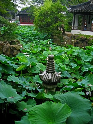
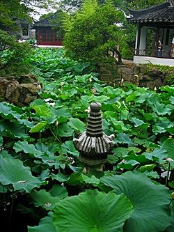 The Humble Administrator's Garden, one of the classical gardens of Suzhou.
Two main subdivisions of the Chinese language, Mandarin (not Putonghua, the national standard speech based on the Beijing dialect, also commonly called Mandarin) and Wu, are spoken in different parts of Jiangsu. Mandarin dialects are spoken over the traditional North Jiangsu, Nanjing and Zhenjiang, while Dialect of Wu is used in South Jiangsu. Mandarin and Wu are not mutually intelligible and the dividing line is sharp and well-defined. (See also Nanjing dialect, Xuzhou dialect, Yangzhou dialect, Suzhou dialect, Wuxi dialect, Changzhou dialect). In addition, Standard Chinese (Putonghua/Mandarin) is also spoken by most people.
Jiangsu is rich in cultural traditions. Kunqu, originating in Kunshan, is one of the most renowned and prestigious forms of Chinese opera. Pingtan, a form of storytelling accompanied by music, is also popular: it can be subdivided into types by origin: Suzhou Pingtan (of Suzhou), Yangzhou Pingtan (of Yangzhou), and Nanjing Pingtan (of Nanjing). Xiju, a form of traditional Chinese opera, is popular in Wuxi, while Huaiju is popular further north, around Yancheng. Jiangsu cuisine is one of the eight great traditions of the cuisine of China.
Suzhou is also famous for its silk, embroidery art, jasmine tea, stone bridges, pagodas, and its classical gardens. Nearby Yixing is famous for its teaware, and Yangzhou is famous for its lacquerware and jadeware. Nanjing's yunjin is a famous form of woven silk, while Wuxi is famous for its peaches.
Since ancient times, south Jiangsu has been famed for its prosperity and opulence, and simply inserting south Jiangsu place names (Suzhou, Yangzhou, etc.) into poetry gave an effect of dreaminess, as was indeed done by many famous poets. In particular, the fame of Suzhou (as well as Hangzhou in neighbouring Zhejiang province) has led to the popular saying: 上有天堂,下有蘇杭 (above there is heaven; below there is Suzhou and Hangzhou), a saying that continues to be a source of pride for the people of these two still prosperous cities. Similarly, the prosperity of Yangzhou has led poets to dream of: 腰纏十萬貫,騎鶴下揚州 (with a hundred thousand strings of coins wrapped around the waist, riding a crane down to Yangzhou).
Notables
This is a list of famous people from Jiangsu in chronological order. Note that modern-day Jiangsu Province dates from the seventeenth century, so most of the people in this list would not have recognised the concept.
- King Helu of Wu (阖闾) (died 496 BC), king of the state of Wu
- Gan Jiang (干将)
- Mo Ye (莫邪)
- Xiang Yu (项羽) (232 – 202 BC), warlord at the end of Qin Dynasty
- Emperor Gaozu of Han (256 – 195 BC), first emperor of Han Dynasty
- The Han Dynasty generals Han Xin (韩信), Xiao He (萧何) and Cao Shen (曹参).
- Zhang Zhao (张昭), Three Kingdoms era strategist.
- Lu Xun (陆逊), Three Kingdoms era strategist and general.
- Ge Hong
- Tao Hongjing
- Gu Kaizhi (顾恺之) (348 – 409), painter.
- Lu Ji[disambiguation needed
 ]
] - Lu Yun
- Emperor Wu of Song (363 – 422), first emperor of the Song Dynasty (420-479).
- Zhang Xu, Tang Dynasty calligrapher.
- Li Houzhu (937 – 978), last emperor of Later Tang Dynasty, poet.
- Fan Zhongyan (范仲淹) (989 – 1052), Song Dynasty politician, poet.
- Shen Kuo (沈括) (1031 – 1095), Song Dynasty scientist, general, and statesman
- Fan Chengda (范成大)
- Gu Xiancheng (顾宪成)
- Marco Polo served the Yuan government in Yangzhou
- Xu Xiake (徐霞客) (1586 – 1641), travel writer.
- Shi Kefa, the hero and martyr of the defense of Yangzhou (1645)
- Shen Zhou (沈周)
- Wen Zhengming (文征明)
- Tang Bohu (唐伯虎) (1470 – 1524), artist.
- Dong Qichang
- Zhu Yunming (祝允明)
- Wu Cheng'en (吴承恩) (died 1582), author of Journey to the West.
- Gui Youguang (归有光) (1506 – 1571), writer.
- Feng Menglong (冯梦龙) writer.
- Zheng Banqiao (郑板桥) (1693 – 1765), poet, painter, scholar.
- Jin Shengtan (1608 – 1661), writer, critic.
- Gu Yanwu (顾炎武)
- Zhao Yi
- Liu E
- Hsing Yun (born 1927), Buddhist monk.
- Xu Beihong (徐悲鸿) (1895 – 1953), painter.
- Mei Lanfang (梅兰芳) (1894 – 1961), Beijing opera actor.
- Liu Tianhua (刘天华) (1895 – 1932), musician and composer.
- Zhou Enlai (周恩来) (1898 – 1976), former Premier of the People's Republic of China.
- Zhou Xuan (周璇) (1920 – 1957), Chinese singer and actress
- Jiang Zemin (江泽民) (born 1926), former General Secretary of the Communist Party of China, President of the People's Republic of China
- Hu Jintao (胡锦涛) (born 1942), current General Secretary of the Communist Party of China, President of the People's Republic of China
- Hau Pei-tsun (郝伯村), Retired general of the ROC Army, former Premier of the Republic of China
- Pearl Buck, a Nobel-prize winning writer and a long-time resident of Zhenjiang
Tourism
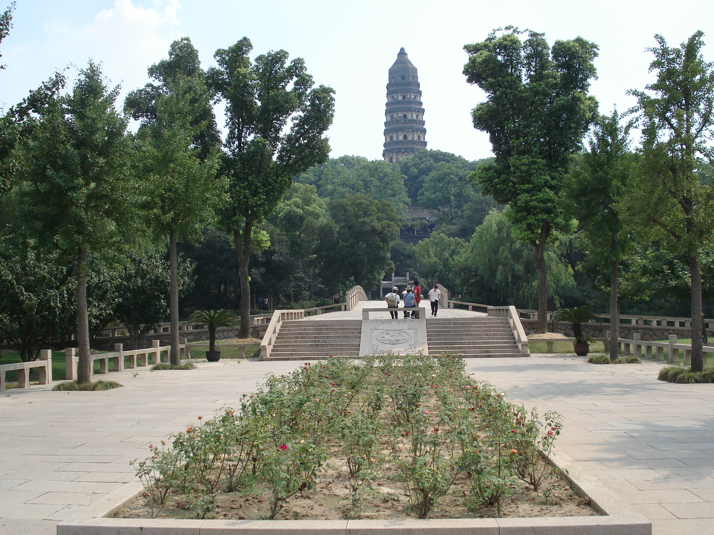
Nanjing was the capital of several Chinese dynasties and contains a variety of historic sites, such as the Purple Mountain, Purple Mountain Observatory, the Sun Yat-sen Mausoleum, Ming Dynasty city wall and gates, Ming Xiaoling Mausoleum (The mausoleum of the first Ming Emperor Zhu Yuanzhang), Lake Xuanwu, Jiming Temple, the Nanjing Massacre Memorial, Nanjing Confucius Temple, Nanjing Yangtze River Bridge, and the Nanjing Zoo, with circus. Suzhou is renowned for its classical gardens (designated as a UNESCO World Heritage Site), as well as Hanshan Temple, and Huqiu Tower. Nearby is the water-town of Zhouzhuang, an international tourist destination where Venice alike waterways, bridges and dwellings have been preserved over centuries. Yangzhou is known for Thin West Lake. Wuxi is known for being the home of the world's tallest buddha statue. In the north, Xuzhou is designated as one of China's "eminent historical cities". The official travel and tourism website for Jiangsu [2] was set up in 2008.
- Lion Garden in Suzhou
- Grand Buddha at Ling Shan, Wuxi
- Chaotian Palace
- Gulin Park
- Jiangxin Island
- Night markets
- Qixia Temple in Qixia Mountains
- Swallow Rock in Yanziji
- Tianning Temple Pagoda
- Tombs of Southern Tang Emperor
Sports
Professional sports teams in Jiangsu include:
- Chinese Super League
- Jiangsu Shuntian
- Chinese Football Association Jia League
- Chinese Basketball Association
- Jiangsu Nan'gang Dragons
Colleges and universities
See also: List of universities and colleges in JiangsuNanjing
- Nanjing University (南京大学)
- Southeast University (东南大学)
- China Pharmaceutical University (中国药科大学)
- Hohai University (河海大学)
- Nanjing Aeronautics and Astronautics University (南京航空航天大学)
- Nanjing Art Institute (南京艺术学院)
- Nanjing University of Finance & Economics (南京财经大学)
- Nanjing Agricultural University (南京农业大学)
- Nanjing Forestry University (南京林业大学)
- Nanjing Medical University (南京医科大学)
- Nanjing Normal University (南京师范大学)
- Nanjing University of Science and Technology (南京理工大学)
- Nanjing University of Information Science and Technology (南京信息工程大学)
- Nanjing University of Posts and Telecommunications (南京邮电大学)
- Nanjing University of Technology (南京工业大学)
- Nanjing Institute of Technology (南京工程学院)
- Jiangsu University of Social Science (江苏社科进修大学)
Suzhou
- Soochow University (苏州大学)
- Xi'an Jiaotong Liverpool University (西交利物浦大学)
Xuzhou
- China University of Mining and Technology (中国矿业大学)
- Xuzhou Normal University (徐州师范大学)
- Xuzhou Medical College (徐州医学院)
Yangzhou
- Yangzhou University (扬州大学)
Zhenjiang
- Jiangsu University (江苏大学)
- Jiangsu University Of Science and Technology (江苏科技大学)
Wuxi
- Jiangnan University (江南大学)
Yancheng
- Yancheng Institute of Technology (盐城工学院)
Nantong
- Nantong University (南通大学)
Schools in Jiangsu
- Nanjing High School of Jiangsu Province 江苏省 南菁 高级中学
- Nantong Middle School of Jiangsu Province 江苏省 南通 中学
- Yangzhou High School of Jiangsu Province 江苏省 扬州 高级中学
- Wuxi No.1 Middle School 江苏省 无锡市第一中学
- Jiangsu Xishan Senior High School 江苏省 锡山 高级中学
- Changzhou Senior High School of Jiangsu Province 江苏省 常州 高级中学
- Jiangyan High School 江苏省 姜堰 中学
- Zhenjiang Middle School 江苏省 镇江 中学
- Huaiyin High School of Jiangsu Province 江苏省 淮阴 中学
- Haimen Changchun Junior High School 江苏省 海门市长春初级中学
- Haimen Qilin Senior High School 江苏省 海门市麒麟中学
- Nantong International School
Nature
Prisons
See also
- Jiangsu-Hong Kong Personnel Training Cooperation Programme
References
- ^ http://www.chinadaily.com.cn/business/2011-02/14/content_12004550.htm
- ^ (Chinese) Origin of the Names of China's Provinces, People's Daily Online.
- ^ China provinces ‘to be bigger than Russia’
- ^ http://www.uvista.com/en/jiangsu/suzhou.htm
- ^ http://images.nikonians.org/galleries/showphoto.php?photo=204283
- ^ http://www.thechinaperspective.com/topics/province/jiangsu-province/
- ^ [1]
- ^ [The China Perspective http://thechinaperspective.com/articles/jiangsusettoreacha100bphotovoltaicindustry6597/index.html]
- ^ http://www.thechinaperspective.com/topics/province/jiangsu-province/
- ^ RightSite.asia | Changzhou Export Processing Zone
- ^ RightSite.asia | Changzhou National Hi-Tech District
- ^ RightSite.asia | Kunshan Economic and Technological Development Zone
- ^ RightSite.asia | Kunshan Export Processing Zone
- ^ RightSite.asia | Nanjing Baixia Hi-Tech Industrial Zone
- ^ RightSite.asia | Nanjing Economic and Technological Development Zone
- ^ RightSite.asia | Nanjing Export Processing Zone
- ^ RightSite.asia | Nanjing New & High-Tech Industry Development Zone
- ^ Rightsite.asia | Nantong Economic & Technological Development Area
- ^ RightSite.asia | Nantong Export Processing Zone
- ^ Rightsite.asia | Lianyungang Economic & Technological Development Zone
- ^ Rightsite.asia | Lianyungang Export Processing Zone
- ^ Rightsite.asia | Suzhou Industry Park
- ^ Rightsite.asia | Suzhou Industrial Park Export Processing Zone
- ^ Rightsite.asia | Suzhou Hi-Tech Industrial Development Zone
- ^ RightSite.asia | Wuxi New District
- ^ RightSite.asia | Wuxi Export Processing Zone
- ^ RightSite.asia | Yixing Economic Development Zone
- ^ RightSite.asia | Zhenjiang Export Processing Zon
- ^ RightSite.asia | Zhangjiagang Free Trade Zone
- ^ RightSite.asia | Zhangjiagang Bonded Logistics Park
External links

Shandong Yellow Sea Anhui 
 Jiangsu

Zhejiang Shanghai
East China SeaJiangsu topics General Geography Cities • Grand Canal of China • Yellow Sea • East China Sea • Xishan Island •
Yangtze River • Lake Tai • Hongze Lake • Yangcheng Lake • Huai RiverEducation Culture Visitor attractions Purple Mountain • Sun Yat-sen Mausoleum • Ming Xiaoling Mausoleum • Jiming Temple • Nanjing Yangtze River Bridge • Hanshan Temple • Huqiu Tower • Grand Buddha at Ling Shan • Chaotian Palace • Qixia Temple • Tianning Temple PagodaJiangsu Province county-level divisions Nanjing: Xuanwu District · Baixia District · Qinhuai District · Jianye District · Gulou District · Xiaguan District · Pukou District · Luhe District · Qixia District · Yuhuatai District · Jiangning District · Lishui County · Gaochun County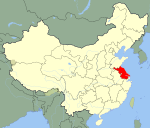 Jiangsu in China
Wuxi: Chong'an District · Nanchang District · Beitang District · Binhu District · Huishan District · Xishan District · Wuxi New District · Jiangyin City · Yixing City
Xuzhou: Yunlong District · Gulou District · Jiuli District · Jiawang District · Tongshan District · Quanshan District · Pizhou City · Xinyi City · Suining County · Pei County · Feng County
Changzhou: Zhonglou District · Tianning District · Qishuyan District · Xinbei District · Wujin District · Jintan City · Liyang City
Suzhou: Jinchang District · Canglang District · Pingjiang District · Huqiu District · Wuzhong District · Xiangcheng District · Wujiang City · Kunshan City · Taicang City · Changshu City · Zhangjiagang City
Nantong: Chongchuan District · Gangzha District · Haimen City · Qidong City · Tongzhou District · Rugao City · Rudong County · Hai'an County
Lianyungang: Xinpu District · Lianyun District · Haizhou District · Ganyu County · Guanyun County · Donghai County · Guannan County
Huai'an: Qinghe District · Qingpu District · Chuzhou District · Huaiyin District · Jinhu County · Xuyi County · Hongze County · Lianshui County
Yancheng: Tinghu District · Yandu District · Dongtai City · Dafeng City · Sheyang County · Funing County · Binhai County · Xiangshui County · Jianhu County
Yangzhou: Guangling District · Weiyang District · Hanjiang District · Yizheng City · Jiangdu City · Gaoyou City · Baoying County
Zhenjiang: Jingkou District · Runzhou District · Dantu District · Yangzhong City · Danyang City · Jurong City
Taizhou: Hailing District · Gaogang District · Jingjiang City · Taixing City · Jiangyan City · Xinghua City
Suqian: Sucheng District · Suyu District · Shuyang County · Siyang County · Sihong CountyProvincial level divisions of the People's Republic of China Provinces 
Autonomous regions Municipalities Special Administrative Regions Territorial disputes - Paracel, Spratly, Zhongsha Islands (see Paracels, Spratlys, & Zhongsha Iss. Authority)
- Pratas Islands
- Senkaku Islands
- South Tibet
- Taiwan, Kinmen & Matsu (see Legal status of Taiwan)


Wikimedia Foundation. 2010.