- Cholame, California
-
Cholame, California — Unincorporated community — Cholame, California Location within the state of California
 Cholame, California
Coordinates: 35°43′26″N 120°17′44″W / 35.72389°N 120.29556°WCoordinates: 35°43′26″N 120°17′44″W / 35.72389°N 120.29556°W Country United States State California County San Luis Obispo Elevation 1,157 ft (353 m) Time zone Pacific (PST) (UTC-8) - Summer (DST) PDT (UTC-7) ZIP codes 93461 Area code(s) 805 FIPS code GNIS feature ID Cholame, California /ʃəˈlæm/ is an unincorporated community in San Luis Obispo County, California, USA. It sits within a mile of the San Andreas Rift Zone fault line at an elevation of 1,157 feet (351 m) above sea level and is located at 35°43′26″N 120°17′44″W / 35.72389°N 120.29556°W. Cholame is reached via State Route 41, just southwest of the junction of Route 46. Rainfall data from a nearby ranch shows that the area around Cholame only receives about eight to nine inches (229 mm) of rain in a normal year.
The town is best known as the place where James Dean died on September 30, 1955. However, Dean actually died at the intersection of State Highways 41 and 46, located one mile to the northeast, when college student Donald Turnupseed made a left turn without seeing Dean's Porsche 550 Spyder approaching in the oncoming lane. On September 30, 2005, the 50th anniversary of Dean's death, a few hundred people gathered in Cholame to pay tribute to Dean. Cholame has a restaurant and a memorial to James Dean erected on the site in 1977 by wealthy Japanese businessman Seita Onishi at the base of a tree.
Cholame's ZIP Code is 93461. The community is inside area code 805.
Municipalities and communities of San Luis Obispo County, California County seat: San Luis Obispo Cities 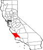
CDPs Avilla Beach | Blacklake | Callender | Cambria | Cayucos | Creston | Edna | Garden Farms | Lake Nacimiento | Los Berros | Los Osos | Los Ranchos | Nipomo | Oak Shores | Oceano | San Miguel | San Simeon | Santa Margarita | Shandon | Templeton | Whitley Gardens | Woodlands
Unincorporated
communitiesAdelaida | Asuncion | Baywood-Los Osos | Bee Rock | Bern | Bromela | California Valley | Cambria Pines | Cholame | Chorro | Halcyon | Harmony | Huasna | Pozo
Categories:- Populated places in San Luis Obispo County, California
- Unincorporated communities in California
- Southern California geography stubs


Wikimedia Foundation. 2010.