- Kyaukse
Infobox Settlement
official_name = Kyaukse
other_name =
native_name =
nickname =
settlement_type =
motto =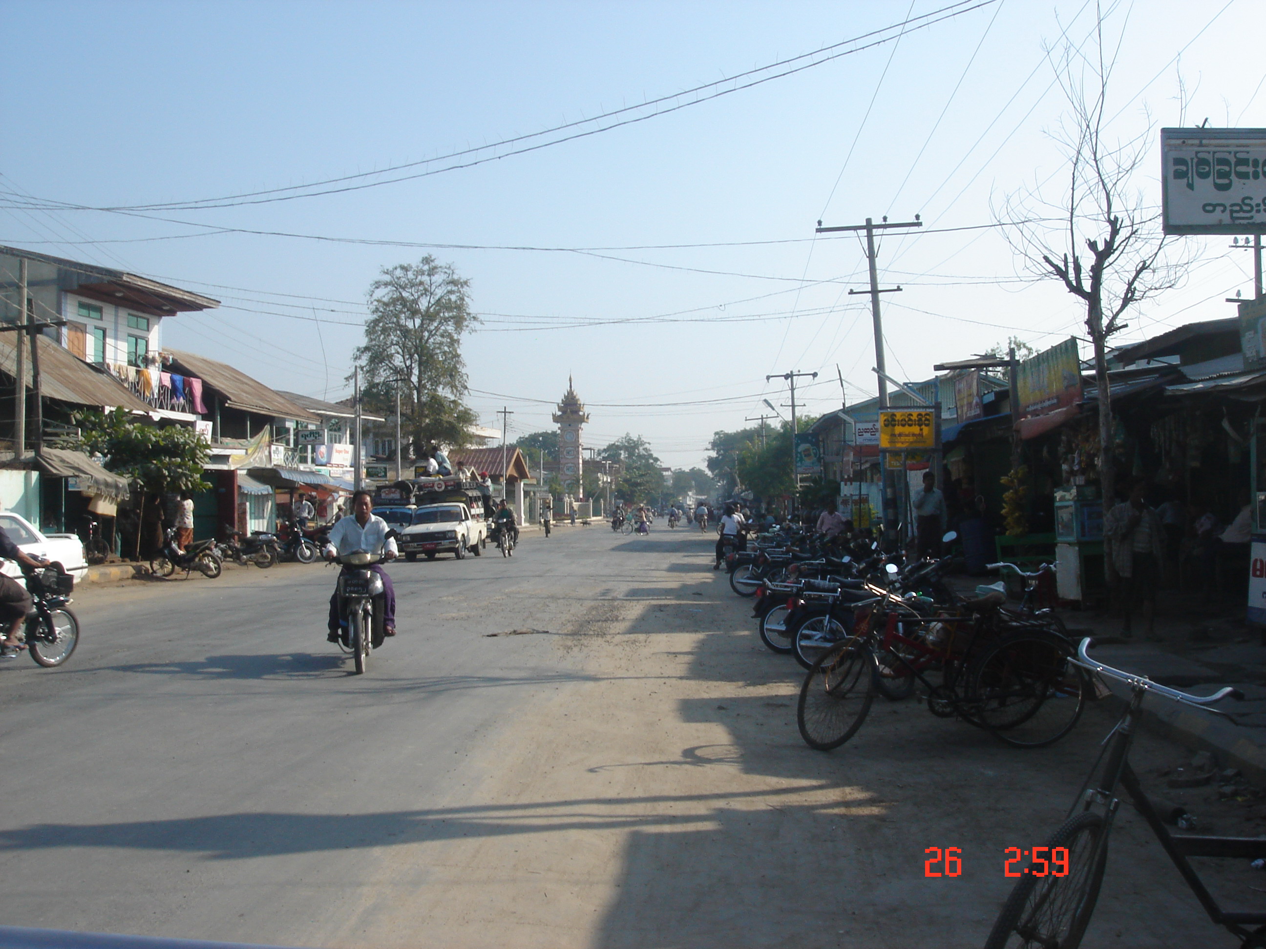
imagesize = 300px
image_caption = Downtown Kyaukse, the Main Road, and Clock Tower
flag_size =
image_
seal_size =
image_shield =
shield_size =
image_blank_emblem =
blank_emblem_type =
blank_emblem_size =
mapsize =
map_caption =
mapsize1 =
map_caption1 =
image_dot_
dot_mapsize =
dot_map_caption =
dot_x = |dot_y =
pushpin_
pushpin_label_position =bottom
pushpin_map_caption =Location in Burma
subdivision_type = Country
subdivision_name =
subdivision_type1 = Admin. division
subdivision_name1 =Mandalay Division
subdivision_type2 = District
subdivision_name2 =Kyaukse District
subdivision_type3 = Township
subdivision_name3 =Kyaukse Township
subdivision_type4 =
subdivision_name4 =
government_footnotes =
government_type =
leader_title = Chairman of Township Peace and Development Council
leader_name =
leader_title1 =
leader_name1 =
leader_title2 =
leader_name2 =
leader_title3 =
leader_name3 =
leader_title4 =
leader_name4 =
established_title =
established_date =
established_title2 =
established_date2 =
established_title3 =
established_date3 =
area_magnitude =
unit_pref =Imperial
area_footnotes =
area_total_km2 =
area_land_km2 =
area_water_km2 =
area_total_sq_mi =
area_land_sq_mi =
area_water_sq_mi =
area_water_percent =
area_urban_km2 =
area_urban_sq_mi =
area_metro_km2 =
area_metro_sq_mi =
area_blank1_title =
area_blank1_km2 =
area_blank1_sq_mi =
population_as_of =2005
population_footnotes =
population_note =
population_total =
population_density_km2 =
population_density_sq_mi =
population_metro =
population_density_metro_km2 =
population_density_metro_sq_mi =
population_urban =
population_density_urban_km2 =
population_density_urban_sq_mi =
population_blank1_title =Ethnicities
population_blank1 =
population_blank2_title =Religions
population_blank2 =Buddhism
population_density_blank1_km2 =
population_density_blank1_sq_mi =
timezone =
utc_offset =
timezone_DST =
utc_offset_DST =
latd=21 |latm=36 |lats= 47|latNS=N
longd=96 |longm=7 |longs=49 |longEW=E
elevation_footnotes =
elevation_m =
elevation_ft =
postal_code_type =
postal_code =
area_code =
blank_name =
blank_info =
blank1_name =
blank1_info =
website =
footnotes =Kyaukse is a small
town making up part ofKyaukse Township in theKyaukse District inMandalay Division , Myanmar, 30 miles fromMandalay . It is famous for the "KyaukseElephant Dance", which was heavily promoted during the government campaign "Visit Myanmar Year1996 ". The Kyaukse area is known for itsturmeric ,mango andonion s. This area is developed more quickly during this administration because it is the native area of thehead of State General Than Shwe .The town is home to the
Kyaukse Education College ,Government Technological College (Kyaukse) andKyaukse University .The town has a relatatively large shopping centre
Aye Mya Kyi Lin Market .

Wikimedia Foundation. 2010.