- Çorovodë
-
Çorovodë 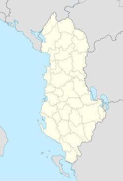
 Çorovodë
Coordinates: 40°30′N 20°13′E / 40.5°N 20.217°ECoordinates: 40°30′N 20°13′E / 40.5°N 20.217°E Country  Albania
County Berat County District Skrapar District Population (2011) – Total 7,124 Time zone Central European Time (UTC+1) – Summer (DST) CEST (UTC+2) Postal code 5401-5402 Area code(s) 0312 Car Plates SK Website http://corovodaonline.blogspot.com  Kasabashi Bridge near Çorovodë
Çorovodë, also written as Çorovoda is the main city of Skrapar District, Albania with a population of around 7,000. The Çorovoda River passes through the city and it is also home to a canyon, known as "Pirogosh". Allegedly, two kings, Piro and Goshi, named the cavern. The name of the town derives from the Slavic for "black water".
The river Osum also passes through the city and forms canyons and caves which are the highest and the longest in Albania at around 12.5 km[citation needed]. The river provides opportunities for kayaking and other aquatic sport. Also of note is an Ottoman-era stone bridge over the river.
Some archaeologists believe Çorovoda might be the oldest city in Albania[citation needed]. They have found ruins of some churches and a buried castle in Rovica which might be more ancient than the castle of Berat[citation needed].
Notable people
- Xhelal bej Koprencka, modern Albania's founding father
- Hajredin bej Carkani, modern Albania's founding father
See Also
- Pirogoshi Cave
- Osum Canyon
References
 Gredec Cliffs near Çorovodë
Skrapar District Capital: ÇorovodëBogovë 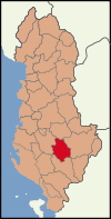
Çepan Çorovodë ÇorovodëGjerbës Melove, Zaloshnje, Gjerbës, Ujanik, Gradeci, Straficke, Vishanji, Barç 1, Barç 2, Kuç, Rehove, Gremsh, Gjergovice, FloqLeshnjë Turbohove, Kapinove, Kraste, Krushove, Faqekuqe, Gostrenske, Leshnjë, VlushëPoliçan Potom Qendër Vendreshë Lavdar, Spathar, Therepel, Vale, Vendreshë e Madhe, Vendreshë e Vogël, Vendreshë e Malit, IbroZhepë Municipalities of Berat County Capital: BeratBerat District 
Kuçovë District Skrapar District Cities in Albania Bajram Curri · Bajzë · Ballsh · Berat · Bilisht · Bulqizë · Burrel · Cërrik · Çorovodë · Delvinë · Divjakë · Durrës · Elbasan · Ersekë · Fier · Fushë-Arrëz · Fushë-Krujë · Gjirokastër · Gramsh · Himarë · Kamëz · Kavajë · Këlcyrë · Klos · Konispol · Koplik · Korçë · Krastë · Krrabë · Krujë · Krumë · Kuçovë · Kukës · Kurbnesh · Laç · Leskovik · Lezhë · Libohovë · Librazhd · Lushnjë · Maliq · Mamurras · Manëz · Memaliaj · Orikum · Patos · Peqin · Përmet · Peshkopi · Pogradec · Poliçan · Prrenjas · Pukë · Reps · Roskovec · Rrëshen · Rrogozhinë · Rubik · Sarandë · Selenicë · Shëngjin · Shijak · Shkodër · Sukth · Tepelenë · Tirana · Ulëz · Urë Vajgurore · Vau i Dejës · Vlorë · Vorë
 Categories:
- Populated places in Berat County
- Berat County geography stubs


Wikimedia Foundation. 2010.